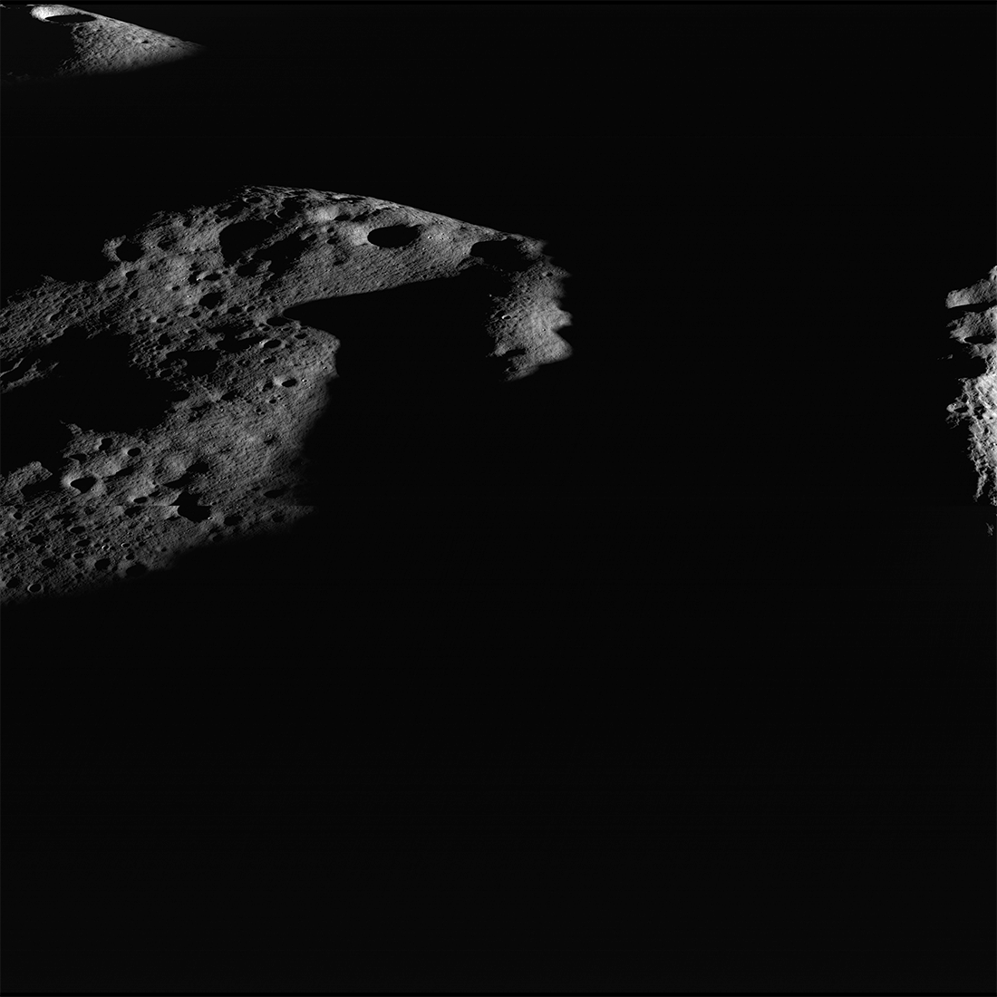
Close to the south pole, the Sun never rises far from the horizon, but as the Moon spins on its axis, the direction to the Sun changes. Local ridges cast ragged shadows that shift dramatically over the landscape as the Sun circles the horizon. Many high points are illuminated for extended periods of time. Conversely, low areas near the poles remain in darkness all year. Areas that never receive direct sunlight are called Permanently Shadowed Regions (PSRs); the interior of Shackleton crater is one such area.
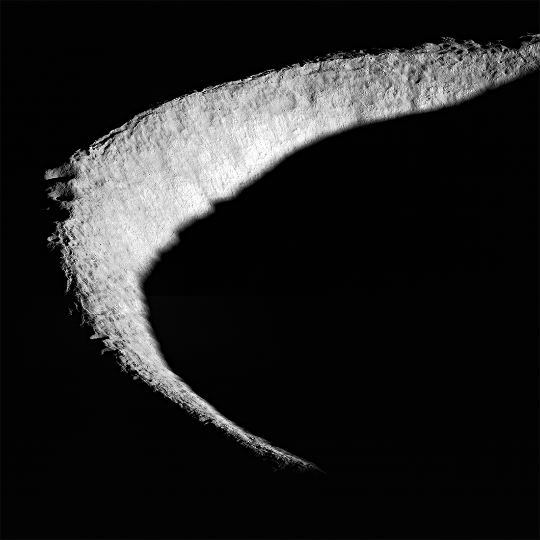
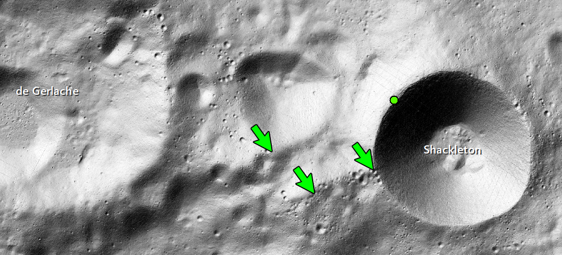
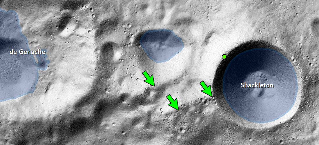
Shackleton crater is 21 kilometers in diameter and over 4 kilometers deep. An elevated ridge runs roughly between Shackleton and de Gerlache craters, and the relatively high elevation of this landscape means that some portions are illuminated up to 90% of the time, but nowhere is permanently illuminated. Future explorers could take advantage of this persistent illumination by setting up solar panels in several closely spaced locations providing nearly constant solar generated electricity. The proximity to Permanently Shadowed Regions in and around Shackleton crater adds scientific value to this destination, as PSRs are often home to compounds such as water ice that are not found elsewhere on the Moon, but which contain clues to the history of of inner Solar System water and other volatile elements. A nearby, ready source of water-ice would also be of benefit to human surface activities, either as a consumable (air or water) or as spacecraft fuel.
Explore the full NAC oblique image of Shackleton crater.
Read More about PSRs
Casting Light on Permanently Shadowed Regions
Searching for Ice at the Moon's Poles
Did you know that LROC's first image of the Moon was of Shackleton crater? 1000 Day Anniversary of LROC Imaging
More about Shackleton crater
Lunar South Pole - Out of the Shadows
Mosaics of the south pole
Published by J. Stopar on 20 May 2019