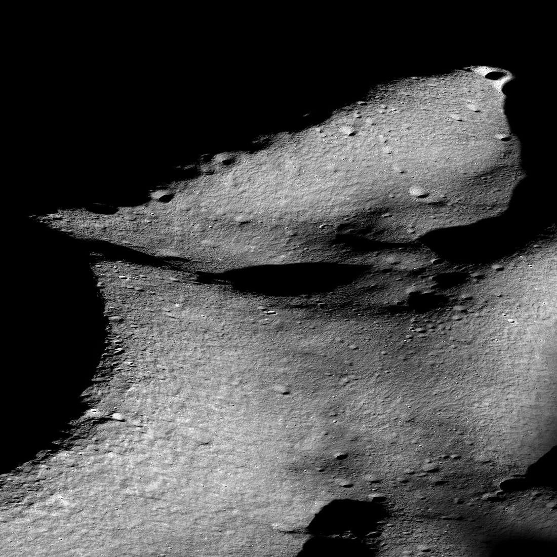
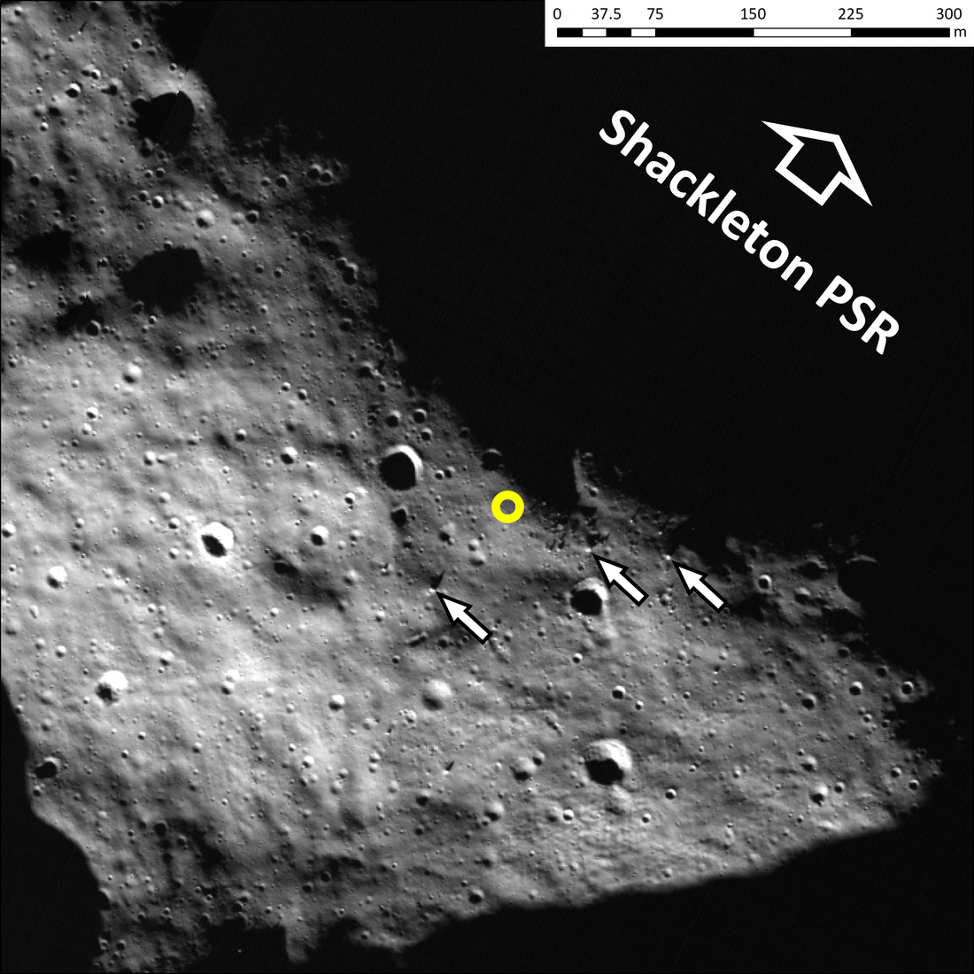
The south pole of the Moon is a unique place where the Sun barely ever creeps above the horizon. For this reason, floors of craters such as 20 kilometers wide Shackleton crater have been locked in perpetual shadow for billions of years and are framed by peaks where the Sun and Earth set for only brief periods each month. Crewed landing missions could therefore enjoy the best of both worlds, utilizing volatiles such as water ice stored in the extremely cold permanently shadowed regions (PSRs) while maintaining easy access to solar energy and Earth communications. Therefore, an ancient ridge between the craters Shackleton and de Gerlache [“duh Gerlush”] has been identified as a potential landing area for future crewed and robotic landings by NASA, such as Artemis III and Intuitive Machines-2 Nova C lander.
Going back to time-proven traditions of the Apollo missions, geomorphic maps at a very large scale are needed to effectively guide and inform landing site selection, traverse planning, and in-situ landscape interpretation by rovers and astronauts. We assembled a geomorphic map covering a candidate landing site on the Shackleton-de Gerlache-ridge and the adjacent rim of Shackleton crater. The map was derived from one meter per pixel NAC image mosaics and five meters per pixel digital elevation models (DEM) from Lunar Orbiter Laser Altimeter (LOLA) ranging measurements.
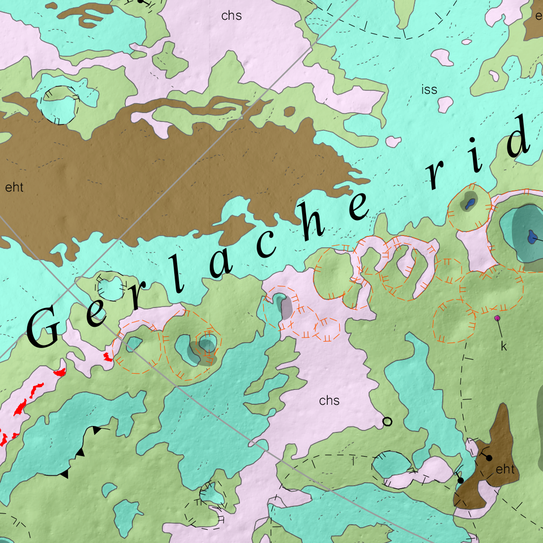
At our mapping scale (1:8000), almost all visible morphology and texture are either a direct result of small impacts or an indirect result of larger impacts. Small impact craters range from muted to fresh, with or without surrounding ejecta affecting the landscape (solid black and yellow circles within the map). The texture resulted from mass wasting processes on the sloped walls of old craters within the upper regolith (blue-green and brown units). These textures have been referred to as “elephant hide” terrain, a common occurrence on the Moon that has the potential to inform on ground stability and thus hazard avoidance.
Link to publication: https://www.sciencedirect.com/science/article/pii/S0019103522000835
Link to full-scale map poster: https://ars.els-cdn.com/content/image/1-s2.0-S0019103522000835-mmc2.pdf
Related Featured Images
Lunar Exploration: Planning The Next Steps
Published by Mark Robinson on 1 April 2022