Hunting for Ancient Lunar Impact Basins

Fig. 1: A lesser-known impact basin, Freundlich-Sharonov, is visible in this Digital Terrain Model (DTM) made from LROC WAC stereo images, and darker shades represent lower elevations than brighter shades. The diameter of the orange-colored ring is 595 km. DTM images like these allow scientists to inventory and study the morphologies of lunar basins [NASA/GSFC/Arizona State University/DLR].

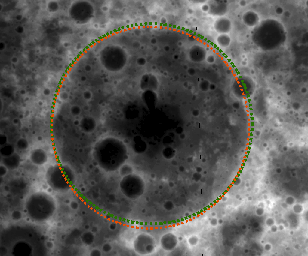
Large impact structures represent important time markers and clues to the early history of the Moon. Unfortunately, older basins may be highly degraded and are sometimes difficult to identify in images. Digital Terrain Models (DTMs) allow us to make more confident identifications of lunar basins and to study their morphologies. Large numbers of tentatively identified lunar impact basins, thoroughly listed in catalogs [1], are awaiting verification and detailed investigation of their ages.

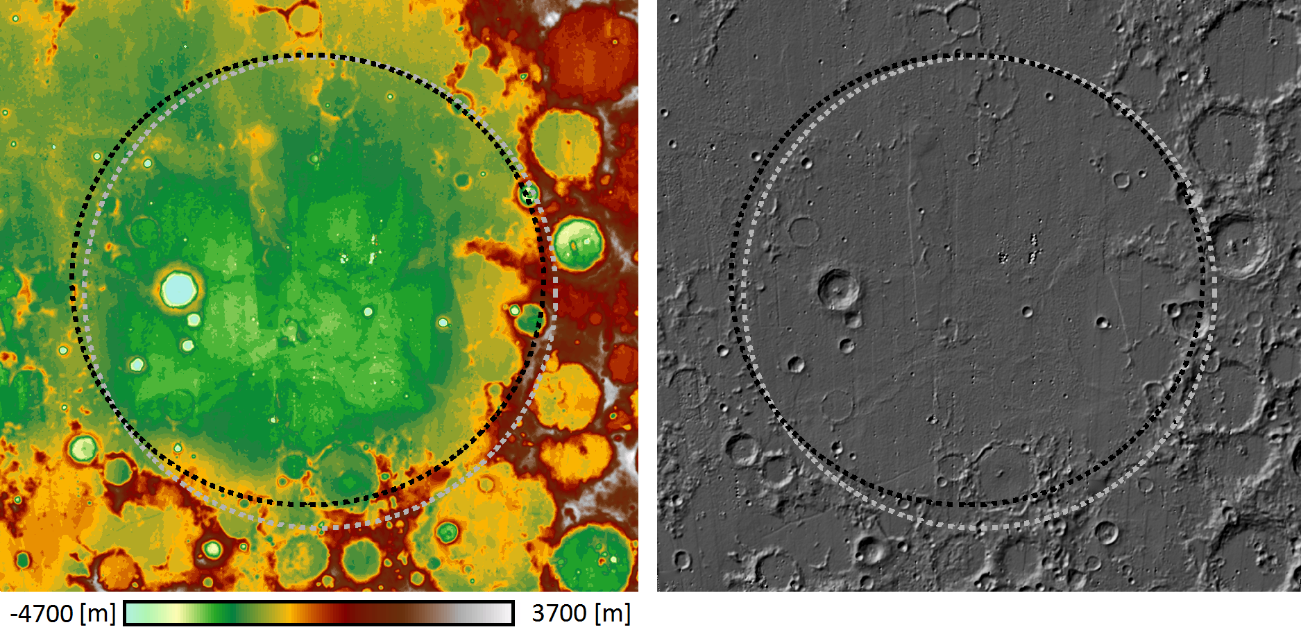
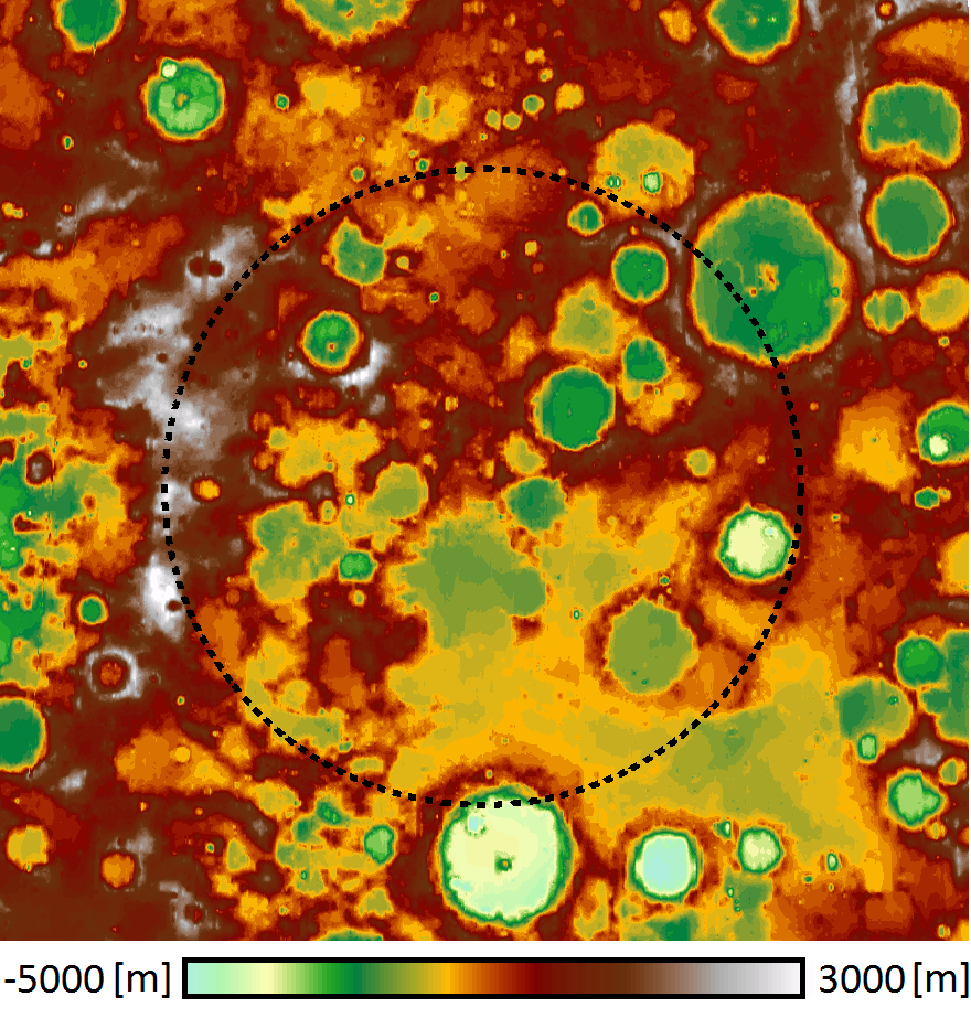
Previous lunar topographic data sets used for studies of basins include the stereo model derived from Clementine images (5 km resolution). Currently, LRO's Lunar Orbiter Laser Altimeter (LOLA) is collecting a global topographic dataset. Due to LRO's polar orbit, the LOLA topographic products have high resolution (better than 40 m) at the poles and suffer from orbit gaps of about a kilometer in the equatorial areas. The DTM of the Nubium basin (below) was made from overlapping WAC images obtained in adjacent orbits. The topography has a uniform global spatial resolution of 500 m except at the poles where deep shadows results in area of no coverage. Using these new WAC topographic data, several degraded impact structures were positively confirmed (opening image and Fig. 2). However, at this time, other basins such as Marginis (Fig. 3) are not yet positively confirmed.

[1] Wood C.A. (2004): Impact Basin Database.

Fig. 2: The geographic location of the ancient Nubium basin (20°S, 16°W) is difficult to determine in images. The color-coded DTM (left) and the hill-shaded model (right) help show Nubium due to a slight topographic depression easily seen in the topographic map. Parts of a rim structure can be identified in the southeast, suggesting a basin diameter of about 675 km (black dashed), which is consistent with previous estimates of 690 km (gray dashed, [1]). The mean rim height (the height difference between rim and basin floor) is ~1.8 km according to the DTM. The hill-shaded model accentuates the smooth bottom of Nubium [NASA/GSFC/Arizona State University/DLR].


Fig. 3: Confirming the location of Marginis basin (20°N, 84°E), with a proposed rim diameter of ~580 km (black dashed, [1]), is difficult. A chain of mountain peaks in the western area may represent remnants of a basin rim. However, this chain could also be part of the neighboring prominent Crisium basin, located to the west. With time the WAC and LOLA topographic maps will have higher resolution and more accuracy to help scientists better decipher the location, size, and relative ages of ancient lunar basins [NASA/GSFC/Arizona State University/DLR].

Published by Juergen Oberst on 9 June 2010