The third mission in China's lunar exploration program, Chang'e 3, was launched on 6 December 2013 and made a soft touchdown on 14 December 2013 with a lander and small rover named Yutu (Jade Rabbit). The landing site was imaged by LROC both before and after the arrival of Chang'e 3, making it relatively easy to spot the spacecraft in NAC images, especially when compared to descent images released by the Chang'e 3 team.
Chang'e 3 was the first soft lander on the surface of the Moon since the Soviet Luna 24 sample-return mission in 1976 (the last US landing was that of Apollo 17 in 1972). Yutu only traversed about 100 m (as measured from tracks seen in the LROC images) before a mechanical failure left it stuck in place. Yutu has survived nine months on the lunar surface with several scientific instruments still functioning, even though it cannot move.
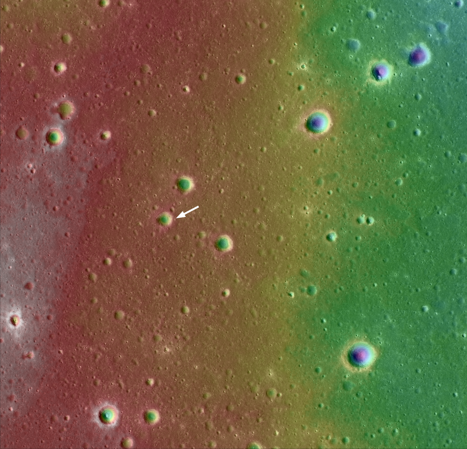
You can see in the color-shaded digital terrain map (DTM) derived from LROC NAC stereo images (below) that Chang'e 3 landed near the rim of a 450-m diameter crater. This crater is 48 m deep and formed on basaltic rocks that erupted around three billion years ago. Landing within the ejecta blanket of this crater allowed Chang'e 3 to examine the volcanic rocks that originally resided tens of meters below the surface.
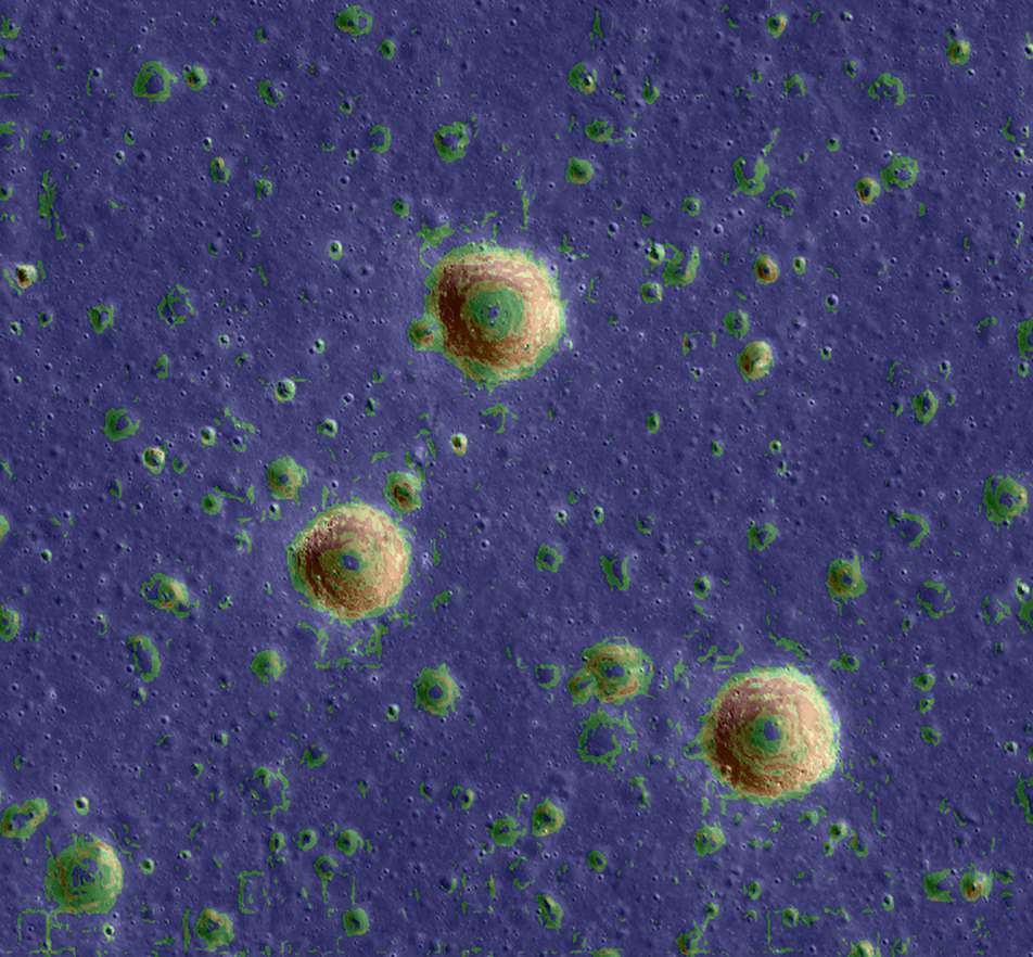
The opening image shows slopes calculated from the NAC DTM for the immediate vicinity of the landing site. Apart from the three large impact craters, with slopes above 15°, the rest of the landing site is relatively flat, with slopes largely below 5° and only a gentle downward west-to-east regional trend, seen as a red-to-green gradient in the above map. Had Yutu continued to rove, it would have had a relatively clear path to a wrinkle ridge to the east and an older basaltic lava deposit with a different compostion (lower titanium) to the north. See this post for more context on the landing site.
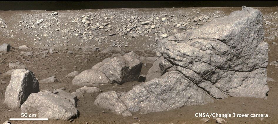
But just because the overall slopes of the landing site are low, and the topography doesn't vary much on the broad scale, that doesn't mean it would be smooth roving everywhere in the area. Check out the view from Yutu of all of the nearby rocks excavated by the large impact crater and note the 0.5-m scale bar. That's downright treacherous for a rover just about 1.5 m in size! Scoping out landing hazards like these at potential sites of future U.S. surface exploration is one of the main reasons that LROC was originally conceived with the capability to image at the 0.5-m scale. Many of those rocks can be seen in the full-resolution NAC images of the landing site.
Explore the entire region below, where contour lines are shown with 10-m intervals overlain on LROC NAC images of the region.
More on Chang'e 3 from LROC:
Sinus Iridium - Next Destination?
Safe on the Surface of the Moon
Chang'e 3 Lander and Rover from Above
Published by Brett Denevi on 7 October 2014