Featured Images
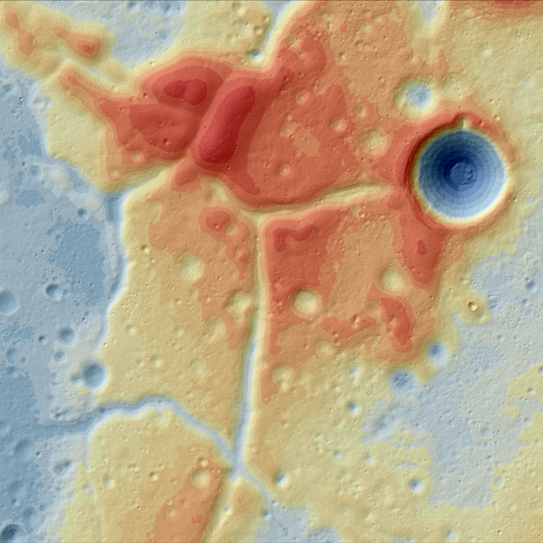
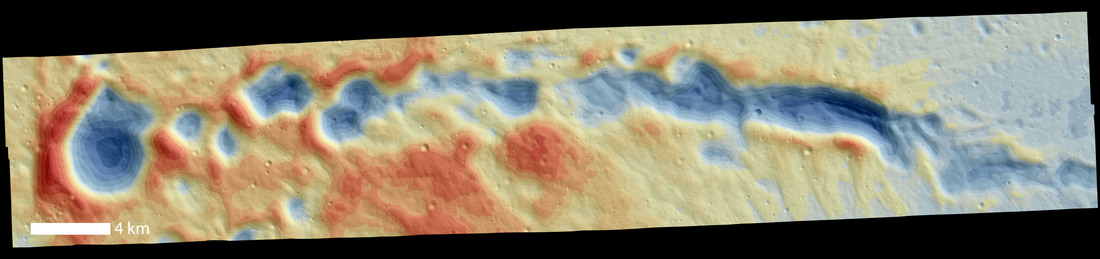
A Lunar Island Surrounded by Lava
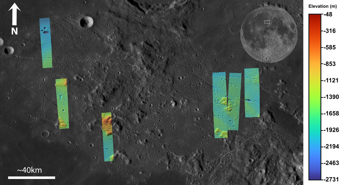
Color-shaded relief map showing the elevations of the Western Crisium Kipuka (WCK) located on the western edge of Mare Crisium. The elevation ranges from -4,218 m (blue) to -3,195 m (red) [NASA/GSFC/Arizona State University].
Published on 01 Apr 2024
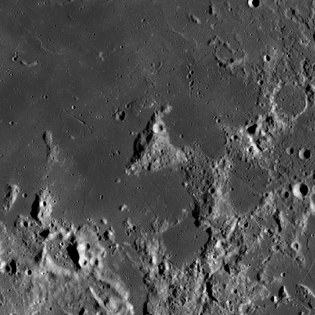
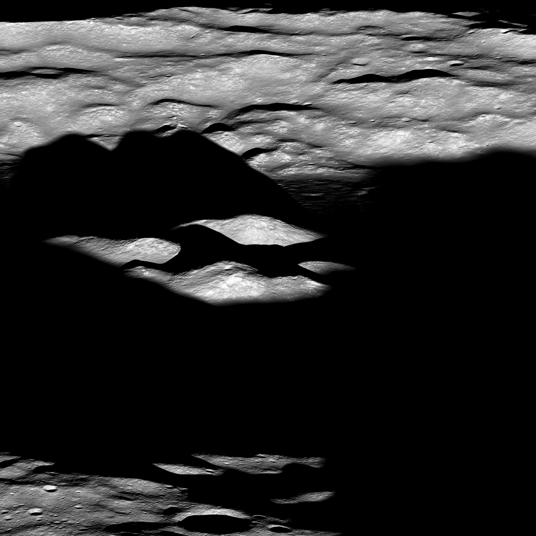
Mount Marilyn: A Lunar Love Story
Mount Marilyn, with its distinctive triangular shape, served as an important navigation landmark for the Apollo 11 astronauts. Portion of LROC Wide Angle Camera mosaic, 138 km wide [NASA/GSFC/Arizona State University].
Published on 31 Aug 2023
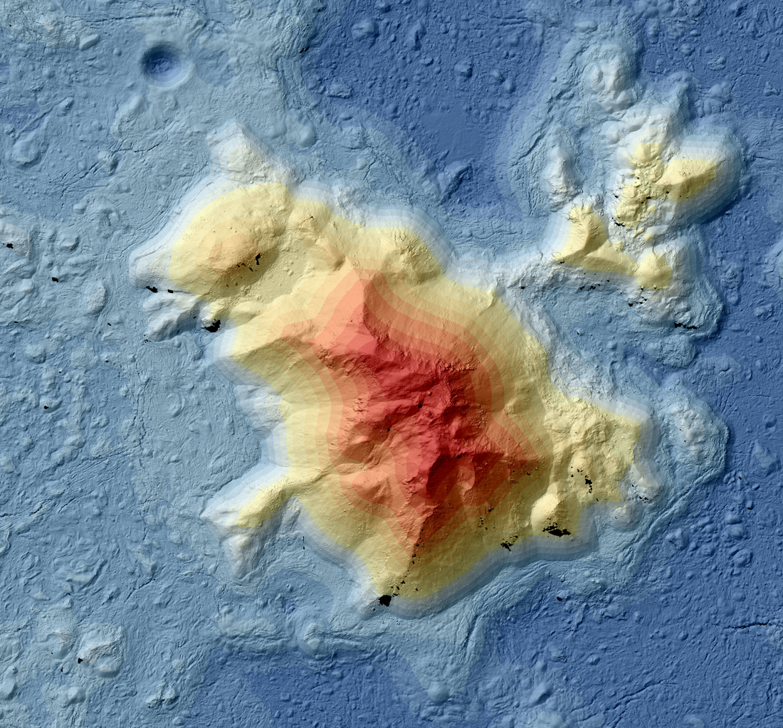
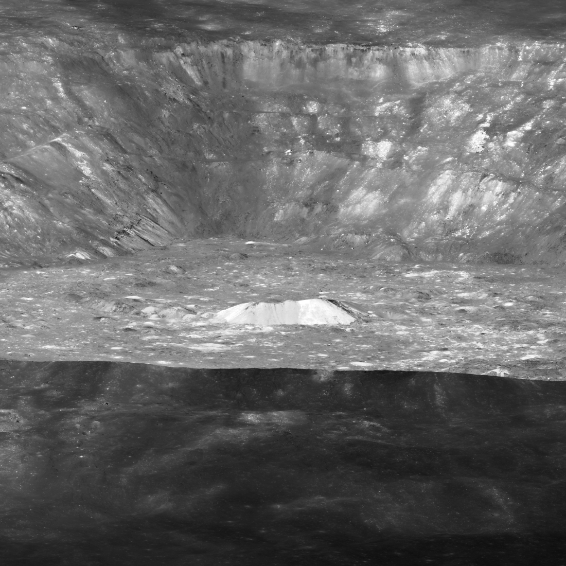
Tycho: A Model Central Peak
Color-shaded relief map showing elevations for the central peak of Tycho crater. Black areas indicate shadows in the stereo images, where no topography could be extracted [NASA/GSFC/Arizona State University].
Published on 29 Mar 2023
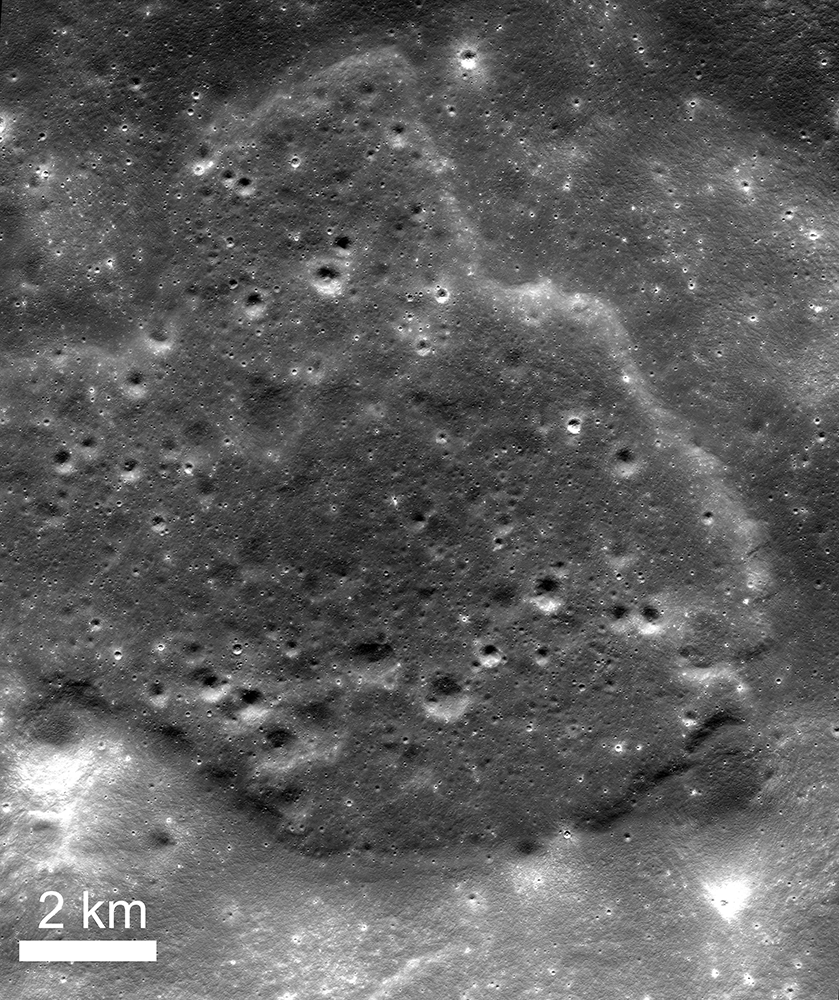
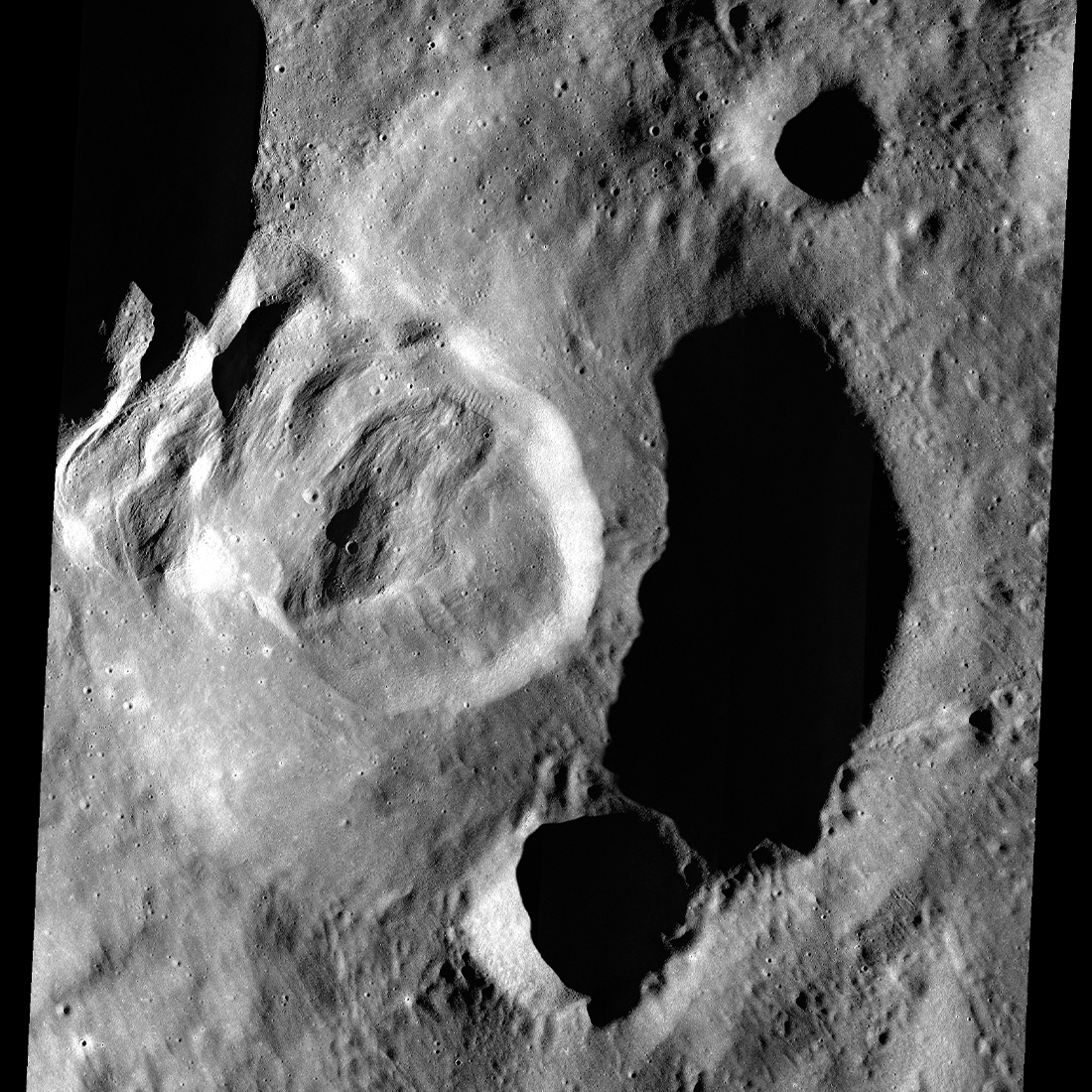
Malapert Massif
Malapert massif (informal name) is thought to be a remnant of the South Pole - Aitken basin rim, which formed more than 4 billion years ago. More recently, this magnificent peak (lower left) was selected as an Artemis 3 candidate...
Published on 14 Mar 2023
Three Impact Events
Spectacular 4500-meter diameter crater (10.67°S, 225.82°E) formed at the intersection of the rims of Lowell W crater (18-kilometer diameter) and the Orientale basin (750-kilometer diameter). Impact melt and debris spilled from the low...
Published on 20 Feb 2023
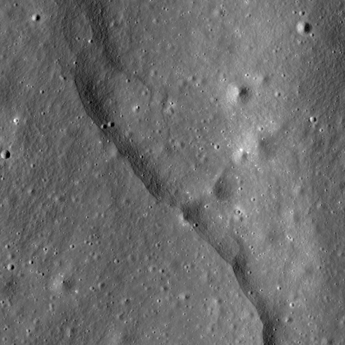
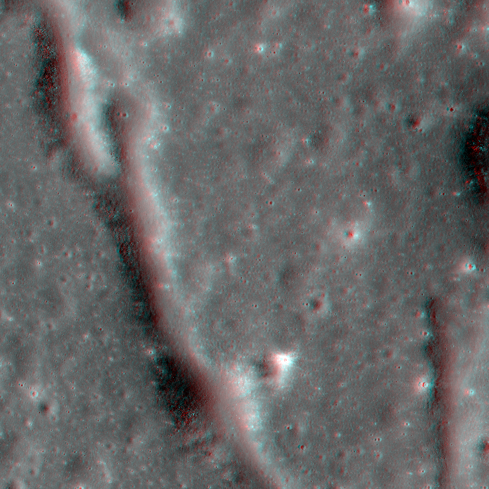
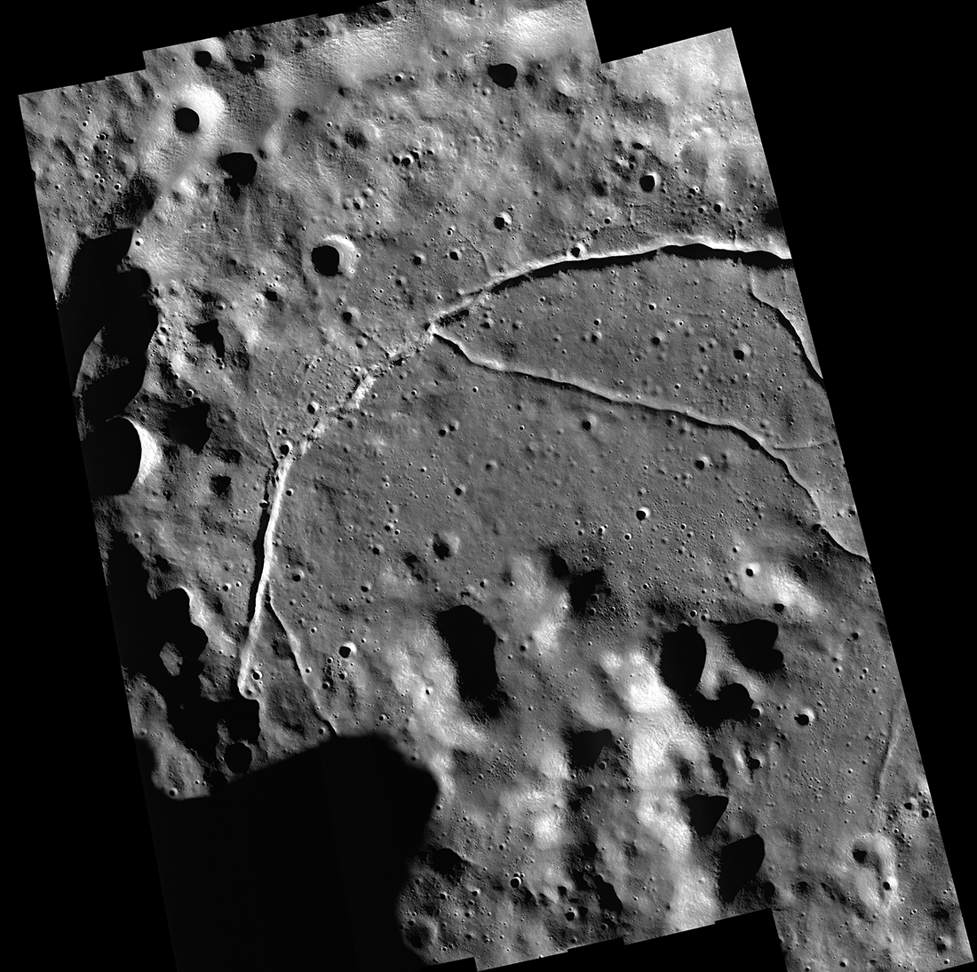
Thousands of Thrust Faults!
Prominent lobate thrust fault scarp in the Mandel’shtam cluster, one of the thousands discovered in Lunar Reconnaissance Orbiter Camera (LROC) images. The fault scarp or cliff is like a stair-step in the lunar landscape formed when the...
Published on 14 Feb 2023
Ancient Impact Melt
Lobate margin of ancient impact melt flow within a nameless farside crater, 45.84° S, 227.32° E, NAC M1117380495LR [NASA/GSFC/Arizona State University].
Published on 28 Dec 2022
Dramatic Contrast
The dark rim of Aristarchus crater (23.7°N, 312.5°E) dramatically highlights its bright interior and central peak. There are more than 2700 meters of relief from the rim to the crater floor, and the central peak is 3,000 meters wide...
Published on 01 Dec 2022
Lunar Terminator
Western portion of Mare Moscoviense seen under extreme lighting, east-to-west view snapped 25 August 2019. The illuminated rim in the background is an unnamed crater 21 kilometers in diameter (24.2°N, 146.3°E); spacecraft altitude was...
Published on 15 Apr 2022
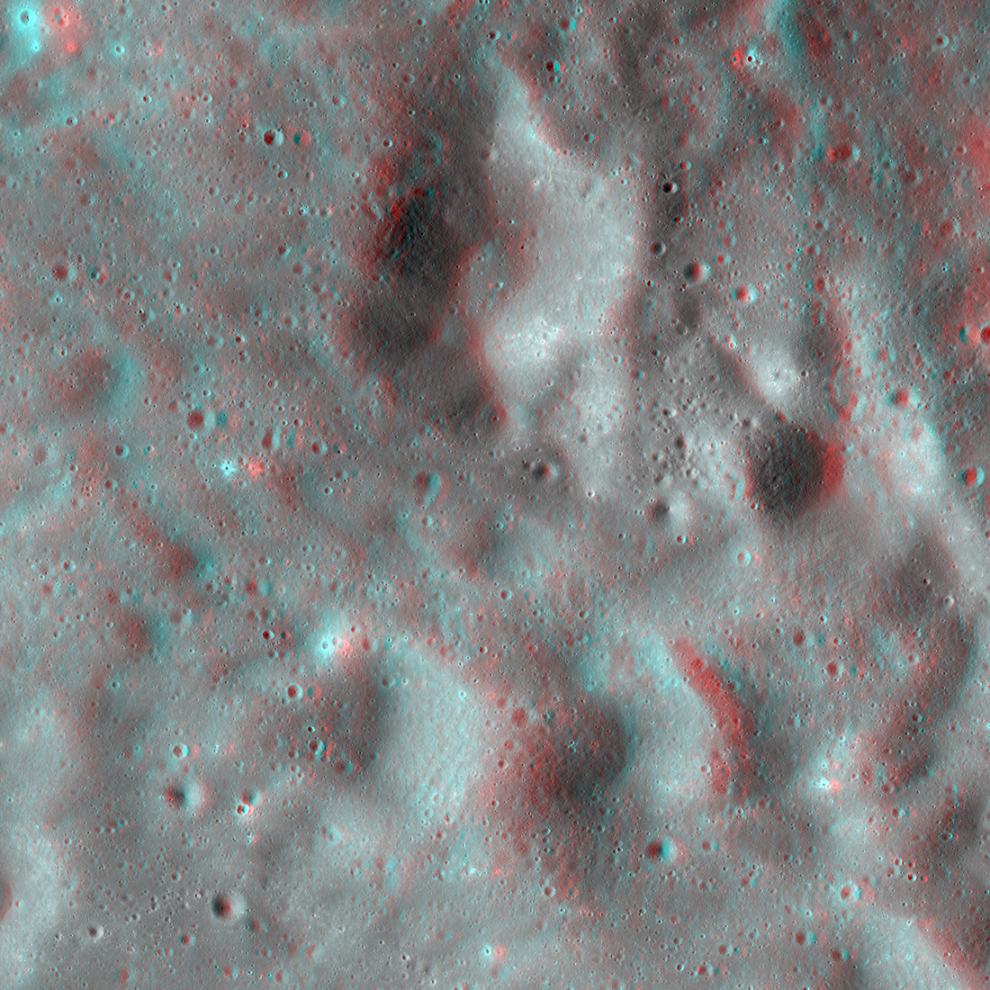
NAC Anaglyph: Alphonsus Vent
A dike (subsurface magma body) was likely intruded under the floor of Alphonsus crater creating an array of fractures seen here. Image is 5700 meters wide, north is towards the top [NASA/GSFC/Arizona State University].
Published on 19 Feb 2022
A “Secondary” View of Copernicus
NAC DTM showing a chain of Copernicus secondaries (15.5°N, 343.4°E). North is pointing right [NASA/GSFC/Arizona State University].
Published on 04 Feb 2022
Mass Wasting: Klute Crater
Mass wasting in Klute Crater (36.79° S, 217.7°E) NAC controlled mosaic containing images, M1155169631LR, M1155162511LR, M1155155392LR [NASA/GSFC/Arizona State University].
Published on 26 Apr 2021
The Highs and Lows of Ryder Crater
Ryder Crater (13 x 17 km across) controlled Feature Mosaic; located at 43.8° S, 143.2° E, north is up, LROC NAC images M1172098182, M1172105288, and M1172112395 [NASA/GSFC/Arizona State University].
Published on 19 Oct 2020
Apennine Bench Formation: A Window into Ancient Volcanism
LROC Wide Angle Camera (WAC) 100 m/px mosaic with 6 colorized Digital Terrain Models (DTMs) of the Apennine Bench Formation (centered near 26° N, 356° E - here in Quickmap), an enigmatic light plains unit located on the central lunar...
Published on 29 Jun 2020
A Rain of Rock
A rain of rock carved these craters west of Vavilov crater. The ground here, which is elevated relative to the surrounding terrain, intersected with rock and other ejected debris excavated during the formation of Vavilov crater. The...
Published on 28 May 2020
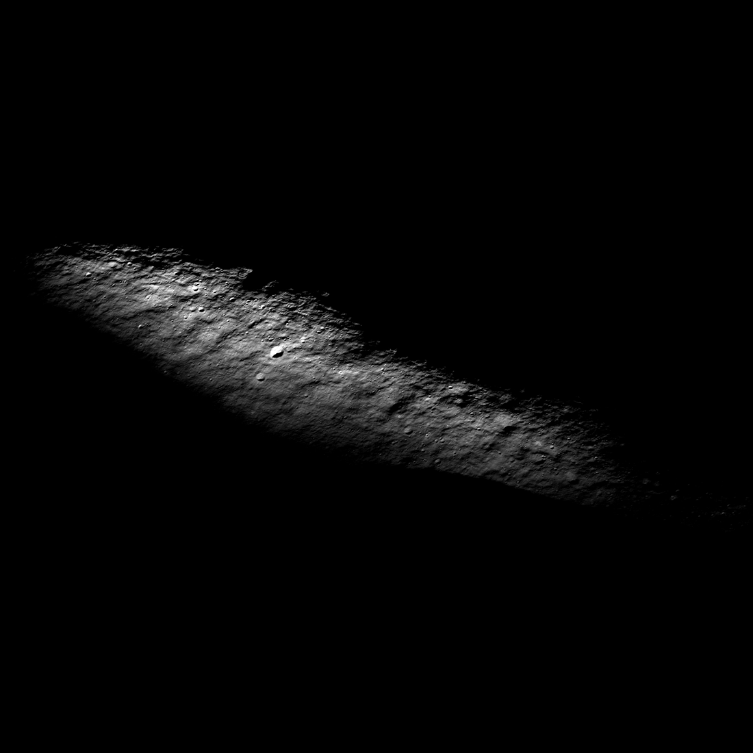
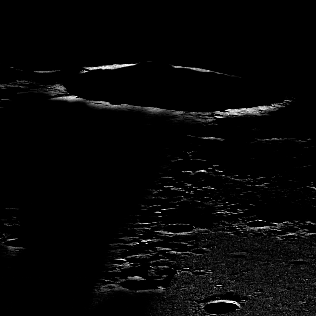
Sea of Night
Rim of Aepinus crater rising above a sea of dark during a winter night. Illuminated area 1.5 kilometers by 6.0 kilometers, NAC M1338480133LR [NASA/GSFC/Arizona State University].
Published on 19 May 2020
Feature Mosaics: Behind the Seams
A seamless mosaic of a portion of Karpinsky crater (91 km diameter, 72.61° N, 166.80°E) seamless mosaic. Scene is 55 km across, NAC images M1309496597L/R, M1309503618L/R, M1309510644L/R, M1309517669L/R, and M1309524696L/R...
Published on 16 Mar 2020
Dawn Over Bhabha Crater
Central peak complex of Bhabha crater (70 kilometer diameter) rising from the shadows of dawn, image snapped on 28 August 2019 from an altitude of 73 kiolmeters. View is seen from east-to-the west, north is to the right, visible portion...
Published on 22 Oct 2019
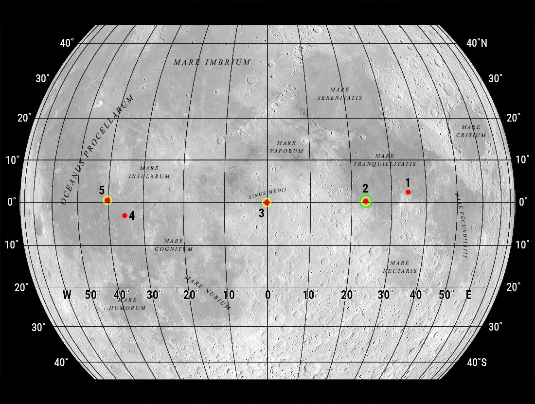
"Oceanus Procellarum Base Here - The Eagle Has Landed"
In 1969, NASA published a map showing candidate Apollo 11 and Apollo 12 landing sites. The map was based on photographs taken using large Earth-based telescopes. The map above, based on an LROC global image mosaic, is a near-copy of...
Published on 09 Aug 2019
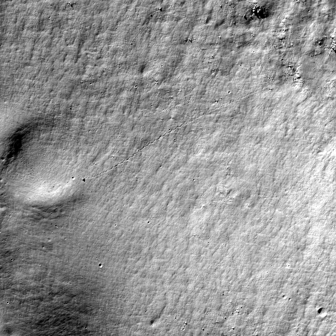
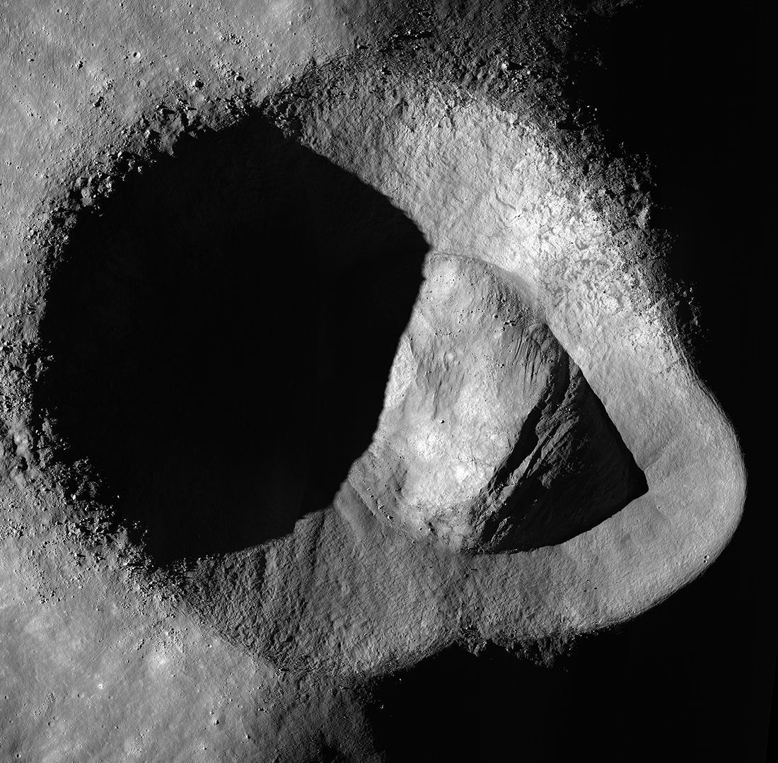
Almost a Hole-in-One
A geologic story in Antoniadi crater on the Moon's far side. North is toward the top. Image width 1.54 kilometers, NAC M1311837924LR [NASA/GSFC/Arizona State University].
Published on 26 Jul 2019