Featured Images
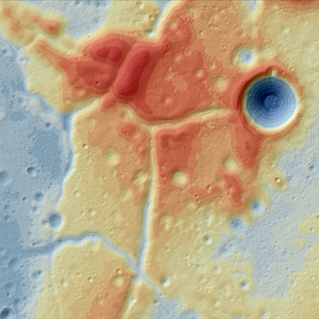
A Lunar Island Surrounded by Lava
Color-shaded relief map showing the elevations of the Western Crisium Kipuka (WCK) located on the western edge of Mare Crisium. The elevation ranges from -4,218 m (blue) to -3,195 m (red) [NASA/GSFC/Arizona State University].
Published on 01 Apr 2024
Looking Over the Orientale Basin
Indian Ocean as seen from lunar orbit (2015-12-10 06:00:29.202 UTC). NAC high-resolution monochrome image merged with WAC lower-resolution color observations. North is to the left, Antarctica to the right, Australia at the top, and...
Published on 07 Apr 2023
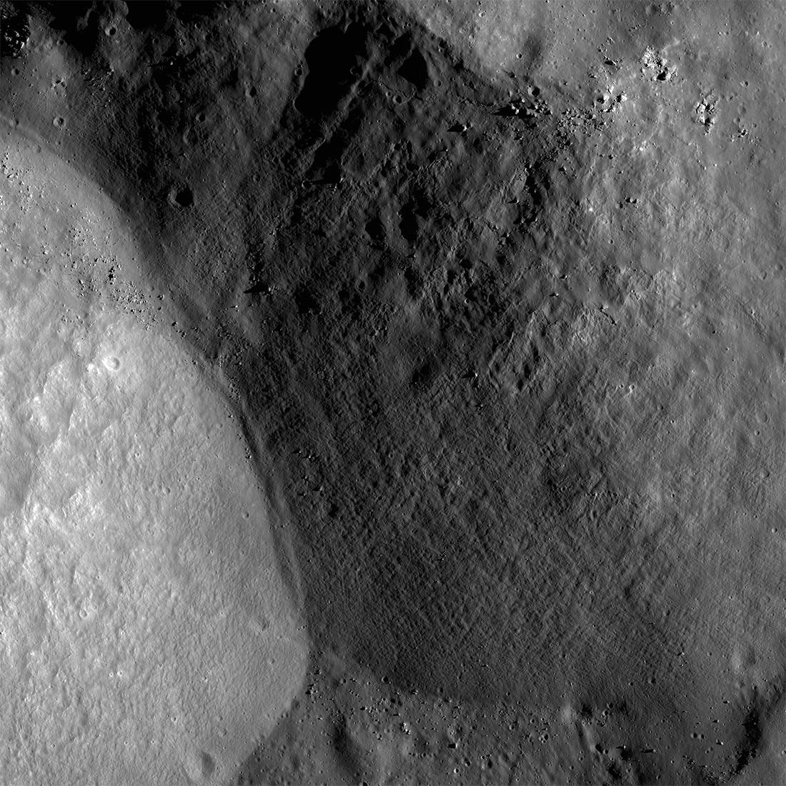
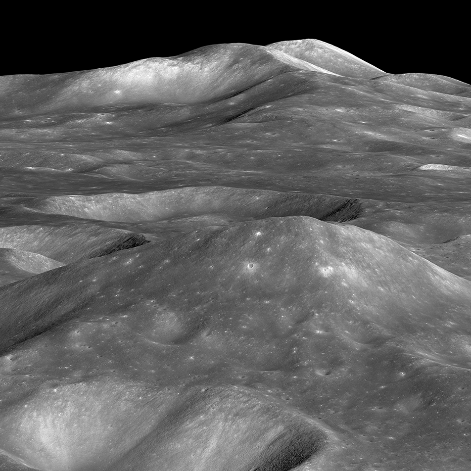
Malapert Massif
Malapert massif (informal name) is thought to be a remnant of the South Pole - Aitken basin rim, which formed more than 4 billion years ago. More recently, this magnificent peak (lower left) was selected as an Artemis 3 candidate...
Published on 14 Mar 2023
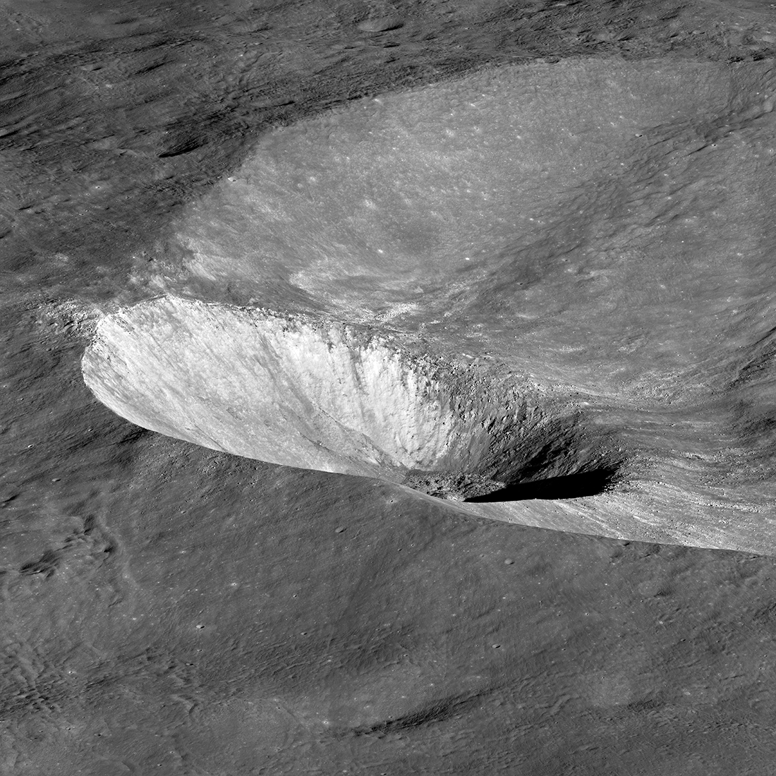
Three Impact Events
Spectacular 4500-meter diameter crater (10.67°S, 225.82°E) formed at the intersection of the rims of Lowell W crater (18-kilometer diameter) and the Orientale basin (750-kilometer diameter). Impact melt and debris spilled from the low...
Published on 20 Feb 2023
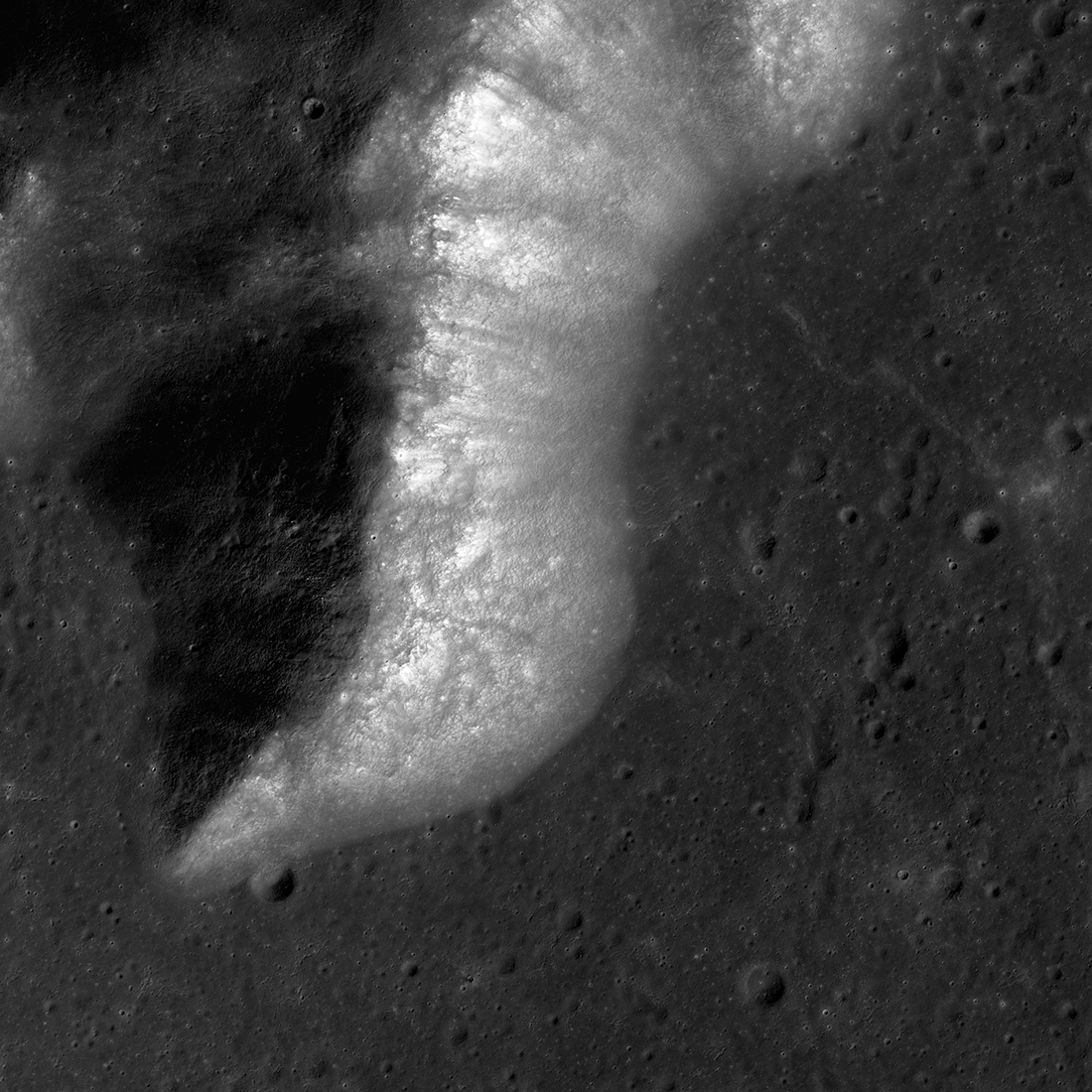
Ancient Impact Melt
Lobate margin of ancient impact melt flow within a nameless farside crater, 45.84° S, 227.32° E, NAC M1117380495LR [NASA/GSFC/Arizona State University].
Published on 28 Dec 2022
Lunar Terminator
Western portion of Mare Moscoviense seen under extreme lighting, east-to-west view snapped 25 August 2019. The illuminated rim in the background is an unnamed crater 21 kilometers in diameter (24.2°N, 146.3°E); spacecraft altitude was...
Published on 15 Apr 2022
The Highs and Lows of Ryder Crater
Ryder Crater (13 x 17 km across) controlled Feature Mosaic; located at 43.8° S, 143.2° E, north is up, LROC NAC images M1172098182, M1172105288, and M1172112395 [NASA/GSFC/Arizona State University].
Published on 19 Oct 2020
Apennine Bench Formation: A Window into Ancient Volcanism
LROC Wide Angle Camera (WAC) 100 m/px mosaic with 6 colorized Digital Terrain Models (DTMs) of the Apennine Bench Formation (centered near 26° N, 356° E - here in Quickmap), an enigmatic light plains unit located on the central lunar...
Published on 29 Jun 2020
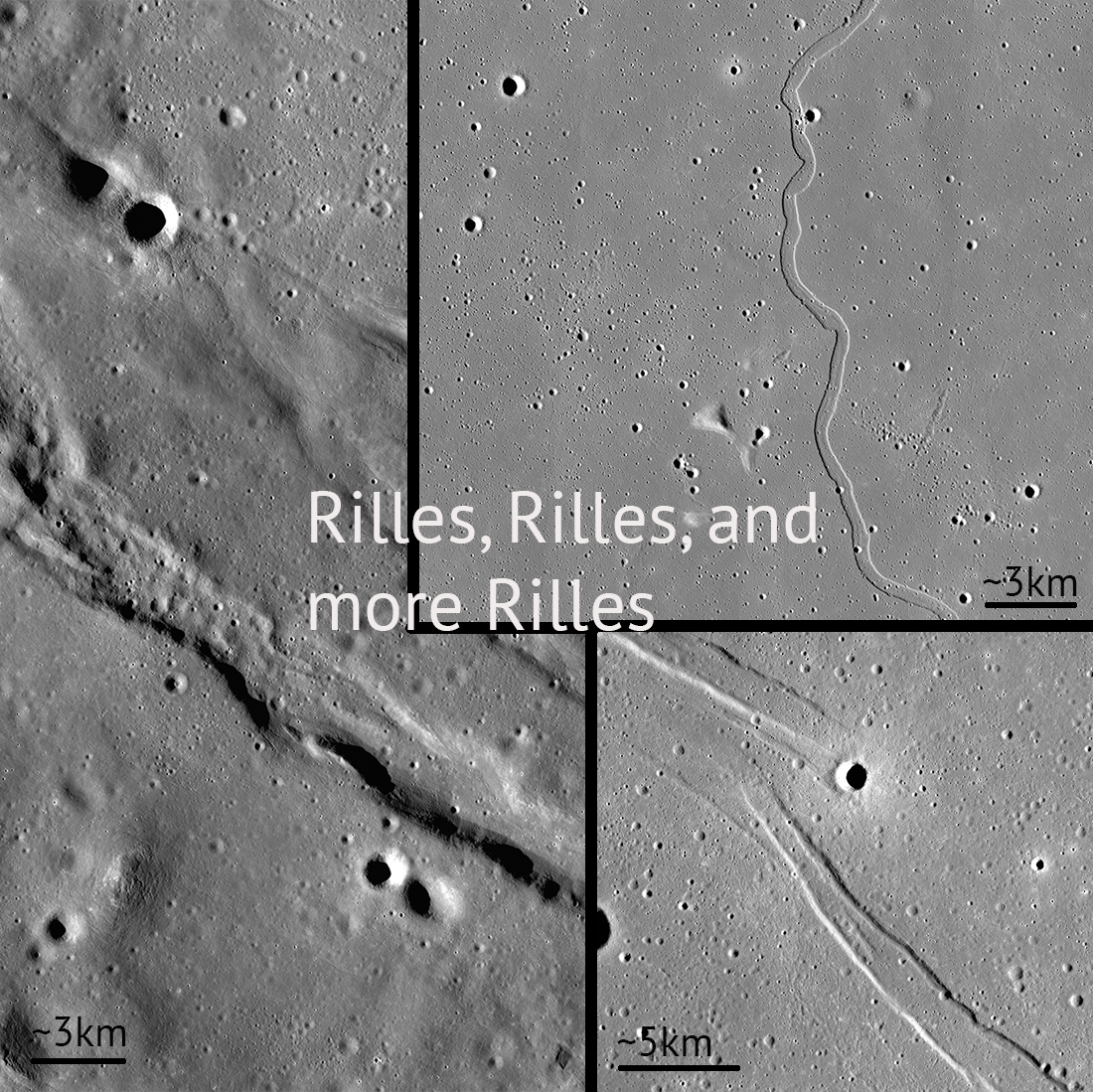
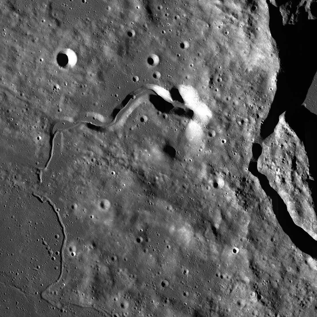
Rilles and Rilles: Sinuous, Straight, and Arcuate
Rilles are all over the Moon! Controlled feature mosaics help us see these features with great detail. Pictured: Rimae Sulpicious Gallus (20°N Lat, 10°E Lon), Rima Sharp (46°N Lat, 309°E Lon), Rima Cauchy (10°N Lat, 38°E Lon)...
Published on 30 Apr 2020
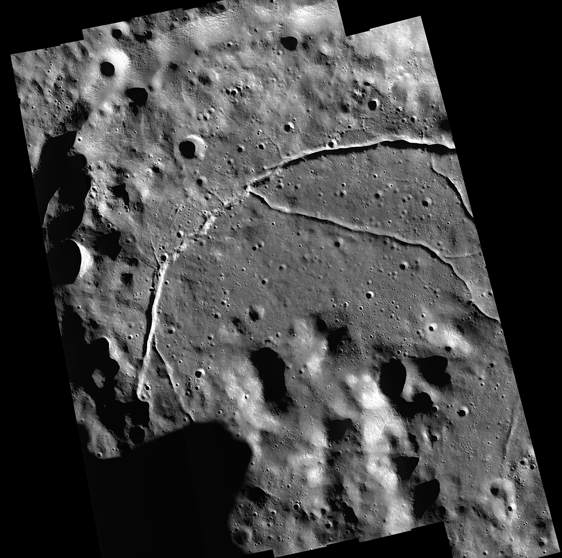
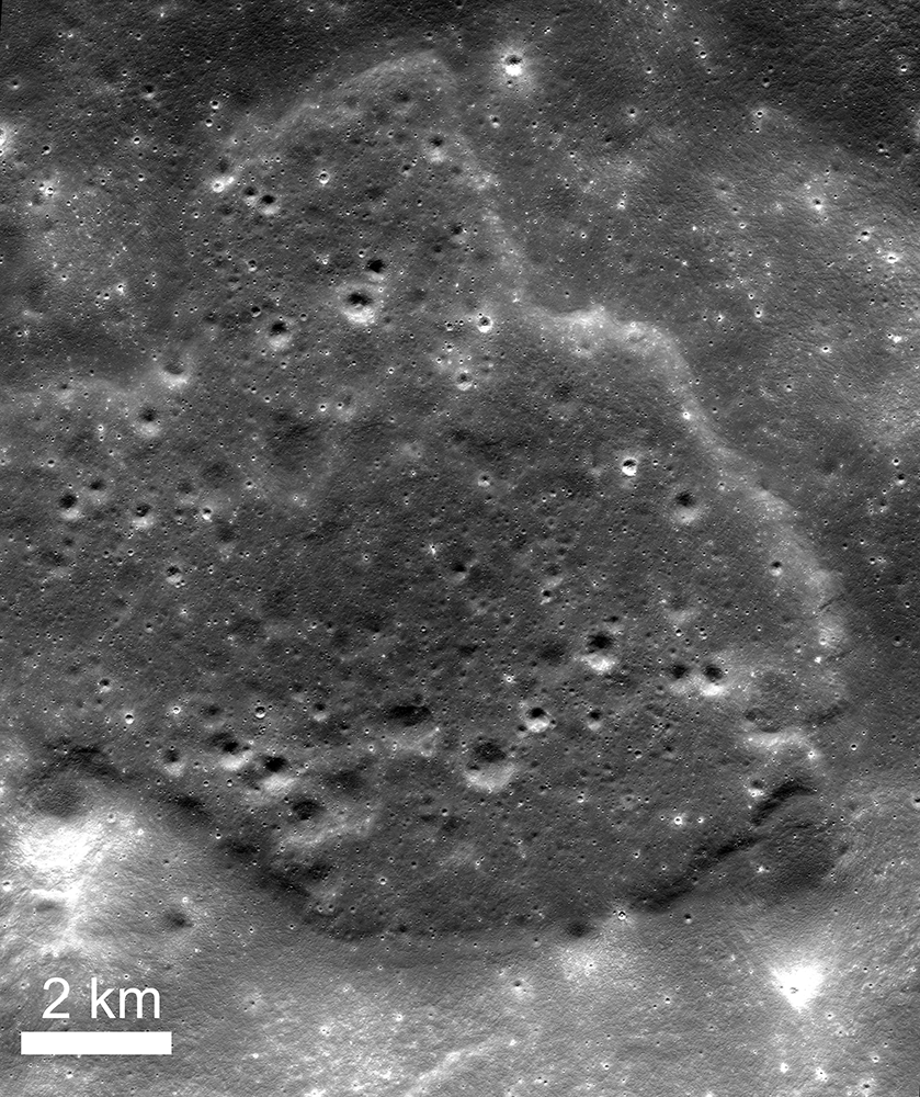
Feature Mosaics: Behind the Seams
A seamless mosaic of a portion of Karpinsky crater (91 km diameter, 72.61° N, 166.80°E) seamless mosaic. Scene is 55 km across, NAC images M1309496597L/R, M1309503618L/R, M1309510644L/R, M1309517669L/R, and M1309524696L/R...
Published on 16 Mar 2020
Plumbing the Depths by Scaling the Heights
The central mountainous peaks of Maunder crater are thought to be made of rock that was melted by the impact event that resulted in the Orientale basin. This impact melt rock deposit was then lifted up from below the surface during the...
Published on 19 Feb 2020
On and Around Mons Piton
Mons Piton rises 2300 meters above the dark volcanic rocks of Mare Imbrium. The image covers an area 15.5 kilometers wide, north is up, and the Sun shines from the east (right). LROC NAC image pair M190609650LR [NASA/GSFC/Arizona State...
Published on 09 May 2019
The West Side of Plato Crater
Western Plato crater (at right) and the geologically complex region west of its rim — part of a controlled and corrected mosaic made up of Lunar Reconnaissance Orbiter Camera (LROC) Narrow Angle Camera (NAC) images. The late afternoon...
Published on 18 Jan 2019
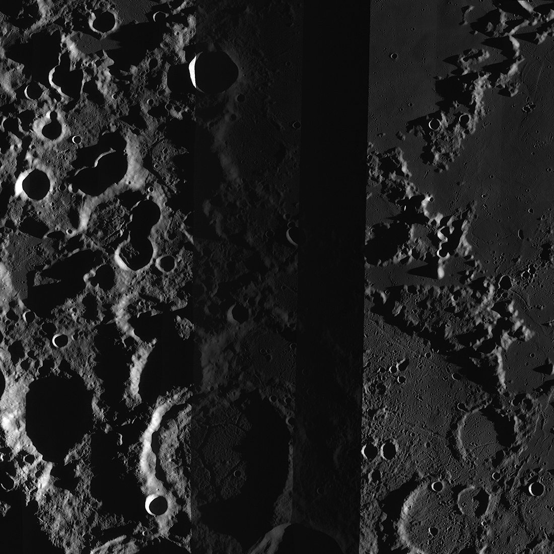
Von Kármán Crater: Awaiting A Visitor
Von Kármán crater (186 kilometer diameter), a treasure house of geologic landforms! LROC Wide Angle Camera mosaic, five degree latitude and longitude grid [NASA/GSFC/Arizona State University].
Published on 02 Jan 2019
Another Eclipse!
LROC WAC mosaic centered at 22.0°N and 277.5°E showing the Earth's shadow during a partial lunar eclipse on June 26, 2010. It takes LRO two hours to orbit the Moon so only during one orbit was the spacecraft in the full shadow, or...
Published on 26 Jul 2018
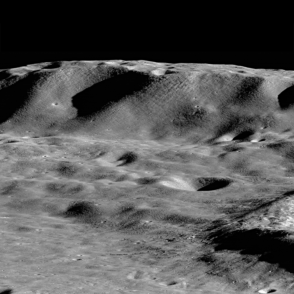
Towering Peak
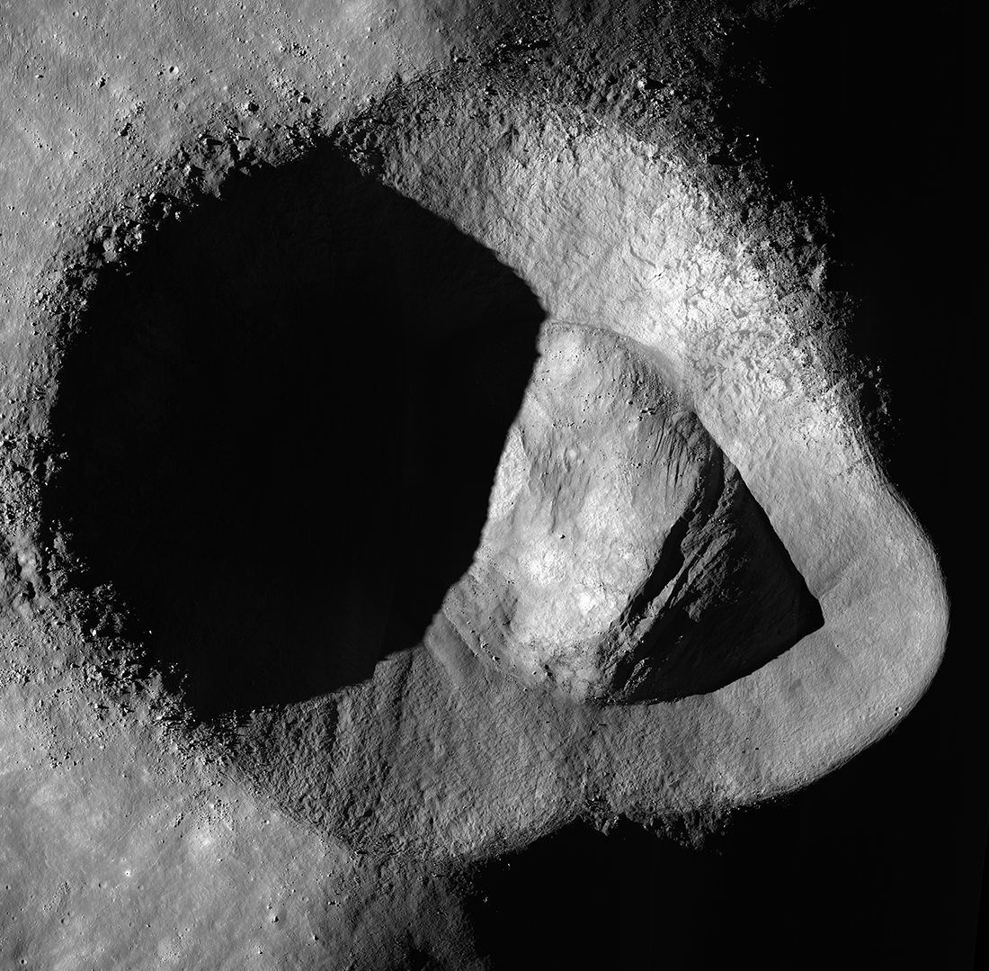
The summit of the unnamed peak in the foreground (50.2° S, 236.6° E) has an elevation of 6710 meters, about 7000 meters of relief relative to the low point at the bottom of the image. The two peaks on the horizon, 200 kilometers in the...
Published on 15 Jun 2018
Hawke Crater
Hawke crater, 13.2 km wide, is noticeably tilted because the impactor - an asteroid or a comet - that excavated it struck the sloping inner wall of Grotrian crater. Visible are light-colored rays that attest to the crater's youth, as...
Published on 03 May 2018
Lunar Light Plains: The Movie
The Orientale Basin, about 950 kilometers wide, is the striking multi-ringed impact feature at lower right. New research suggests that the impact event that formed Orientale may have emplaced light plains deposits - visible here...
Published on 20 Apr 2018
Mountains of the Moon: Zeeman Mons
The largest mountains on the Moon rival those of the Earth. Here Zeeman mons (informal name) rises more than 7,570 m (24,500 ft, 73.39°S, 213.31°E) above the floor of Zeeman crater, and the flank of Zeeman Y is just visible on the right...
Published on 20 Nov 2017
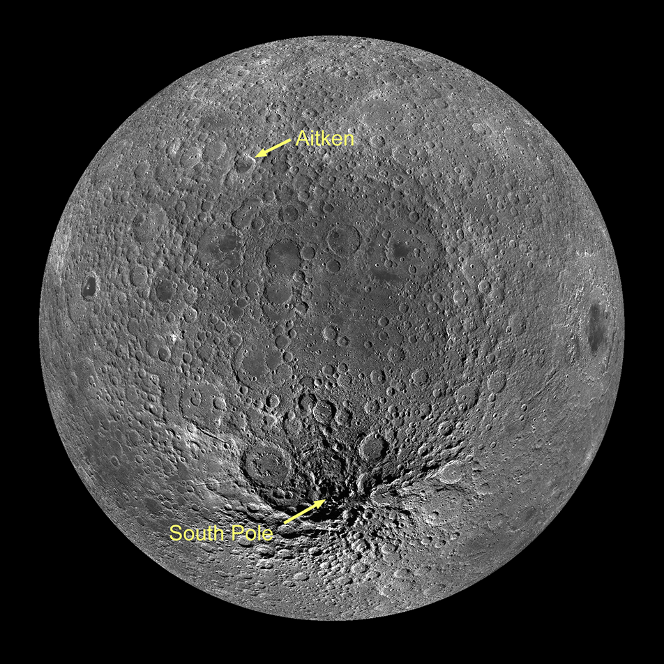
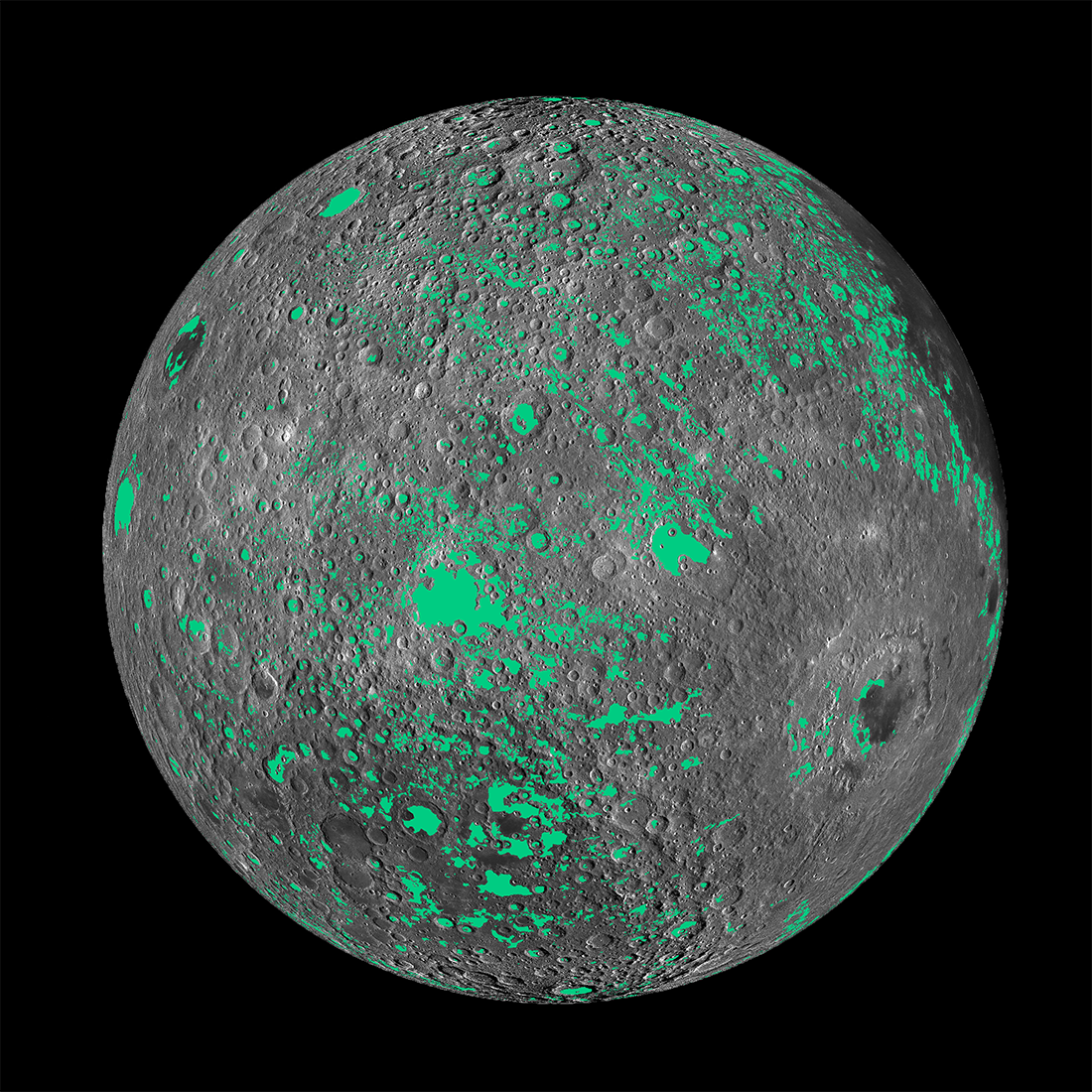
The History of Volcanism in the Moon's Largest Basin
A view of the Moon's largest impact feature, the South Pole–Aitken basin, so named because it stretches between Aitken crater and the south pole. The orthographic projection here centered on the basin (53°S, 191°E) highlights how much...
Published on 02 Nov 2017