Featured Images
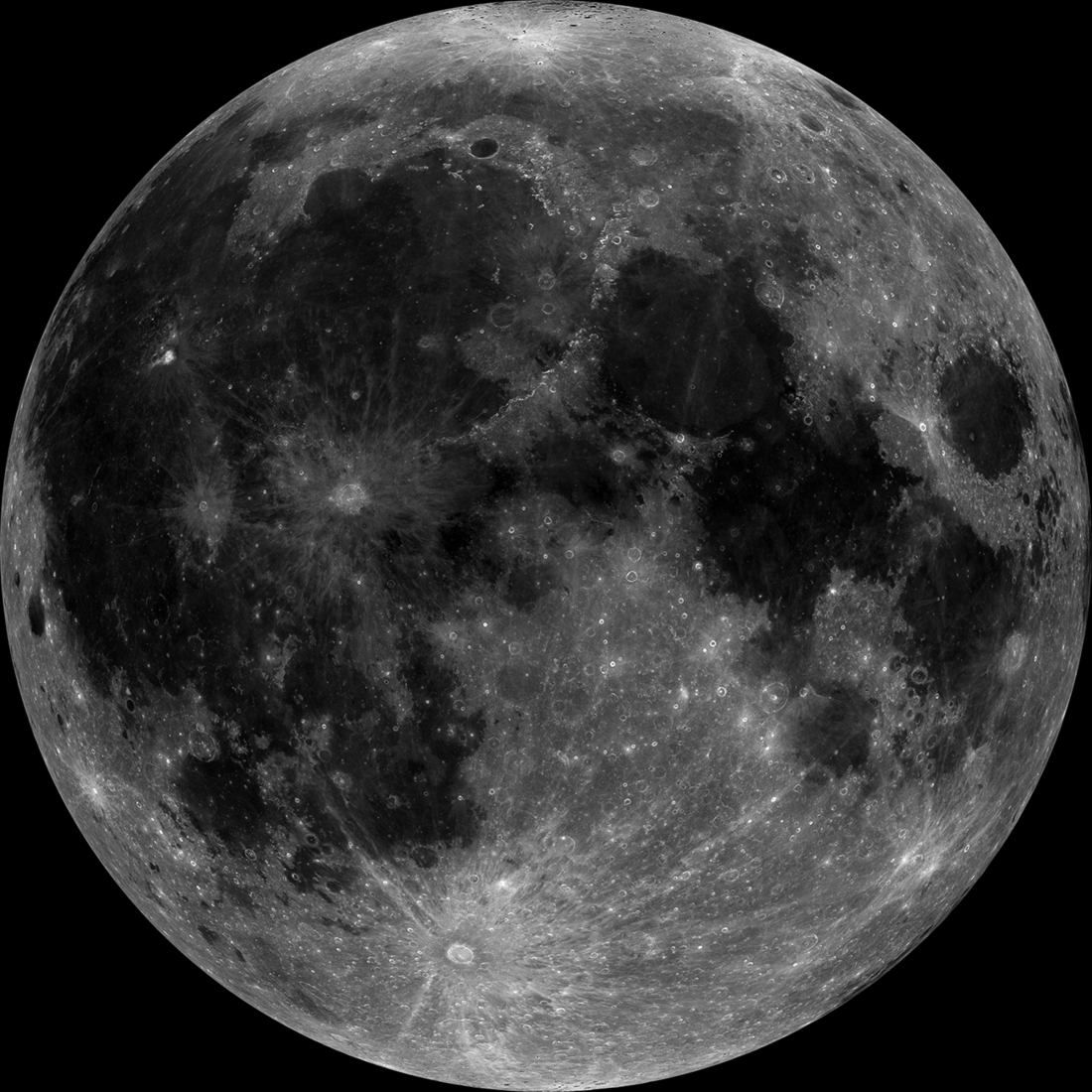
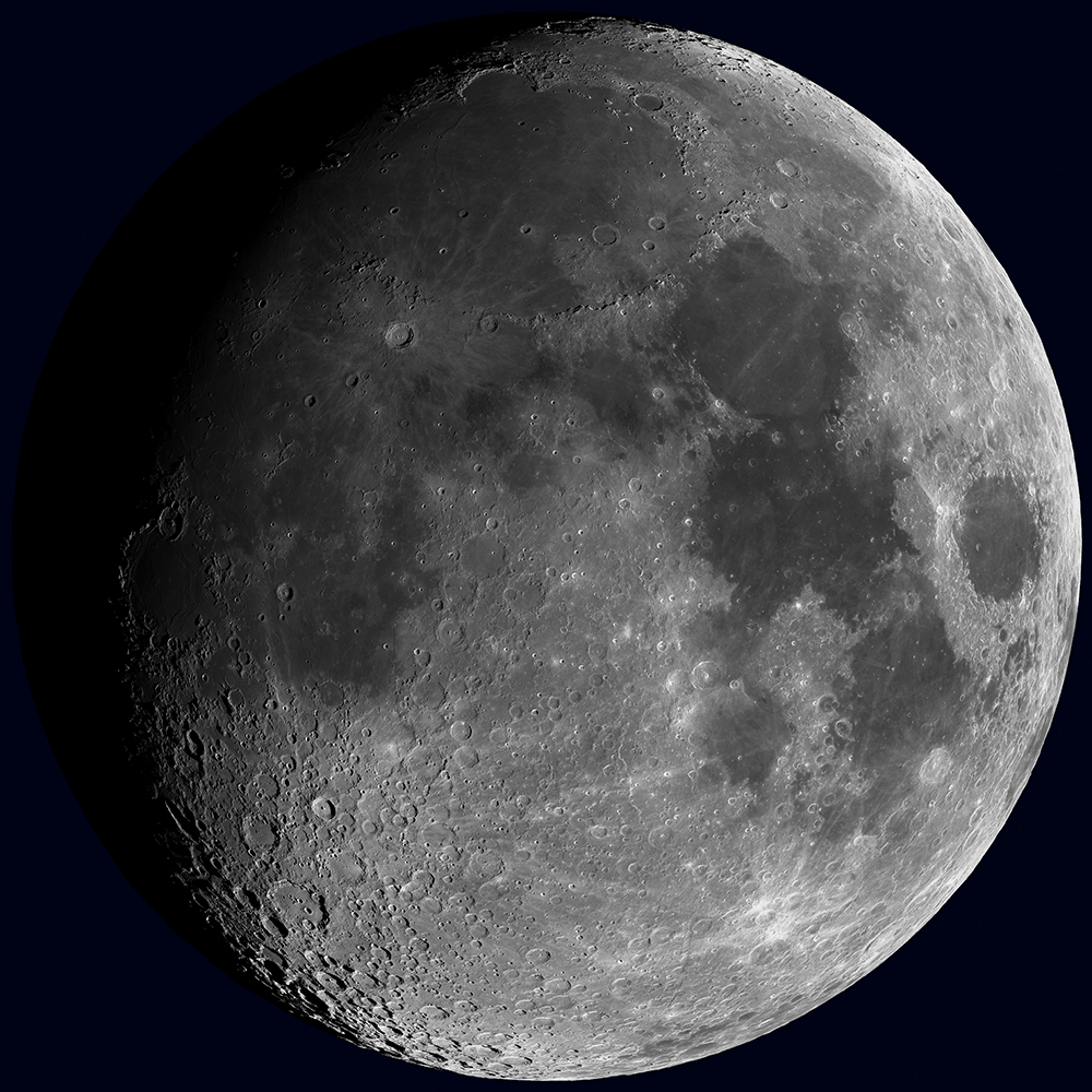
Once in a Super Blue Moon
A projection of the LROC Wide Angle Camera (WAC) mosaic showing the Moon as it will appear during the August 30th, 2023 super blue Moon [NASA/GSFC/Arizona State University].
Published on 26 Aug 2023
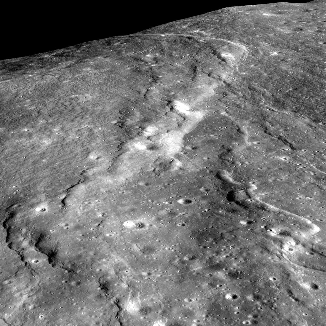
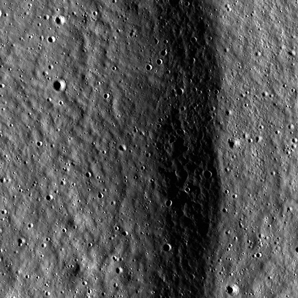
Lobate Scarps: The Movie
Lobate scarps - like those shown here on the floor of the farside crater d'Alembert - are not large, but they tell us much about how hot the Moon was when it was born and its ongoing thermal evolution. Image width is about four...
Published on 31 Oct 2018
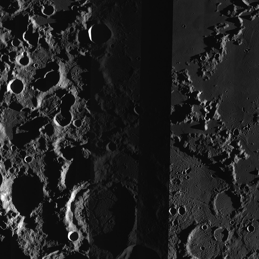
Another Eclipse!
LROC WAC mosaic centered at 22.0°N and 277.5°E showing the Earth's shadow during a partial lunar eclipse on June 26, 2010. It takes LRO two hours to orbit the Moon so only during one orbit was the spacecraft in the full shadow, or...
Published on 26 Jul 2018
Polar Illumination Maps and More!
New Reduced Data Records (RDRs) available as part of the 32nd Planetary Data System (PDS) release include two versions of the polar illumination maps for each pole. They include this time-weighted north pole illumination...
Published on 12 Jan 2018
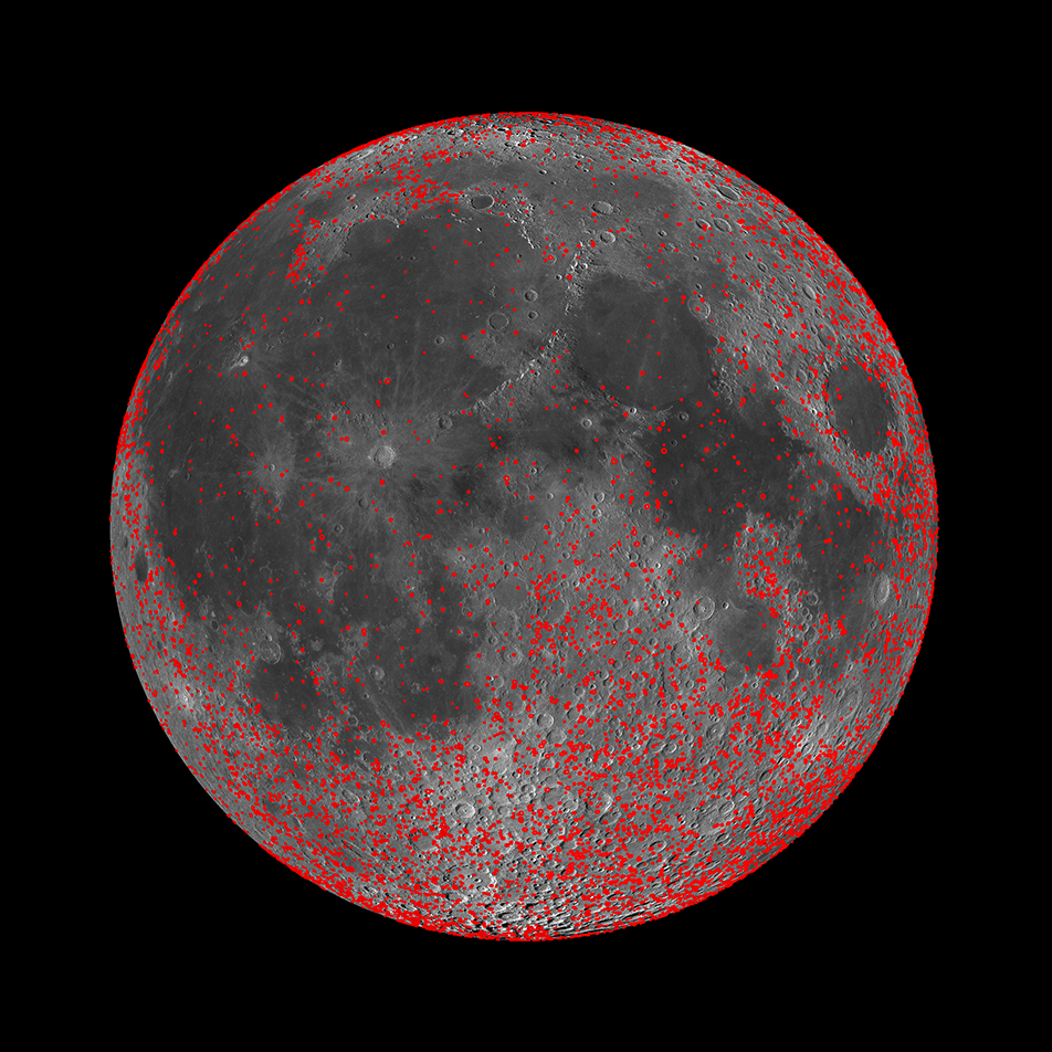
Every Crater on the Moon (Larger than 5 km)
New work from the LROC team resulted in a map of all detectable craters on the Moon between 5 and 20 km in diameter (red circles). When combined with an existing map of craters larger than 20 km in diameter, the differences in the...
Published on 13 Nov 2017
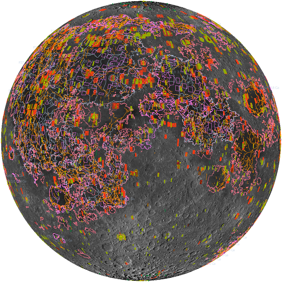
'Shaping' Lunar Science with Vector Data
Twenty new shapefiles created by the LROC Team are now available! A few of the shapefiles shown here include mare age units, footprints of digital terrain models (DTMs), and the locations of small geologic features such as...
Published on 18 Jul 2017
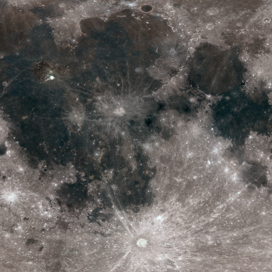
Resolved Hapke Parameter Maps
LROC Wide Angle Camera (WAC) color composite mosaic of the Moon, photometrically normalized using new Hapke parameter maps. Red: 689 nm, green: 415 nm, and blue: 321 nm band; latitude 55°S to 55°N, longitude -68.6° to 41.4°E.
Published on 28 Sep 2014
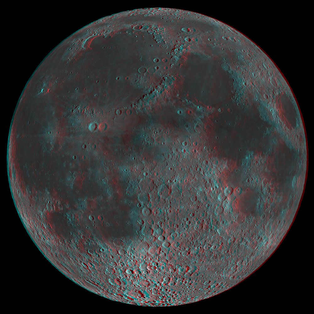
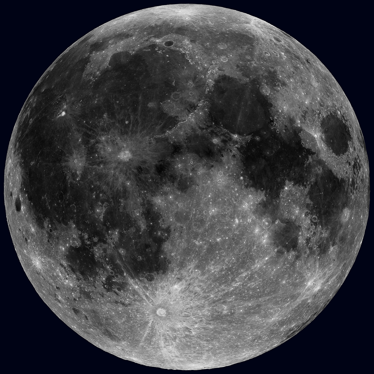
3D Moon!
Today's featured image is a 3D anaglyph of the low-Sun LROC WAC 643 nm mosaic of the lunar nearside [NASA/GSFC/Arizona State University].
Published on 18 Oct 2013
Synthetic Views of the Moon
Synthetic view of the waxing Moon as viewed from Earth on 2013-10-15 17:00:00 UTC [NASA/GSFC/Arizona State University].
Published on 15 Oct 2013
A Unique View Of The Moon
The Sun overhead, across the whole Moon! Of course this is not possible in real life, but 36 nearly complete WAC mosaics make this view possible [NASA/GSFC/Arizona State University].
Published on 17 Jul 2013
Lunar Lobate Scarp
A North-South trending lobate scarp lies within Xenophanes crater. LROC NAC M118031613LE, image width is 600 m [NASA/GSFC/Arizona State University].
Published on 14 Sep 2011
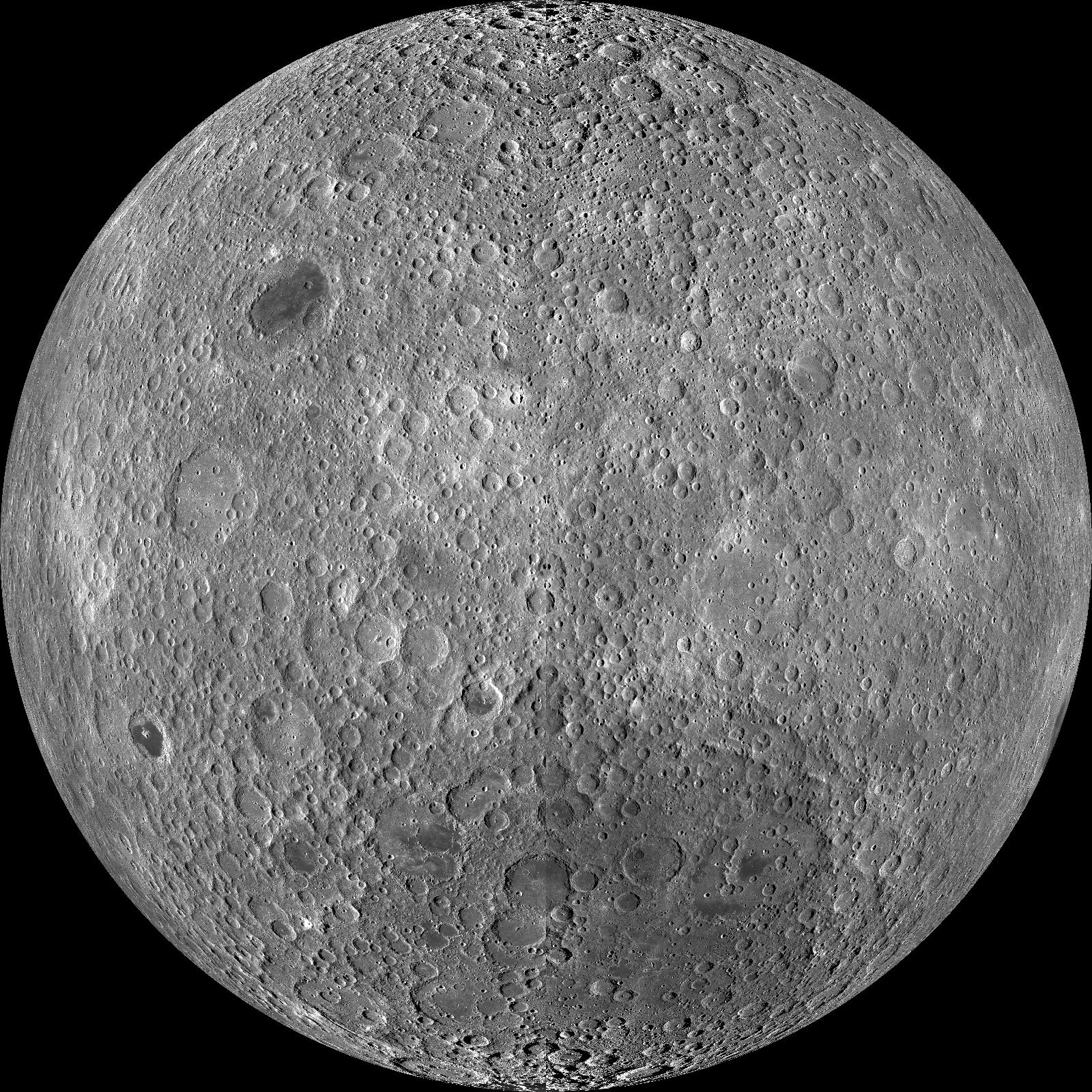
Farside! And all the way around
The lunar farside as never seen before! LROC WAC orthographic projection centered at 180° longitude, 0° latitude [NASA/GSFC/Arizona State University].
Published on 11 Mar 2011
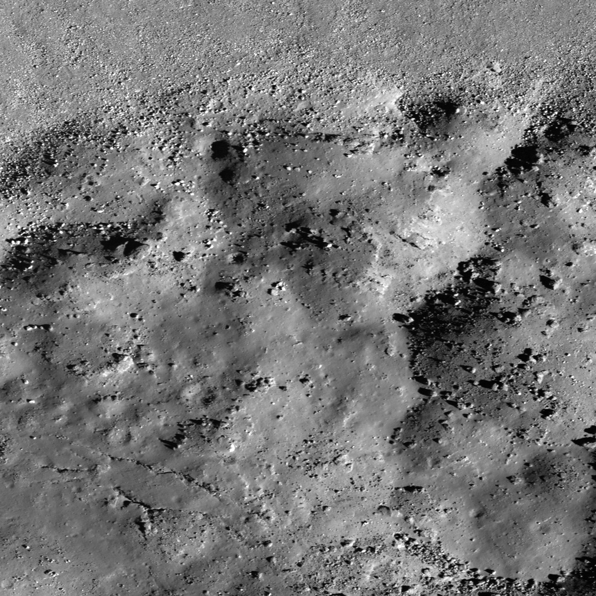
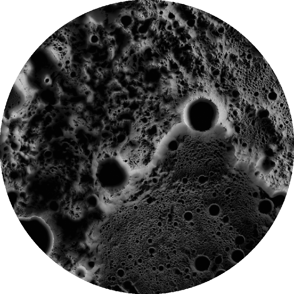
Mounds in a melt pond
Bottom of Laplace A crater cavity. LROC NAC M129466485R, 0.80 m/pixel, image width is about 960 m. Sunlight is from lower-right side, incidence angle is 66° [NASA/GSFC/Arizona State University].
Published on 24 Feb 2011
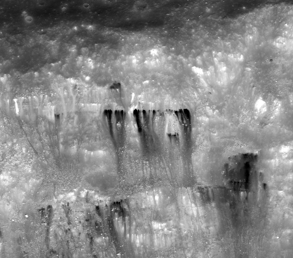
Dark streaks in Diophantus crater
Northern flank of Diophantus crater. LROC NAC M124797072L, 0.56 m/pixel, image width is about 678 m. Illumination is from the bottom of the image, downslope direction is from top to bottom of the image [NASA/GSFC/Arizona State University].
Published on 23 Feb 2011
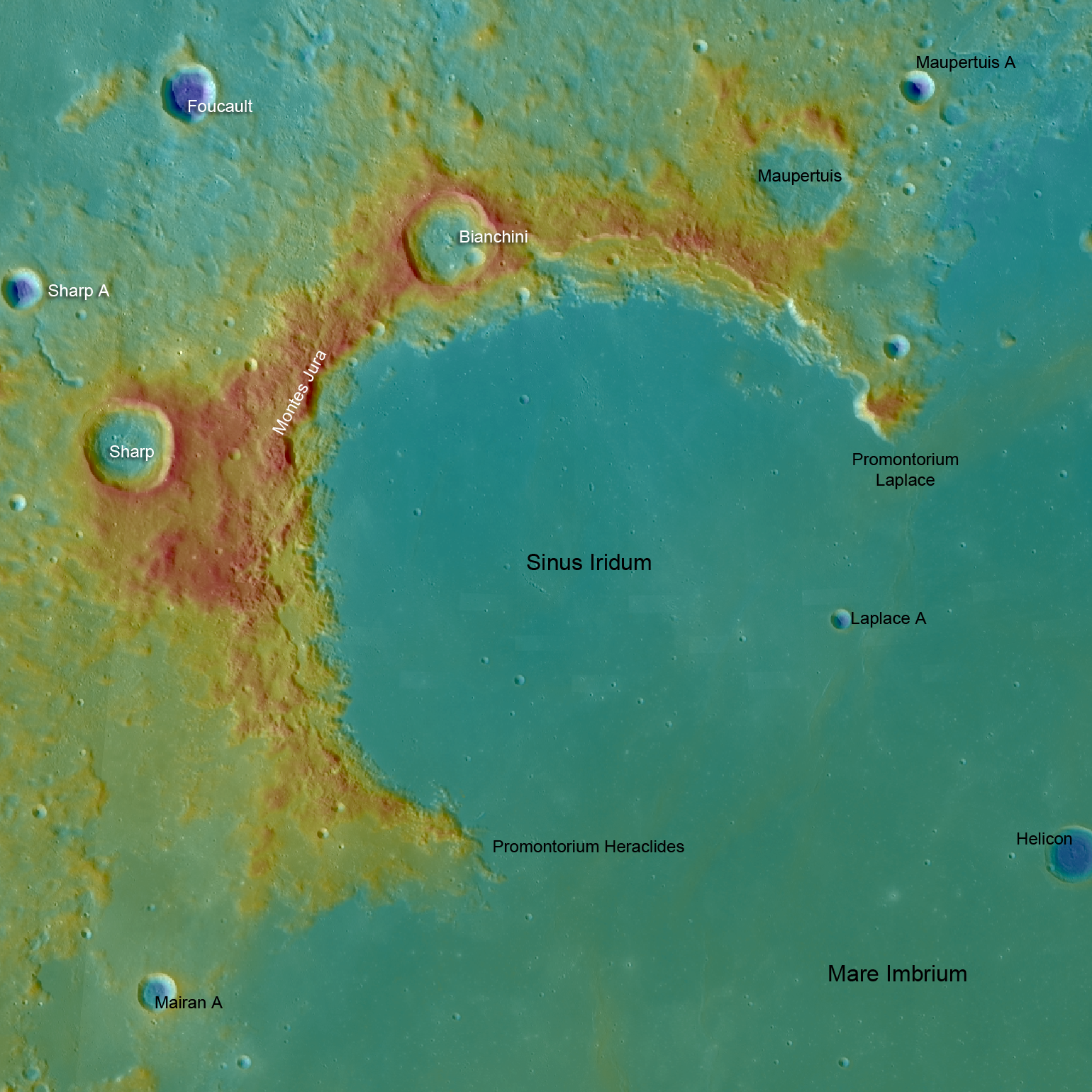
Sinus Iridum - Next Destination?
LROC WAC topography of Sinus Iridum, blue shows the lowest areas and red the highest. From promontory to promontory Sinus Iridum is 235 km across [NASA/GSFC/Arizona State University].
Published on 15 Oct 2010