LROC Lunar QuickMap received a major update this week that includes powerful improvements to interactive features and data. For those unfamiliar with the Lunar QuickMap, it's a highly interactive, web-based Geographic Information System (GIS) tool that hosts a tremendous pool of data from the Lunar Reconnaissance Orbiter Camera and several other prominent instruments that have gathered, or continue to gather, data about the Moon.
Most notably, the fall release includes updated user features, like the ability for users to import their own data, the option to export and import search features and settings, and enhanced Draw & Search tools that help users access and analyze data — including interactive inspection of values and Data Cube extraction. On the data side, a collection of new or updated data layers has been added, like the Wide Angle Camera (WAC) Hapke-Normalized layer, and additional numeric data layers, such as Olivine Abundance. Some raster layers have also been updated and replaced by improved numeric layers, which are layers that have pixels containing geophysical data values in addition to color values. These notable features and layers will be briefly highlighted below, but a full list of the fall updates can be found here.
Updates to user features
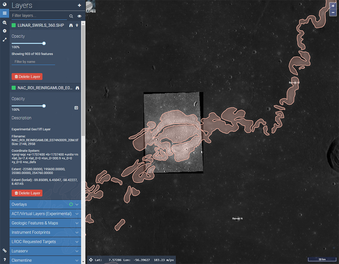
Jumping into some of the new features, users can now import GeoTIFF files, re-projecting them onto the Lunar QuickMap 2D views. No data is transferred to the QuickMap servers, so all rendering is done locally, and importing these files to the 3D view is not yet supported. Users can also import Shapefiles in lat/lon projection in addition to previously supported vector data import formats like GeoJSON and CSV. The image below shows how some of these new features might be used together.
In addition to importing new layers, users now have the option to export and import their Draw & Search tool layers and settings. The features are saved to the user's local machine in GeoJSON format and the files can then be shared between users or reimported when the user is ready to resume work or analysis.
The Draw & Search tools have also been enhanced to allow for the extraction and download of numeric datasets along user-defined point, line, and polygon geometries. The animated image below shows how these new tool functions can be leveraged to analyze regions of interest in greater detail.
Updates to data layers
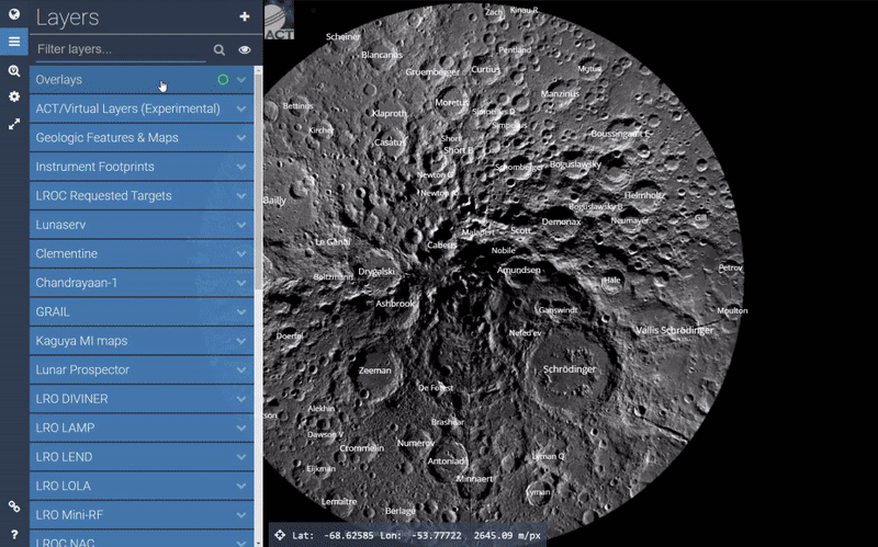
Updates to the data layers include new and improved layers that allow for more advanced control and analysis. Improved layers like the WAC+NAC+NAC_ROI_MOSAIC basemap includes select images from the WAC, Narrow Angle Cameras (NACs), and LROC ROI Mosaics to offer a wonderful combination of LROC image resolution and repeat coverage under multiple lighting conditions to deliver amazing, elaborate views of the lunar surface.
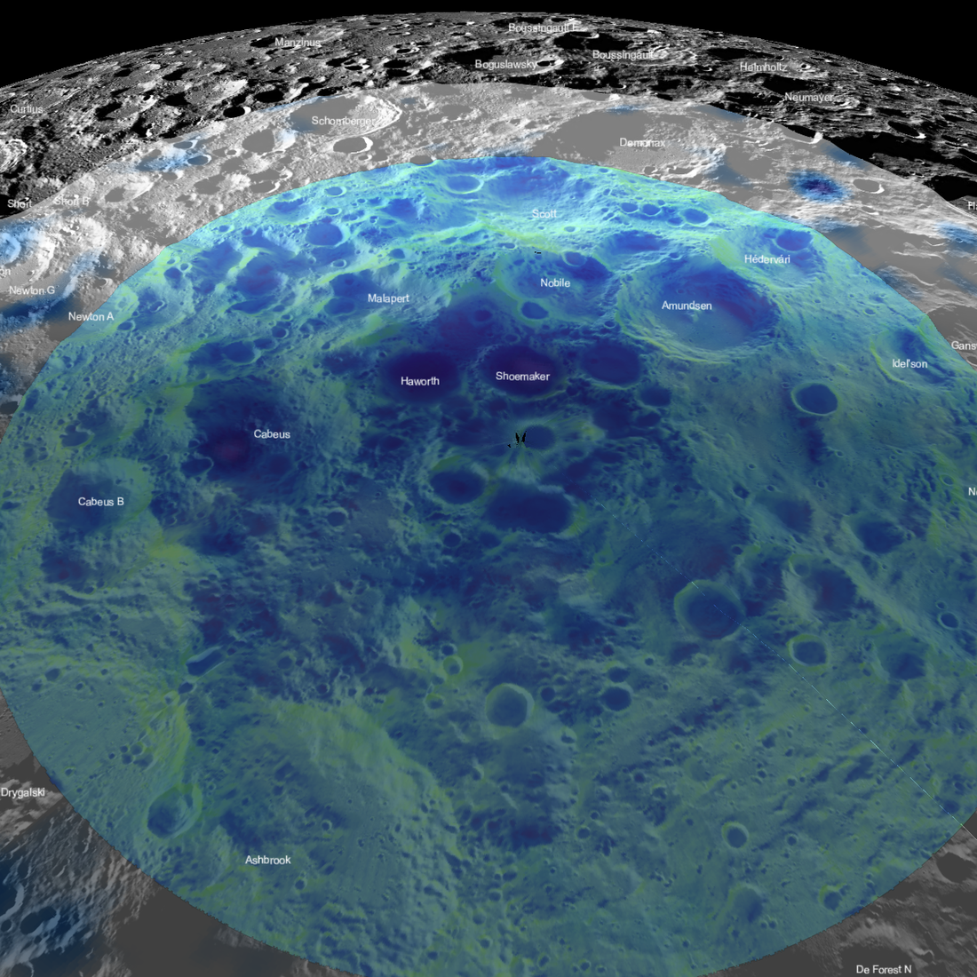
Additionally, quite a few more numeric layers have been added. These layers allow users to dynamically stretch, extract, and analyze layer data in much more detail than standard image layers. For example, the WAC Hapke-Normalized layer that previously contained data for just three of the seven WAC color bands has now been supplemented by seven numeric layers, one for each color band, giving users individual control — unlike the previously combined layer. The image below shows one of a few ways that these numeric layers can be quite handy.
The complete list of Lunar QuickMap fall updates can be found here. Check back often as LROC continues to provide future updates that deliver a robust experience and improved data analysis for anyone looking to explore the Moon. Additionally, feel free to look at the previous Lunar QuickMap update post here, which highlights many of the improvements released in the spring 2020 update.
Lunar QuickMap links:
Lunar QuickMap
Fall updates online list
Fall updates PDF list
User Guide
Examples
Layer Inventory
Draw & Search usage
Published by Rick Hoppe on 29 October 2020