Eyeball navigation was a critical check for the Apollo astronauts as they descended to the lunar surface. For the first landing attempt several prominent landmarks were chosen to allow the crew to visually check that the descent profile was on schedule. In the case of Apollo 11, Armstrong and Aldrin had Lunar Orbiter and Apollo 10 images of these landmarks. At a given time each landmark should be visible out the Command Module window. It was simply a matter of glancing out the window and making sure the landmark was visible. If the landmark was not visible then the astronauts would know that they were off the nominal descent timeline.
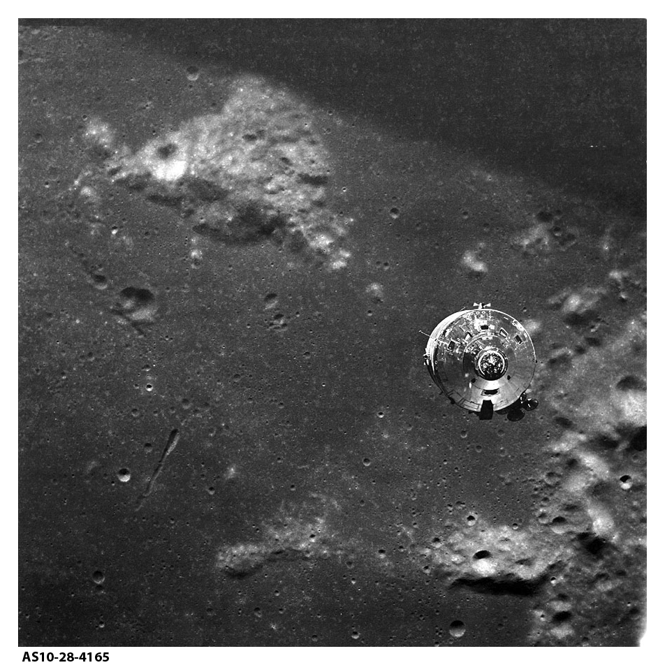
One of the most important and best known Apollo eyeball landmarks is Mt Marilyn, named by James Lovell for his wife. This important landmark was called out on at least three Apollo missions as the astronauts passed overhead.
Apollo 8 (72:05:40 Ground Elapsed Time or GET)
Lovell: I can see the old second initial point right now, Mount Marilyn.
Apollo 10 (120:28:52 GET)
Stafford: Houston, Apollo 10. We've just passed over Mount Marilyn and the crater Weatherford. Over.
Apollo 11 (76:37:55 GET)
Aldrin: We’re going over Mount Marilyn at the present time, and it’s ignition point. CapCom: Roger. Thank you. And our preliminary tracking data for the first few minutes shows you in a 61.6 by 169.5 orbit. Over.
Aldrin: Roger.
The Apollo 11 Descent Monitoring Chart Sheet 3A showed the descent path of the lunar module Eagle (scan courtesy Apollo Lunar Surface Journal and the Lunar and Planetary Institute).
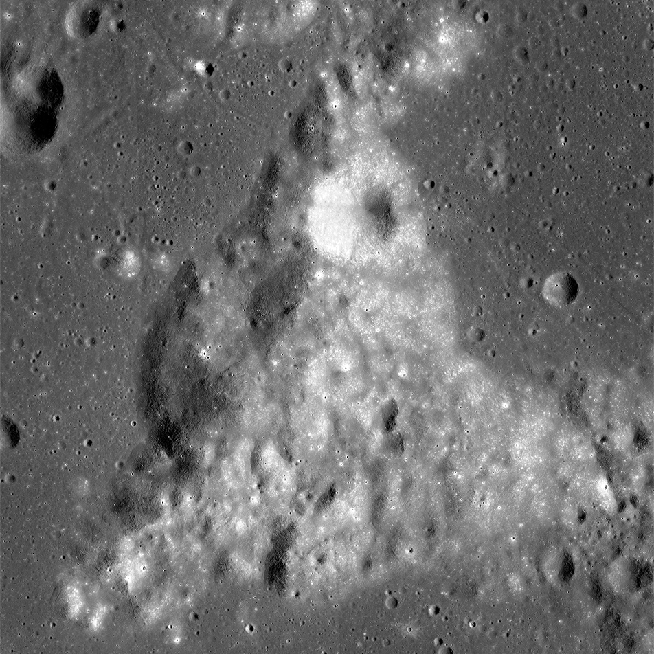
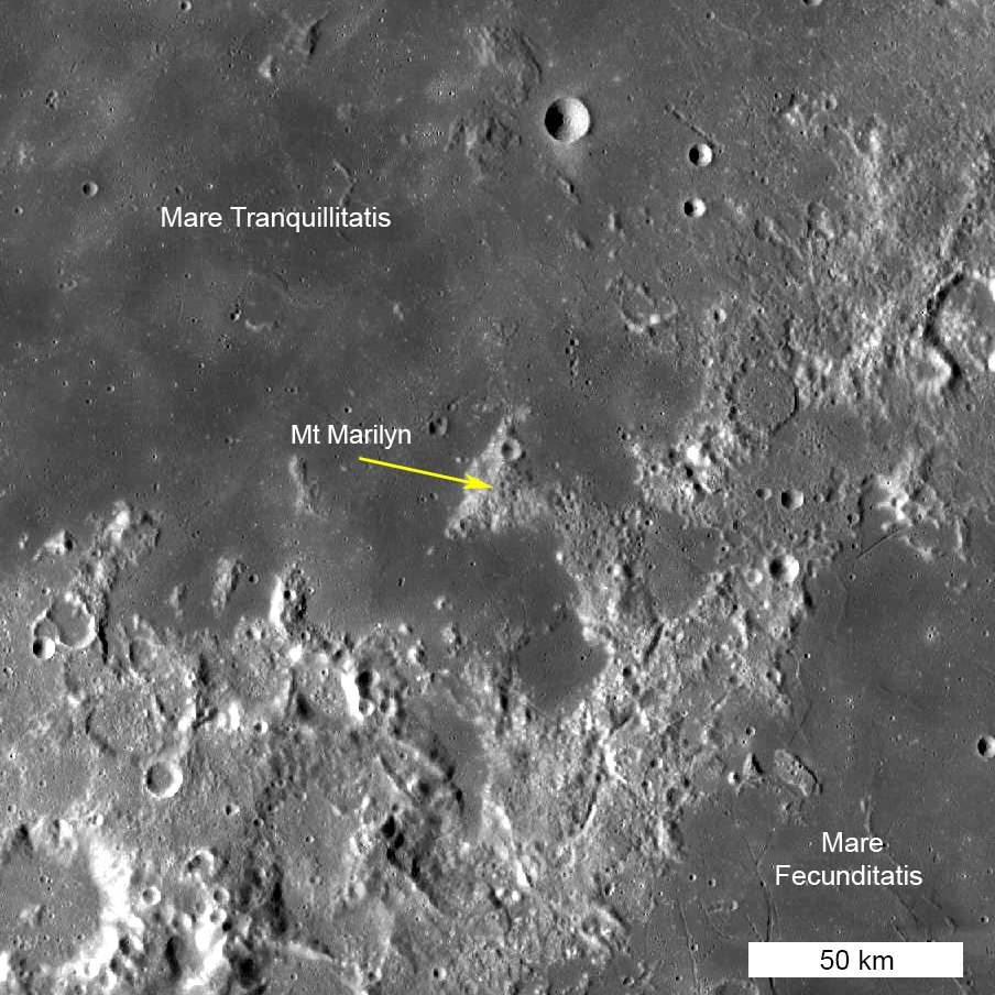
Mt Marilyn is located on the boundary between two major nearside mare, Mare Tranquillitatis and Mare Fecunditatis. Its hummocky surface rises 1400 m (4593 ft) above the surrounding basalt plains. Like most lunar mountains it likely formed as a result of a large basin-forming impact event 4 billion years ago.
This modest, yet historic peak will forever live on in the history of humankind's first step on another celestial body. There are many other Apollo era landmarks that appear in technical reports and maps, but many of these names are not officially recognized by the International Astronomical Union (IAU). To aid researchers and historians these place names were added to the official IAU nomenclature database and appear on the LROC Quickmap interface (102 names; for example Fifty Four crater, Left Foot crater, MOCR crater, Snoopy crater). The appended shape file can be found on the LROC Apollo webpage (updated quarterly as the IAU adds more official names to the database). Note that these unoffical names are marked as "Unofficial Apollo" in the Approval field.
LROC oblique of Mt. Marilyn (NAC M1142226401LR).
Related Featured Images
"Houston, Tranquility base here."
Published by Mark Robinson on 4 January 2016