Featured Images
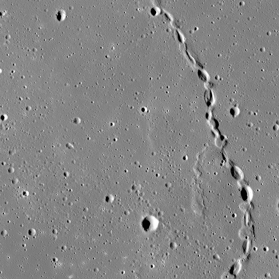
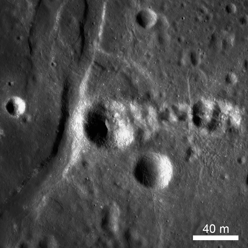
Gruithuisen: Collapsed Lava Tube?
The spectacular sinuous landform shown above is thought to be a collapsed lava tube (34.7°N, 316.6°E), located near Gruithuisen K crater. NAC controlled mosaic containing images M1173350480L/R, M1173357586L/R [NASA/GSFC/Arizona...
Published on 06 Oct 2023
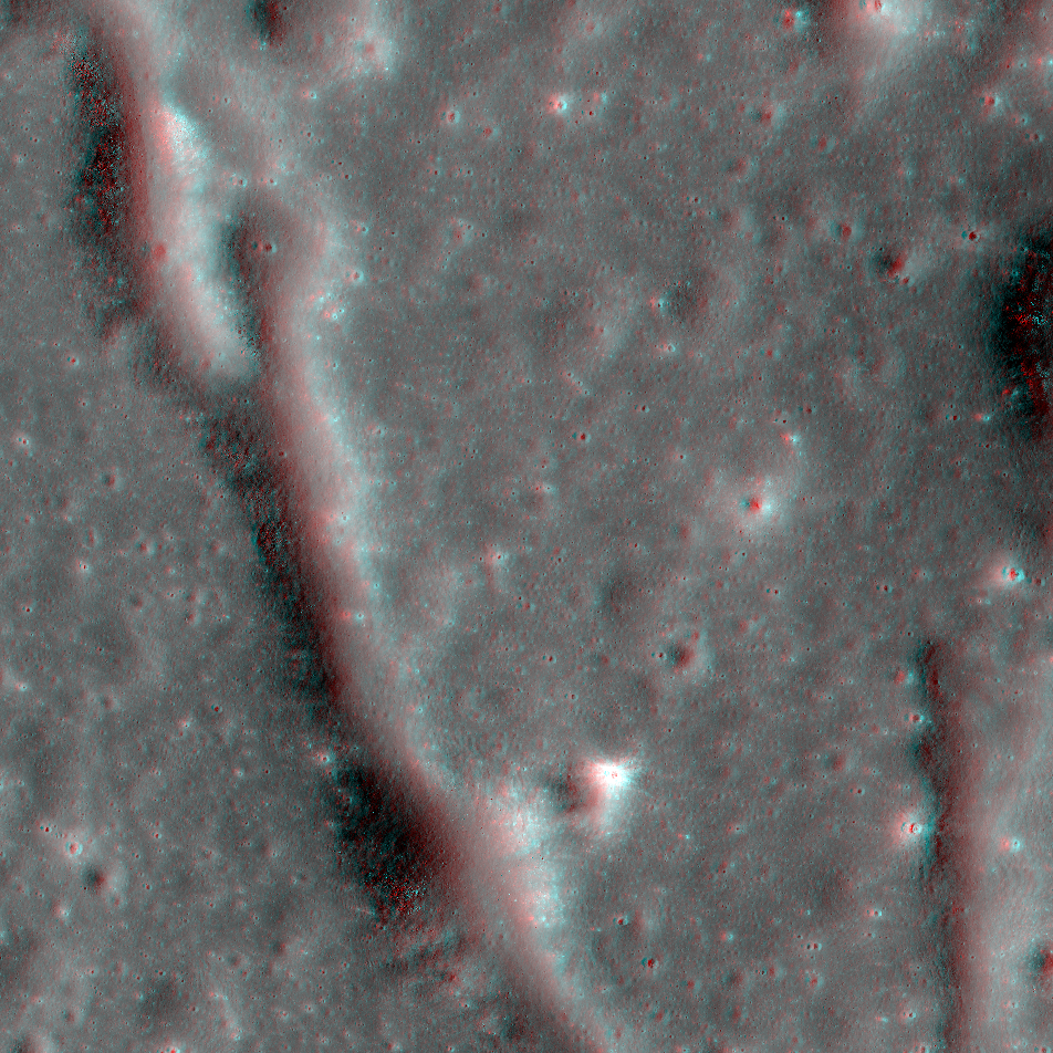
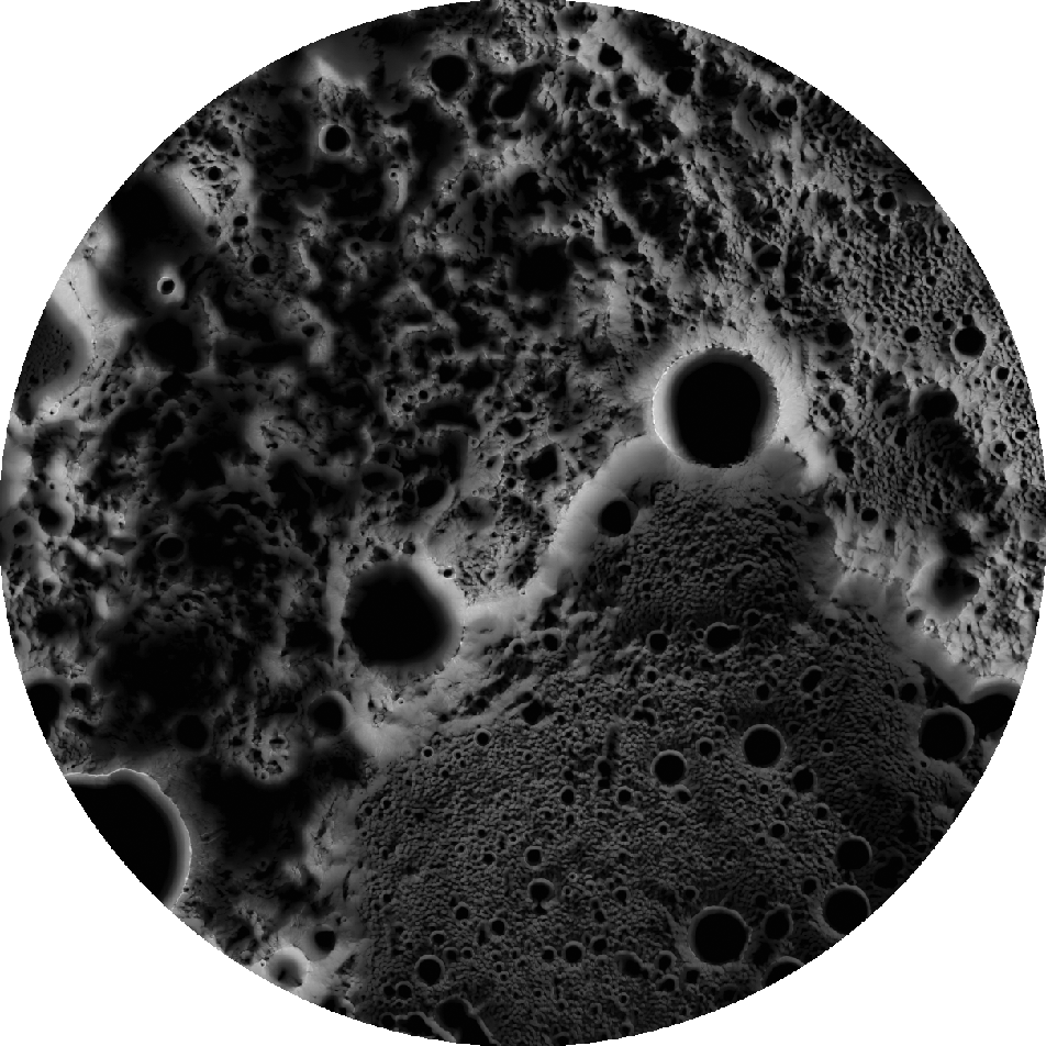
NAC Anaglyph: Alphonsus Vent
A dike (subsurface magma body) was likely intruded under the floor of Alphonsus crater creating an array of fractures seen here. Image is 5700 meters wide, north is towards the top [NASA/GSFC/Arizona State University].
Published on 19 Feb 2022
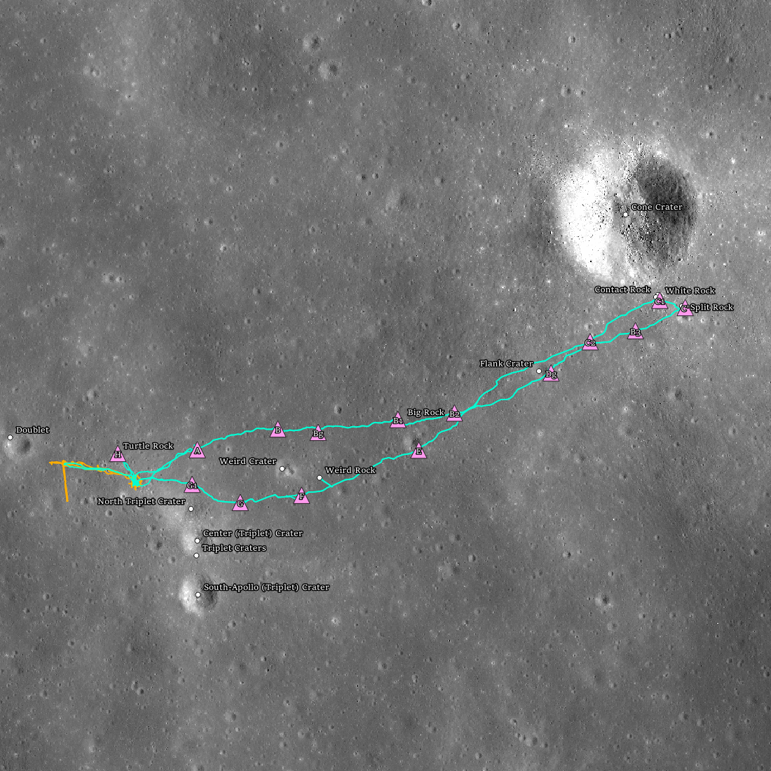
Apollo 14 Fiftieth Anniversary!
Apollo 14 landing site (4.646°S, 342.528°E) showing the two extra-vehicular activities (EVAs; orange = EVA1 and teal = EVA2) with stations (pink triangles), and geologic features (white dots).
Published on 05 Feb 2021
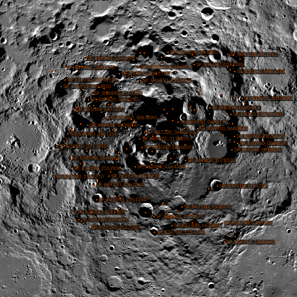
Casting Light on Permanently Shadowed Regions
The locations of south pole permanently shadowed regions (PSRs) with areas >10 km2. Images and information about each PSR can be found in the LROC PSR Atlas. [NASA/GSFC/Arizona State University]
Published on 27 Jan 2018
Polar Illumination Maps and More!
New Reduced Data Records (RDRs) available as part of the 32nd Planetary Data System (PDS) release include two versions of the polar illumination maps for each pole. They include this time-weighted north pole illumination...
Published on 12 Jan 2018
High Resolution Maps of the Moon
A section of Narrow Angle Camera (NAC) Region of Interest (ROI) mosaic of Catena Littrow (22.23°N, 29.61°E) represents one of 12 new Reduced Data Records (RDRs) recently released as part of Volume 31 of the LROC Planetary Data System...
Published on 31 Oct 2017
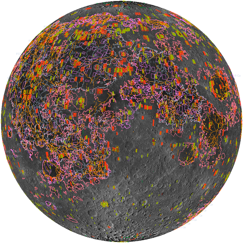
'Shaping' Lunar Science with Vector Data
Twenty new shapefiles created by the LROC Team are now available! A few of the shapefiles shown here include mare age units, footprints of digital terrain models (DTMs), and the locations of small geologic features such as...
Published on 18 Jul 2017