Featured Images
Mysteries Remain Frozen in our Celestial Backyard
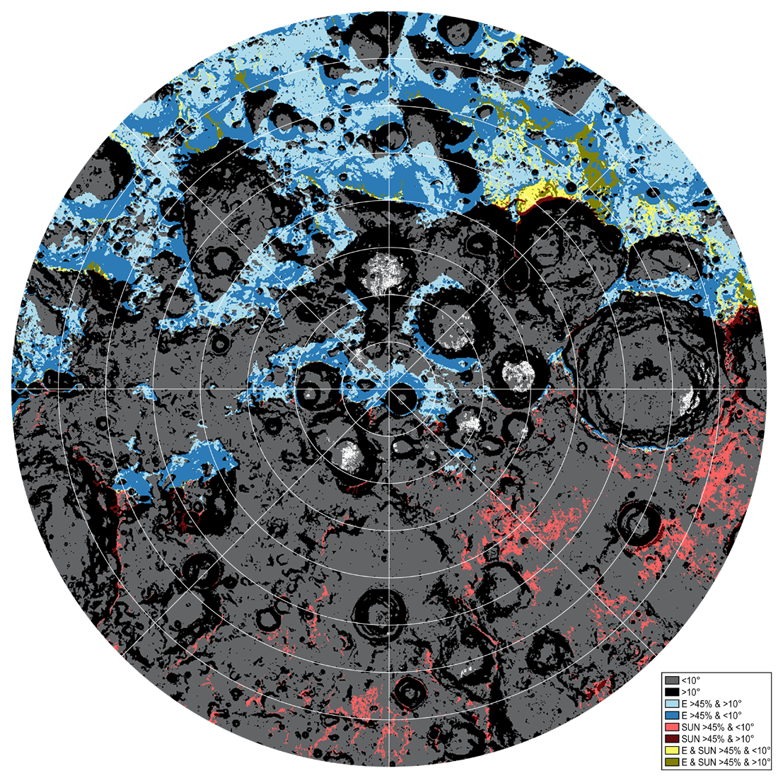
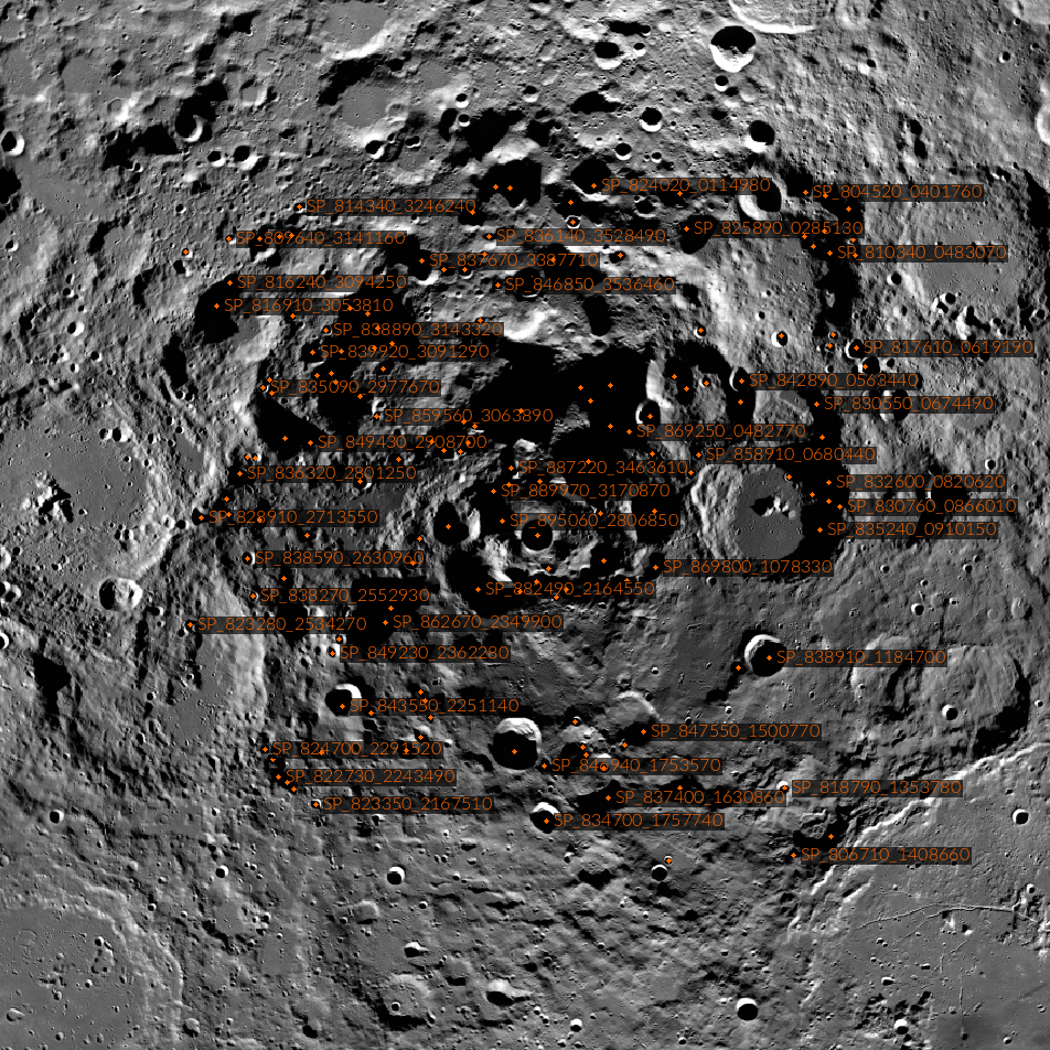
Traversability conditions and landing site assessment map for the lunar south polar region. The percentage of time that the surface will be illuminated and visible to the Earth is modeled for the expected Artemis timeframe (July 9, 2024...
Published on 13 Jun 2023
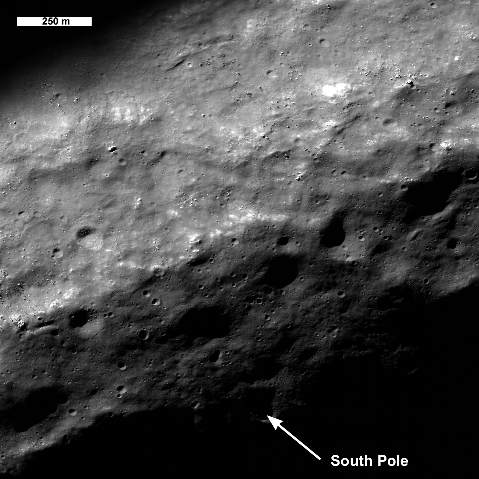
Where is the South Pole?
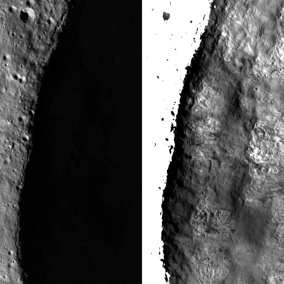
Often hidden in shadows, the south pole (90°S, 0°E) occurs just inside the rim of Shackleton crater (20-kilometer diameter). This spectacular view, aimed at the pole, was acquired on 18 May 2022. The image is 2400 meters wide in the...
Published on 19 Oct 2022
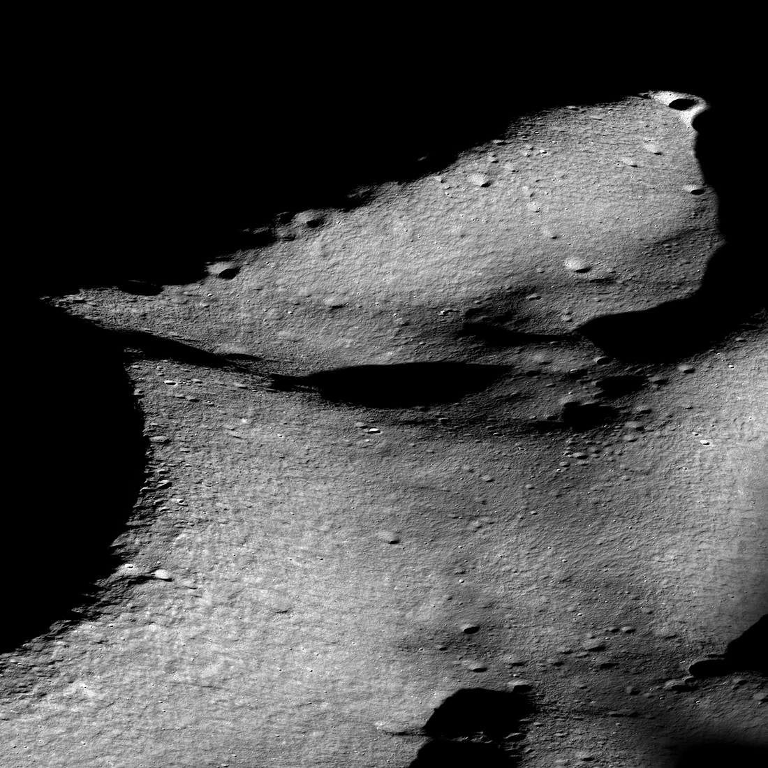
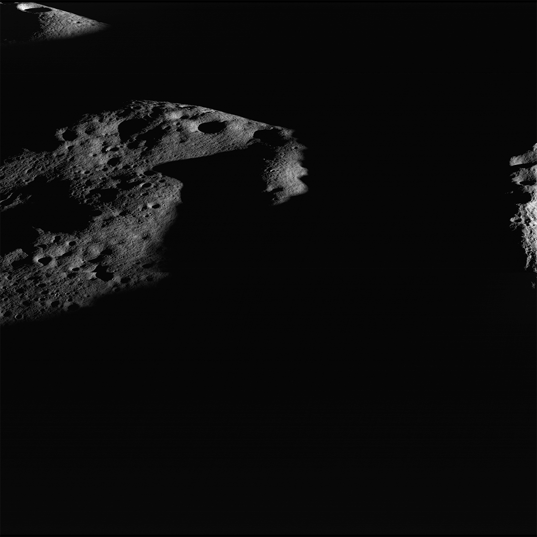
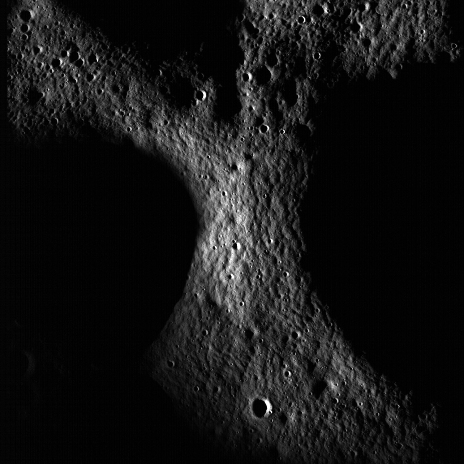
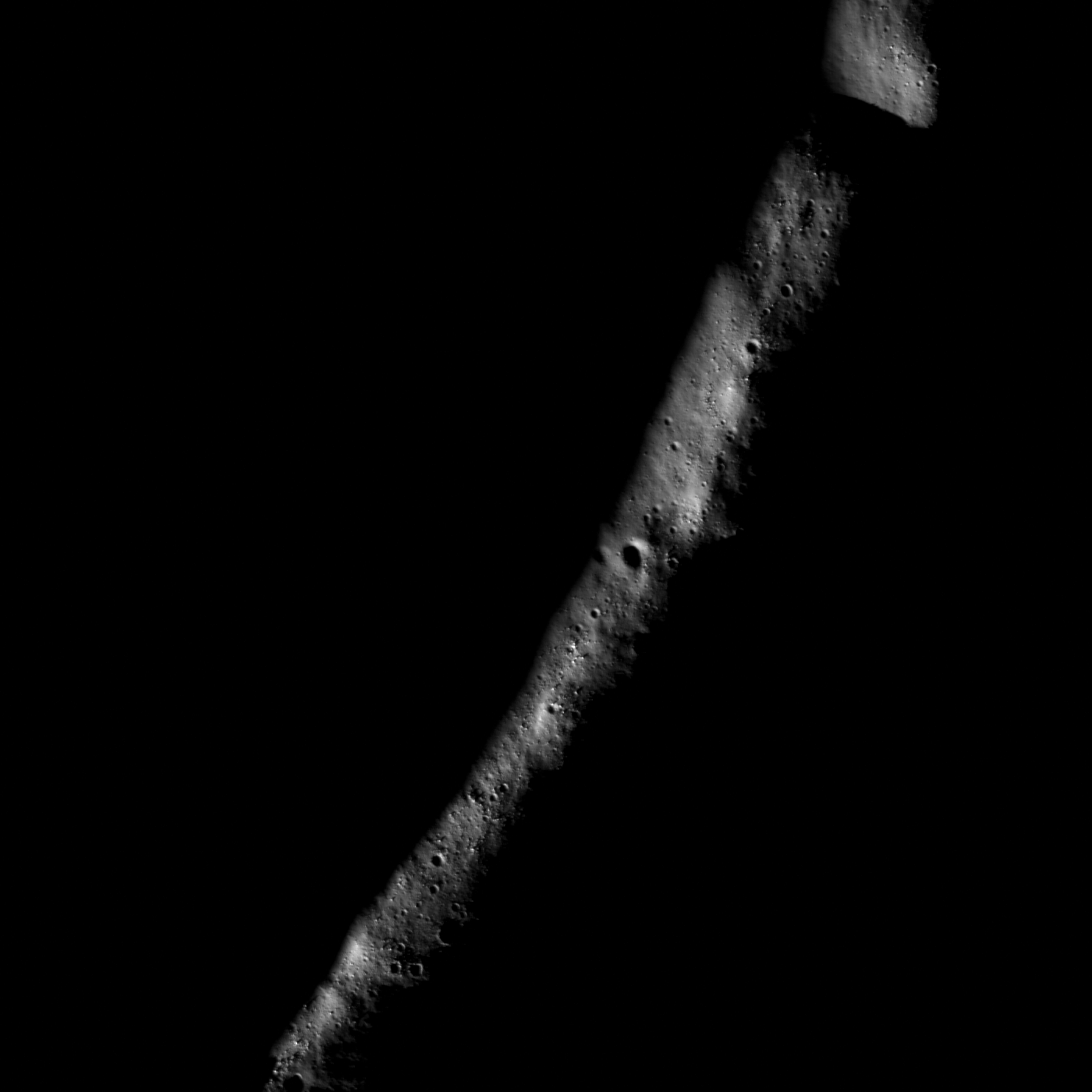
Traversing the Shackleton de Gerlache Ridge
Amazing oblique view of the rim of Shackleton crater (on the left) and the Shackleton - de Gerlache ridge that runs from middle left to upper right. The south pole is near the small, sharp, bright crater on the rim of Shackleton (left...
Published on 01 Apr 2022
Sea of Night
Rim of Aepinus crater rising above a sea of dark during a winter night. Illuminated area 1.5 kilometers by 6.0 kilometers, NAC M1338480133LR [NASA/GSFC/Arizona State University].
Published on 19 May 2020
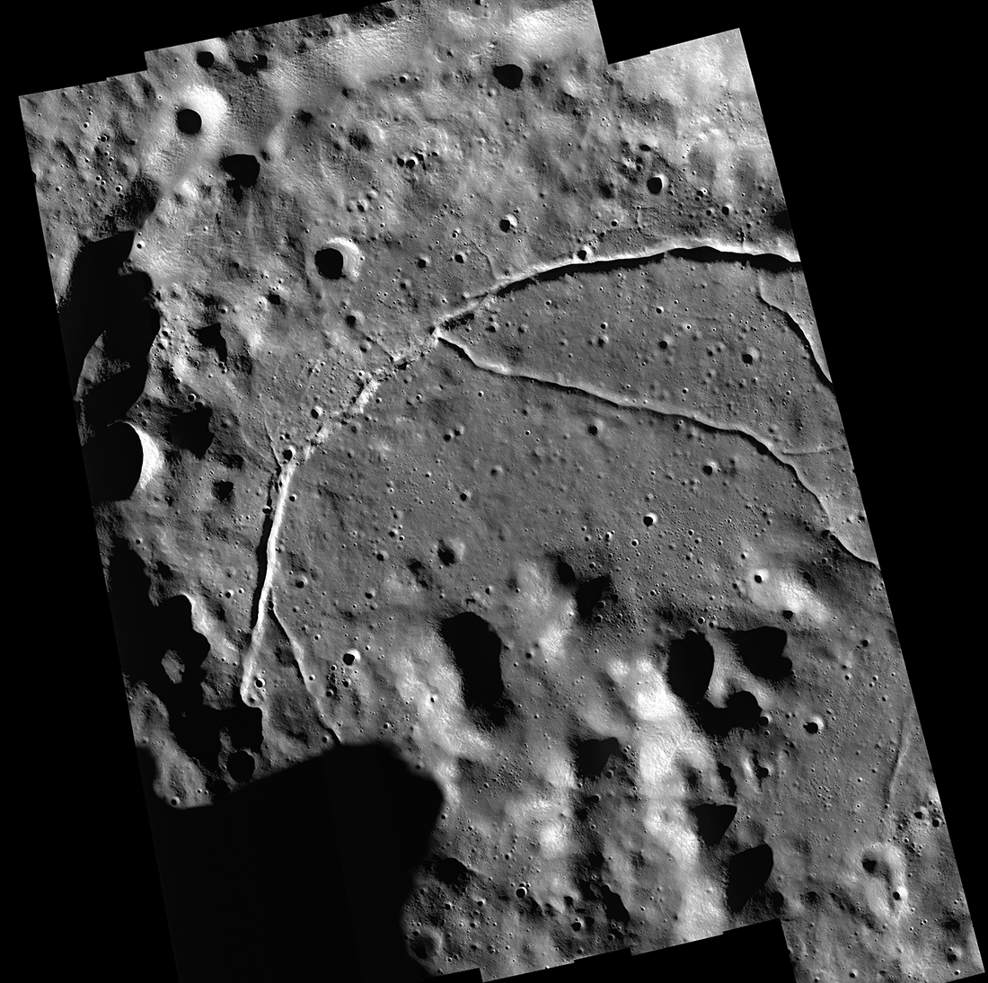
Feature Mosaics: Behind the Seams
A seamless mosaic of a portion of Karpinsky crater (91 km diameter, 72.61° N, 166.80°E) seamless mosaic. Scene is 55 km across, NAC images M1309496597L/R, M1309503618L/R, M1309510644L/R, M1309517669L/R, and M1309524696L/R...
Published on 16 Mar 2020
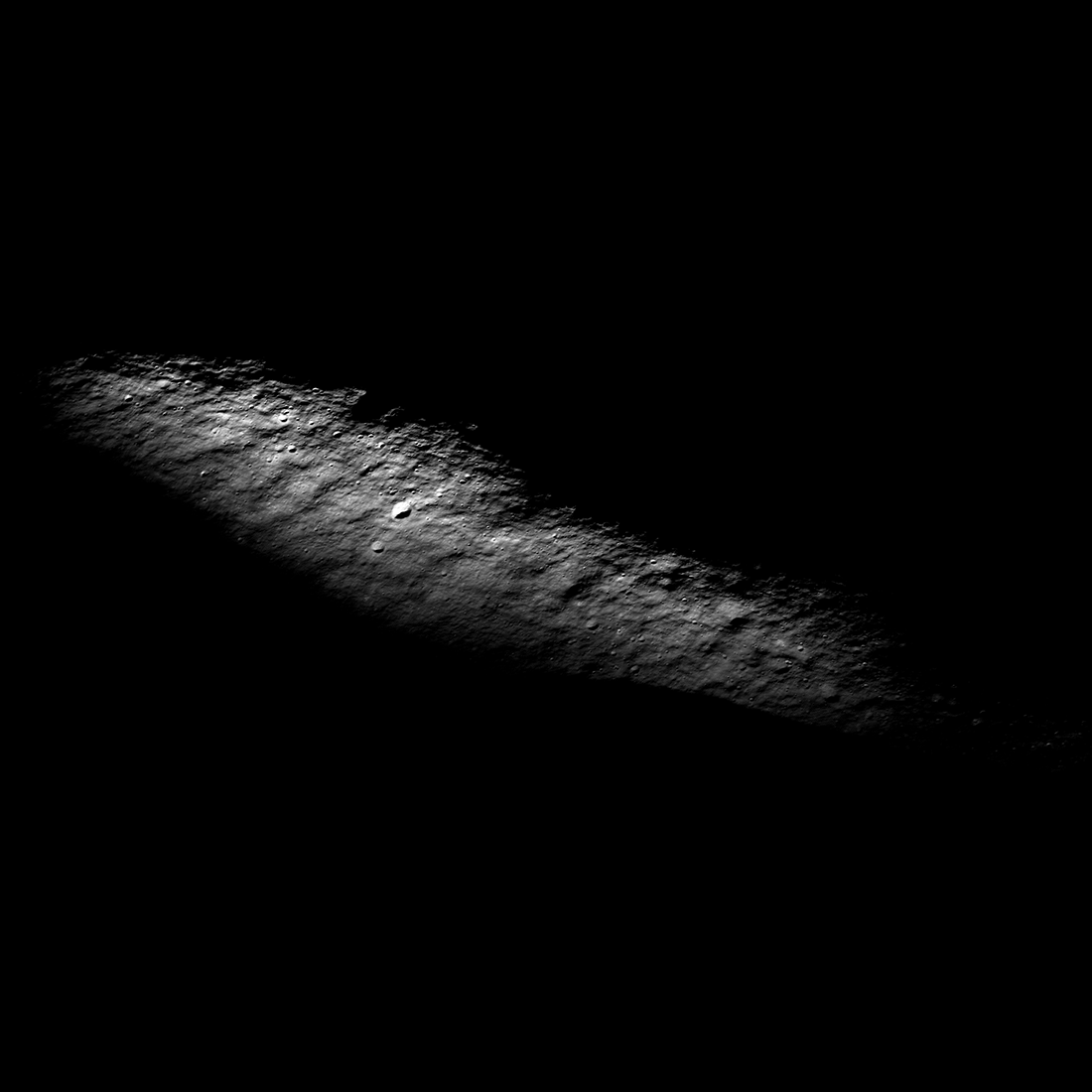
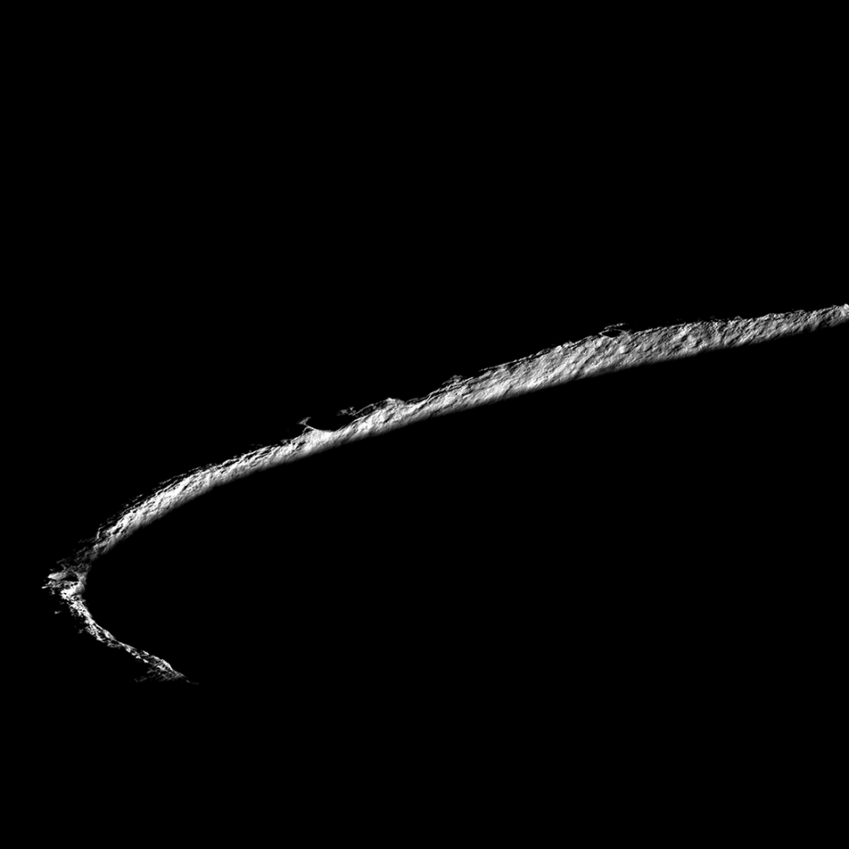
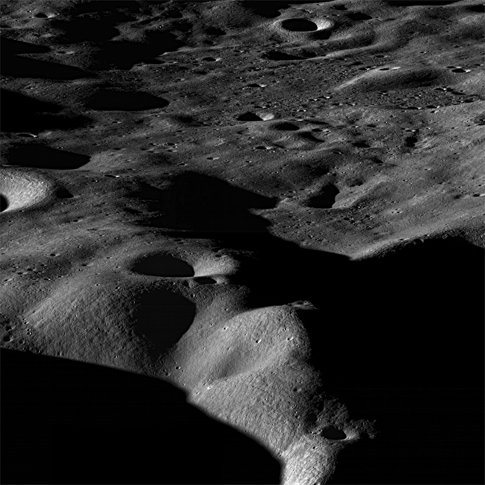
Islands in the Dark
Darkness surrounds illuminated peaks between Shackleton crater (rim crest at right) and de Gerlache crater (out of scene left). As lunar days and seasons progress, darkness creeps along this elevated ridge near the south pole. Image...
Published on 20 May 2019
On the Rim!
Spectacular oblique view of the rim of Shackleton crater (21 km diameter, 89.66°S, 129.20°E). While no location on the Moon stays continuously illuminated, three points on the rim remain collectively sunlit for more than 90% of the...
Published on 01 Feb 2018
Casting Light on Permanently Shadowed Regions
The locations of south pole permanently shadowed regions (PSRs) with areas >10 km2. Images and information about each PSR can be found in the LROC PSR Atlas. [NASA/GSFC/Arizona State University]
Published on 27 Jan 2018
Polar Illumination Maps and More!
New Reduced Data Records (RDRs) available as part of the 32nd Planetary Data System (PDS) release include two versions of the polar illumination maps for each pole. They include this time-weighted north pole illumination...
Published on 12 Jan 2018
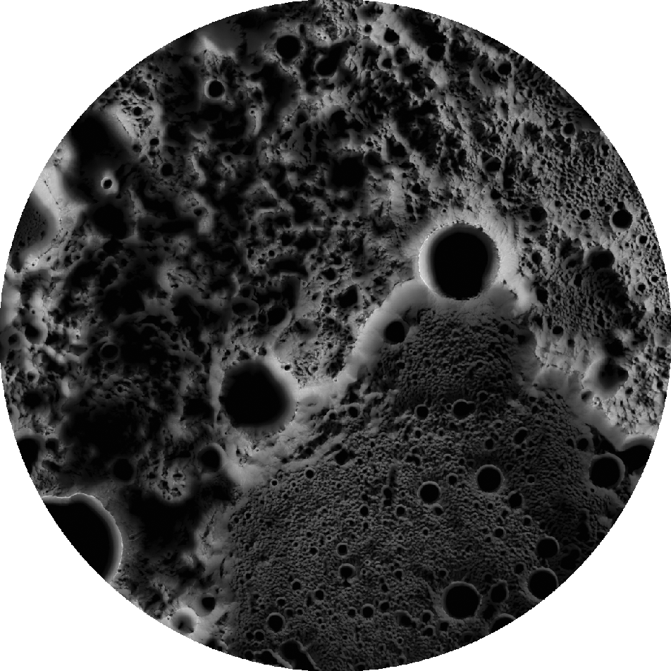
Searching for Ice at the Moon's Poles
Flank, rim and shadowed interior of Sylvester N crater (20 km diameter, 82.41°N, 291.32°E). Left stretch shows off details of illuminated ground while right stretch brings out details of permanently shadowed interior, which is...
Published on 20 Dec 2017
North Pole Mosaics and Movie
LROC Wide Angle Camera mosaic of the Moon's north pole; polar stereographic projection, 60°N to 90°N [NASA/GSFC/Arizona State University].
Published on 16 Mar 2011
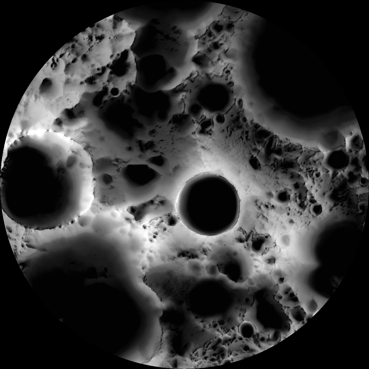
South Pole Illumination Map
Multi-temporal illumination map of the lunar south pole, Shackleton crater (19 km diameter) is in the center, the south pole is located approximately at 9 o'clock on its rim. Mapped area extends from 88°S to 90°S [NASA/GSFC/Arizona...
Published on 15 Dec 2010
Rock avalanche in Robinson crater
Northern slope inside Robinson crater. LROC NAC M114259768R, 0.52 m/pixel, image width is 620 m, sun light is from right side. Slope direction is from top to the bottom of the image [NASA/GSFC/Arizona State University].
Published on 18 Nov 2010
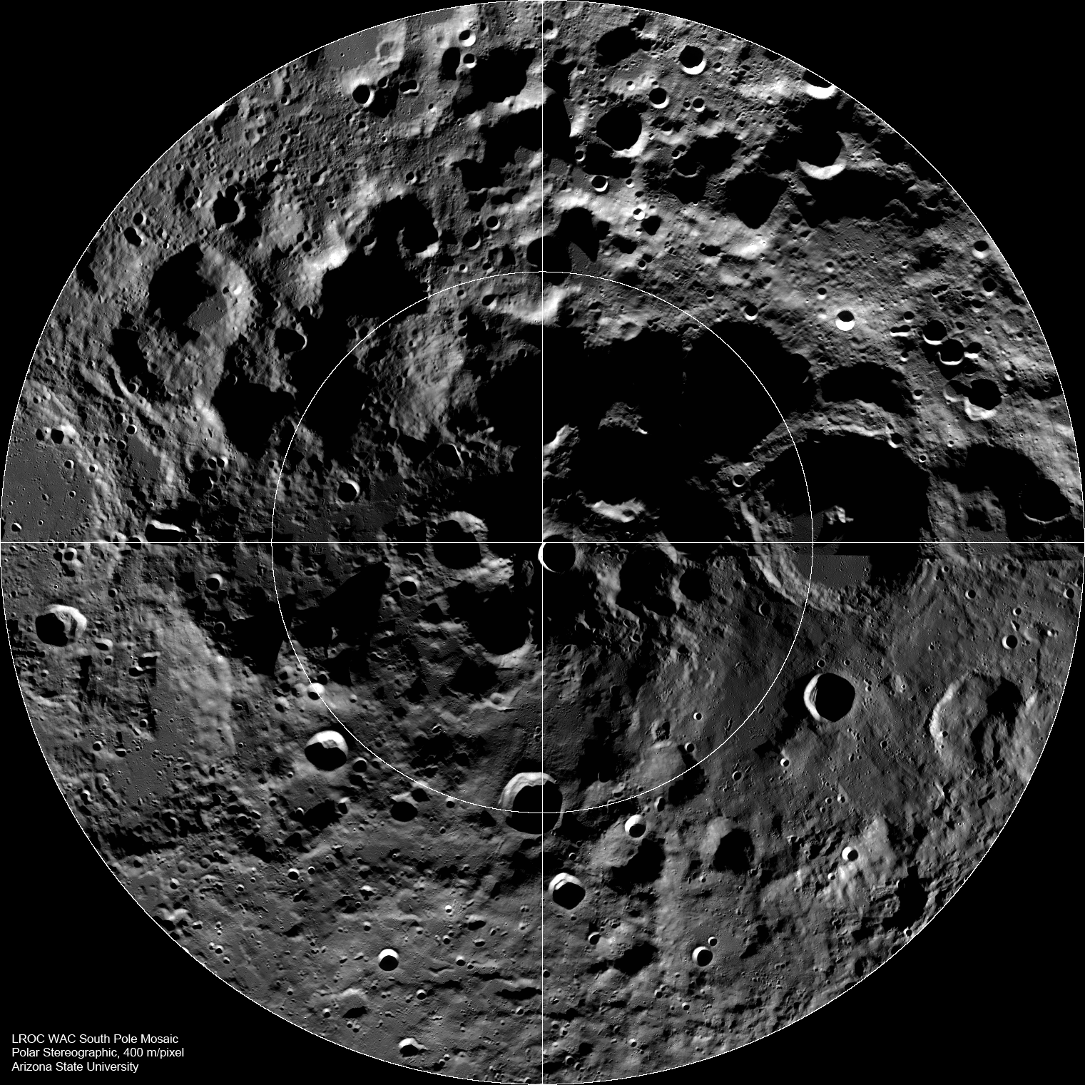
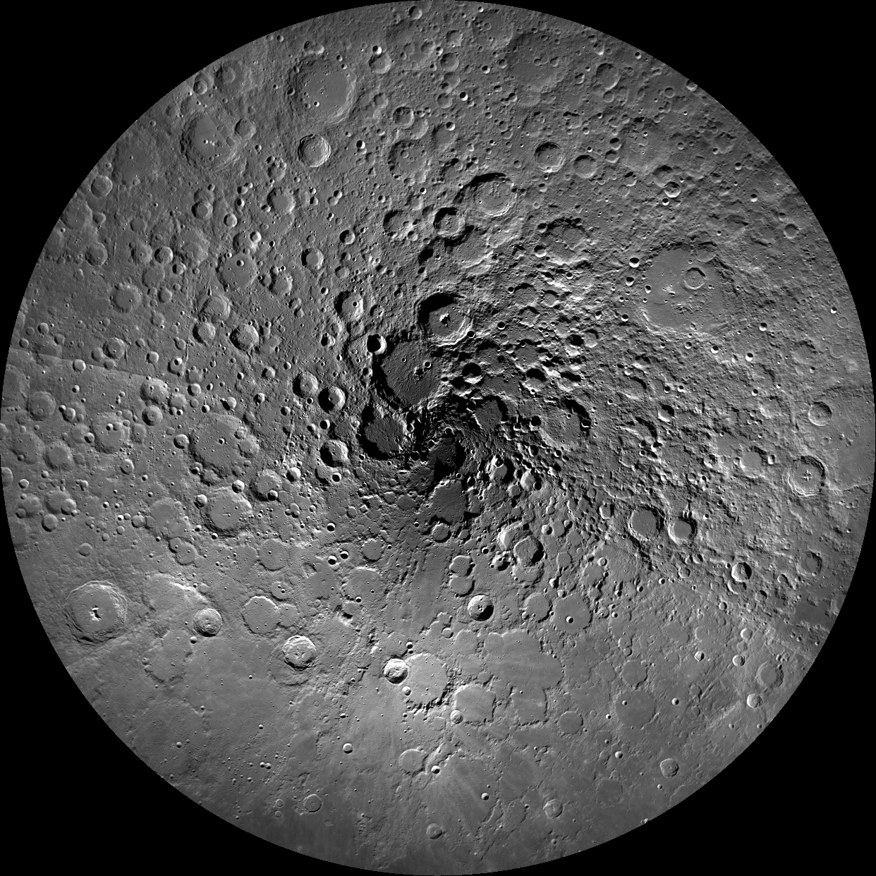
The Lunar South Pole
LROC Wide Angle Camera (WAC) mosaic of the south polar region, width ~600 km [NASA/GSFC/Arizona State University].
Published on 27 Sep 2010
Peary Crater: Greetings from the North Pole of the Moon
A junction between the rims of three craters on the floor of Peary crater near the lunar north pole is evident in this NAC image (M101955359L). Note the mottled texture of the regolith. Peary is a key exploration site for future...
Published on 24 Dec 2009
Mountains of the Moon
Most mountains on the Earth are formed as plates collide and the crust buckles. Not so for the Moon, where mountains are formed as a result of impacts. Images taken looking across the landscape rather than straight down really bring out...
Published on 17 Nov 2009
Lunar South Pole - Out of the Shadows
As the Moon heads into southern summer the region around the south pole is better seen by LROC. One of the many goals of the LRO mission is to improve our cartographic knowledge of the Moon. The location of the pole shown here (image...
Published on 17 Sep 2009
Eternal Darkness Near the North Pole
Small portion of the rim of Erlanger crater (10 km in diameter). Much of its floor remains in permanent shadow due to its location near the north pole. Image width 2.65 km, north is up [NASA/GSFC/Arizona State University].
Published on 24 Aug 2009