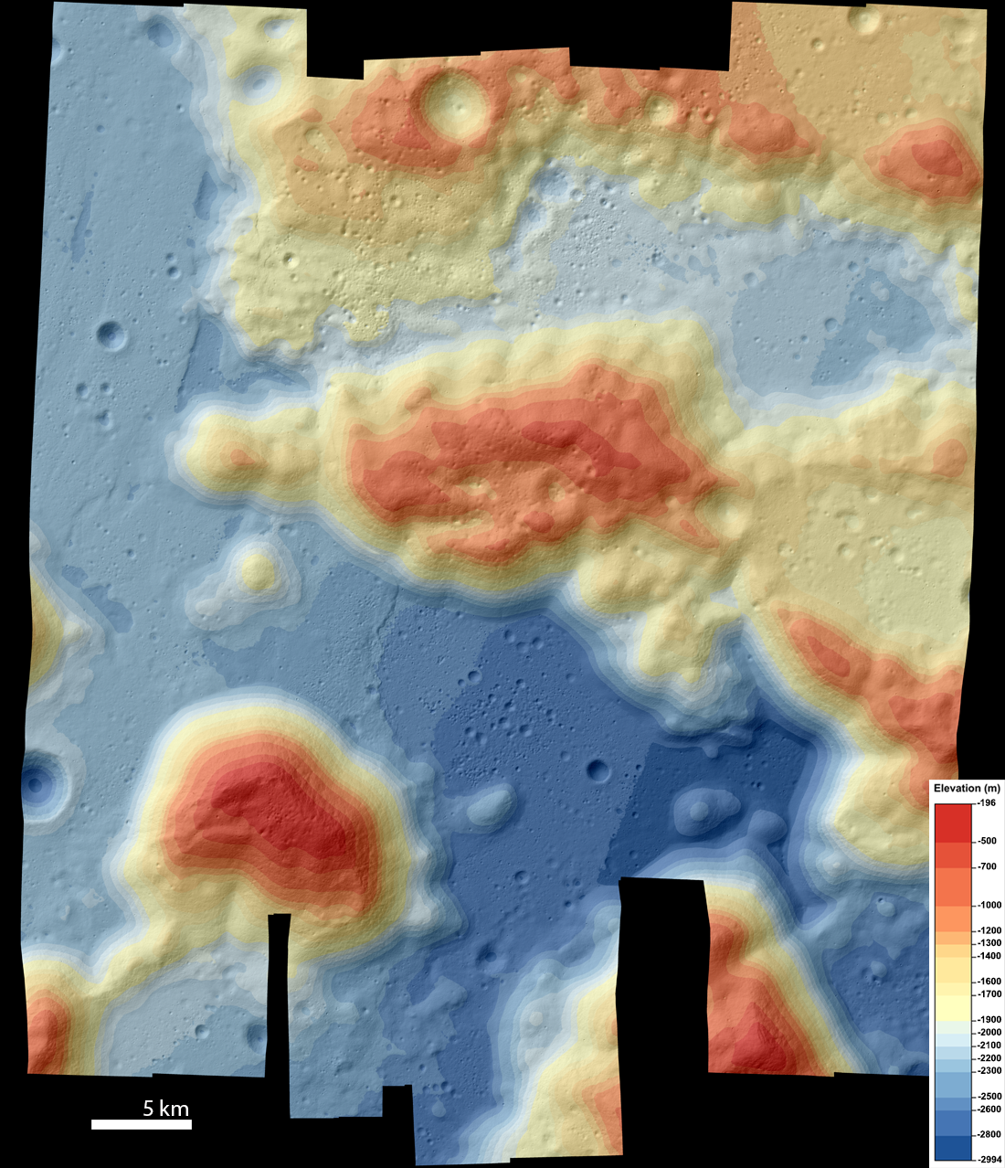
This Taurus-Littrow NAC Digital Terrain Model (DTM) was made from eleven stereo pairs. It covers the entire area explored by the Apollo 17 astronauts and extends much further to display the topography that made Taurus-Littrow valley such an appealing exploration site. The DTM is sampled at five meters per pixel, covering an area 47 kilometers across by about 50 kilometers north–south, and is here displayed as a color-shaded elevation map.
DTM mosaics are essential in cases where features of interest cover an area larger than one NAC DTM. They are created by aligning several individual DTMs (each produced from one NAC stereo pair) relative to each other, and both the mosaic and the individual products are released to NASA's Planetary Data System (PDS) archive. Because the Apollo 17 astronauts travelled over significantly more area than did most of the earlier Apollo missions, multiple NAC stereo pairs were needed in order to cover the entire site (compared to the single pair required for the Apollo 11, 12, 14, and 15 sites). Additional pairs were added to expand the mosaic outward, providing topographical context for the landing site.
The APOLLO17 DTM can be downloaded through the PDS, along with its derived products. These include a color-shaded relief map, a slope-shaded relief map, and orthophoto mosaics at both 5 meters/pixel and 120 centimeters/pixel. The eleven DTMs that make up this large area mosaic are also available. In addition, we released a version of the DTM at 2 meters/pixel consisting of six of the DTMs that cover nearly the entire Apollo 17 traverse area (APOLLO17_2M).
From the DTM and orthophotomosaic we created detailed map sheets of the region that show the traverse paths of the Apollo 17 astronauts with annotations, as well as the topography of Taurus-Littrow Valley. Two of these maps, a color-shaded relief map and a topo-photo map, can be explored below using Zoomify. Or, download the full-resolution maps to keep!
These map sheets and more can also be downloaded from the LROC Featured Downloads page.
Also be sure and visit the LROC online Apollo 17 Traverse Map!
Related Featured Images
Approach to Taurus Littrow Valley
Taurus Littrow Valley, West-to-East
Published by Madeleine Manheim on 11 February 2022