Featured Images
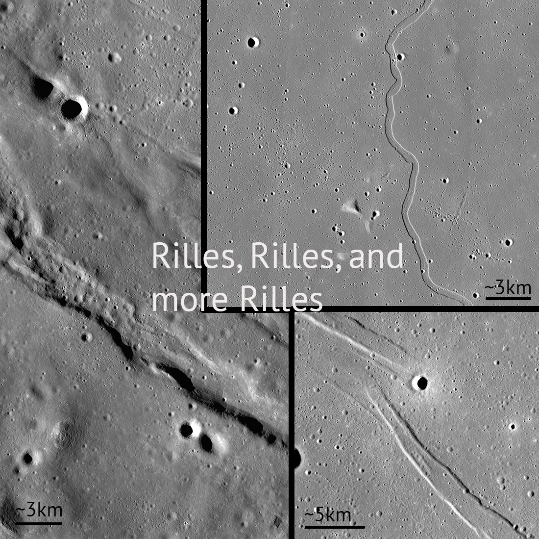
Rilles and Rilles: Sinuous, Straight, and Arcuate
Rilles are all over the Moon! Controlled feature mosaics help us see these features with great detail. Pictured: Rimae Sulpicious Gallus (20°N Lat, 10°E Lon), Rima Sharp (46°N Lat, 309°E Lon), Rima Cauchy (10°N Lat, 38°E Lon)...
Published on 30 Apr 2020
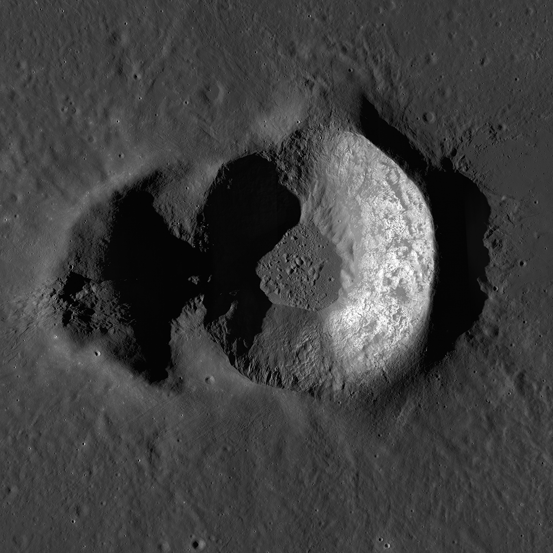
Double Trouble: Messier A
Messier A crater (2.039°S, 46.887°E, 10.6 km across from north to south) feature mosaic, created from NAC images M1188059614LR, M1188045553LR, and M1188052583LR [NASA/GSFC/Arizona State University].
Published on 01 Apr 2020
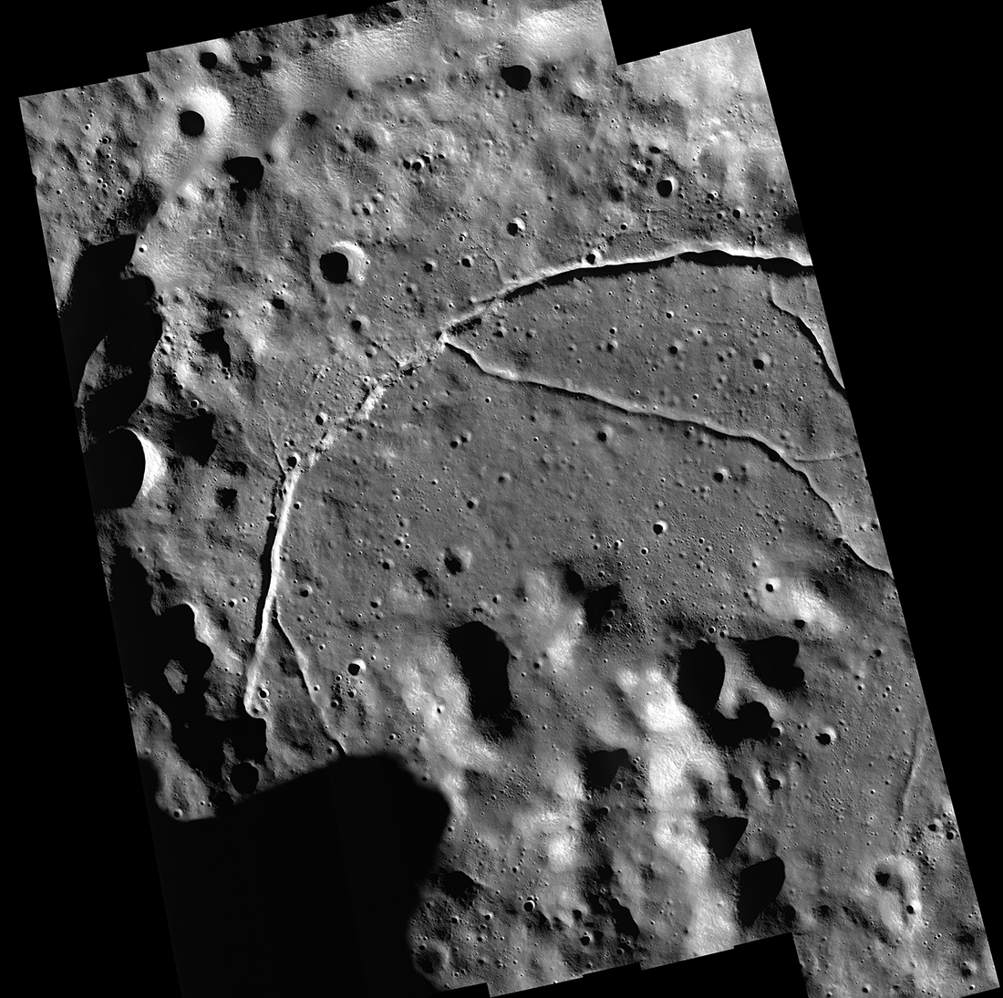
Feature Mosaics: Behind the Seams
A seamless mosaic of a portion of Karpinsky crater (91 km diameter, 72.61° N, 166.80°E) seamless mosaic. Scene is 55 km across, NAC images M1309496597L/R, M1309503618L/R, M1309510644L/R, M1309517669L/R, and M1309524696L/R...
Published on 16 Mar 2020
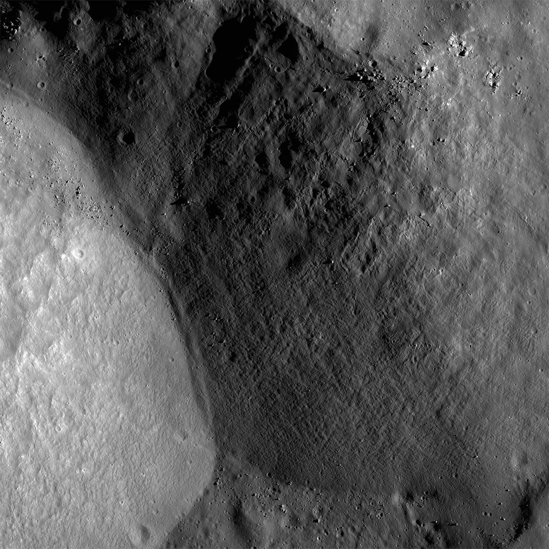
Plumbing the Depths by Scaling the Heights
The central mountainous peaks of Maunder crater are thought to be made of rock that was melted by the impact event that resulted in the Orientale basin. This impact melt rock deposit was then lifted up from below the surface during the...
Published on 19 Feb 2020
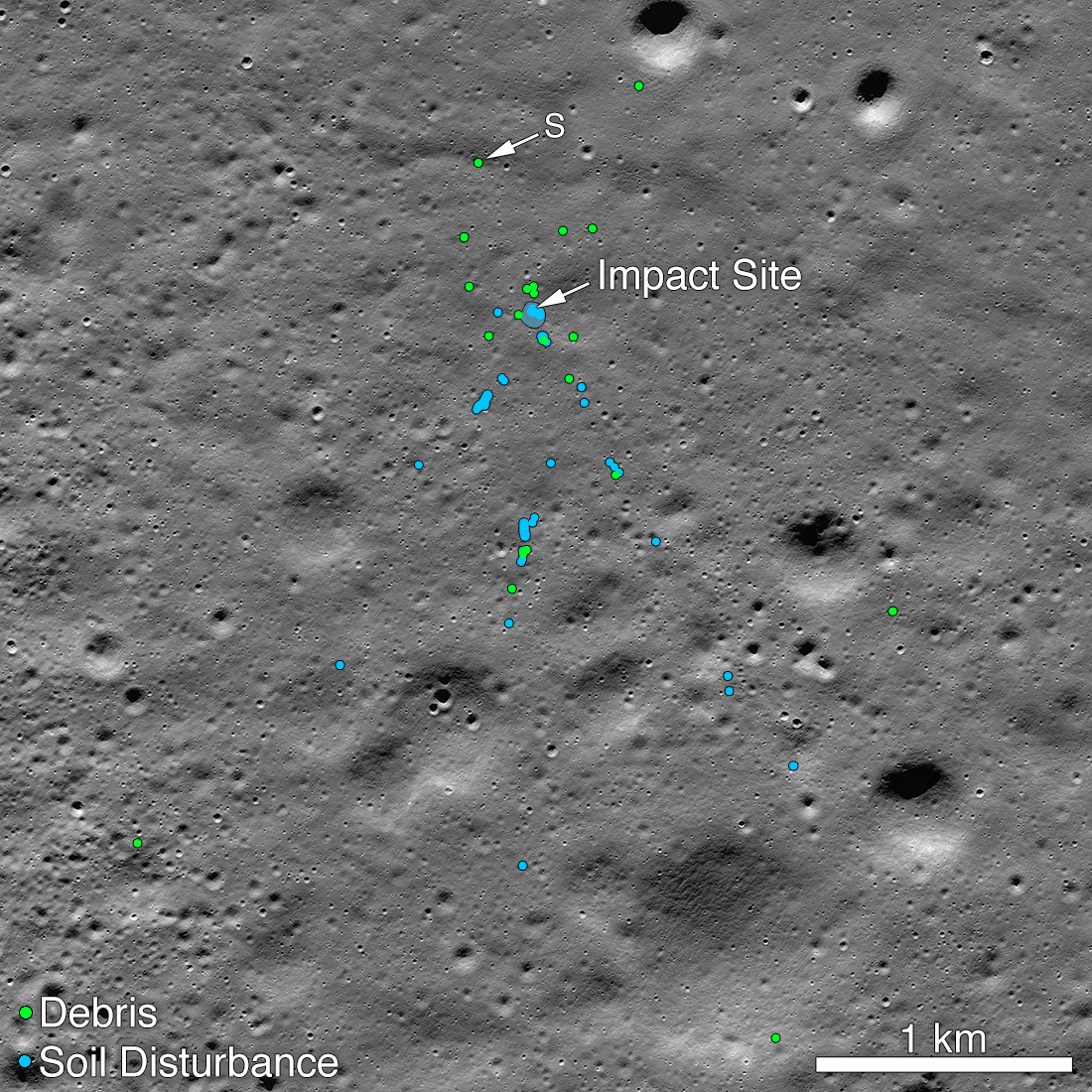
Vikram Lander Found
Vikram impact point and associated debris field. Green dots indicate spacecraft debris (confirmed or likely). Blue dots are locating disturbed soil, likely where small bits of the spacecraft churned up the regolith. "S" indicates debris...
Published on 02 Dec 2019
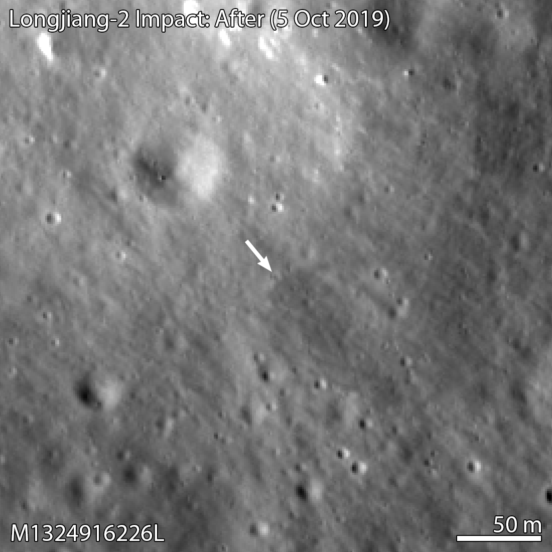
Longjiang-2 Impact Site Found!
The Longjiang-2 spacecraft (also known as DSLWP-B) crashed onto the lunar farside on 31 July 2019 after completing its orbital mission. This new crater was most likely the result of that impact. Image width 330 meters, north is up,...
Published on 14 Nov 2019
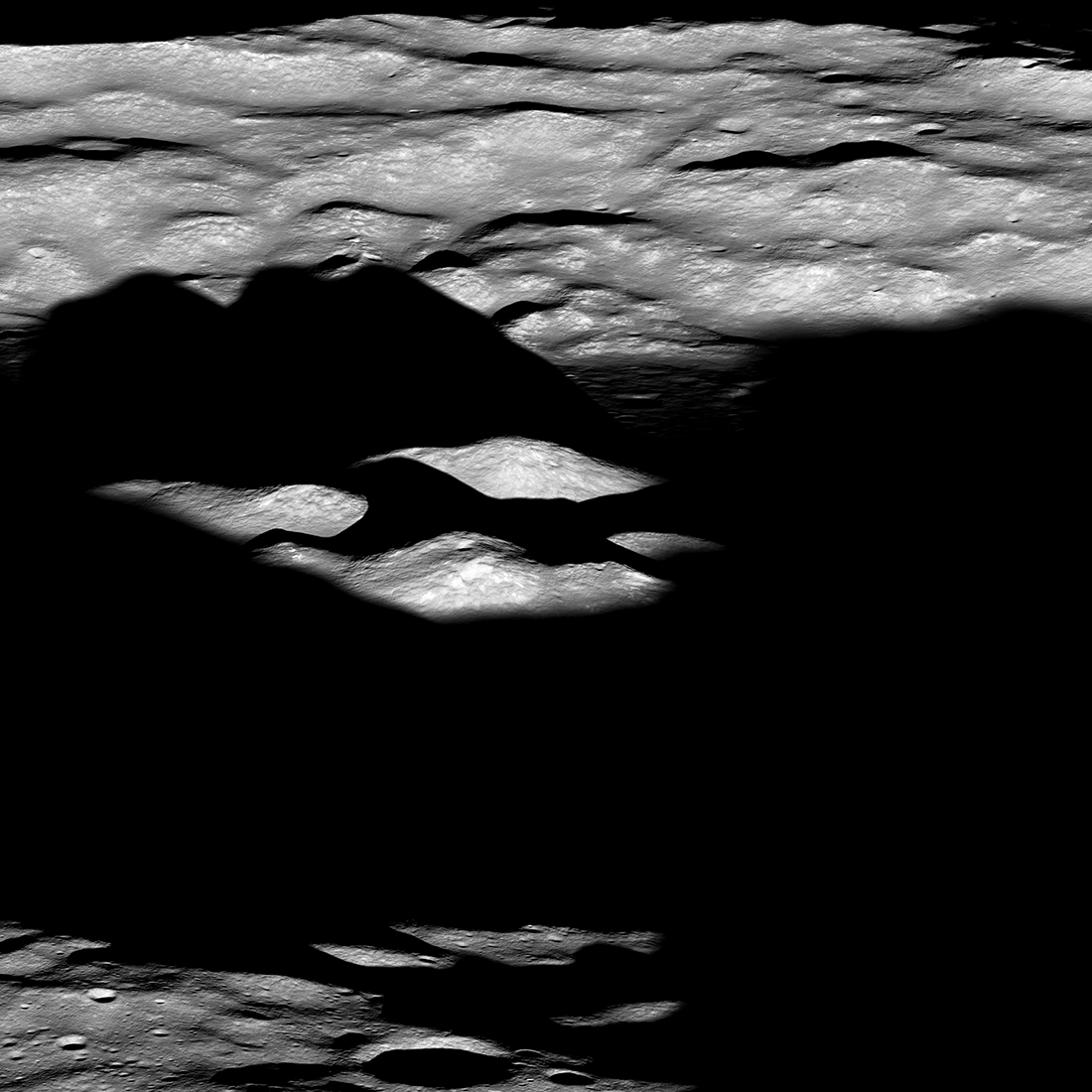
Dawn Over Bhabha Crater
Central peak complex of Bhabha crater (70 kilometer diameter) rising from the shadows of dawn, image snapped on 28 August 2019 from an altitude of 73 kiolmeters. View is seen from east-to-the west, north is to the right, visible portion...
Published on 22 Oct 2019
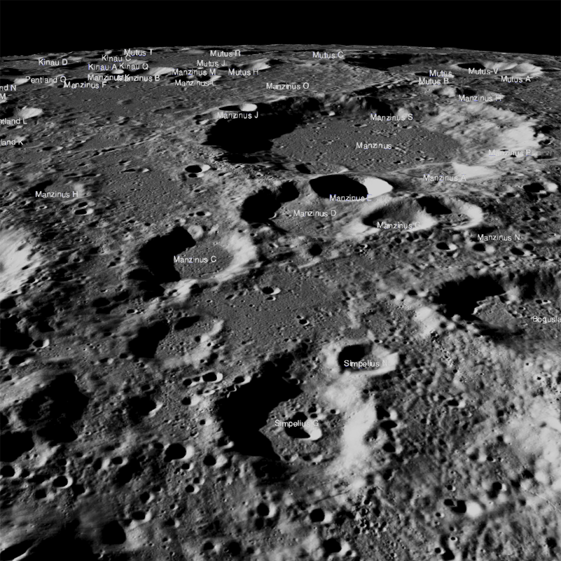
Obscured in the Lunar Highlands?
The Chandrayaan-2 lander, Vikram, attempted a landing September 7th Indian time (Friday the 6th in the United States), on a small patch of lunar highland smooth plains between Simpelius N and Manzinus C craters. Unfortunately the...
Published on 26 Sep 2019
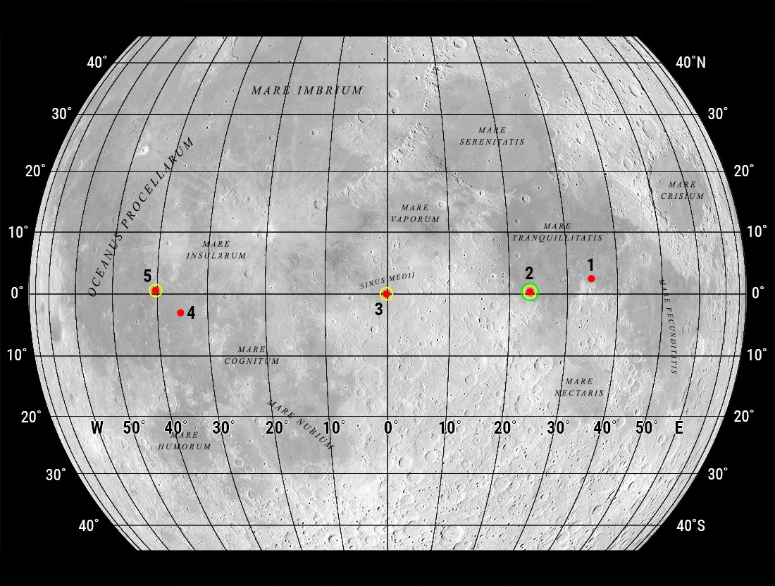
"Oceanus Procellarum Base Here - The Eagle Has Landed"
In 1969, NASA published a map showing candidate Apollo 11 and Apollo 12 landing sites. The map was based on photographs taken using large Earth-based telescopes. The map above, based on an LROC global image mosaic, is a near-copy of...
Published on 09 Aug 2019
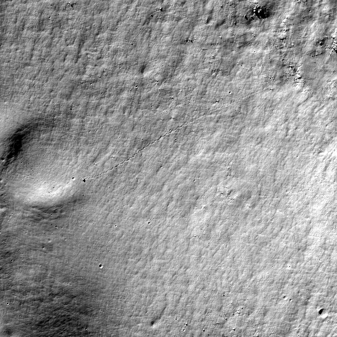
Almost a Hole-in-One
A geologic story in Antoniadi crater on the Moon's far side. North is toward the top. Image width 1.54 kilometers, NAC M1311837924LR [NASA/GSFC/Arizona State University].
Published on 26 Jul 2019
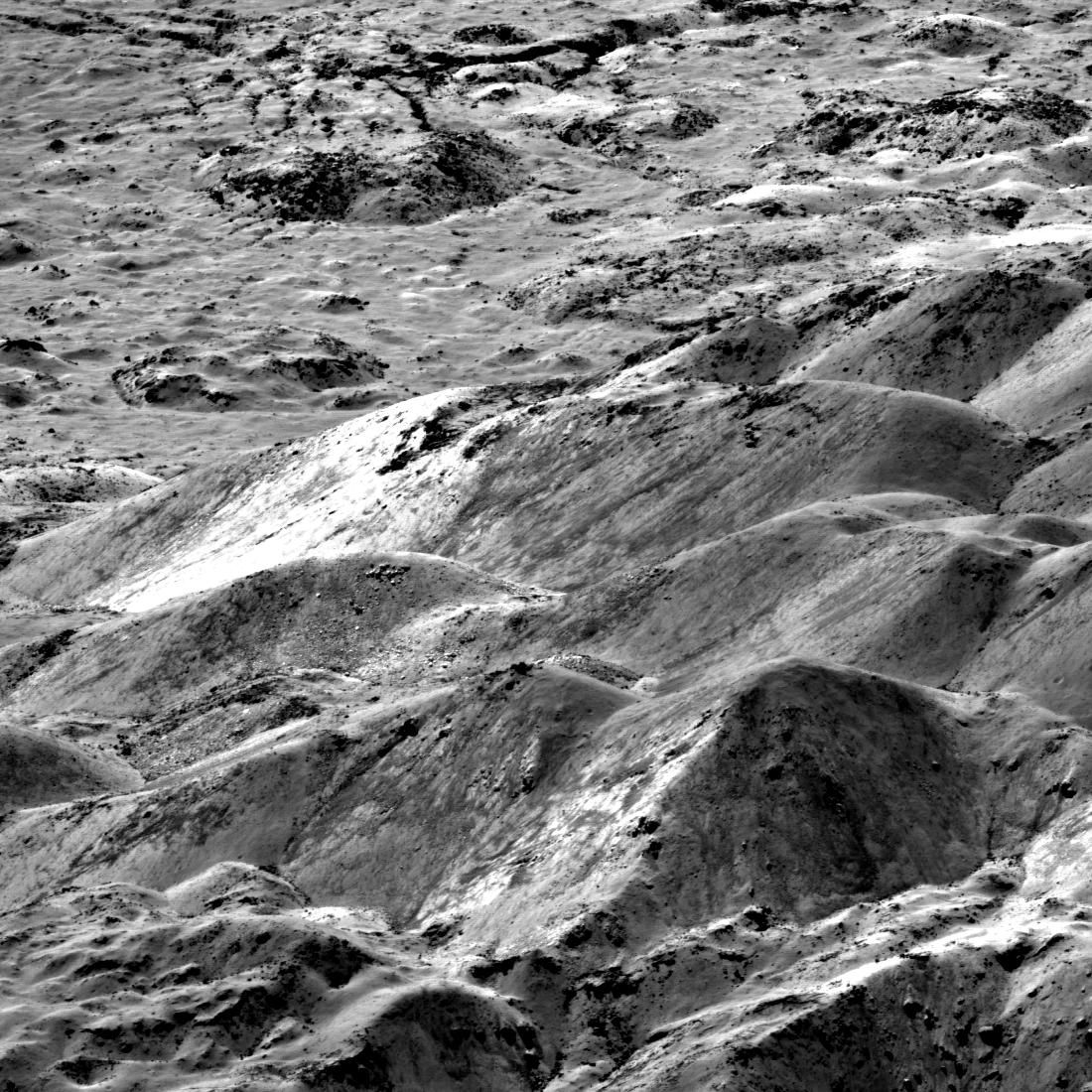
What Lies Beneath
Spectacular contrasts of gray scale in the central peak of Jackson crater signal variations in both composition and maturity (degree of freshness of the surface). Image is 3100 meters wide, north is to the right, M1265842750LR...
Published on 19 Jul 2019
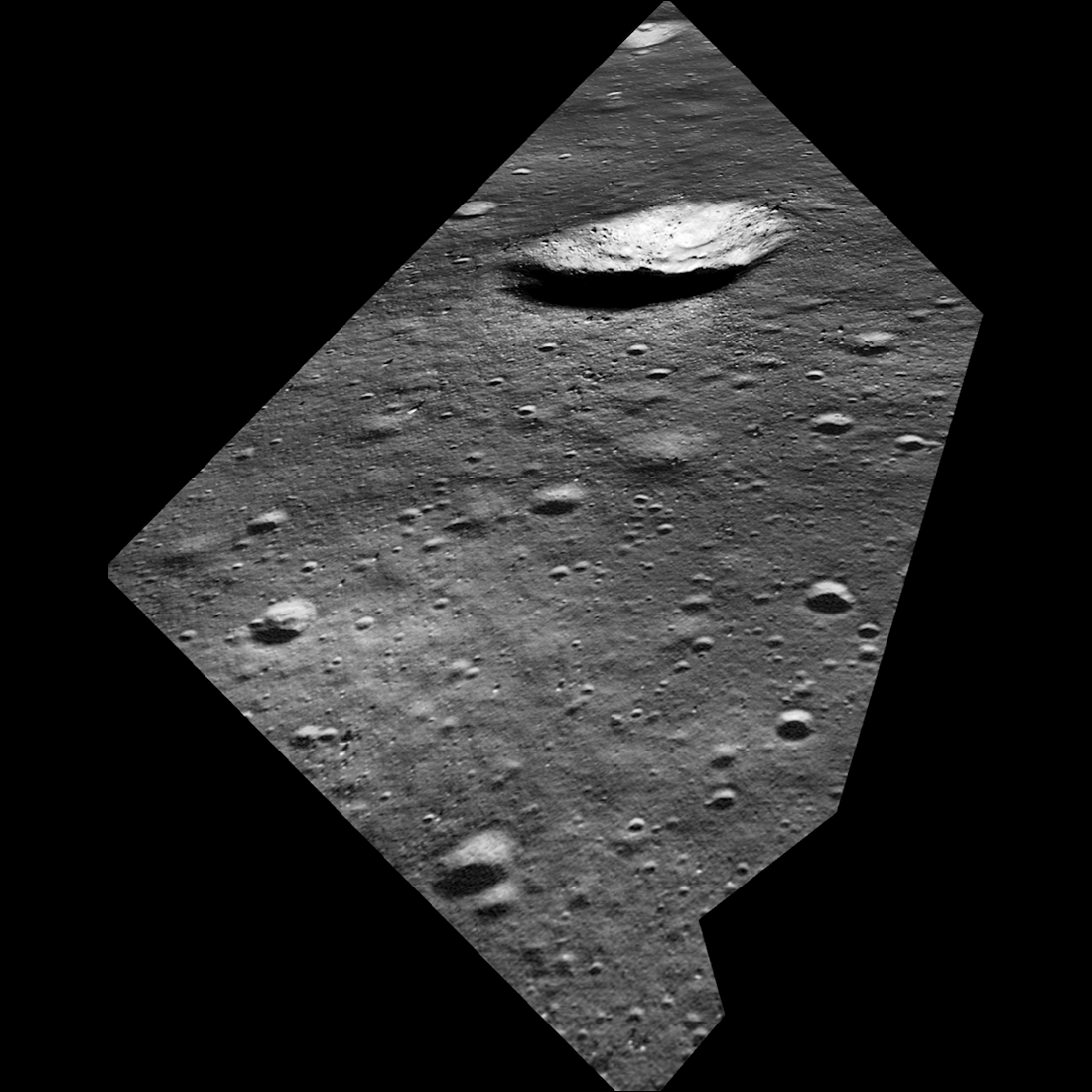
What Armstrong Saw
Simulated view of what Armstrong saw as the Lunar Module Eagle approached the aim point on the northeast flank of West crater (190 meters diameter). The odd shape of the image area is due to the small windows in the Eagle. North is to...
Published on 16 Jul 2019
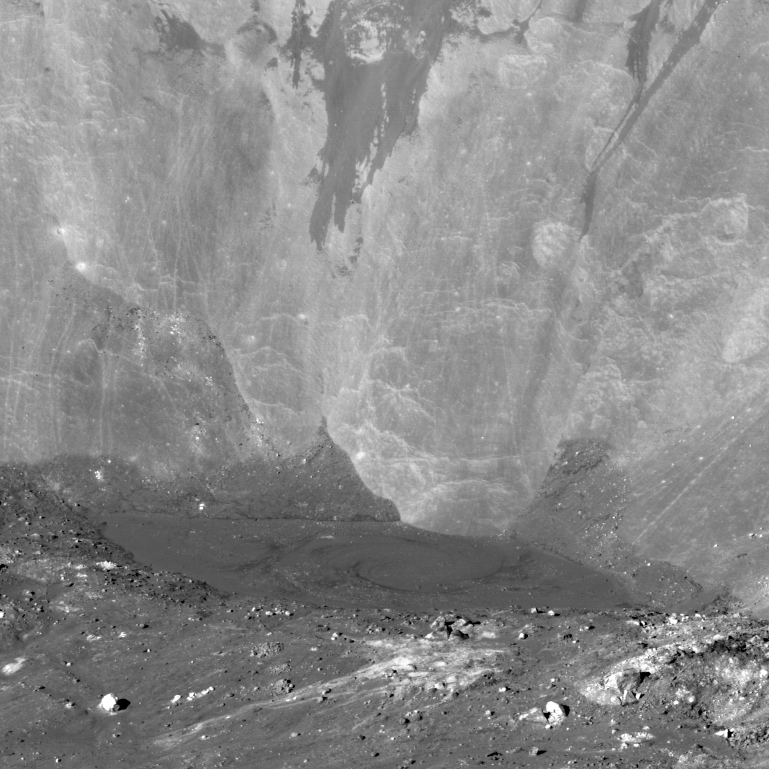
How Spectacular is this View?!?!
Oblique view of what might be the most spectacular young crater on the Moon - Giordano Bruno. The imposing cliff in the background rises 3000 m above the melt pool seen in the middle ground (top of cliff not seen here). Scene is about 3...
Published on 15 Jul 2019
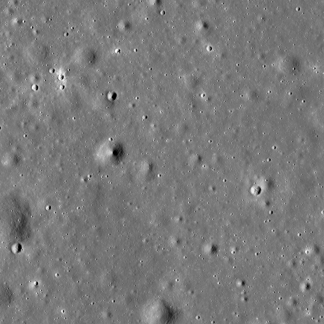
The Moon in Arizona
This 3.48-kilometer-wide part of the Sea of Tranquility is very special, though no one has ever landed or walked here. NAC image M1123426954LR [NASA/GSFC/Arizona State University].
Published on 02 Jul 2019
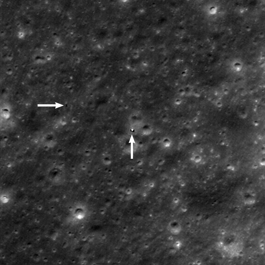
Yutu-2 Still on the Move!
Yutu-2 (horizontal arrow) was about 130 meters west of the Chang'e 4 lander (vertical arrow) on 3 June 2019. North is up, image is 495 meters wide and enlarged two times, M1314237625L [NASA/GSFC/Arizona State University].
Published on 27 Jun 2019
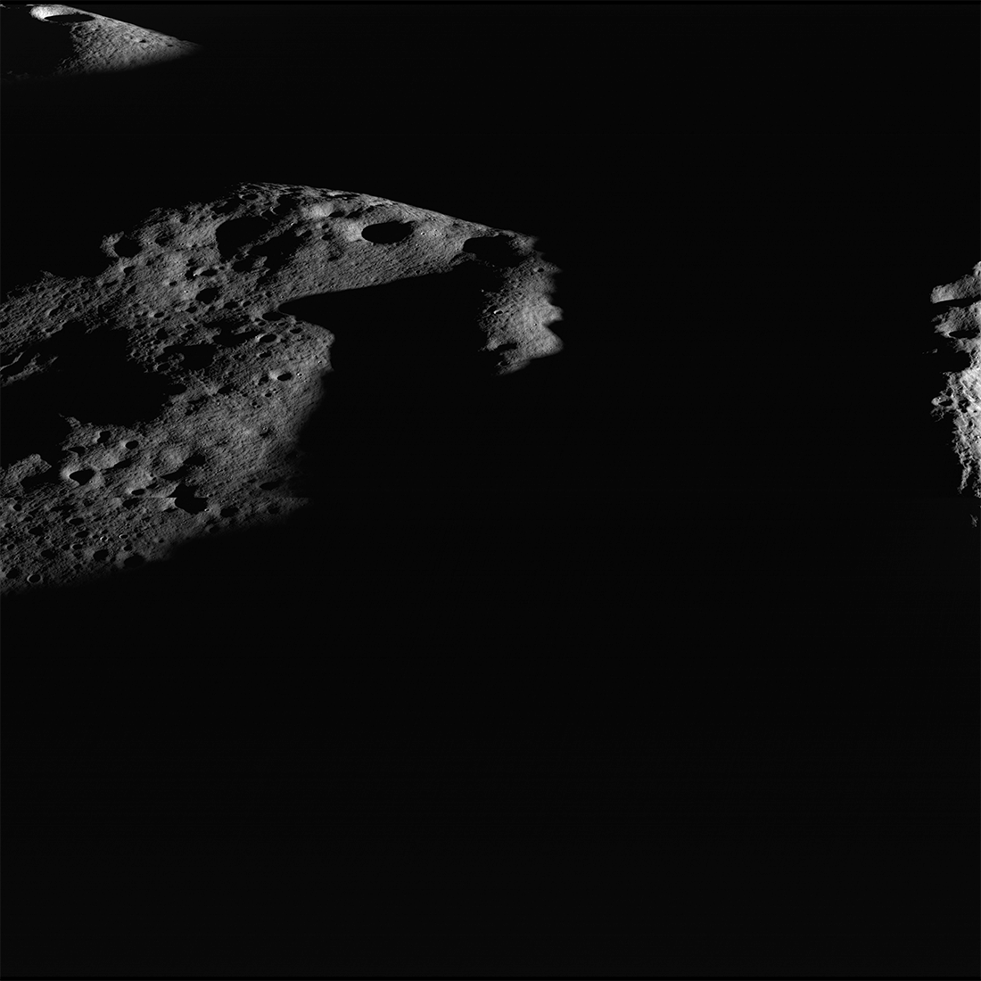
Islands in the Dark
Darkness surrounds illuminated peaks between Shackleton crater (rim crest at right) and de Gerlache crater (out of scene left). As lunar days and seasons progress, darkness creeps along this elevated ridge near the south pole. Image...
Published on 20 May 2019
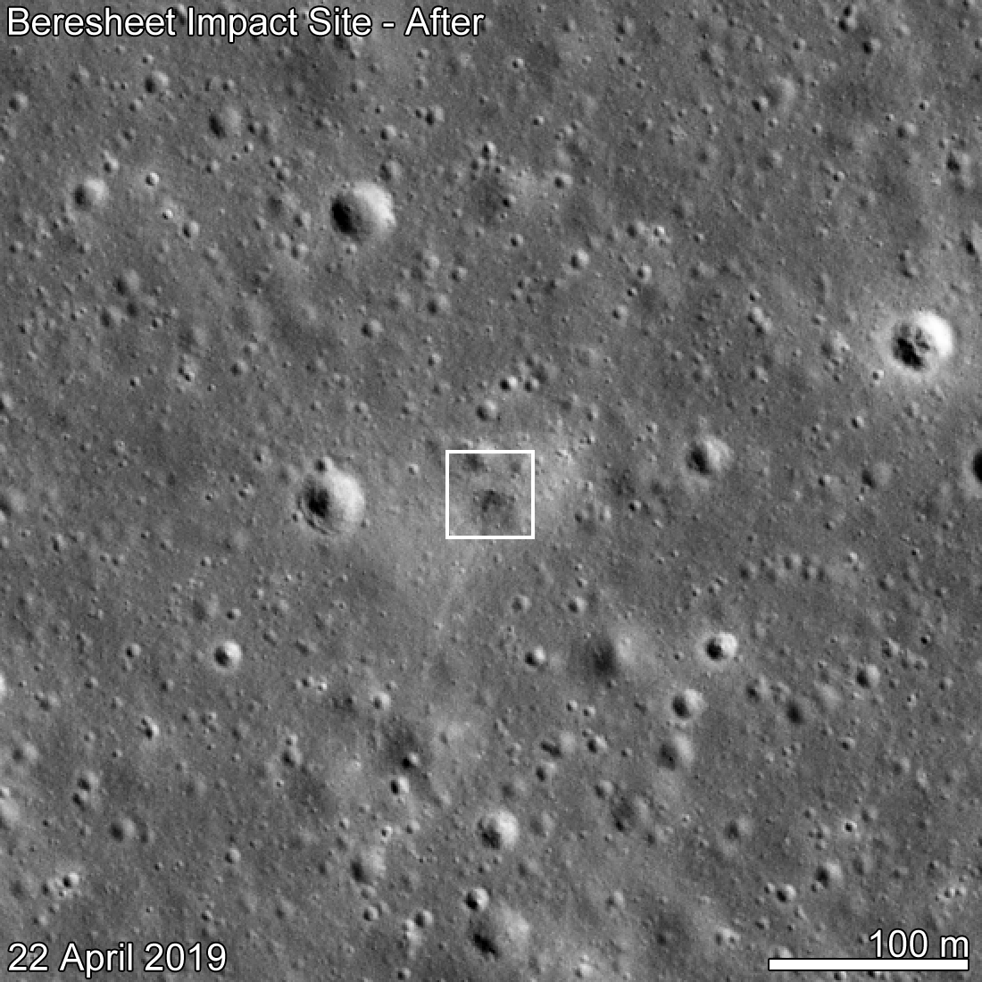
Beresheet Crash Site Spotted!
SpaceIL Beresheet crash site as seen by LROC eleven days after the attempted landing. Date in lower left indicates when the NAC image was acquired, M1310536929R [NASA/GSFC/Arizona State University].
Published on 15 May 2019
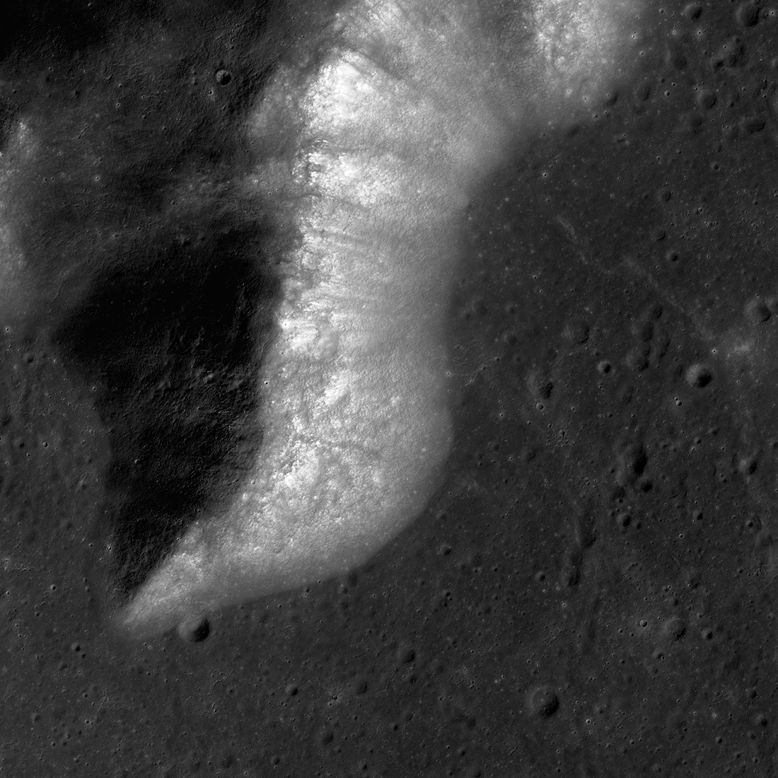
On and Around Mons Piton
Mons Piton rises 2300 meters above the dark volcanic rocks of Mare Imbrium. The image covers an area 15.5 kilometers wide, north is up, and the Sun shines from the east (right). LROC NAC image pair M190609650LR [NASA/GSFC/Arizona State...
Published on 09 May 2019
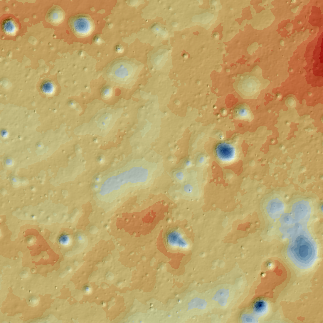
Topographic Map of the Chang'e 4 Site
Topographic map of the Chang'e 4 landing site derived from LROC NAC stereo pair (M1303619844LR, M1303640934LR obtained on 1 February 2019). North is up, map is 5500 meters wide [NASA/GSFC/Arizona State University].
Published on 30 Apr 2019
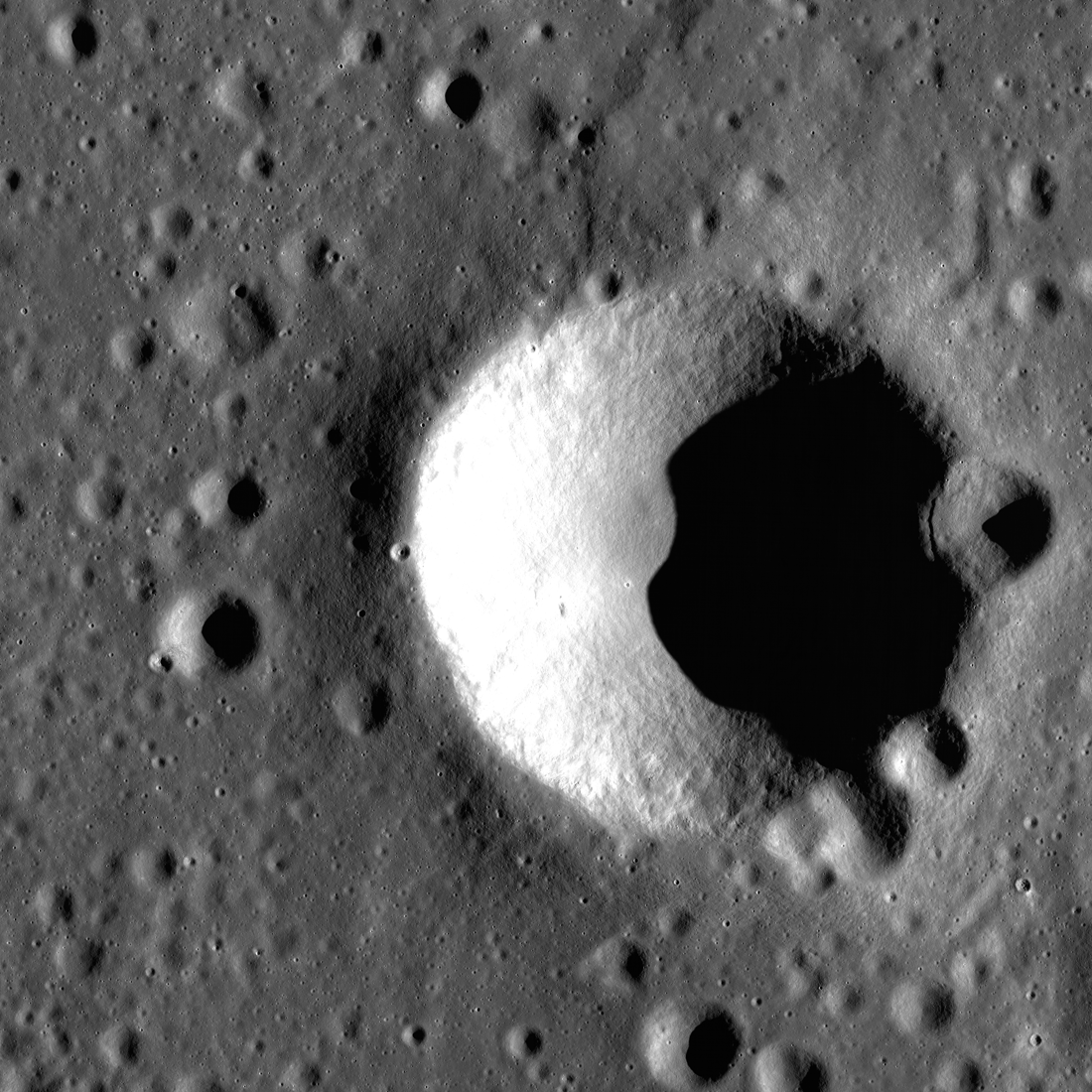
Order from Chaos — Blagg Crater
Blagg crater, named for the British astronomer who helped bring order to lunar naming chaos, is full of surprises. Taken during morning with the Sun shining from the right (east), the image above shows an area of the Moon just 9.5...
Published on 16 Apr 2019