Copernicus crater (93 km diameter) is one of the most prominent craters on the lunar nearside and formed approximately 800 million years ago when an asteroid about 10 kilometers in diameter slammed into the Moon with a velocity somewhere around 15 km/s.
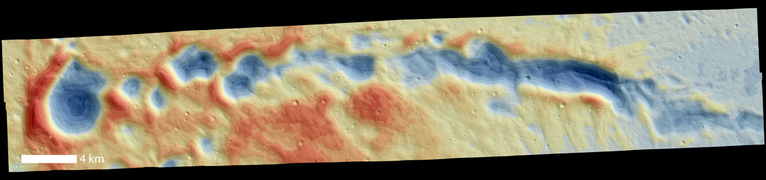
When a primary impact (like Copernicus) occurs, large pieces of the crust are ejected and impact the nearby terrain forming what are known as secondary craters. These secondary craters are often irregular in shape, shallower than primary craters, and can occur within rays or chains radiating out from the primary crater (see below). Scientists use topographic maps known as Digital Terrain Models (DTMs) to characterize the physical characteristics of craters (both primary and secondary). The DTM shown here is made from two LROC NAC images and covers approximately 10 by 50 km at 4 m/pixel. Using DTMs, scientists can measure and analyze surface characteristics of lunar features and understand the lunar landscape and the rate at which landforms on the Moon degrade.
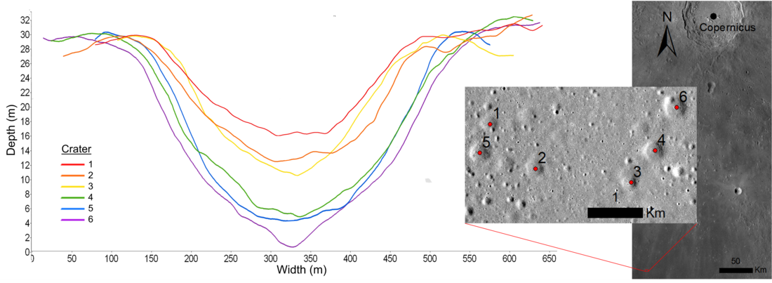
In recent studies, scientists used DTMs to measure the depths, diameters, and slopes of Copernicus secondary craters. In doing so, they documented that smaller craters had shallower depths relative to their diameters, indicating that small craters degrade more quickly than large craters. In addition, they compared the DTM measurements to a theoretical model of topographic diffusion, a process by which small cometary, asteroidal and micrometeroid impacts essentially “sand-blast” features on the Moon. They found that the observational measurements broadly agreed with the model, although the model predicted shallower slopes than observed. The results from DTMs like the one above suggest avenues for future morphological study, allowing us to better understand processes that happen on the Moon.
Explore the DTM with the Zoomify below, or download it here!
Related Featured Images
Photogrammetric Processing of LROC NAC Stereo Images
Curiously Fast Degradation of Small Lunar Craters
Published by Victoria Roseborough on 4 February 2022