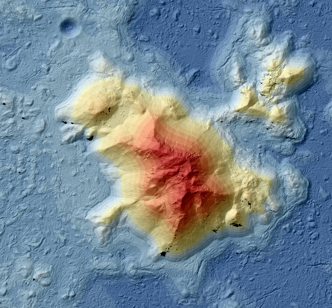
Recently, the LROC team released a DTM mosaic of the central peak of Tycho crater. This peak, which rises ~2.5 km above the crater floor and is ~8 km across, formed when the asteroid (or comet) that created Tycho crater impacted the Moon around 85 million years ago. As a relatively young and prominent feature, this crater is fascinating to geomorphologists working to understand lunar processes. Because of its high scientific value and extremes of topography, it is a great candidate for a DTM mosaic!
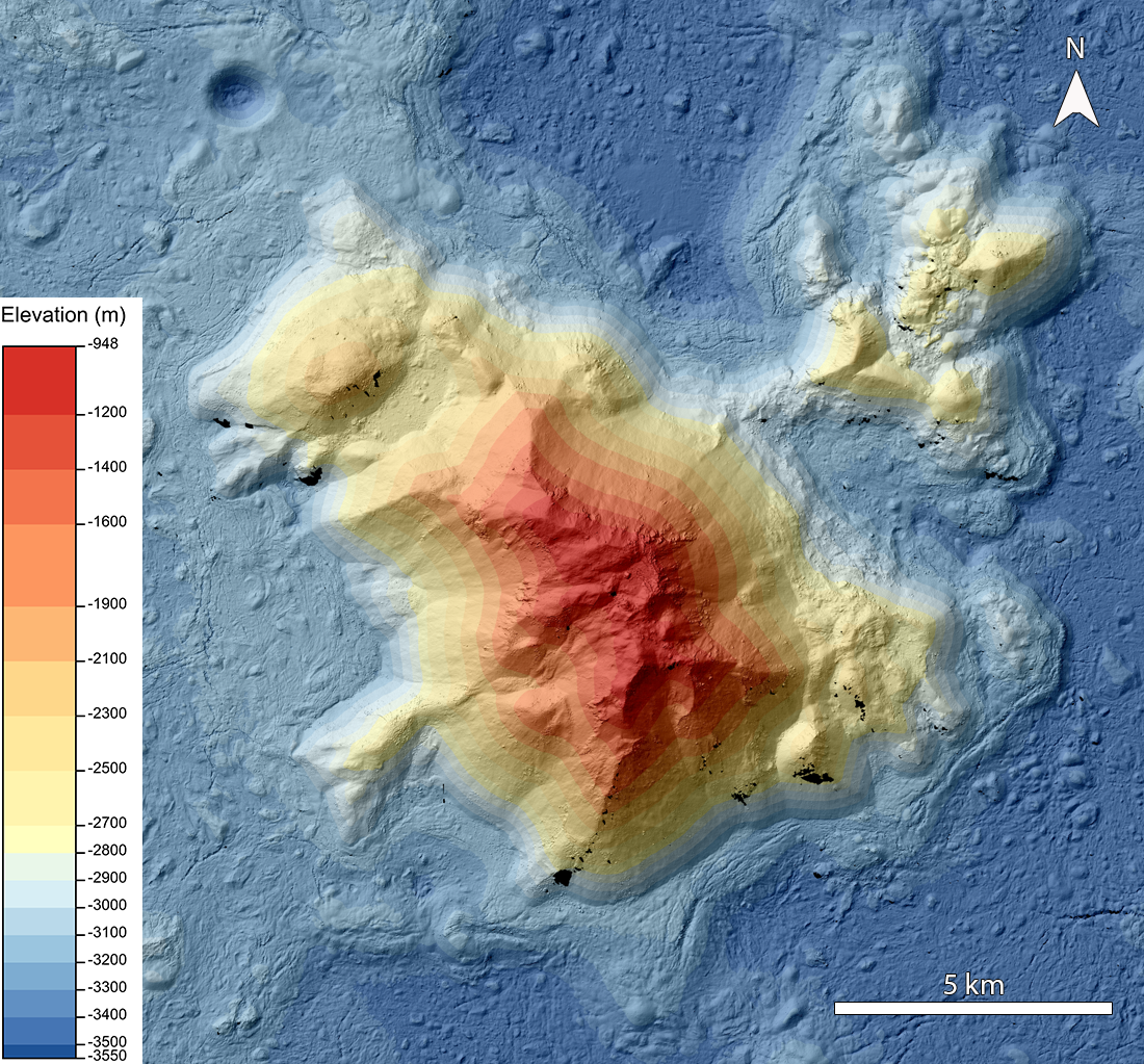
What are DTMs? DTMs, or digital terrain models, show the surface elevation of the Moon as derived from stereo image pairs: images of the same area taken at different look angles. This difference in angle, known as parallax, allows us to calculate the elevation of features - this same phenomenon gives humans depth perception. Knowing the elevation of landforms allows scientists to determine how the surface of the Moon changes and what processes are causing that change.
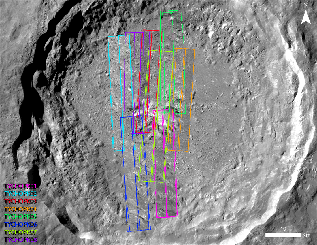
We usually create a single LROC DTM using four Narrow Angle Camera (NAC) images. Because we acquire images in left-right pairs, the four images form one set of stereo pairs. However, as with the Tycho central peak, sometimes an area of interest is larger than two NAC pairs, or scientists are interested in the broader regional context around the geologic feature of interest. In these cases, we can create a larger DTM mosaic derived from several stereo sets (see figure below).
There are a few challenges to creating wide-area DTM mosaics. For very steep areas of the Moon, like the Tycho central peak, parts of the terrain will sometimes be in shadow, especially at higher latitudes. Because we cannot calculate elevation data from shadows, we acquire images over time as the Sun azimuth changes for a full-coverage mosaic. However, capturing these images can be complicated because a day on the Moon is long, and lighting conditions change very slowly. Combined with limited opportunities to slew the spacecraft, capturing stereo images of the same feature under different lighting can take a long time; in this case, seven years. In addition, all stereo pairs must be tied together to ensure the DTM is topographically consistent with no visible seams. Tying pairs together becomes more complicated as more images are incorporated into the mosaic, and is even more difficult when the added stereo pairs have been taken under different lighting conditions. However, once we have addressed these factors, we can create a DTM mosaic covering a large area!
In this mosaic, the central peak of Tycho is larger than the area covered by the standard four-image setup. We created the mosaic (available here) out of eight sets of stereo images (32 images in total), which amply cover the peak and the surrounding crater floor.
Explore Tycho’s central peak in the Zoomify window below!
Read more about Tycho crater and its central peak:
Tycho Central Peak Spectacular!
Published by Victoria Roseborough on 29 March 2023