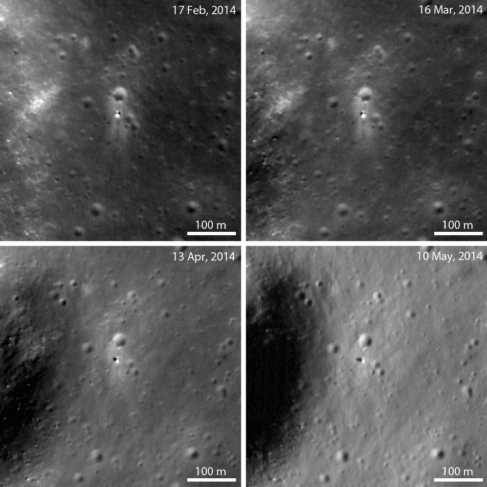
LROC imaged China’s Chang'e 3 lander and Yutu rover once each month from February to May. Chang'e 3 set down in Mare Imbrium near Laplace F crater. In the 10 May 2014 image, the lander casts a long shadow to the northwest. Yutu’s shadow (located 17 m southwest of the lander) can just barely be discerned in this image, and the blast zone around the lander is nearly indistinguishable from its surroundings.
Planetary scientists usually measure the Sun angle relative to the surface normal (an imaginary line perpendicular to the ground), and is called the angle of incidence. High incidence angles occur when the Sun is low on the horizon (such as at dawn or dusk). And low angles of incidence equate to midday, when the Sun is at its highest point in the sky. The range of possible solar incidence angles at a surface point is affected by local topography, axial tilt, and latitude.
The rover’s tracks have not disappeared from February to May! The difference in reflectance between the tracks and the surroundings is just harder to see near dawn or dusk. The blast zone (the bright halo around the lander) is also hard to discern in the 10 May 2014 image. As the incidence angle increases, the spacecraft hardware and topographic features such as craters cast larger shadows. The long, distinctive shadows cast by the lander help to identify it on the surface.
When the Sun is higher in the sky (low incidence angle), the rover, blast zone, and rover tracks are easier to identify -- compare the 10 May image with the 17 Feb image. The rover’s tracks are most visible when the Sun’s position is greater than 30° above the horizon.
As LROC continues imaging the recent landing zone, we will be able to assess small changes in the surface around the lander and rover over time.
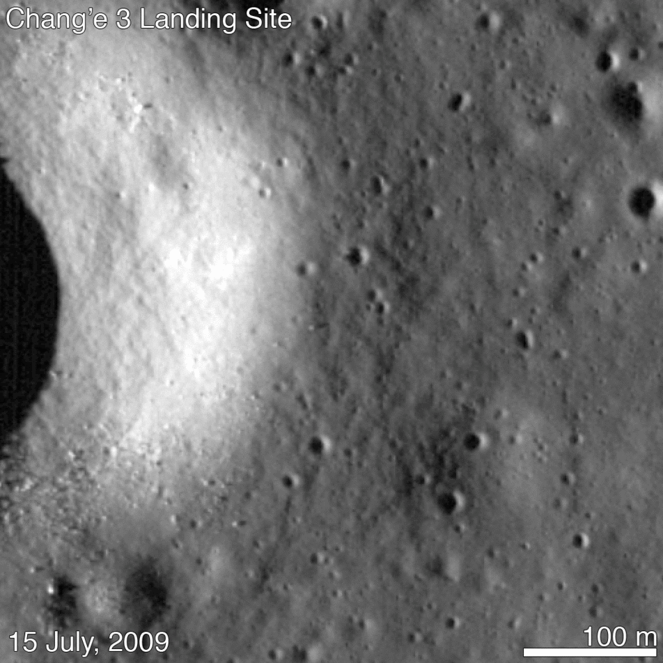
Pan and zoom around the Chang'e 3 landing site below (NAC M1154358210):
Explore more LROC images of the Chang'e 3 landing site on our newly updated Featured Sites page, or continue reading about LROC imaging of the Chang'e 3 lander and Yutu rover:
Sinus Iridum - Next Destination?
Chang'e 3 Lander and Rover from Above
Safe on the Surface of the Moon!
The Chang'e 3 Landing Site in 3D
Published by J. Stopar on 9 October 2014