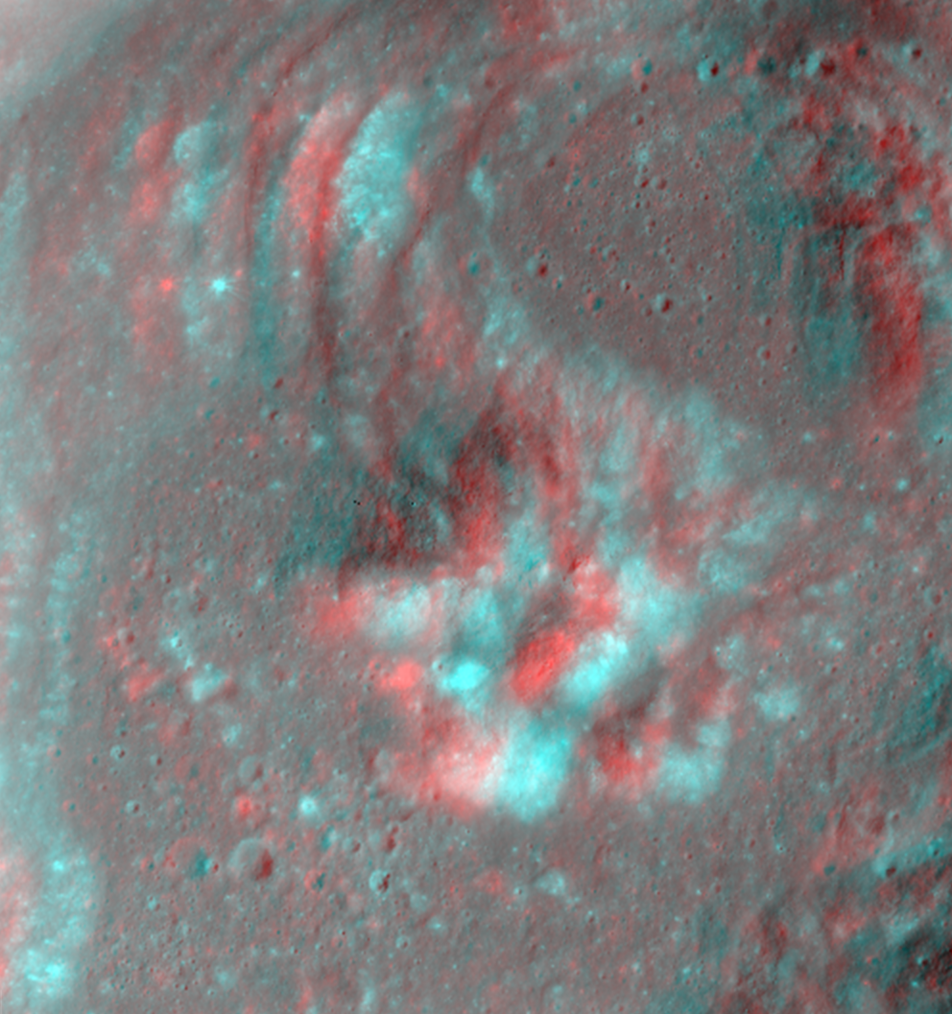
Anaglyphs are great because they are an excellent way to get a quick look at the topography of an area! Take this example of Euler Crater, located in southwest Mare Imbrium. This 28-km wide crater contains all sorts of interesting topographic features, including slumps visible along the crater walls, a knobby central peak complex, and smooth ejecta blanket.
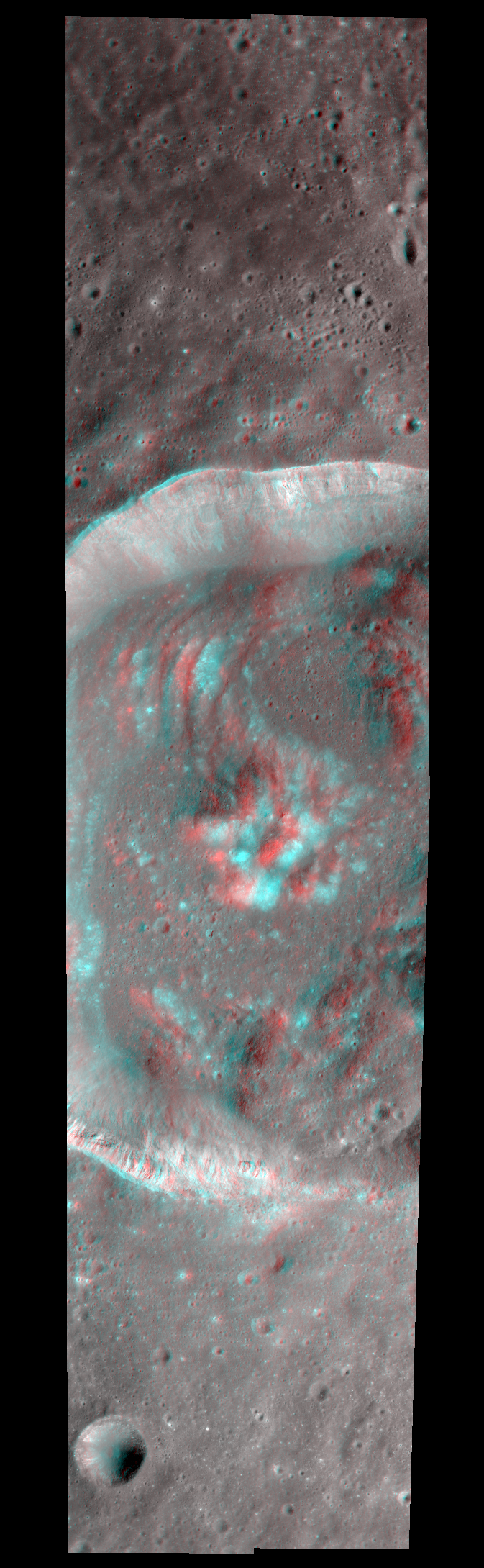
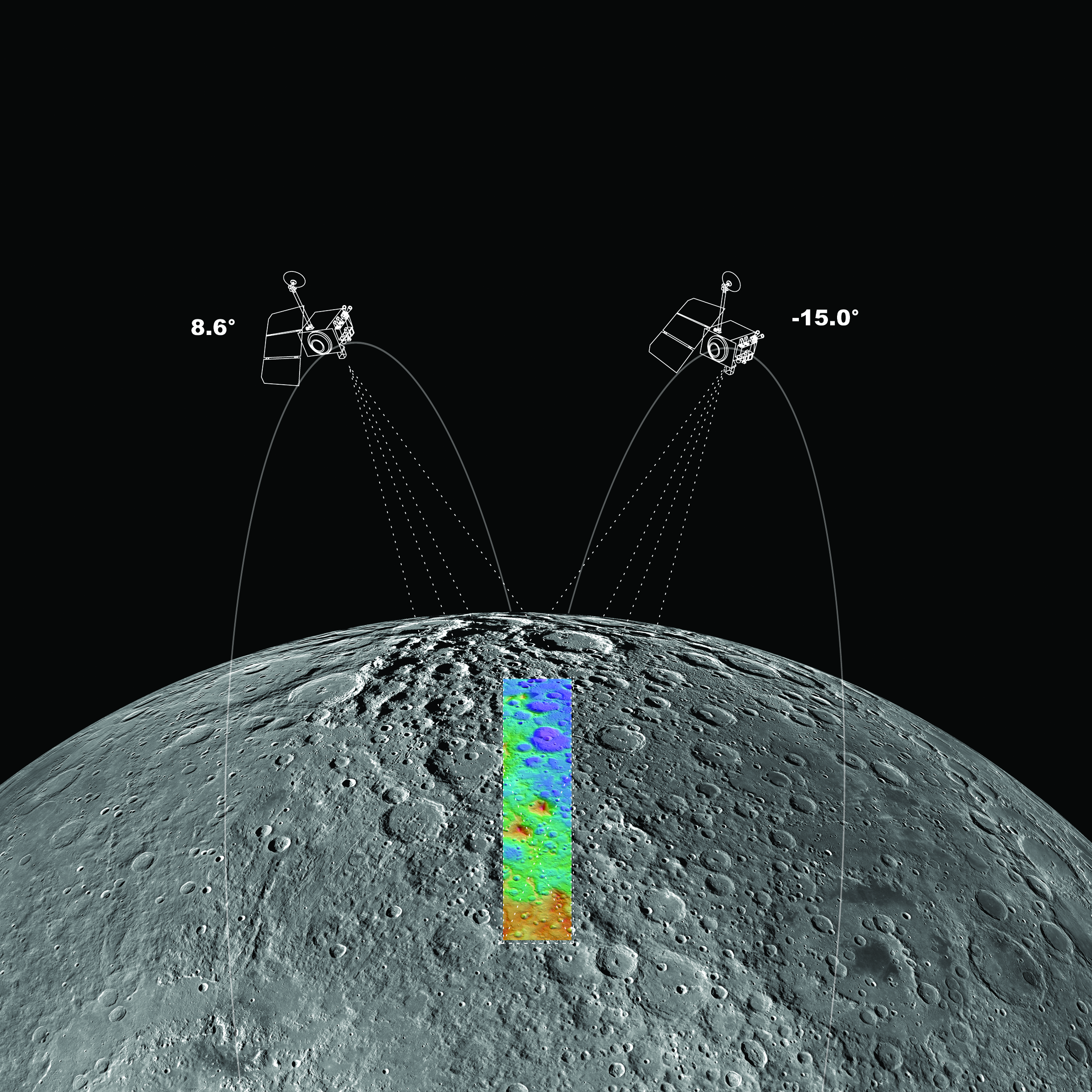
Anaglyphs are created from two image pairs (stereo) of the same area taken from different angles. As the spacecraft orbit track nears a feature of interest, LRO is slewed (<30°) so that the NAC field-of-view is centered on the target. On the next orbit, as the same area comes into view LRO is slewed in the opposite direction to obtain a second view. These two image pairs are then processed into a 2-band image with the left eye image in the red channel and the right eye image in the green and blue channels (making cyan). The parallax between the two images provides the stereo effect - presto a 3D look at the lunar surface -- so go put on your 3D glasses and check out the new NAC Anaglyph products!
The same stereo images used for making anaglyphs are used to make NAC Digital Terrain Model (DTM) products. The DTM products provide a very accurate and detailed topographic map. The perfect map for planning exploration traverses for rovers and astronauts. To find out more about how DTMs are created, visit this LROC Featured Image.
Published by Kristen Paris on 22 December 2014