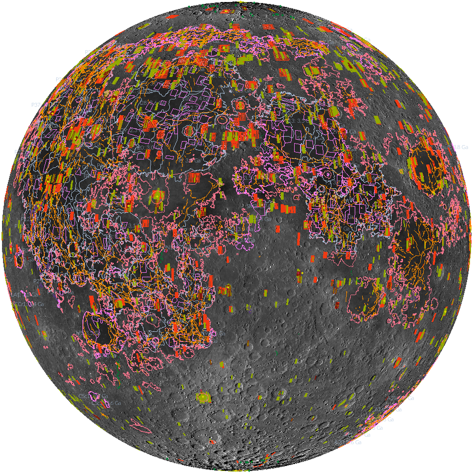
A shapefile is a common format for vector data: points, lines, or polygons that represent features such as the locations of the Apollo landers, the linear lobate scarps, and the footprints of NAC DTMs. Shapefiles can be used with many geographic information system (GIS) software tools, including ArcGIS, QGIS, LunaServ and JMARS, to locate, display, and analyze LROC data. There are many ways to use this type of data, such as locating small geologic features that are otherwise difficult to find, identifying existing LROC data (i.e. NAC stereo images, DTMs, or featured mosaic image sets) that cover specific regions of interest, and to clip raster data to a specific area.
All of these shapefiles and more are archived in the PDS and can be found on the LROC RDR Products site. You can also find these layers through Quickmap and the Lunaserv Global Explorer. There are currently 20 different shapefiles available:
- Anthropogenic Features
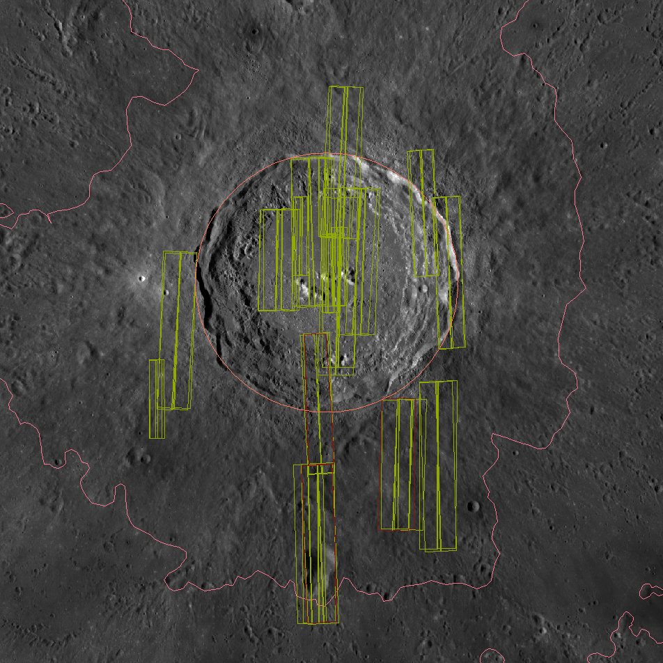
- Constellation Targets
- NAC DTMs
- Stereo Observations
- Featured Mosaic Observations
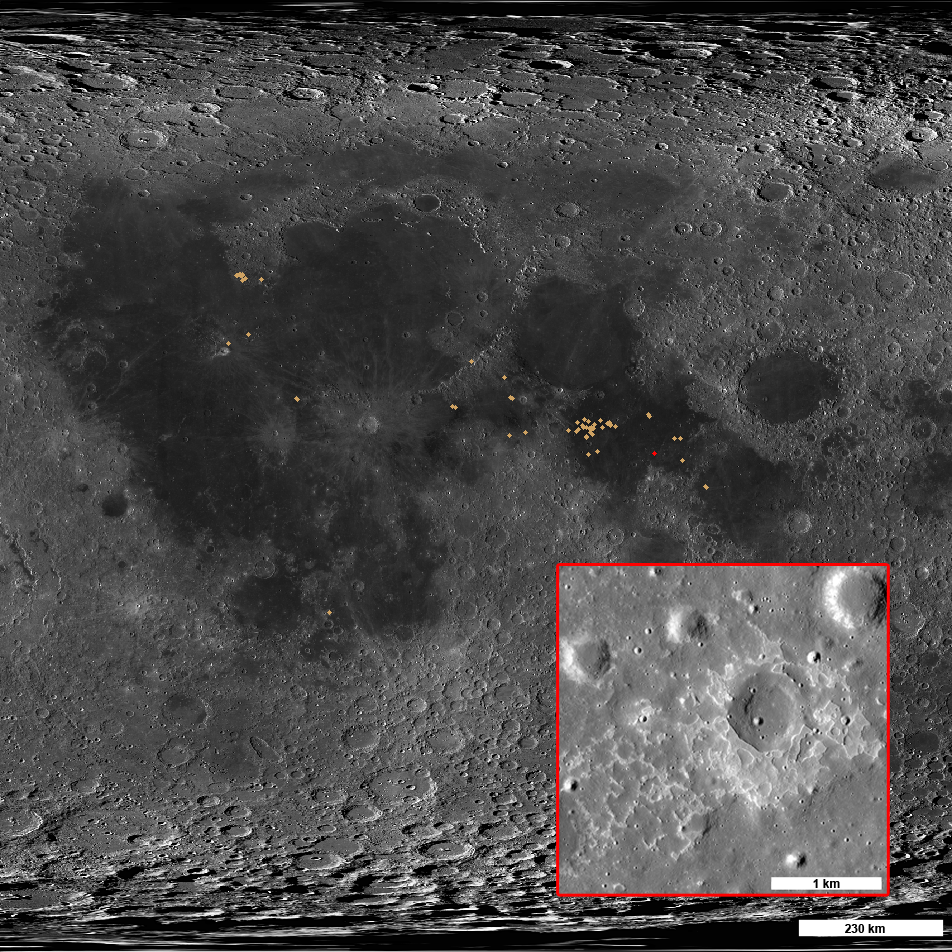
- IMP Locations
- Swirls
- Wrinkle Ridges
- Lobate Scarps
- Polar Lobate Scarp Locations
- Mare
- Hiesinger (2011) Mare Age Units
- Hiesinger (2011) Mare Count Areas
- Copernican Craters
- Craters 5 to 20 km Diameter: 0° to 90°E
- Craters 5 to 20 km Diameter: 0° to 90°W
- Craters 5 to 20 km Diameter: 90°E to 180°E
- Craters 5 to 20 km Diameter: 90°W to 180°W
- Craters 5 to 20 km Diameter: North Pole
- Craters 5 to 20 km Diameter: South Pole
Published by Megan Henriksen on 18 July 2017