Featured Images
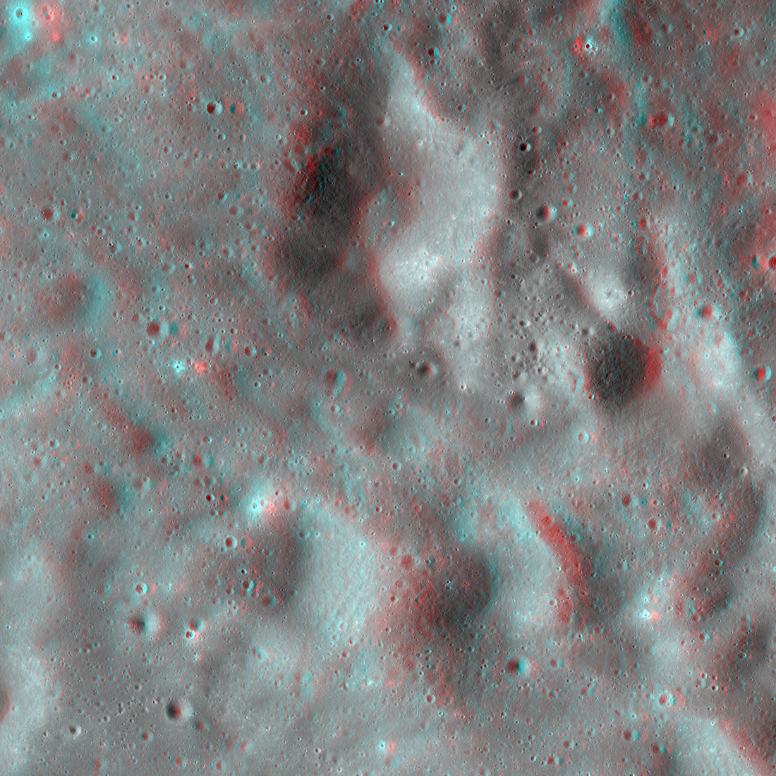
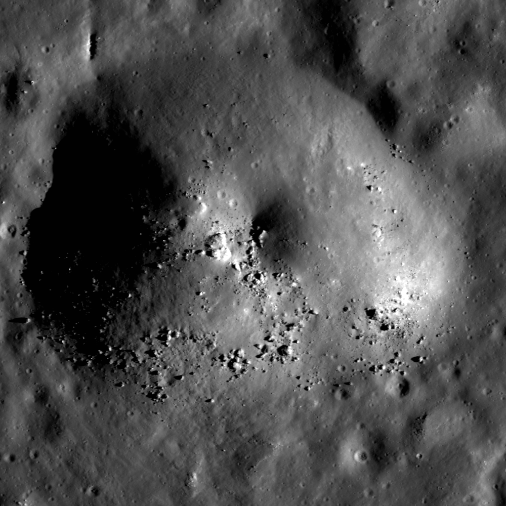
A Rain of Rock
A rain of rock carved these craters west of Vavilov crater. The ground here, which is elevated relative to the surrounding terrain, intersected with rock and other ejected debris excavated during the formation of Vavilov crater. The...
Published on 28 May 2020
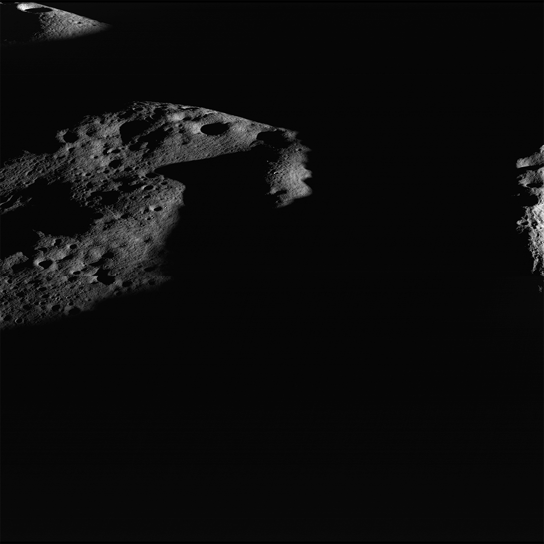
Islands in the Dark
Darkness surrounds illuminated peaks between Shackleton crater (rim crest at right) and de Gerlache crater (out of scene left). As lunar days and seasons progress, darkness creeps along this elevated ridge near the south pole. Image...
Published on 20 May 2019
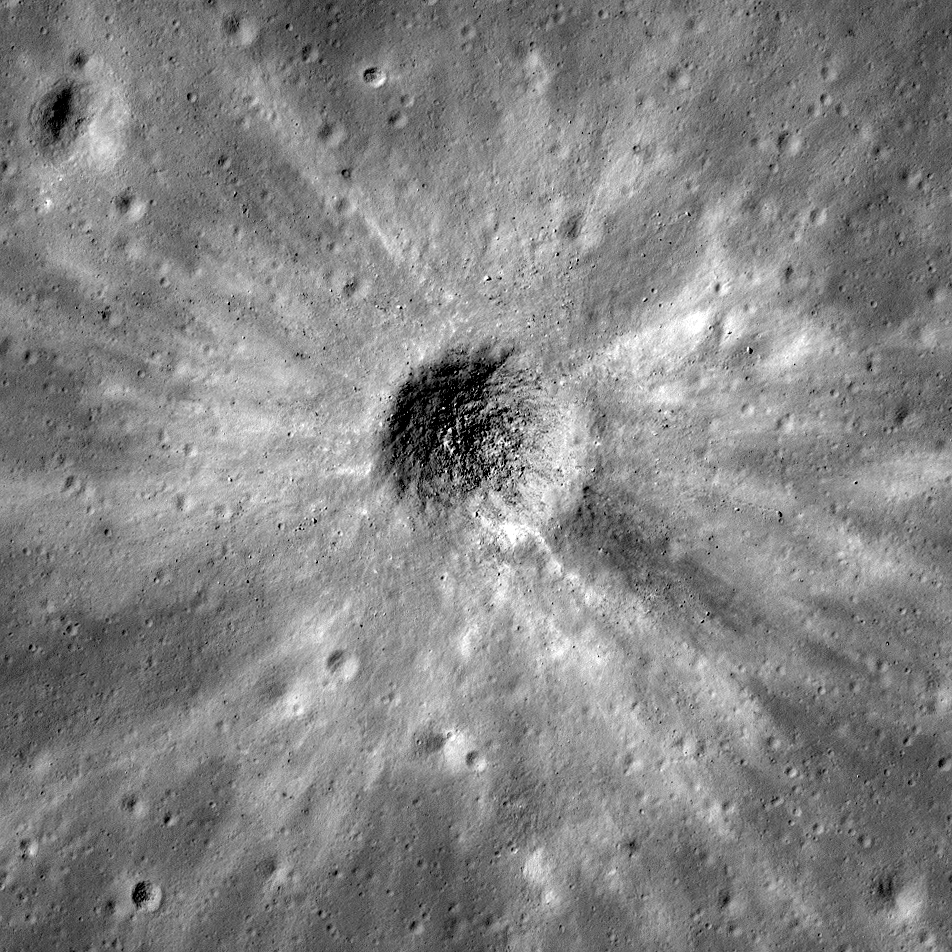
Probing the Lunar Surface Using Small Impact Craters
A fresh impact crater with finely detailed ejecta patterns. How has this crater changed since it was formed? Can the shape of this crater tell us anything about the surface in which it formed? The crater cavity (centered at 20.870°S,...
Published on 20 Oct 2017
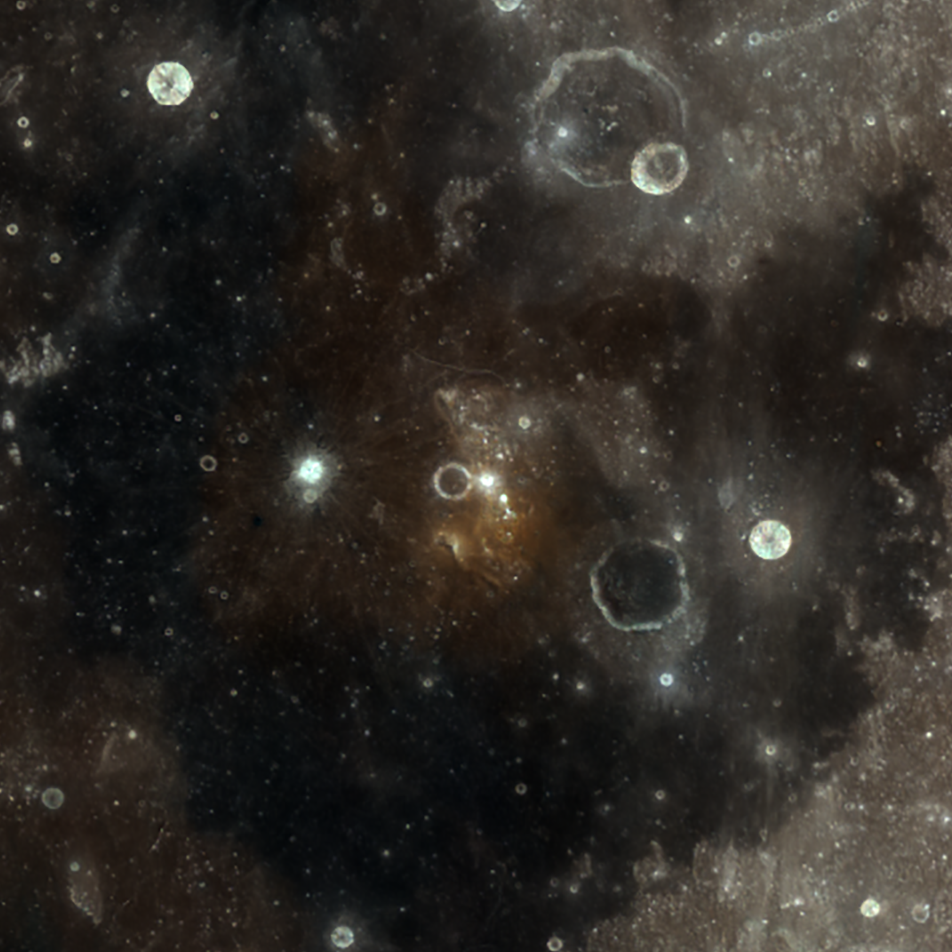
Color of the Lassell Massif
A shock of color on the Moon! The Lassell Massif (a so-called "red spot") in Mare Nubium appears orange in the center of this WAC color composite image. The image was derived by assigning red to 689 nm, green to 415 nm, and blue to 321...
Published on 12 Sep 2016
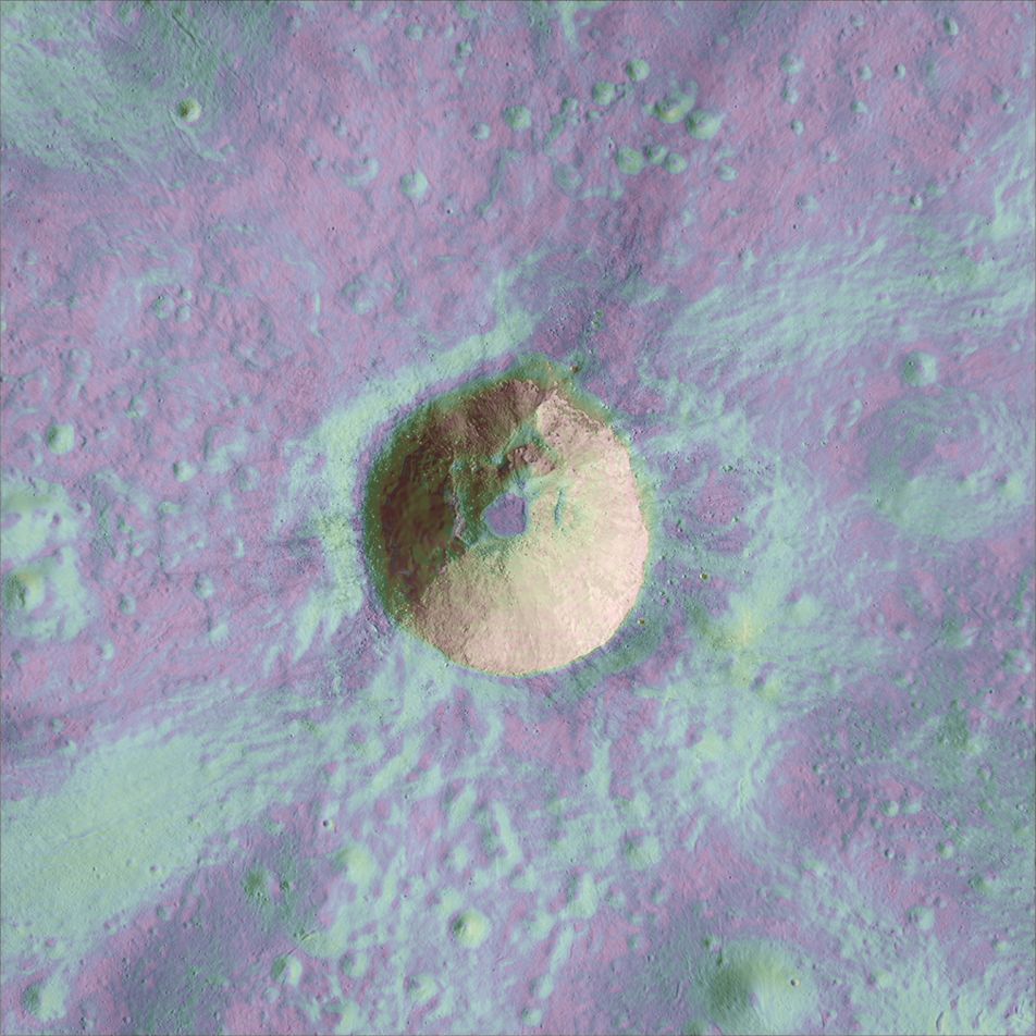
Thick and Sticky Melt-Rock
Colorized slope map of a fresh impact crater and its ejecta. A deposit of solidified melt-rock and debris was formed at the end of the impact event on the floor of this 1.5-km diameter crater. The flat-lying floor materials (purple,...
Published on 15 Apr 2016
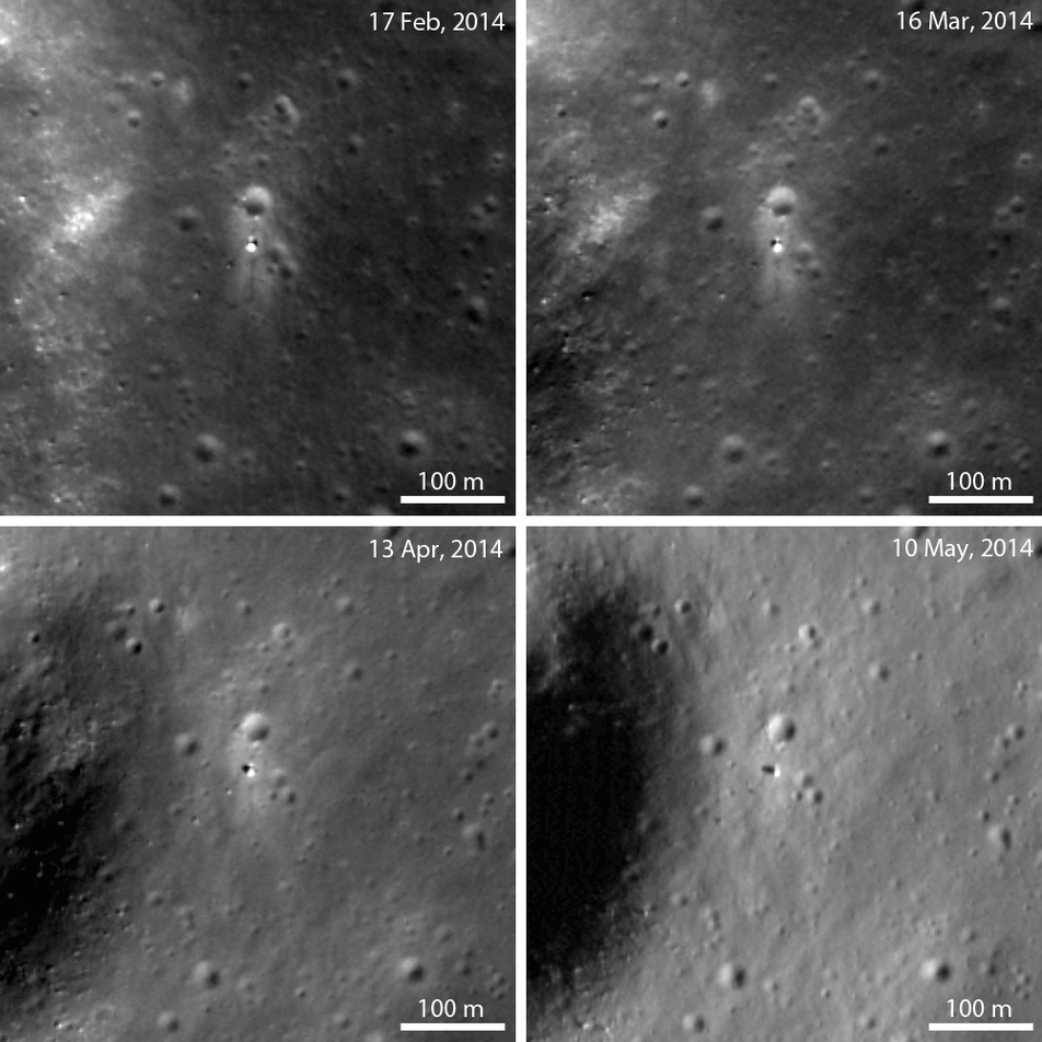
Casting a Long Shadow
Sun angle profoundly affects the surface features of the Chang'e 3 landing site. When the Sun is higher in the sky (low incidence angle), the tracks left by the Yutu rover and the bright blast zone around the lander are most visible....
Published on 09 Oct 2014
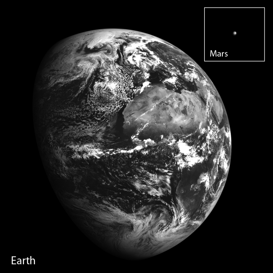
Two-Planet Perspective from Lunar Orbit
Composite of Earth and Mars imaged in a single NAC frame on 24 May 2014. This amazing view of two planets was visible from lunar orbit when LROC pointed homeward! Mars is about 12 pixels wide; Earth was downscaled by a factor of eight...
Published on 02 Oct 2014
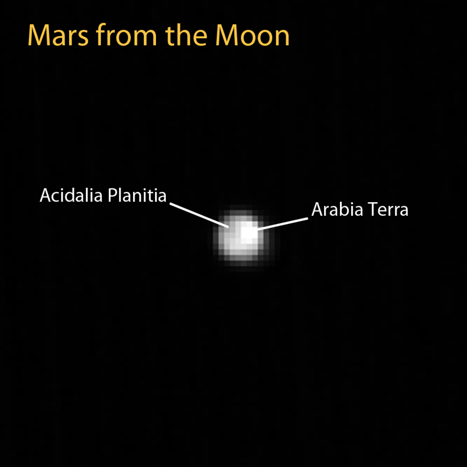
Two Faces of Mars (from the Moon)
Moon-facing hemisphere of Mars on 8 May 2014 at 14:27:04 UTC seen from lunar orbit! Instruments on LRO sometimes use stars and planets for calibration or other special observations. During one of these off-Moon observations, LROC...
Published on 30 Sep 2014
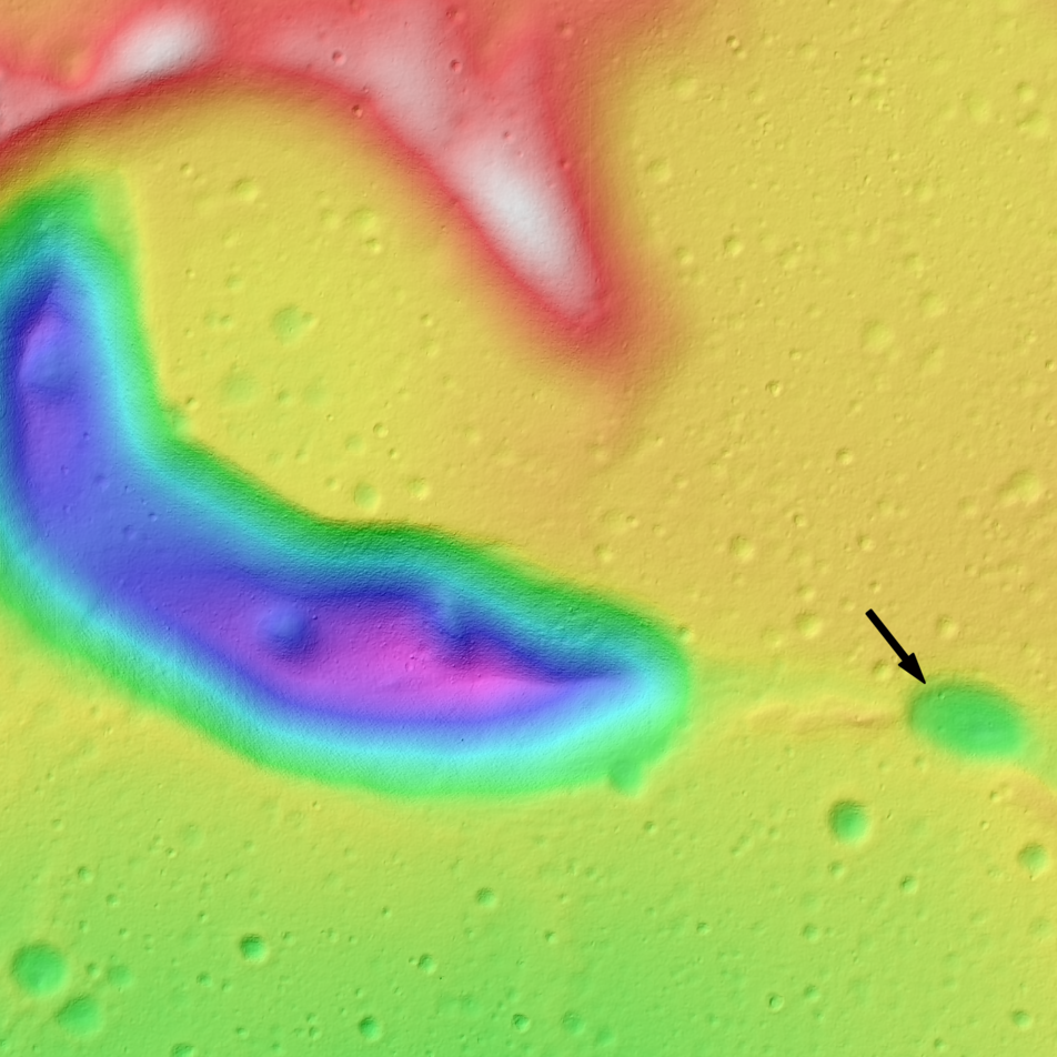
Tadpole and Lava Tube
An irregularly shaped depression, resembling a tadpole (center left), which is part of a sinuous chain of pits. The black arrow indicates the beginning of the pit chain that trends to the southeast. This feature is about 8 km long and...
Published on 29 Aug 2014
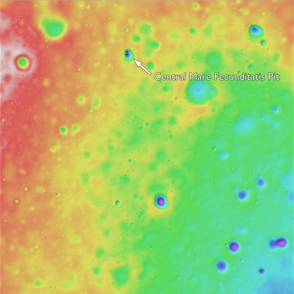
Mare Pit Topography!
The crisp morphology of the central Mare Fecunditatis pit (white arrow) stands out in elevation data and suggests a relatively young age. This pit is about 200-m in length and 45 m deep. Image width is 5 km; north is up. Color...
Published on 27 Aug 2014
Banded Slump in Berzelius W
A complex interplay of slumping and slides in the northwest wall of Berzelius W result in banding patterns; downslope is toward the bottom right. LROC NAC M174921824R; image width 600 m [NASA/GSFC/Arizona State University].
Published on 24 Jul 2014
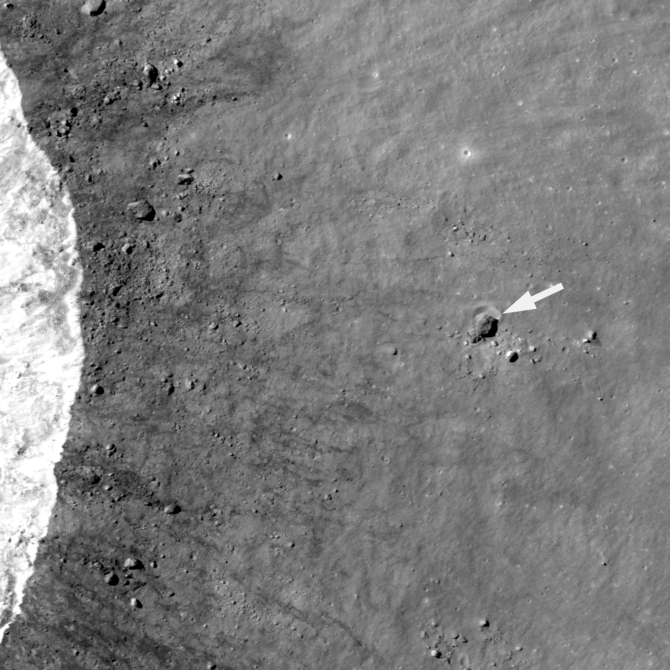
Small Step or Giant Leap?
A house-sized boulder (more than 30 m in diameter) left a clear impression (arrow) in the lunar surface. This boulder was thrown a relatively short distance (500 m) to the east of a young 1.6-km crater (rim crest to the left); LROC NAC...
Published on 21 Jul 2014
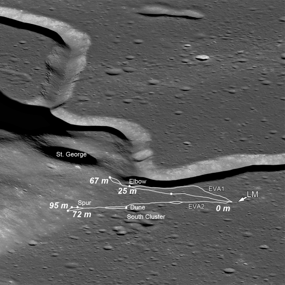
The Original Interplanetary Mountaineers
Traverse plots of the first two Apollo 15 EVAs, on which astronauts Scott and Irwin ventured to the lower slopes of Mons Hadley Delta (center left); numbers indicate elevations above the landing site (LM) (oblique LROC NAC M1123519889;...
Published on 20 Jun 2014
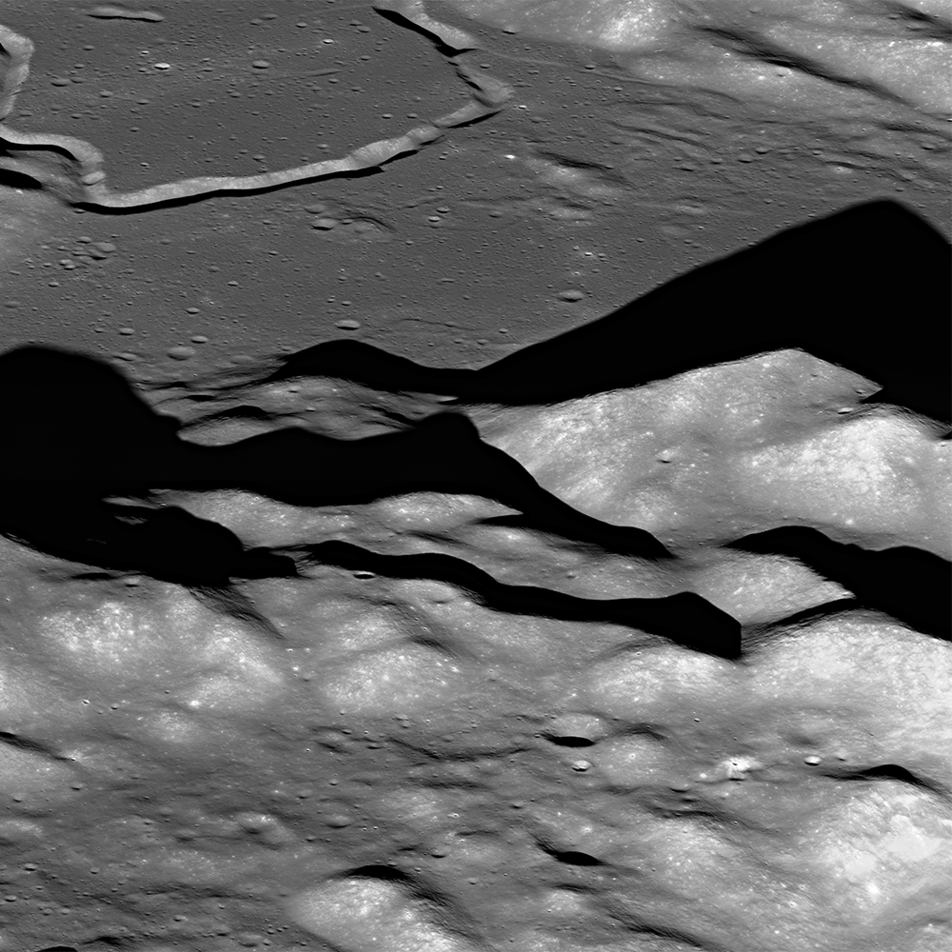
Soaring Over Mighty Mt. Hadley
An oblique view, looking east-to-west over the Apennine Mountains towards Hadley Rille (upper left) (LROC NAC M1123519889, north is to the right). A long shadow is cast by mighty Mt. Hadley (center right). Nestled between the Apennines...
Published on 18 Jun 2014
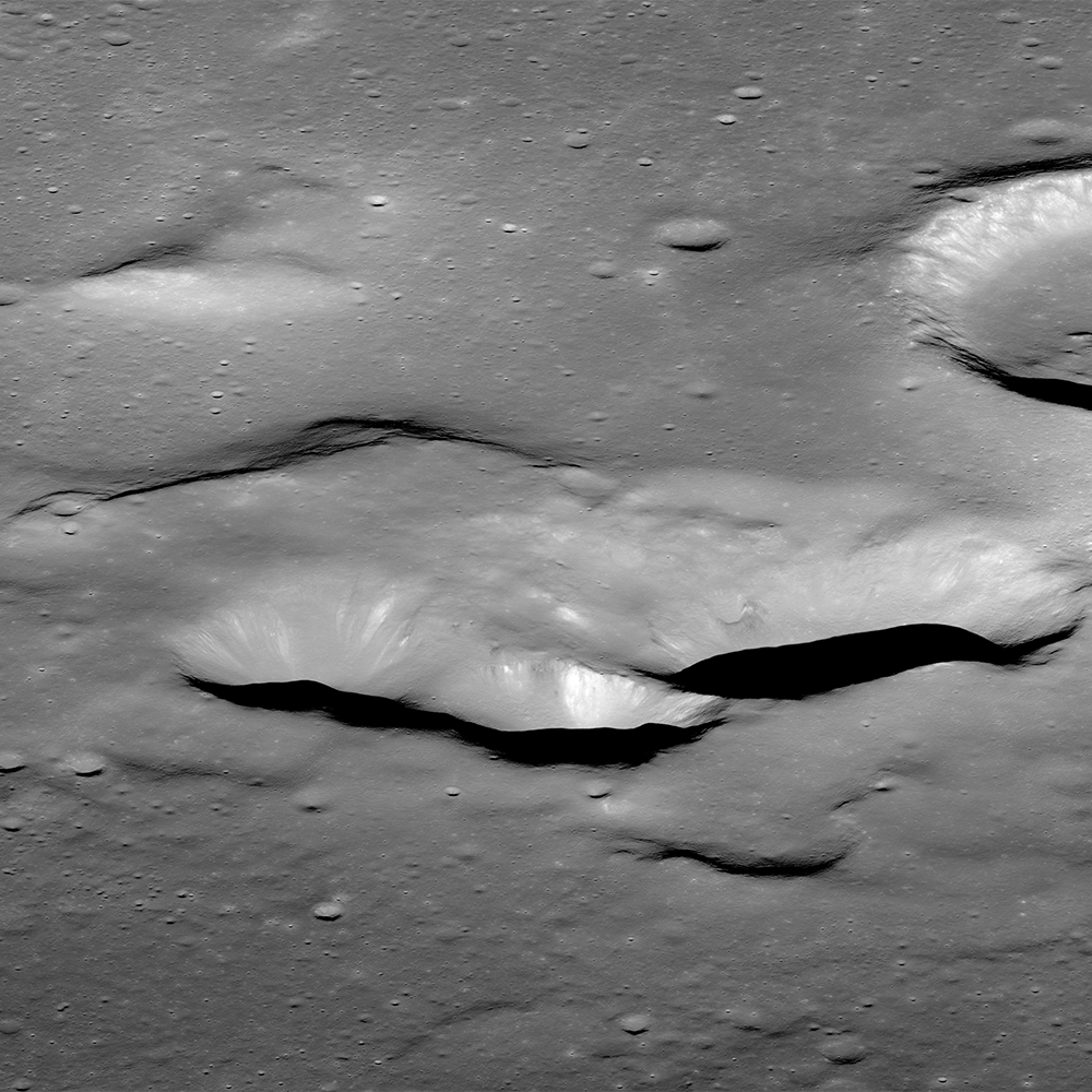
The Complex Case at Lassell K
An early morning view looking east-to-west from an altitude of 86 km across the southern portion of the Lassell Massif, an irregularly shaped series of hills and steep-walled depressions. North is to the right; oblique LROC NAC mosaic...
Published on 15 May 2014
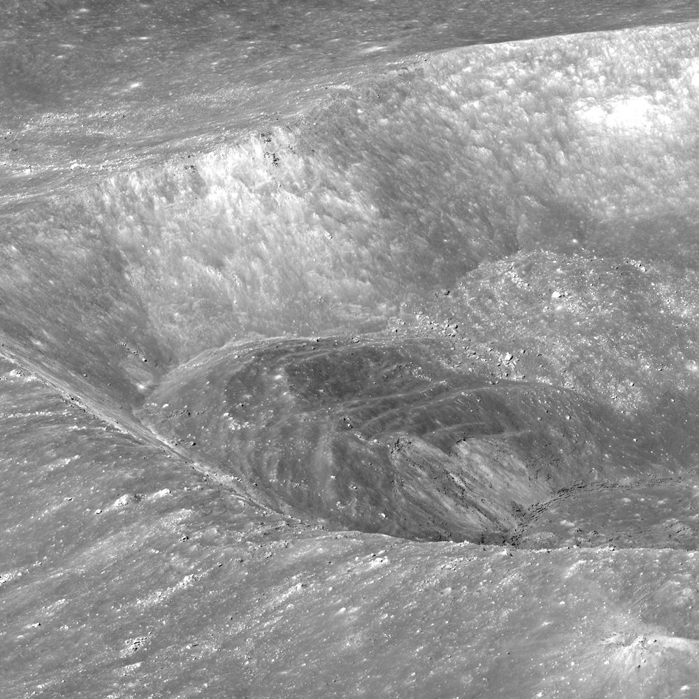
A Splendid View of Larmor Q
LROC NAC view of the south wall and rim of splendiferous Larmor Q crater, looking obliquely east-to-west from an altitude of 60 km; image M174081337 [NASA/GSFC/Arizona State University].
Published on 13 May 2014
One in a Million Mounds
Boulders, most 10 to 20 meters across, pepper the flanks of a cratered mound in the floor of Copernicus crater. The scene is illuminated from the east (right); LROC NAC M1339037292R; image width ~1.1 km [NASA/GSFC/Arizona State University].
Published on 10 Apr 2014
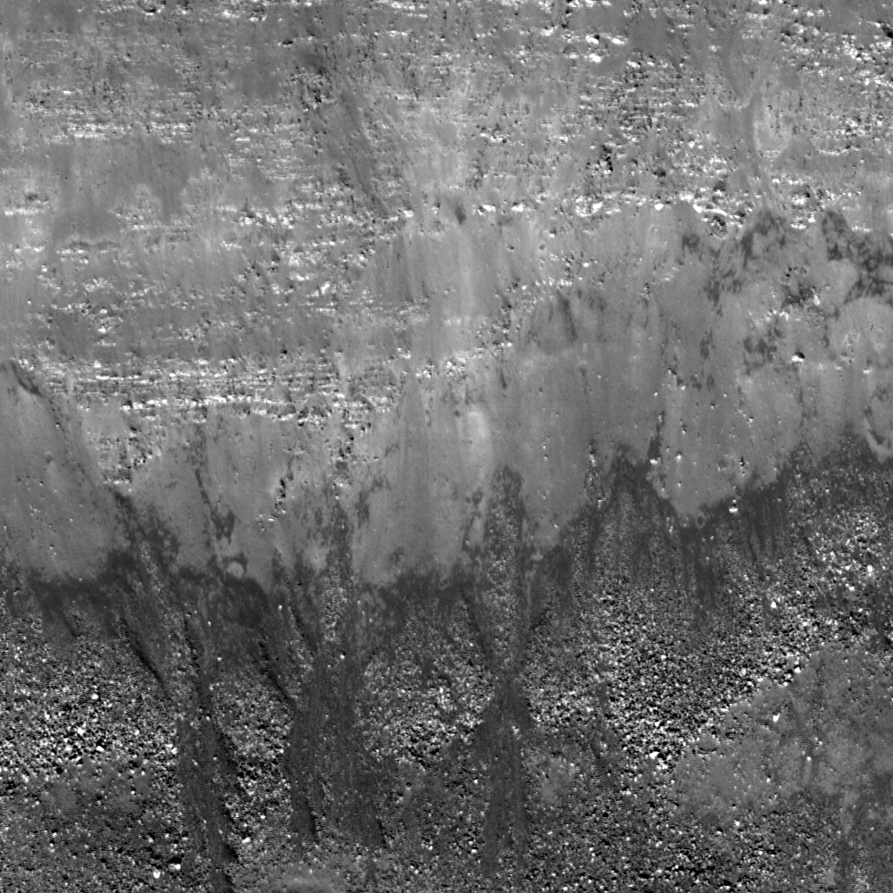
Swept Slopes of Herigonius
Banded layers of mare basalts revealed in the east wall of Herigonius crater. The crater rim crest is located outside the top of the image (north to the left). Debris and boulders accumulate downslope (bottom) toward the crater floor....
Published on 08 Apr 2014
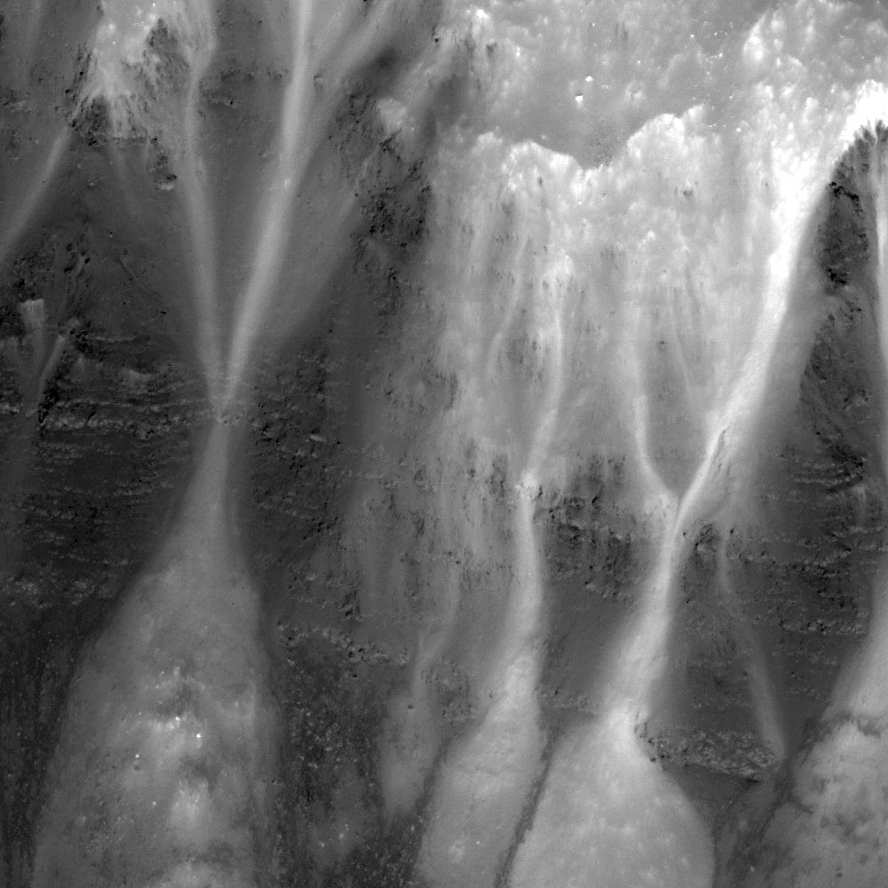
Stratification in a Tranquil Sea
Bright talus winds downslope through crags and crannies in the banded scarps exposed in the east wall of Dionysius crater. Horizontal lineations result from differential mass wasting of stratified rock in Mare Tranquilitatis; LROC NAC...
Published on 13 Mar 2014
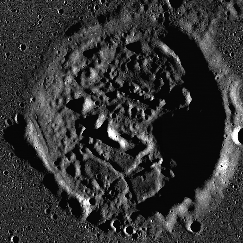
Modified Craters of Moscoviense
Morning light beams over the walls and peaks of an irregularly shaped crater in Mare Moscoviense. This unnamed crater is approximately 17 km in diameter; portion of controlled NAC Mosaic MOSCOVNSLOA, downsampled for web browsing...
Published on 11 Mar 2014