Featured Images
2024 Eclipse as Seen From The Moon
When LROC acquired this image on 8 April 2024, the shadow of the Moon was centered near Cape Girardeau, Missouri. LROC E1467242026L [NASA/GSFC/Arizona State University].
Published on 15 Apr 2024

Another Close Encounter!
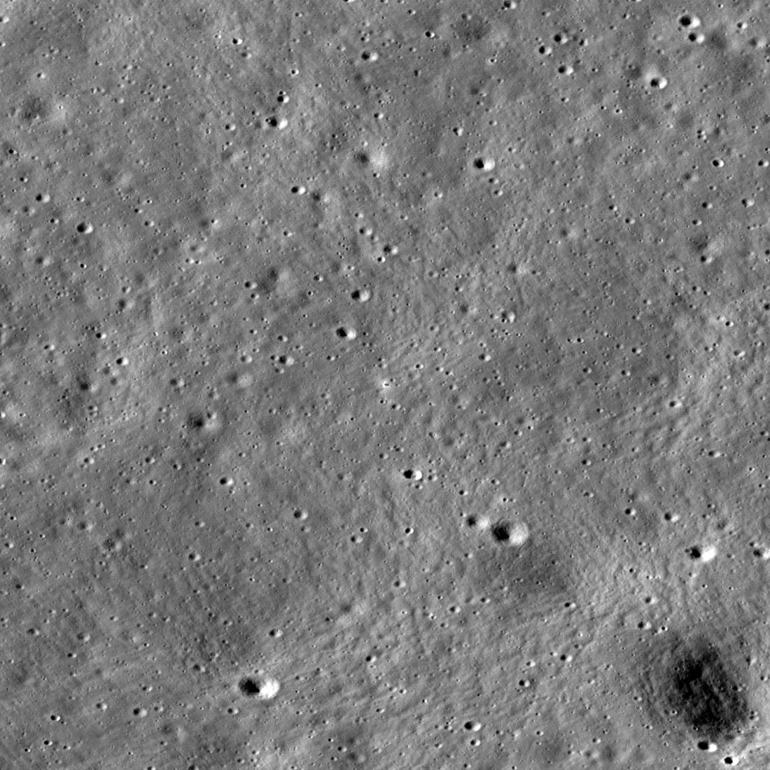
Hard to find, but centered here, you can see a fuzzy view of the Korea Aerospace Research Institute (KARI) lunar orbiter, Danuri, as it flew just 8 kilometers below LRO. Image width about 3000 meters, NAC M1464323568...
Published on 05 Apr 2024
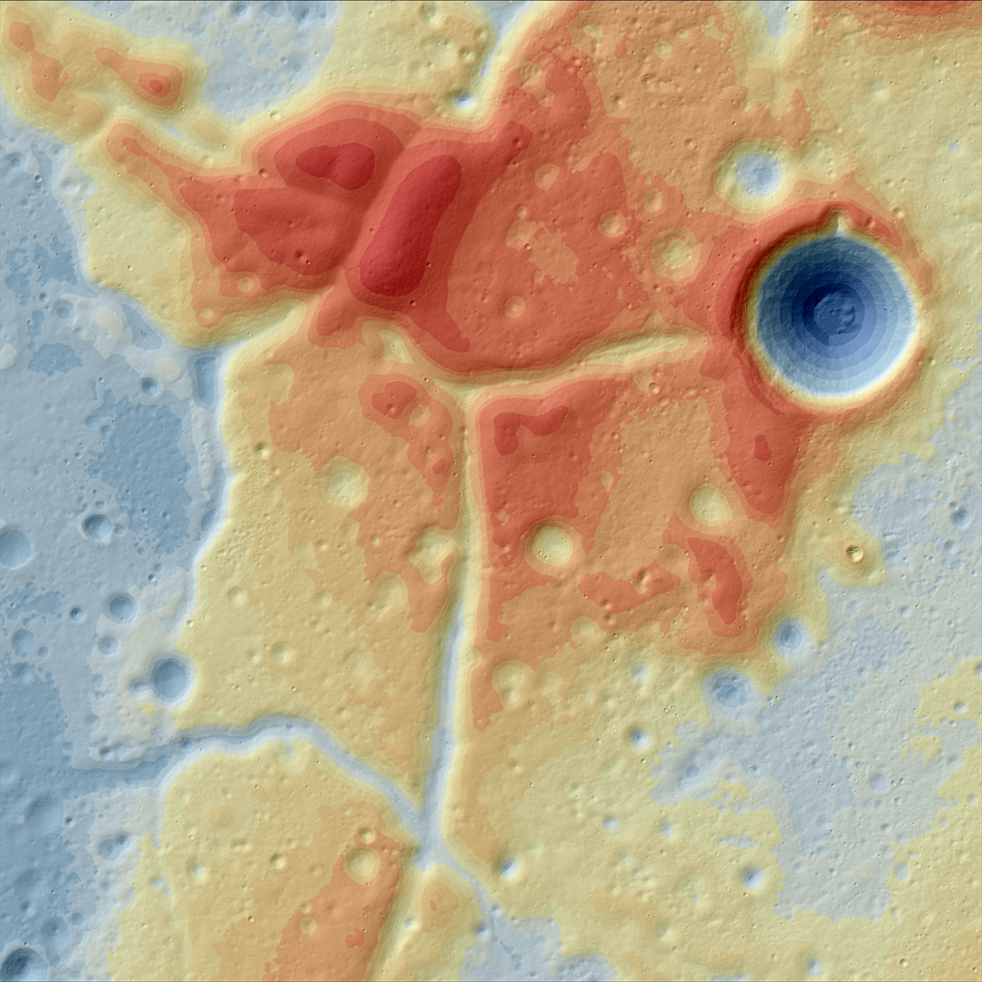
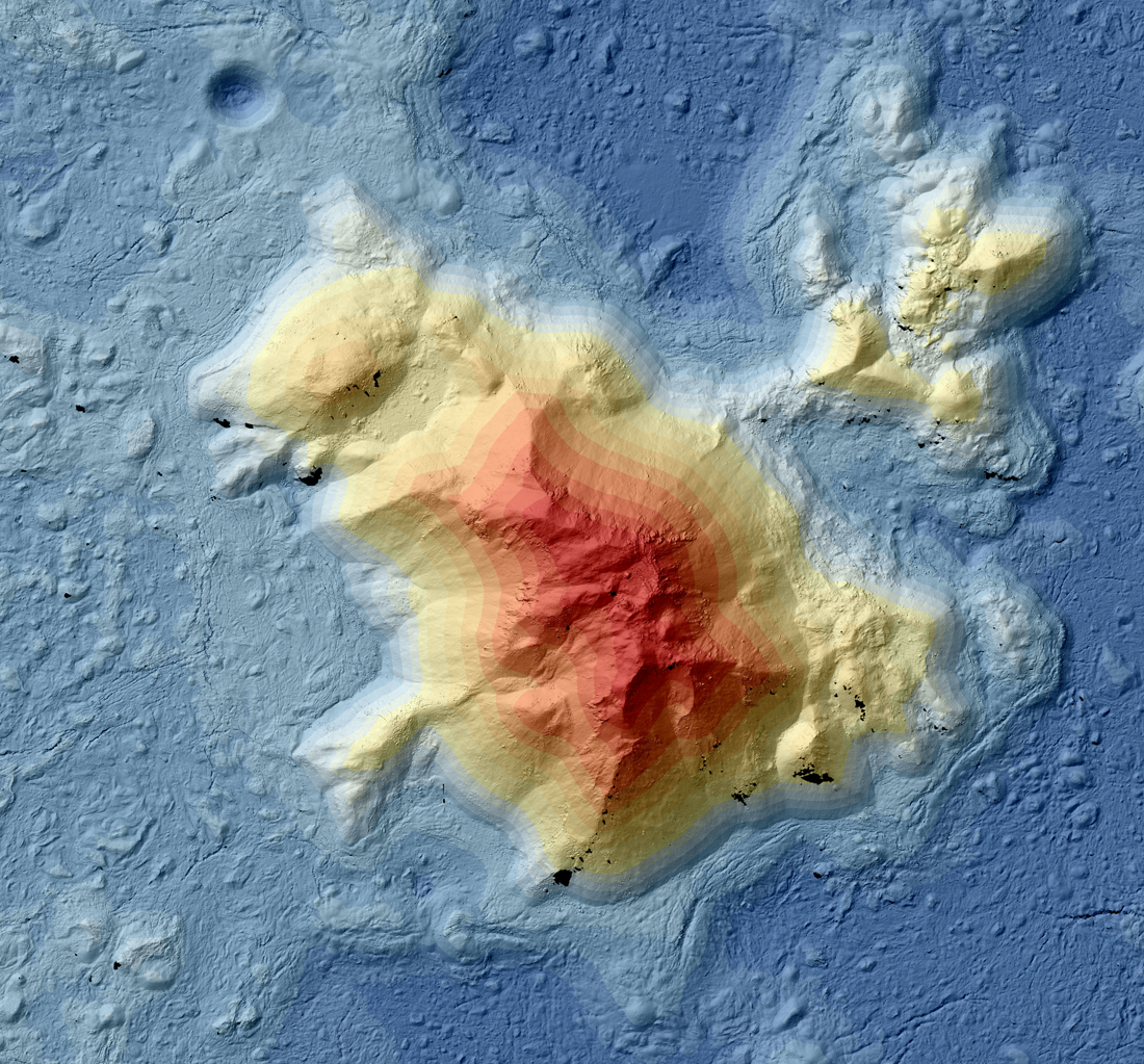
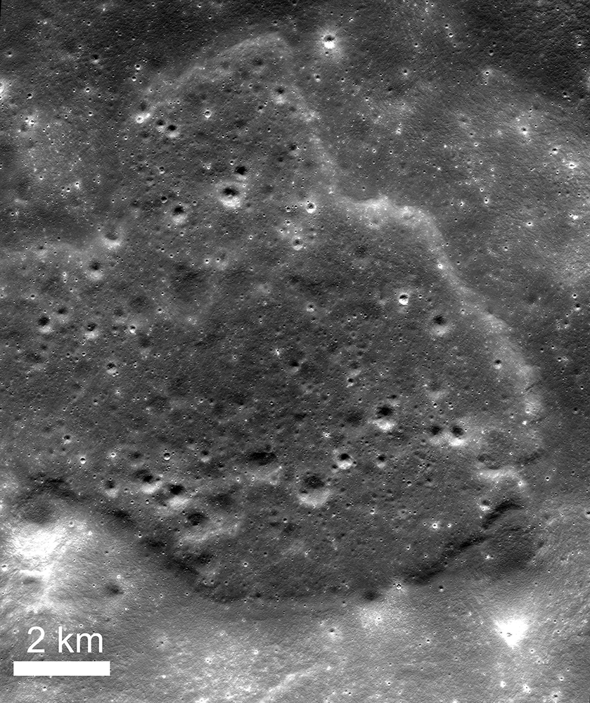
A Lunar Island Surrounded by Lava
Color-shaded relief map showing the elevations of the Western Crisium Kipuka (WCK) located on the western edge of Mare Crisium. The elevation ranges from -4,218 m (blue) to -3,195 m (red) [NASA/GSFC/Arizona State University].
Published on 01 Apr 2024
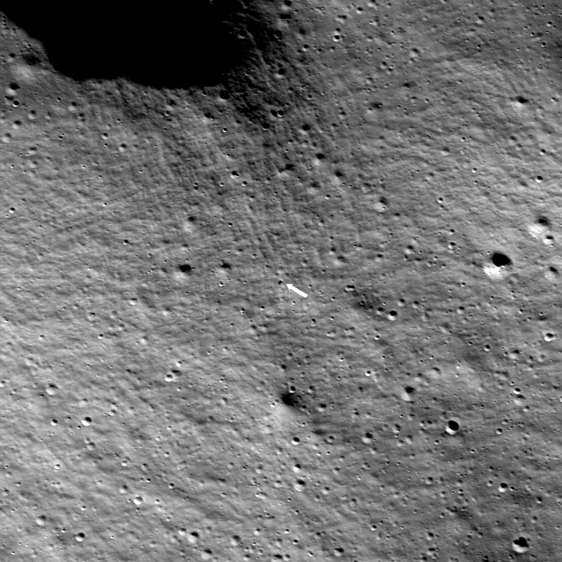
Intuitive Machines IM-1 On The Moon!
The Intuitive Machines IM-1 Nova-C, known as Odysseus, touched down on the Moon Thursday, 22 February, at 23:23:53 UTC (17:23 CST). The arrow indicates the Nova-C lander; the image width is 973 meters, NAC M1463440322L...
Published on 26 Feb 2024
JAXA SLIM Landing
The SLIM lander on the lunar surface (13.3160°S, 25.2510°E, -912 m elevation). The image is 880 meters wide, and north is up, LROC NAC M1460739214L [NASA/GSFC/Arizona State University].
Published on 26 Jan 2024
IM-1 Landing Region
IM-1 landing region, the map is 1870 meters wide; north and nearside are towards the top, 1.70 meters per pixel. NAC M1435274280LR [NASA/GSFC/Arizona State University].
Published on 19 Jan 2024
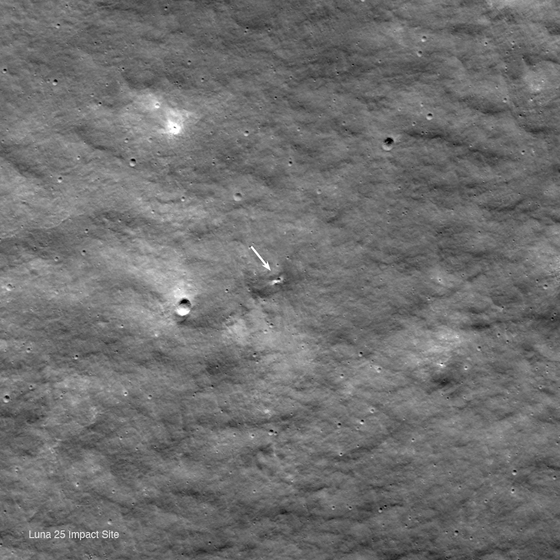
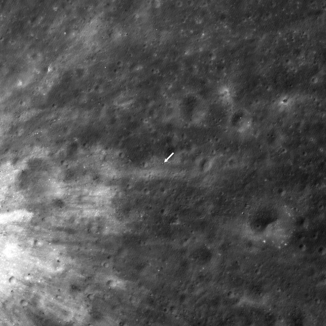
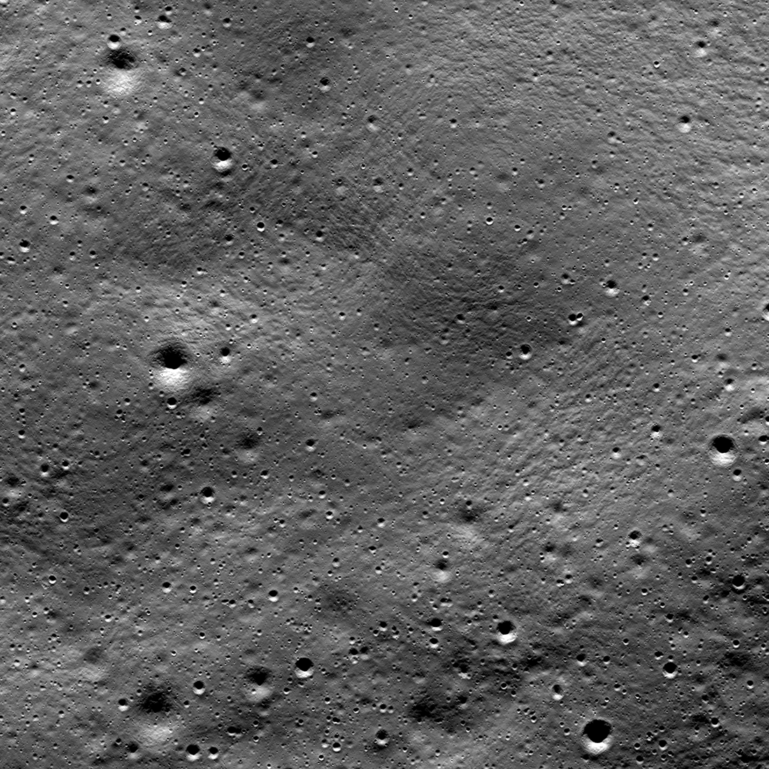
Luna 25 Impact Crater
During the descent to the surface, the Russian spacecraft Luna 25 experienced an anomaly that caused it to impact into the southwest rim of Pontecoulant G crater on 19 August 2023 11:58 am UTC (14:58 Moscow time). Image is 1100 meters...
Published on 29 Nov 2023
On the Way to Shioli Crater
The upcoming Japan Aerospace Exploration Agency (JAXA) lunar lander will touchdown in the vicinity of Shioli crater (center foreground, 210-meter diameter). The bright interior and rays indicate a very young age for this crater...
Published on 07 Nov 2023
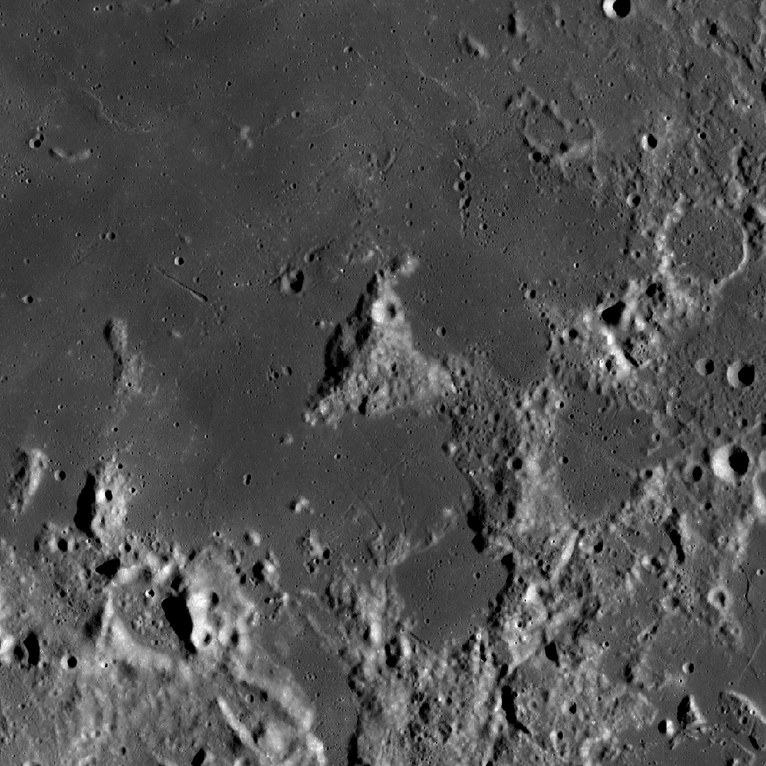
Gruithuisen: Collapsed Lava Tube?
The spectacular sinuous landform shown above is thought to be a collapsed lava tube (34.7°N, 316.6°E), located near Gruithuisen K crater. NAC controlled mosaic containing images M1173350480L/R, M1173357586L/R [NASA/GSFC/Arizona...
Published on 06 Oct 2023
Chandrayaan-3 Landing Site
Chandrayaan-3 lander is in the center of the image, its dark shadow is visible against the bright halo surrounding the vehicle. The image is 1738 meters wide, M1447750764LR [NASA/GSFC/Arizona State University].
Published on 05 Sep 2023
Mount Marilyn: A Lunar Love Story
Mount Marilyn, with its distinctive triangular shape, served as an important navigation landmark for the Apollo 11 astronauts. Portion of LROC Wide Angle Camera mosaic, 138 km wide [NASA/GSFC/Arizona State University].
Published on 31 Aug 2023
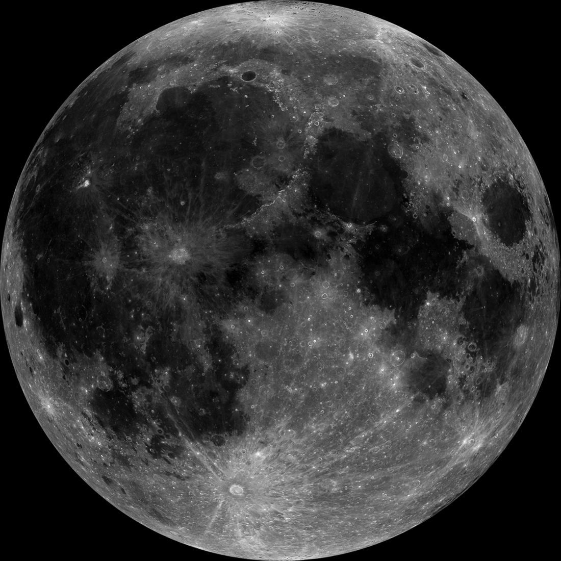
Once in a Super Blue Moon
A projection of the LROC Wide Angle Camera (WAC) mosaic showing the Moon as it will appear during the August 30th, 2023 super blue Moon [NASA/GSFC/Arizona State University].
Published on 26 Aug 2023
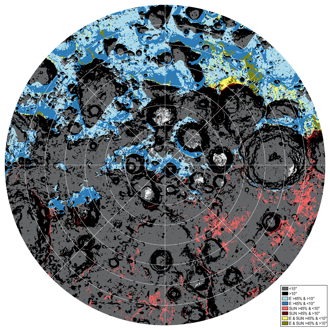
Mysteries Remain Frozen in our Celestial Backyard
Traversability conditions and landing site assessment map for the lunar south polar region. The percentage of time that the surface will be illuminated and visible to the Earth is modeled for the expected Artemis timeframe (July 9, 2024...
Published on 13 Jun 2023
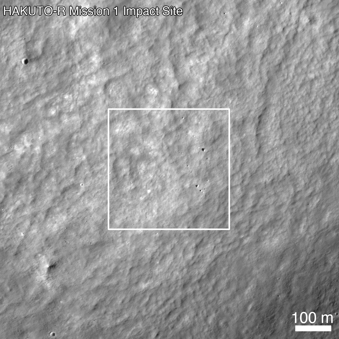
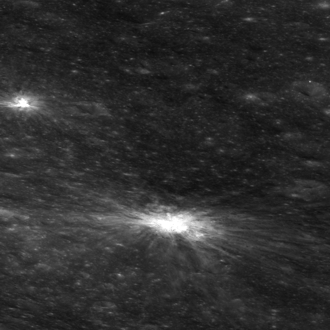
Impact Site of the HAKUTO-R Mission 1 Lunar Lander
HAKUTO-R Mission 1 Lunar Lander impact site, as seen by LROC the day after the attempted landing. LROC NAC image M1437131607R [NASA/GSFC/Arizona State University].
Published on 23 May 2023
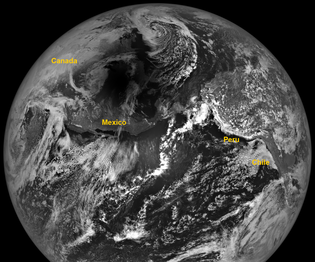
Looking Over the Orientale Basin
Indian Ocean as seen from lunar orbit (2015-12-10 06:00:29.202 UTC). NAC high-resolution monochrome image merged with WAC lower-resolution color observations. North is to the left, Antarctica to the right, Australia at the top, and...
Published on 07 Apr 2023
Tycho: A Model Central Peak
Color-shaded relief map showing elevations for the central peak of Tycho crater. Black areas indicate shadows in the stereo images, where no topography could be extracted [NASA/GSFC/Arizona State University].
Published on 29 Mar 2023
Malapert Massif
Malapert massif (informal name) is thought to be a remnant of the South Pole - Aitken basin rim, which formed more than 4 billion years ago. More recently, this magnificent peak (lower left) was selected as an Artemis 3 candidate...
Published on 14 Mar 2023
Three Impact Events
Spectacular 4500-meter diameter crater (10.67°S, 225.82°E) formed at the intersection of the rims of Lowell W crater (18-kilometer diameter) and the Orientale basin (750-kilometer diameter). Impact melt and debris spilled from the low...
Published on 20 Feb 2023
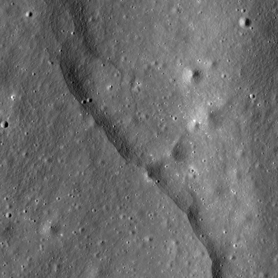
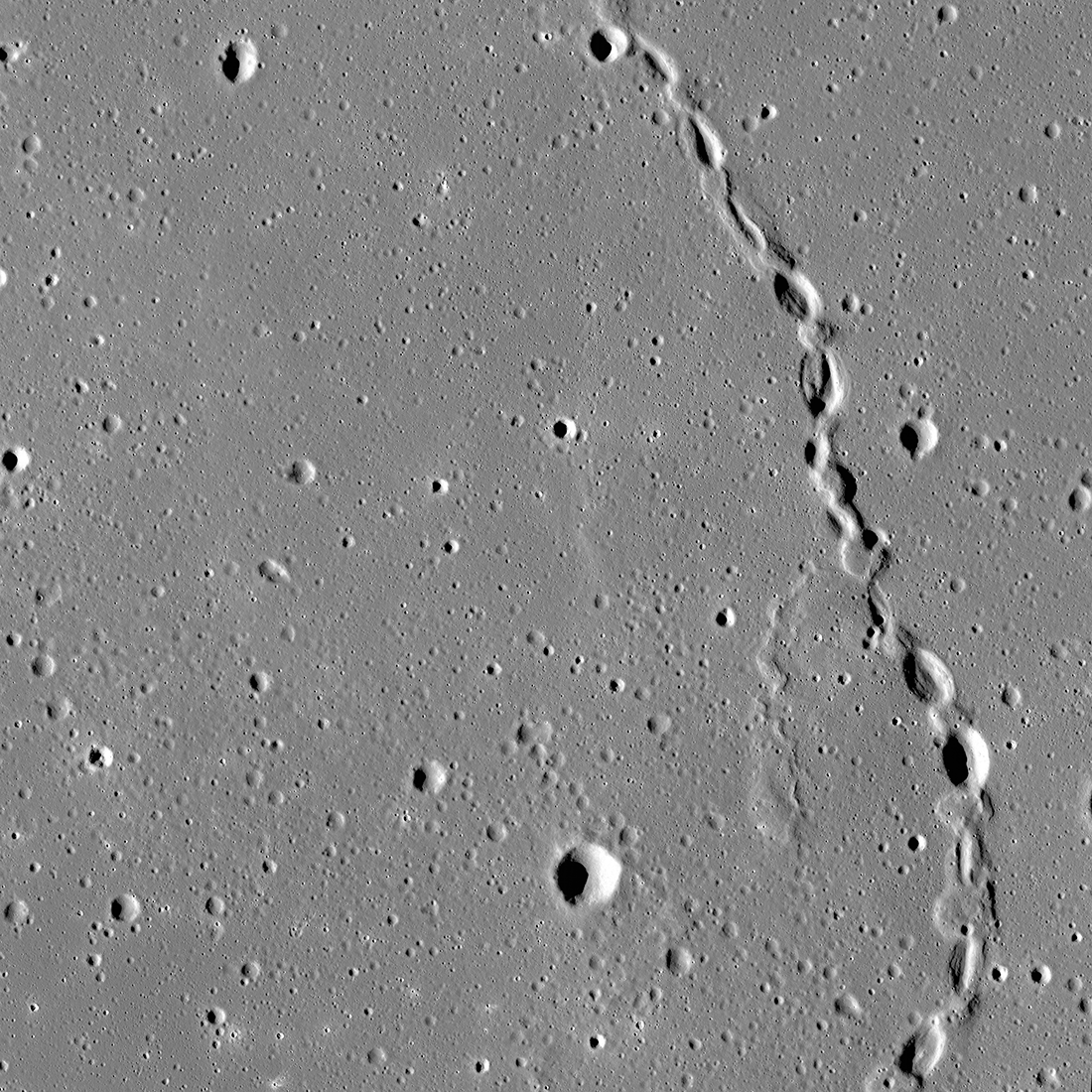
Thousands of Thrust Faults!
Prominent lobate thrust fault scarp in the Mandel’shtam cluster, one of the thousands discovered in Lunar Reconnaissance Orbiter Camera (LROC) images. The fault scarp or cliff is like a stair-step in the lunar landscape formed when the...
Published on 14 Feb 2023
Ancient Impact Melt
Lobate margin of ancient impact melt flow within a nameless farside crater, 45.84° S, 227.32° E, NAC M1117380495LR [NASA/GSFC/Arizona State University].
Published on 28 Dec 2022