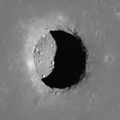
Lunar Atlases
Lunar atlases feature collections of images, regional maps, and cooresponding data for areas of scientific interest on the Moon. After more than 10 years in orbit on LRO imaging the lunar surface, LROC has collected massive amounts of images and data that allow for detailed investigations of regions and features like Permanently Shadowed Regions (PSRs) and lunar Pits. These atlases continue to grow, so check back often for updates and additions.