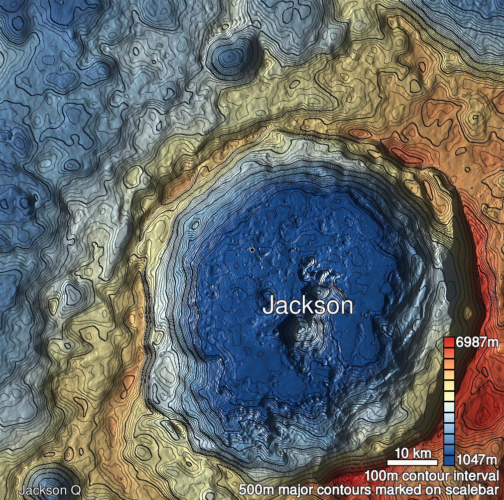
Pits Atlas: Jackson 1b
| Impact Melt pit: Jackson | |
|---|---|
| Name | Jackson 1b |
| Lat. | 22.4191 |
| Long. | 196.2828 |
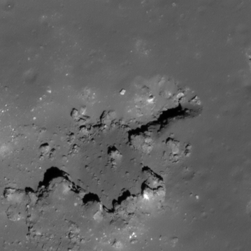
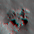
| Desc. | Western of the Jackson 1 pits. Very pronounced funnel. East end opens into a larger depression, ~100m wide, the south side of which is a ~100m long broken boulder (or hill with caprock layer) (it looks like the boulder was impact breccia, and half of it disintegrated and fell into the depression). NW corner may be a smooth slope to the floor. Probable overhang to the east- the (flat) floor is casting a visible shadow in a slewed image looking down-Sun to the east (M105593167L). Funnel is steeper than 39 degrees. |
| Types | |
| Terrain | Impact Melt |
| Host Feature | Jackson |
| Funnel Min. Diam. | 49 |
| Funnel Max. Diam. | 51 |
| Inner Min. Diam. | 26 |
| Inner Max. Diam. | 30 |
| Azimuth | 60 |
| Depth | 20.0 |
| Depth 1 | 17.5 |
| Depth 2 | 20.2 |
| Depth 3 | 20.9 |
| Best Stereo Left | M105593167L |
| Best Stereo Right | M105593167L |
| DTMs | |
| Clipping Width | 200 |
| Other IMGs | M1122318040R |
| Data Warning | Depth 3 is from top of funnel. |
| Entrance Ramp | Y? |
| Overhang | Y? |
| Nearby Pits? | Y |
| Nearby Fractures? | N |
| Nearby Depressions? | Y |
| In Dome | N |
| Beside Dome | Y |
| In Depression | N |
| Colinear Pits | Y |
| Colinear Depressions | N |
| Colinear Fractures | N |
| Jackson 1b Shaded Relief | |
|---|---|
 |
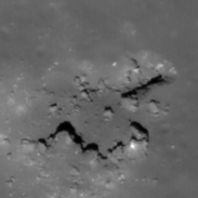
| M125645661L | |
|---|---|
 |
|
| Line | 39338 |
| Sample | 4734 |
| Inc. Angle | 24.5 |
| Emission Angle | -0.39 |
| Time | 11.12 |
| Resolution | 0.53 |
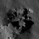
| M1178843656L | |
|---|---|
 |
|
| Inc. Angle | -21.59 |
| Emission Angle | 0.41 |
| Time | 12.21 |
| Resolution | 1.35 |
| M1097558297L | |
|---|---|
 |
|
| Inc. Angle | -59.46 |
| Emission Angle | 2.4 |
| Time | 15.73 |
| Resolution | 1.44 |
| Jackson 1b Stereo |
|---|
 |