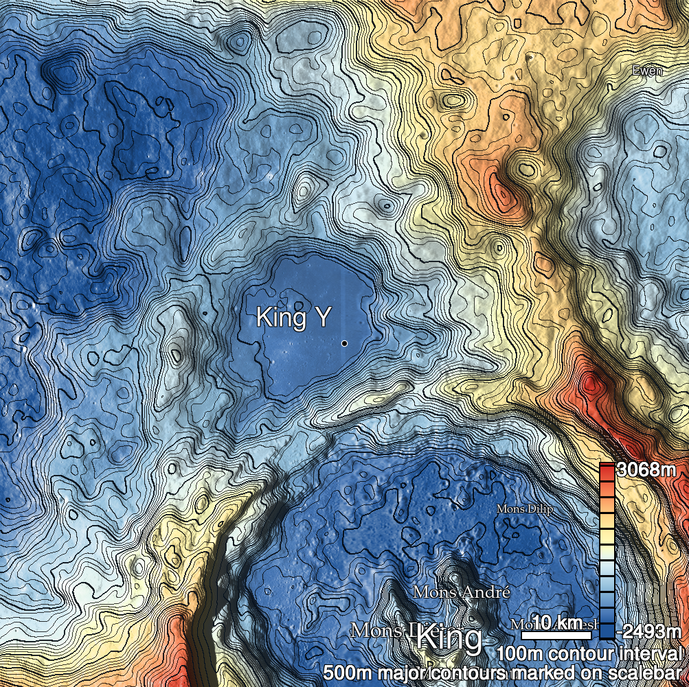
Pits Atlas: King 2a
| Impact Melt pit: King | |
|---|---|
| Name | King 2a |
| Lat. | 6.3808 |
| Long. | 119.9992 |
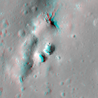
| Desc. | Round/square pit, northern of a pair of pits in the S end of a PRF that look like (but are not) a second natural bridge. N and E walls are a slope from rim to floor, other walls are nearly vertical. Floor looks rough. King 2b is 10m SW, and there are larger collapses in the PRF ~20m to the W and N. There is a set of fractures running N from the N end of the PRF, in line with King 2. King 37 is ~200m E. |
| Types | |
| Terrain | Impact Melt |
| Host Feature | King |
| Funnel Min. Diam. | 17 |
| Funnel Max. Diam. | 24 |
| Inner Min. Diam. | 12 |
| Inner Max. Diam. | 12 |
| Azimuth | 35 |
| Depth | 7.0 |
| Depth 1 | 5.9 |
| Depth 2 | 9.6 |
| Depth 3 | 5.6 |
| Best Stereo Left | M128509025L |
| Best Stereo Right | M128509025L |
| DTMs | NAC_DTM_KINGCRATER2 |
| Clipping Width | 200 |
| Other IMGs | |
| Data Warning | |
| Entrance Ramp | Y |
| Overhang | N? |
| Nearby Pits? | Y |
| Nearby Fractures? | Y |
| Nearby Depressions? | Y |
| In Dome | Y |
| Beside Dome | N |
| In Depression | N |
| Colinear Pits | N |
| Colinear Depressions | N |
| Colinear Fractures | N |
| King 2a Shaded Relief | |
|---|---|
 |
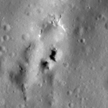
| M182745931R | |
|---|---|
 |
|
| Line | 22998 |
| Sample | 2658 |
| Inc. Angle | -48.5 |
| Emission Angle | -1.29 |
| Time | 15.22 |
| Resolution | 1.27 |
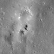
| M1131053889R | |
|---|---|
 |
|
| Inc. Angle | -27.63 |
| Emission Angle | -0.16 |
| Time | 13.77 |
| Resolution | 1.17 |
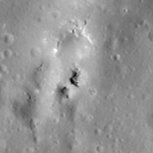
| M106088433R | |
|---|---|
 |
|
| Inc. Angle | -35.36 |
| Emission Angle | -2.24 |
| Time | 14.31 |
| Resolution | 1.29 |
| King 2a Stereo |
|---|
 |