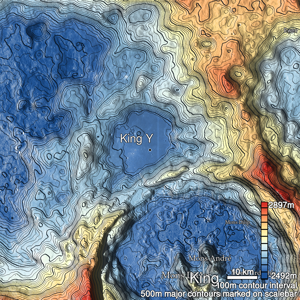
Pits Atlas: King 23
| Impact Melt pit: King | |
|---|---|
| Name | King 23 |
| Lat. | 6.3794 |
| Long. | 119.9019 |
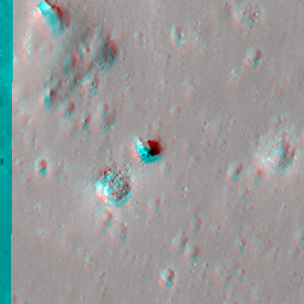
| Desc. | Diamond-shaped pit in a fairly flat area. Floor is fairly flat with a couple boulders. Slewed images suggest overhangs of a couple meters. ~50m to the NW is a pair of shallow 60m wide depressions joined by a ~5m wide linear collapse, which is roughly in line with this pit; Starting ~160m E and winding N is a sinuous series of <5m probable pits joined by subtle depressions; ~150m N is a ~5x60m collapse that ends at the foot of a PRF. |
| Types | |
| Terrain | Impact Melt |
| Host Feature | King |
| Funnel Min. Diam. | 11 |
| Funnel Max. Diam. | 18 |
| Inner Min. Diam. | 9 |
| Inner Max. Diam. | 15 |
| Azimuth | 120 |
| Depth | 8.0 |
| Depth 1 | 8.7 |
| Depth 2 | 7.5 |
| Depth 3 | 8.0 |
| Best Stereo Left | M128509025R |
| Best Stereo Right | M128509025R |
| DTMs | NAC_DTM_KINGCRATER3 |
| Clipping Width | 200 |
| Other IMGs | |
| Data Warning | |
| Entrance Ramp | N |
| Overhang | Y? |
| Nearby Pits? | Y |
| Nearby Fractures? | Y |
| Nearby Depressions? | Y |
| In Dome | N |
| Beside Dome | N |
| In Depression | N |
| Colinear Pits | N |
| Colinear Depressions | Y |
| Colinear Fractures | Y |
| King 23 Shaded Relief | |
|---|---|
 |
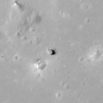
| M1135766659L | |
|---|---|
 |
|
| Line | 26900 |
| Sample | 3021 |
| Inc. Angle | 28.81 |
| Emission Angle | -1.46 |
| Time | 10.13 |
| Resolution | 1.18 |
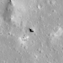
| M1131053889L | |
|---|---|
 |
|
| Inc. Angle | -27.53 |
| Emission Angle | 1.4 |
| Time | 13.76 |
| Resolution | 1.17 |
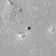
| M1181692437R | |
|---|---|
 |
|
| Inc. Angle | 32.25 |
| Emission Angle | 0.17 |
| Time | 9.88 |
| Resolution | 1.23 |
| King 23 Stereo |
|---|
 |