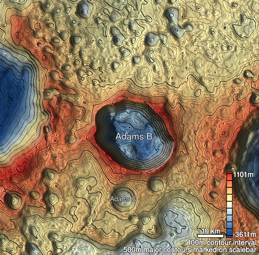
Pits Atlas: Adams B 1
| Impact Melt pit: Adams B | |
|---|---|
| Name | Adams B 1 |
| Lat. | -31.4121 |
| Long. | 65.6408 |
| Desc. | Elongated pit/cliff on a subtle rise. South wall is a slope, north wall is a vertical wall. Depth 1 is from highest-sun image, shadow is always cast on south slope |
| Types | |
| Terrain | Impact Melt |
| Host Feature | Adams B |
| Funnel Min. Diam. | 10 |
| Funnel Max. Diam. | 19 |
| Inner Min. Diam. | N/A |
| Inner Max. Diam. | 10 |
| Azimuth | 110 |
| Depth | 9.0 |
| Depth 1 | 10.1 |
| Depth 2 | 8.5 |
| Depth 3 | 9.3 |
| Best Stereo Left | M1166758989L |
| Best Stereo Right | M1166758989L |
| DTMs | |
| Clipping Width | 200 |
| Other IMGs | |
| Data Warning | Multiple stereo triplets and temporal pairs, very little lighting variation |
| Entrance Ramp | Y |
| Overhang | ? |
| Nearby Pits? | N |
| Nearby Fractures? | N |
| Nearby Depressions? | N |
| In Dome | Y |
| Beside Dome | N |
| In Depression | N |
| Colinear Pits | N |
| Colinear Depressions | N |
| Colinear Fractures | N |
| Adams B 1 Shaded Relief | |
|---|---|
 |
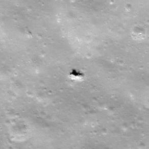
| M1149067652R | |
|---|---|
 |
|
| Line | 31979 |
| Sample | 721 |
| Inc. Angle | 33.57 |
| Emission Angle | 0.13 |
| Time | 11.4 |
| Resolution | 0.68 |
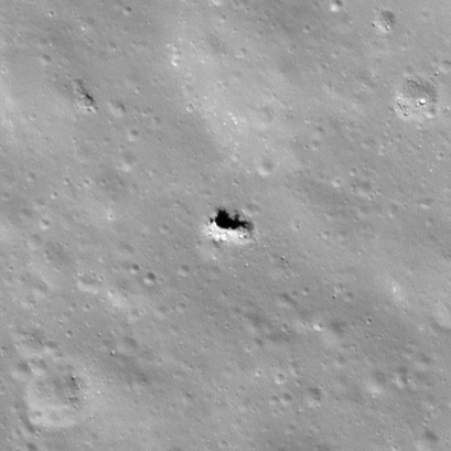
| M126499815R | |
|---|---|
 |
|
| Inc. Angle | 39.5 |
| Emission Angle | 2.0 |
| Time | 10.46 |
| Resolution | 0.43 |
| M187806127R | |
|---|---|
 |
|
| Inc. Angle | 34.99 |
| Emission Angle | 1.8 |
| Time | 11.13 |
| Resolution | 0.69 |
| Adams B 1 Stereo |
|---|
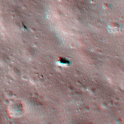 |