Pits Atlas: Stevinus 19
| Impact Melt pit: Stevinus | |
|---|---|
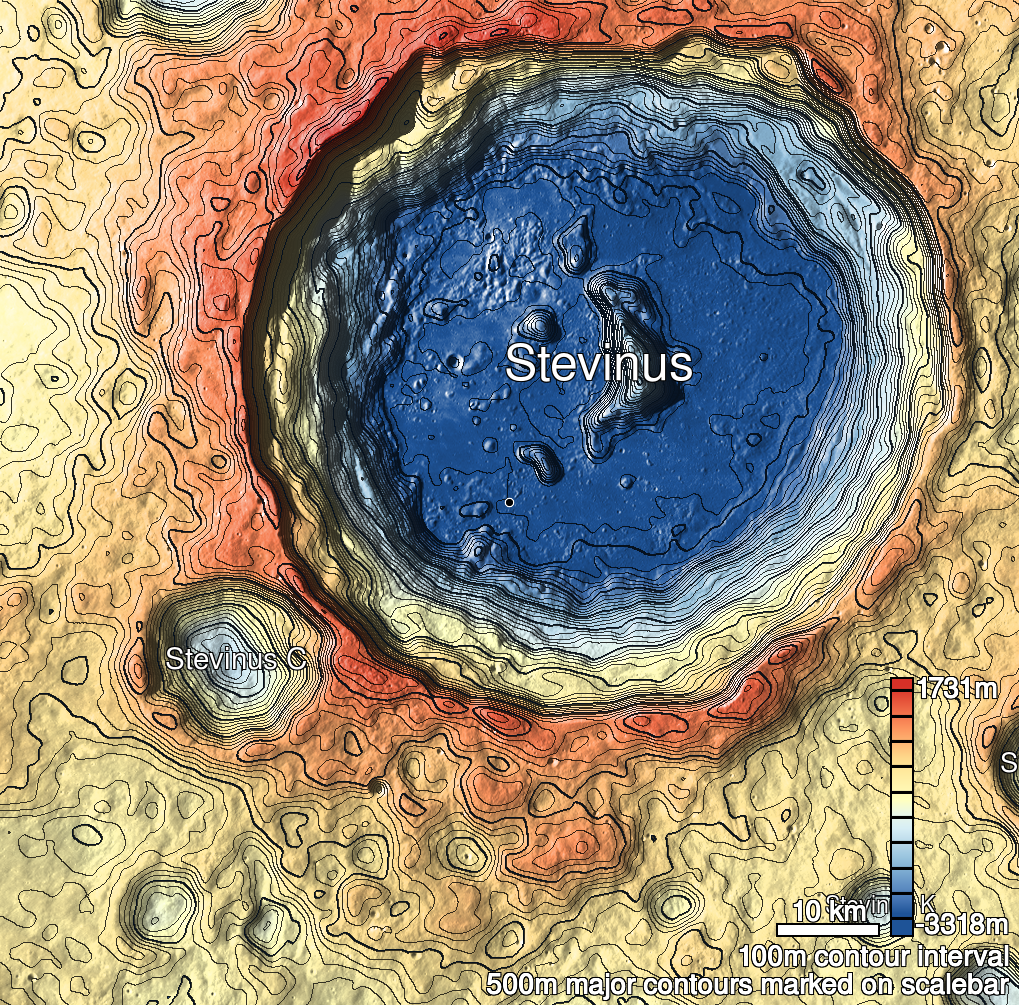
| Name | Stevinus 19 |
| Lat. | -32.9337 |
| Long. | 53.7983 |
| Desc. | Linear pit, running WNW-ESE, with a wider section near the W end. No floor visible. There's a chain of ~30m wide bowl-shaped collapses running ESE from a point ~175m S of this pit. No other collapses in the area, but there are PRFs ~30m SE and ~120m E. |
| Types | |
| Terrain | Impact Melt |
| Host Feature | Stevinus |
| Funnel Min. Diam. | 14 |
| Funnel Max. Diam. | 25 |
| Inner Min. Diam. | 6 |
| Inner Max. Diam. | 16 |
| Azimuth | 120 |
| Depth | >13.0 |
| Depth 1 | >10.0 |
| Depth 2 | >6.0 |
| Depth 3 | >12.0 |
| Best Stereo Left | |
| Best Stereo Right | |
| DTMs | |
| Clipping Width | 200 |
| Other IMGs | M1157415551L |
| Data Warning | Depth 3 is from top of funnel, and runs the full length of the pit. |
| Entrance Ramp | N |
| Overhang | ? |
| Nearby Pits? | N |
| Nearby Fractures? | N |
| Nearby Depressions? | Y |
| In Dome | N |
| Beside Dome | N |
| In Depression | N |
| Colinear Pits | N |
| Colinear Depressions | N |
| Colinear Fractures | N |
| Stevinus 19 Shaded Relief | |
|---|---|
 |
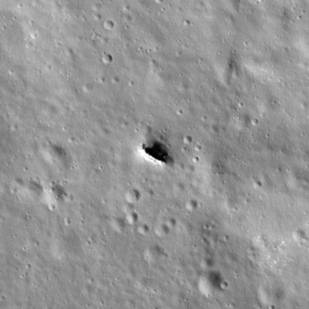
| M185525835R | |
|---|---|
 |
|
| Line | 12086 |
| Sample | 2731 |
| Inc. Angle | -36.79 |
| Emission Angle | -1.29 |
| Time | 12.91 |
| Resolution | 0.64 |
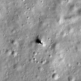
| M144274383R | |
|---|---|
 |
|
| Inc. Angle | 51.89 |
| Emission Angle | 0.25 |
| Time | 9.09 |
| Resolution | 0.58 |
| M1113807800L | |
|---|---|
 |
|
| Inc. Angle | -54.58 |
| Emission Angle | 1.43 |
| Time | 15.0 |
| Resolution | 0.6 |