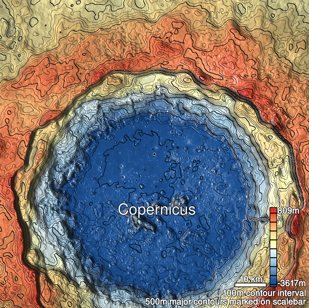
Pits Atlas: Copernicus 14
| Impact Melt pit: Copernicus | |
|---|---|
| Name | Copernicus 14 |
| Lat. | 10.2215 |
| Long. | 339.9041 |
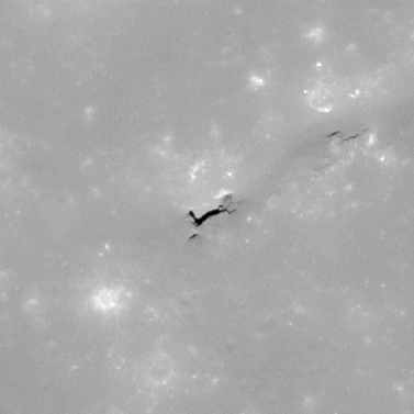
| Desc. | Linear pit at the SW end of a linear depression. Floor may slope down from NE to SW. Tiny pit-like dark spot (~1-2m) 3m S. There is a deeper section of the depression with vertical sidewalls ~50m NE. No other features of note nearby. ~400m N of Copernicus 23. |
| Types | |
| Terrain | Impact Melt |
| Host Feature | Copernicus |
| Funnel Min. Diam. | 40 |
| Funnel Max. Diam. | NA |
| Inner Min. Diam. | 7 |
| Inner Max. Diam. | 20 |
| Azimuth | 60 |
| Depth | 17.0 |
| Depth 1 | 12.2 |
| Depth 2 | 15.9 |
| Depth 3 | 21.7 |
| Best Stereo Left | M1106059896L |
| Best Stereo Right | M1106059896L |
| DTMs | |
| Clipping Width | 200 |
| Other IMGs | |
| Data Warning | Depth3 is from W rim, largely outside the funnel, others are from S rim inside funnel. |
| Entrance Ramp | N |
| Overhang | Y? |
| Nearby Pits? | N |
| Nearby Fractures? | N |
| Nearby Depressions? | Y |
| In Dome | N |
| Beside Dome | N |
| In Depression | Y |
| Colinear Pits | N |
| Colinear Depressions | N |
| Colinear Fractures | N |
| Copernicus 14 Shaded Relief | |
|---|---|
 |
| M109365462R | |
|---|---|
 |
|
| Line | 3710 |
| Sample | 4398 |
| Inc. Angle | 12.07 |
| Emission Angle | 2.27 |
| Time | 11.81 |
| Resolution | 0.52 |
| M1103695396R | |
|---|---|
 |
|
| Inc. Angle | 17.44 |
| Emission Angle | 0.43 |
| Time | 11.12 |
| Resolution | 1.21 |
| M1177898186L | |
|---|---|
 |
|
| Inc. Angle | -16.15 |
| Emission Angle | 1.76 |
| Time | 12.9 |
| Resolution | 1.18 |
| Copernicus 14 Stereo |
|---|
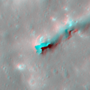 |