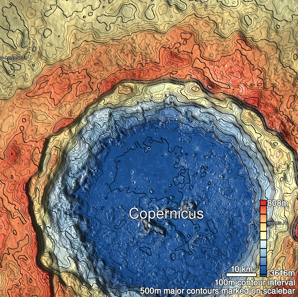
Pits Atlas: Copernicus 20
| Impact Melt pit: Copernicus | |
|---|---|
| Name | Copernicus 20 |
| Lat. | 10.3522 |
| Long. | 339.7351 |
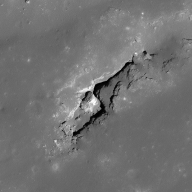
| Desc. | Long pit at the SW end of a linear depression/collapse that runs parallel to the base of a PRF. Consists of two parts: A rectangular section in the SW (~40x25m), and a narrow crevice running from the N corner NE along the N edge of the linear depression (~53x7m). There is a large (~18m) block at the NE end of the floor of the rectangular section that appears to have broken off of the SE wall intact. There is a shallower linear depression running parallel ~75m NW. |
| Types | |
| Terrain | Impact Melt |
| Host Feature | Copernicus |
| Funnel Min. Diam. | 48 |
| Funnel Max. Diam. | NA |
| Inner Min. Diam. | 31 |
| Inner Max. Diam. | 95 |
| Azimuth | 50 |
| Depth | 14.0 |
| Depth 1 | 14.9 |
| Depth 2 | 13.2 |
| Depth 3 | 13.0 |
| Best Stereo Left | M1106059896R |
| Best Stereo Right | M1106059896R |
| DTMs | |
| Clipping Width | 200 |
| Other IMGs | |
| Data Warning | See description for dimension details. Depths are to rectangular section near large block; narrow crevice may be deeper. |
| Entrance Ramp | N |
| Overhang | ? |
| Nearby Pits? | N |
| Nearby Fractures? | N |
| Nearby Depressions? | Y |
| In Dome | N |
| Beside Dome | Y |
| In Depression | Y |
| Colinear Pits | N |
| Colinear Depressions | N |
| Colinear Fractures | N |
| Copernicus 20 Shaded Relief | |
|---|---|
 |
| M173049982L | |
|---|---|
 |
|
| Line | 51051 |
| Sample | 4523 |
| Inc. Angle | 20.86 |
| Emission Angle | -0.57 |
| Time | 10.84 |
| Resolution | 0.47 |
| M1136683665R | |
|---|---|
 |
|
| Inc. Angle | 40.09 |
| Emission Angle | 1.44 |
| Time | 9.41 |
| Resolution | 1.15 |
| M1190842495L | |
|---|---|
 |
|
| Inc. Angle | -42.32 |
| Emission Angle | 0.94 |
| Time | 14.72 |
| Resolution | 0.96 |
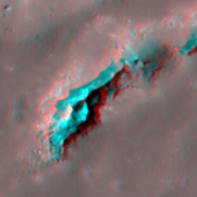
| Copernicus 20 Stereo |
|---|
 |