How do lunar scientists understand the surface of the Moon from afar? One way is by creating a morphologic map, which separates an area into units based on the landforms, or morphology, of the surface. Because different rocks respond differently to the conditions on the Moon, these morphologic units might indicate different rock types!
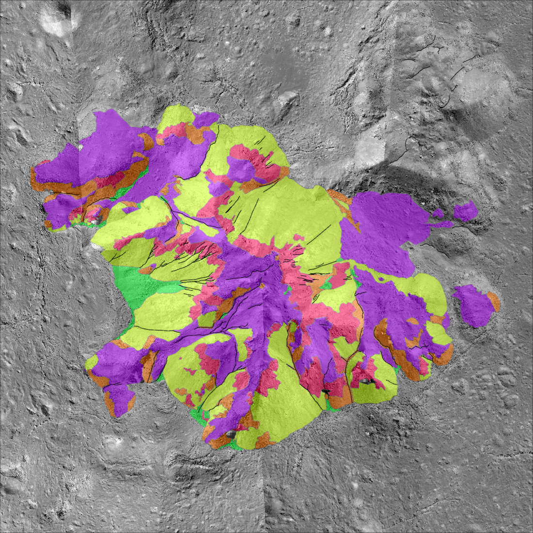
Scientists at LROC recently analyzed the central peak of Tycho crater using this technique. Tycho crater is a prominent crater on the nearside of the Moon, and is home to an impressive central peak. Central peaks are mountains that form during a large impact due to rebound of the surface, and are made of rock brought up from deep within the Moon’s interior. Mapping central peaks like the one in Tycho crater may provide a glimpse below the lunar surface!
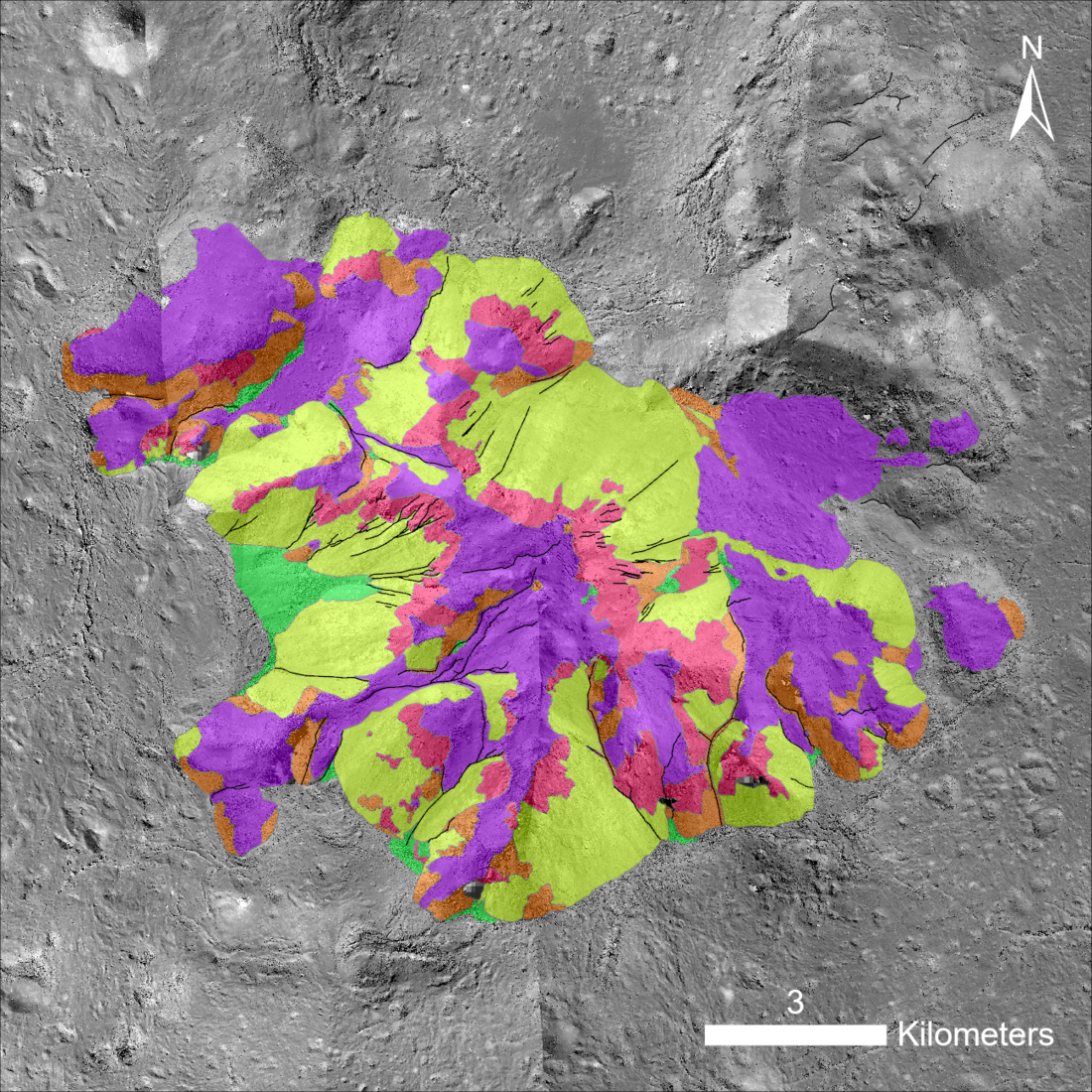
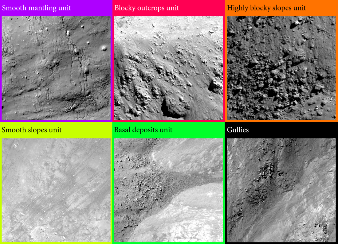
Morphologic units are identified through variations in surface roughness and reflectance properties, as well as for unique landforms such as hills or impact melt rock. A digital terrain model, or DTM (or for large features, a mosaic of several DTMs) highlights morphology and slopes. At the Tycho central peak, we categorized the rocks into five main units: smooth impact melt rock (purple), large rock outcrops (pink), blocky (orange) and fine-grained (yellow) regolith on the peak’s flanks, and a fan unit composed of loose material deposited at the bases of slopes (green).
Preliminary analysis suggests that these morphologic differences are due to the underlying slope rather than rock type, but many questions still remain about Tycho crater and its central peak. Watch the video below to learn more about this crater and how we made the digital terrain model of its central peak. Can you find the above units in the video? {NASA/ASU/Arizona State University].
See more:
Published by Victoria Roseborough on 3 May 2025