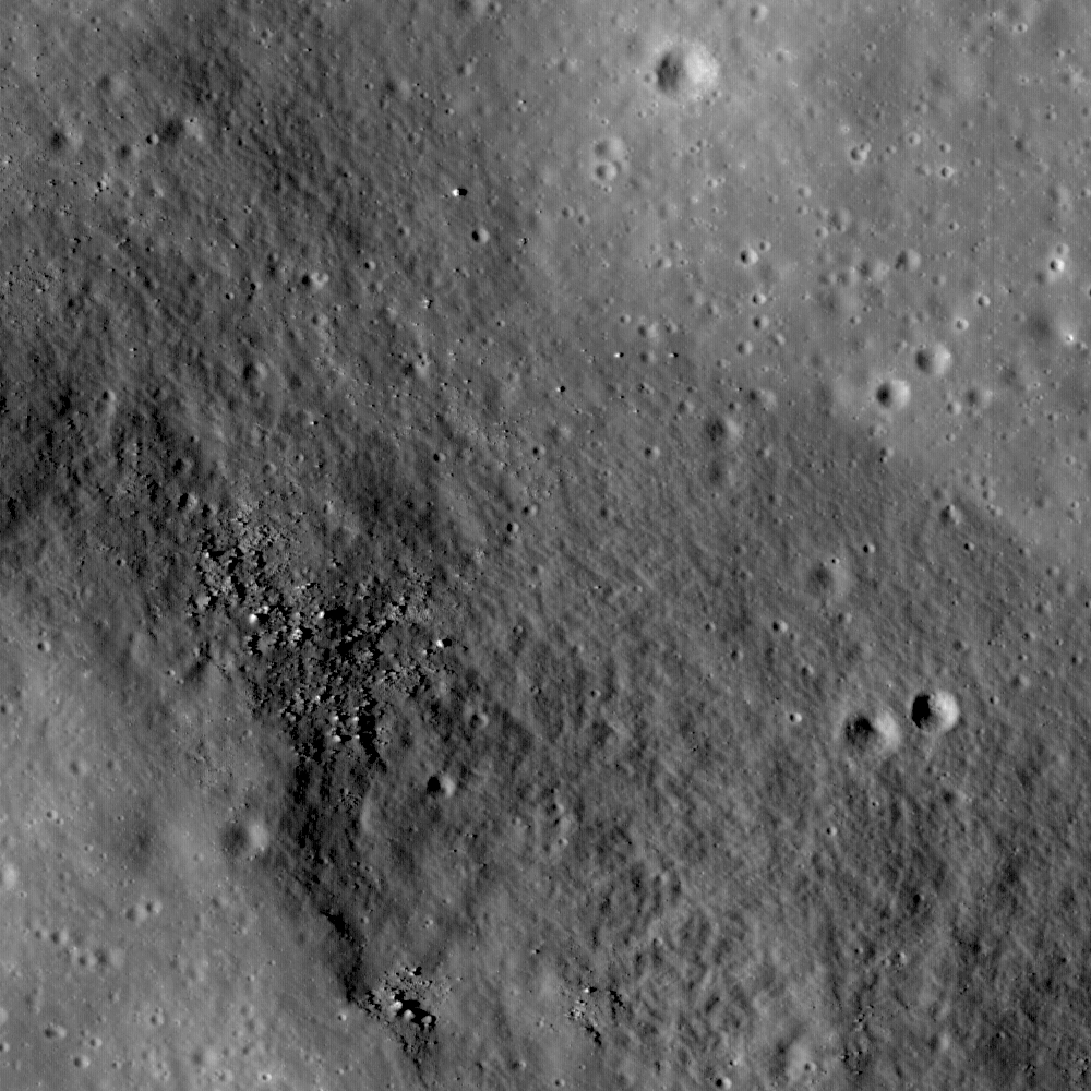
Rima Ariadaeus (6.5 ° N, 12.4 ° E) is one of several linear rille systems nestled in the highlands between Mare Vaporum and Mare Tranquillitatis. Some rilles, such as Vallis Schroteri, were formed by volcanic eruptions. Other rilles, such as Rima Ariadaeus, are believed to be faults that formed as a result of tectonic activity. Some scientists believe that the linear rilles might have formed after large impact events, while others believe that the rilles were formed as a surface manifestation of deep-seated dike systems when the Moon was still volcanically active. LROC NAC images are providing scientists with data to examine the relationships of the surface features until future human lunar explorers can complete field research. However, experts agree that Rima Ariadaeus, which extends for approximately 300 km, is a fault system exhibiting a well-developed graben typical of normal fault systems on Earth. A large portion of Rima Ariadaeus is visible in this subset of an uncalibrated LROC WAC frame (below), and the LROC NAC image (above) shows part of the rille fault scarp. A mare surface is visible in the SW corner of the image and a defined contact between the rille wall and the rille floor is visible in the NE corner of the image. Rima Ariadaeus is 5 km wide and disrupts the pre-existing geologic features, which can be observed in the WAC frame. The stratigraphic relationships between the rille and other surface features can help determine whether the rille is older or younger than these features with respect to relative age. For example, the rille cross-cuts a ridge in the middle-left of the WAC frame (near the arrow in the WAC image below); this relationship suggests that the rille is younger than the ridge, because the rille changed the shape of the ridge. However, in the LROC NAC image, there are small craters present on the rille floor, which suggests that the rille is older than these superposing craters. These types of observations are used to examine stratigraphic relationships and the relative ages of landforms in this region so that scientists can reconstruct the Moon's geologic history. Can you find other stratigraphic relations in the WAC frame?
Uncalibrated LROC NAC data; north is up; image width is 1.2 km. Browse the whole NAC image!
Published by Lillian Ostrach on 28 September 2009
