Featured Images
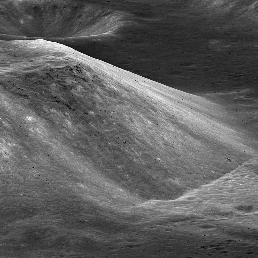
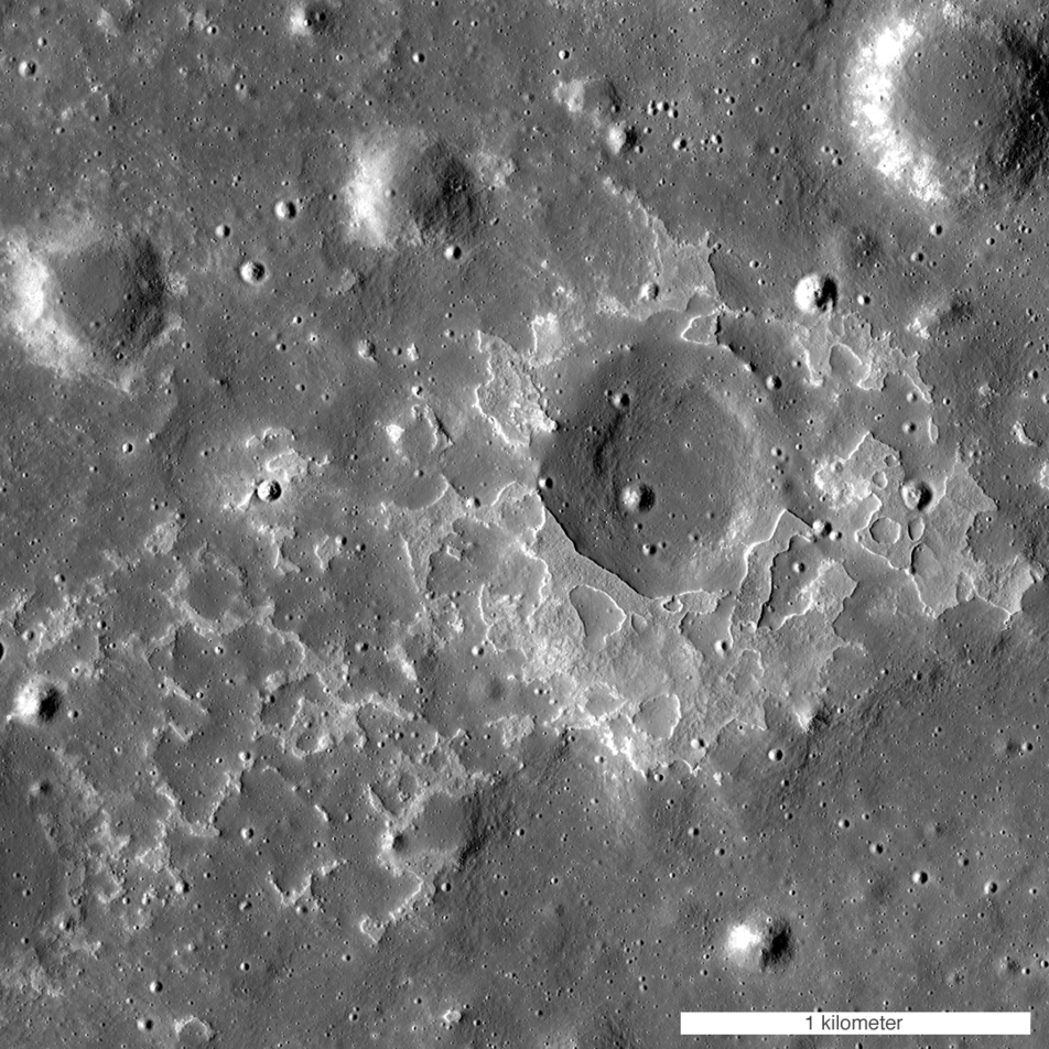
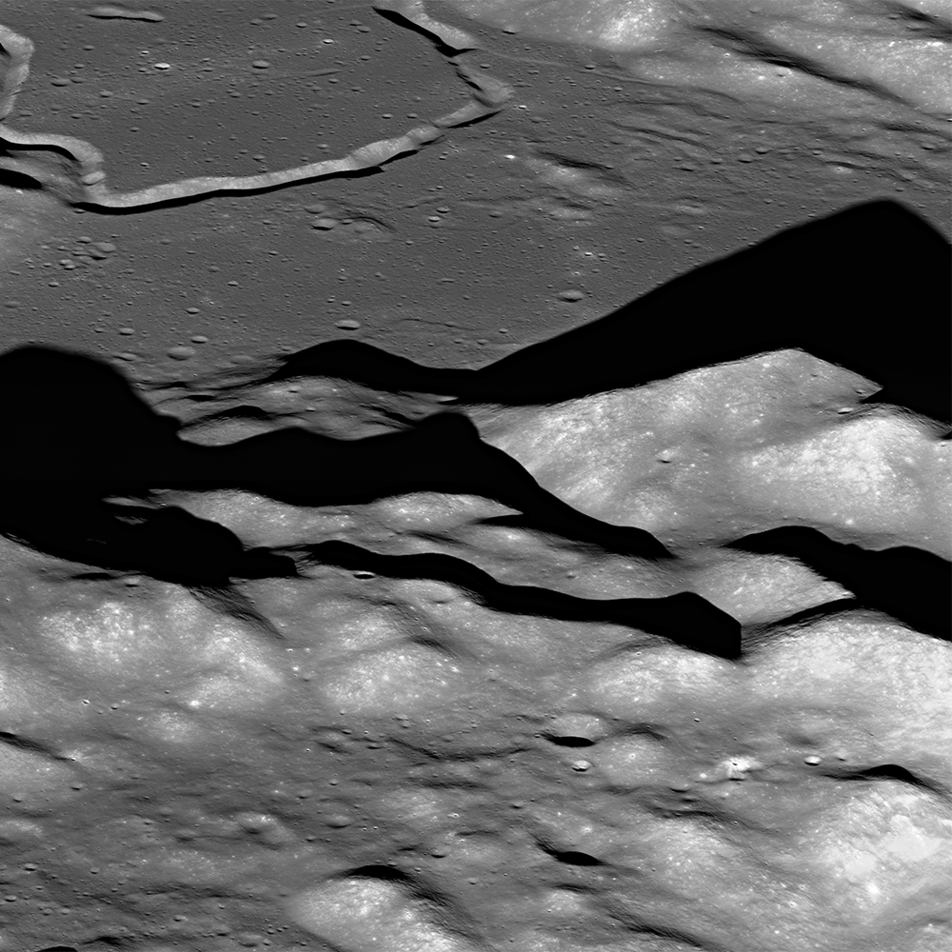
South Massif Landslide
By lunar standards South Massif is a relatively modest mountain, but with a rich history (geologic and exploration). The massif is about 7000 meters across at the base and 2300 meters tall; M1266925685LR, incidence angle 33°, slew angle...
Published on 09 Jun 2018
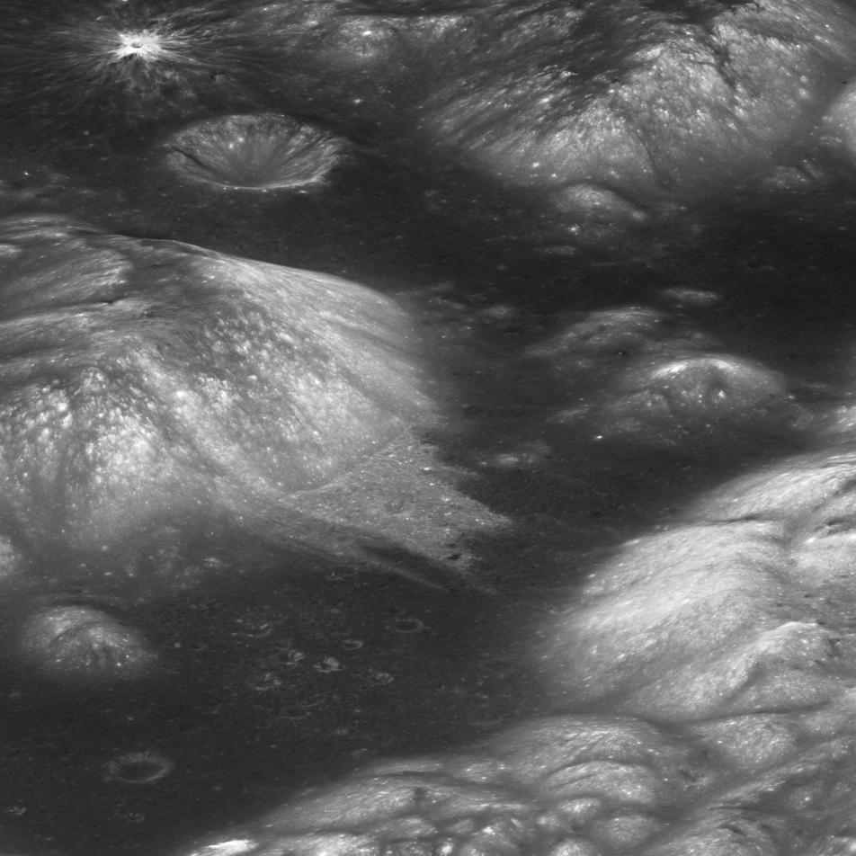
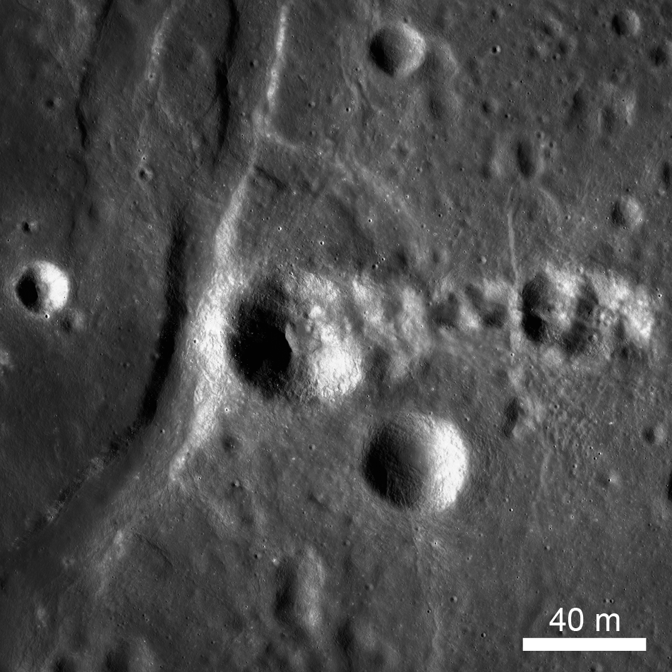
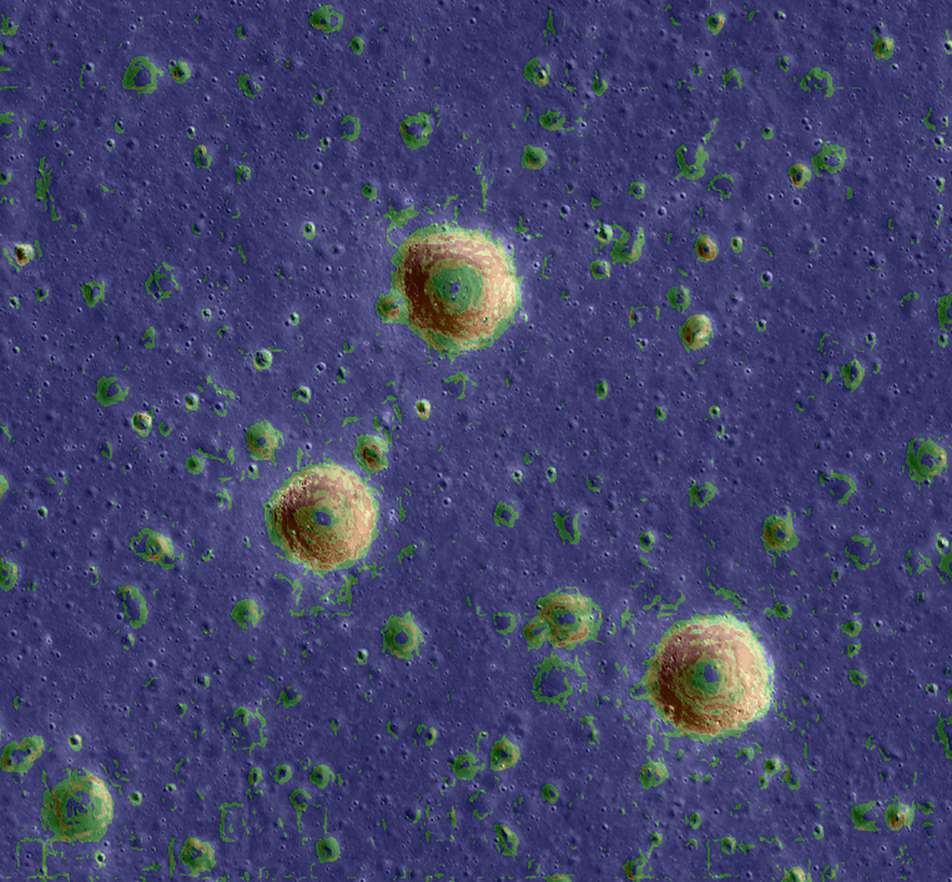
Curiously Fast Degradation of Small Lunar Craters
Taurus-Littrow valley, geologic exploration target for Apollo 17 and the Lunar Reconnaissance Orbiter Camera study team led by Dr. Prasun Mahanti. Center latitude 20.15°N, center longitude 30.98°E, image 18 km wide, image...
Published on 24 Apr 2018
Lunar Light Plains: The Movie
The Orientale Basin, about 950 kilometers wide, is the striking multi-ringed impact feature at lower right. New research suggests that the impact event that formed Orientale may have emplaced light plains deposits - visible here...
Published on 20 Apr 2018
Montes Carpatus
The Montes Carpatus region (16.67°N, 332.93°E) contains numerous examples of volcanic materials. The low albedo (dark) patterns may indicate pyroclastic (explosive) material that erupted over 3 billion years ago. Tobias Mayer G crater...
Published on 08 Mar 2018
Ilmenite Seen with Ultraviolet Light
The low-reflectance portions of the Moon are composed of mare basalts, which formed via large eruptions of lava in the ancient lunar past. Variations in reflectance within the mare depend on composition, in particular, the abundance of...
Published on 01 Dec 2017
High Resolution Maps of the Moon
A section of Narrow Angle Camera (NAC) Region of Interest (ROI) mosaic of Catena Littrow (22.23°N, 29.61°E) represents one of 12 new Reduced Data Records (RDRs) recently released as part of Volume 31 of the LROC Planetary Data System...
Published on 31 Oct 2017
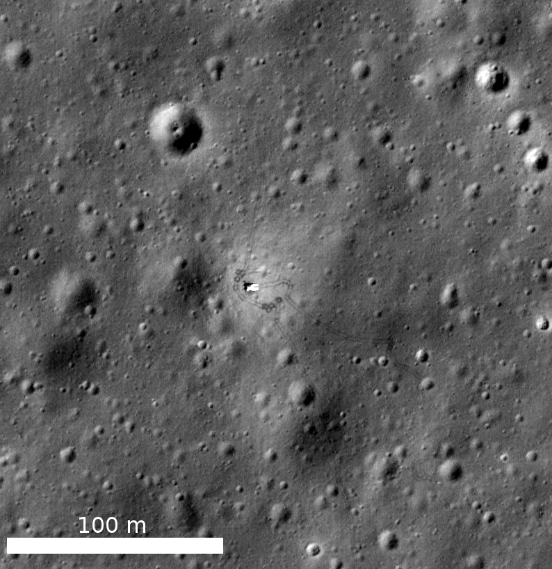
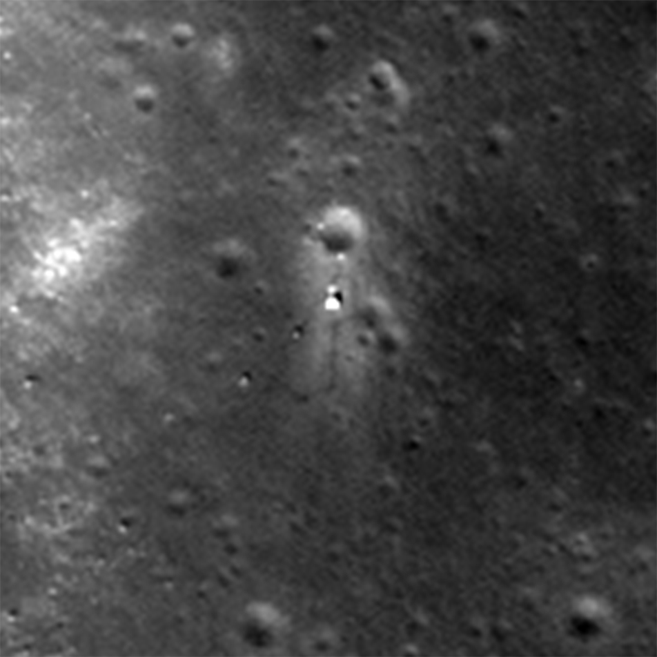
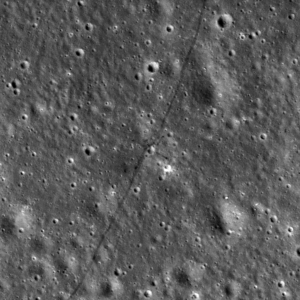
Spacecraft Related Coordinates - 2016 Update
Luna 17, the intrepid lander that carried the Lunokhod 1 rover to the surface. You can make out the rover's tracks around the lander, the tight circles were formed as the Earth-bound drivers tested out the maneuverability of their just...
Published on 25 Nov 2016
What's Next for LRO?
LRO and LROC will continue to explore the Moon during the mission's third extended mission to understand fundamental processes that shape our Solar System.
Published on 22 Aug 2016
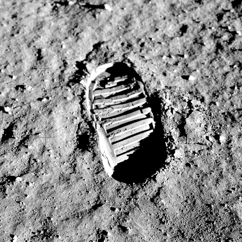
Regolith Porosity from Orbit
Apollo 11 photograph of boot-print in the lunar regolith (cropped version of AS11-40-5878).
Published on 08 Jun 2016
What a Blast! – Revisiting the Chang'e 3 Landing Site
View of the Chang'e-3 landing site from the LROC NAC. The region around the lander was brightened from the interaction of rocket exhaust with the regolith. Scene is approximately 240 m across, located at 44.121°N, 340.488°E. NAC image...
Published on 13 May 2016
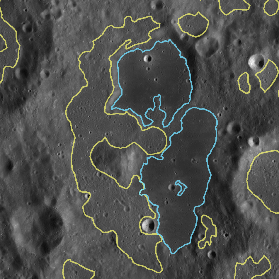
Making an Impact
Light plains (outlined in yellow) are smooth, gently rolling deposits located in the lunar highlands. Their resemblance to mare ponds (outlined in blue) originally led to the idea that they were volcanic in origin. Image width is...
Published on 06 May 2016
New Evidence For Young Lunar Volcanism!
One of many newly-discovered young volcanic deposits on the Moon (4.330°N, 33.750°E), this example is near the crater Maskelyne. The direction of sunlight is from the right and north is up, NAC M1123370138R [NASA/GSFC/Arizona State...
Published on 12 Oct 2014
The Chang'e 3 Landing Site in 3D
Slope map overlain on an LROC NAC image of the Chang'e 3 landing site at 44.12°N, 340.49°E in Mare Imbrium. The Chinese spacecraft landed just to the east of the large crater near the center. Slopes range from zero (blue) to...
Published on 07 Oct 2014
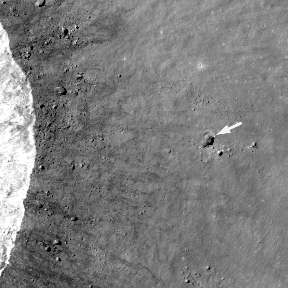
Small Step or Giant Leap?
A house-sized boulder (more than 30 m in diameter) left a clear impression (arrow) in the lunar surface. This boulder was thrown a relatively short distance (500 m) to the east of a young 1.6-km crater (rim crest to the left); LROC NAC...
Published on 21 Jul 2014
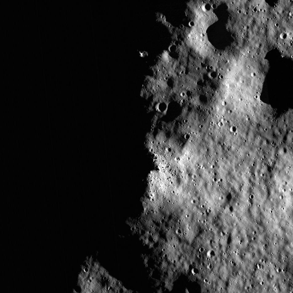
Five Years Later: Revisiting an Old Friend
A portion of LROC's first image (M101013931), acquired five years ago today. This region of the rim of Shackleton crater near the lunar South Pole is illuminated over 70% of the time, while the floor of the crater is permanently...
Published on 03 Jul 2014
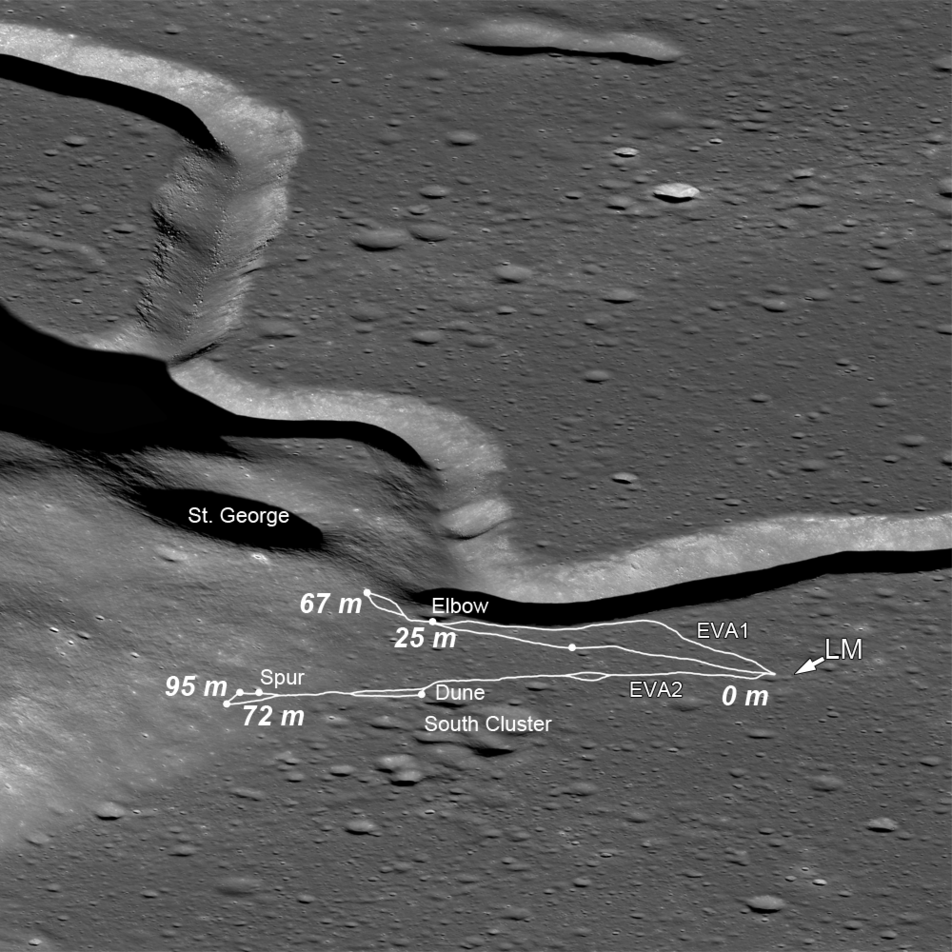
The Original Interplanetary Mountaineers
Traverse plots of the first two Apollo 15 EVAs, on which astronauts Scott and Irwin ventured to the lower slopes of Mons Hadley Delta (center left); numbers indicate elevations above the landing site (LM) (oblique LROC NAC M1123519889;...
Published on 20 Jun 2014
Soaring Over Mighty Mt. Hadley
An oblique view, looking east-to-west over the Apennine Mountains towards Hadley Rille (upper left) (LROC NAC M1123519889, north is to the right). A long shadow is cast by mighty Mt. Hadley (center right). Nestled between the Apennines...
Published on 18 Jun 2014
Trundling Across the Moon
Tracks made by Lunokhod 2 as it tested for variations in local magnetic properties while traversing around a small crater (25.764°N, 30.474°E), M122007650R, image width 470 m [NASA/ GSFC/ Arizona State University].
Published on 23 May 2014
Elongated Crater
Full resolution LROC NAC M155084711R showing the northeastern wall and floor of Arago E crater. The floor is peppered with rocks that tumbled down the crater wall. In this image North is up, image width is ~0.5 miles (800 m)...
Published on 01 May 2014
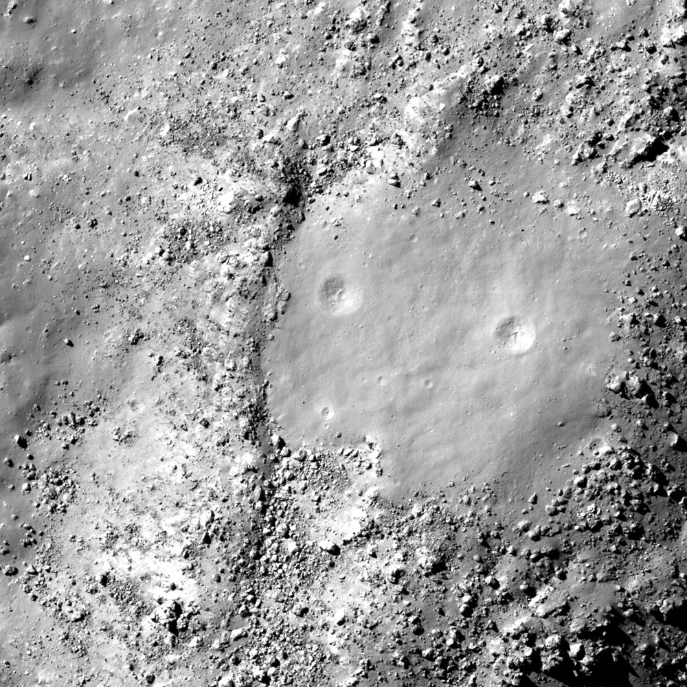
Small Clearing
LROC NAC M1144856403R of a mound littered with boulders located within the floor of Tycho crater. The small clearing, which lacks boulders, is most likely squeezed up impact melt. Image width is ~2400 ft (730 m) and North points up...
Published on 03 Apr 2014