Featured Images
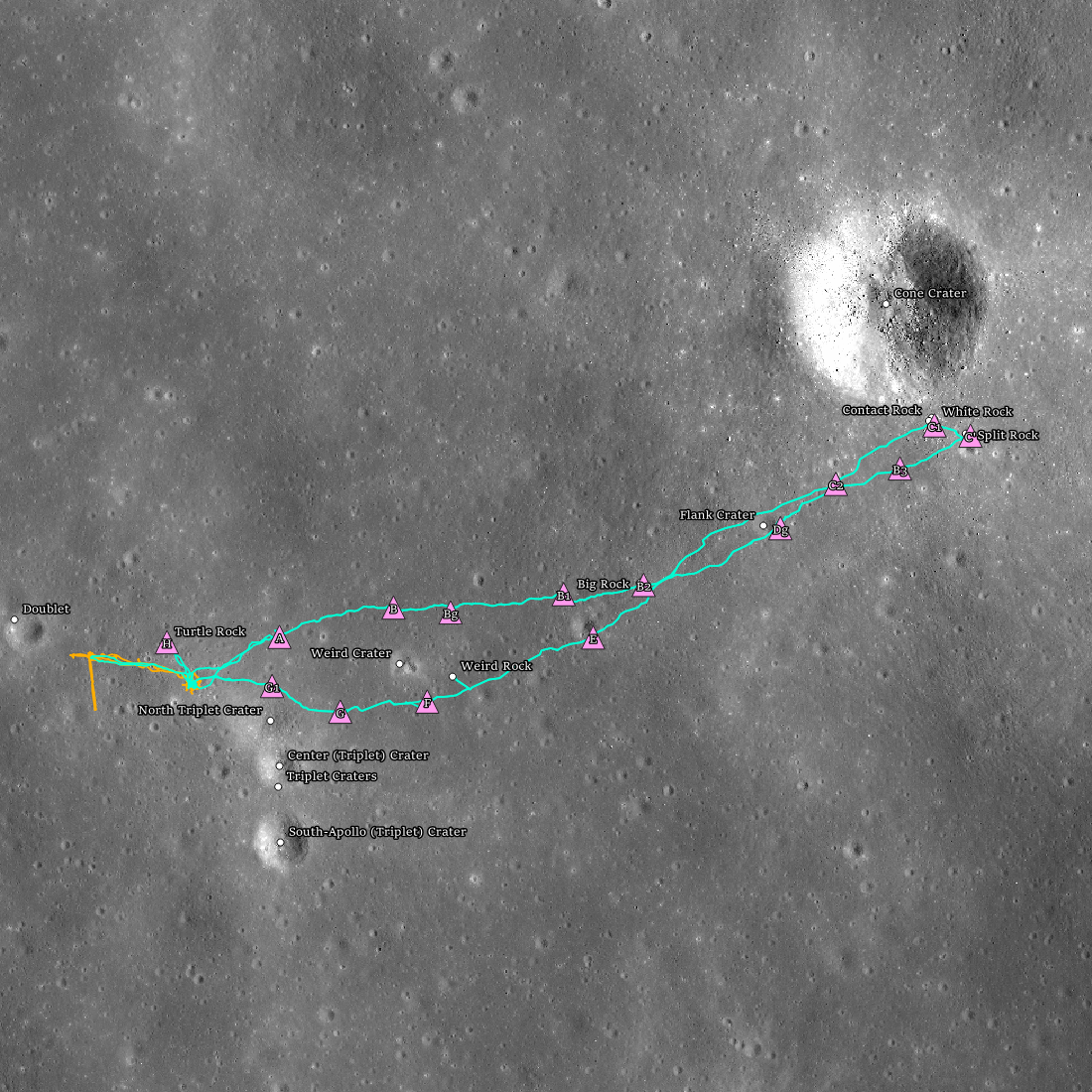
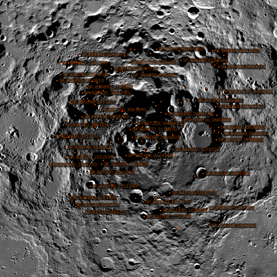
Apollo 14 Fiftieth Anniversary!
Apollo 14 landing site (4.646°S, 342.528°E) showing the two extra-vehicular activities (EVAs; orange = EVA1 and teal = EVA2) with stations (pink triangles), and geologic features (white dots).
Published on 05 Feb 2021
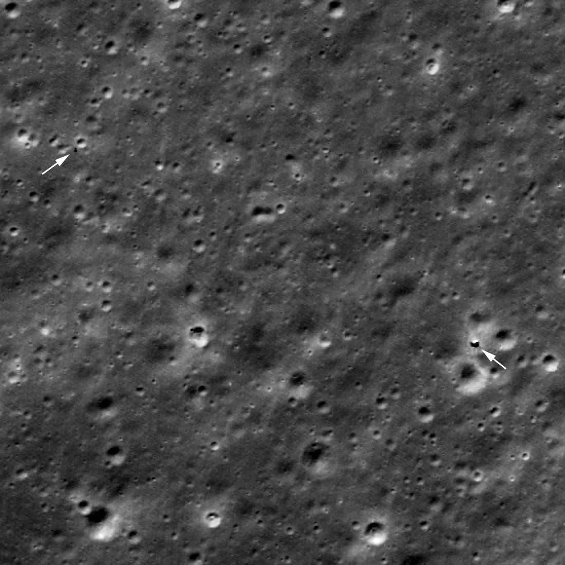
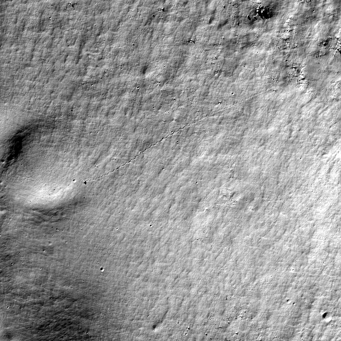
Keeps on Roving!
Arrows indicate Yutu-2 (left) and Chang'e 4 lander (right). Rover tracks are faintly visible between the lander and Yutu-2. LROC image acquired 18 October 2020, M1357657468LR, enlarged 2x [NASA/GSFC/Arizona State University].
Published on 01 Dec 2020
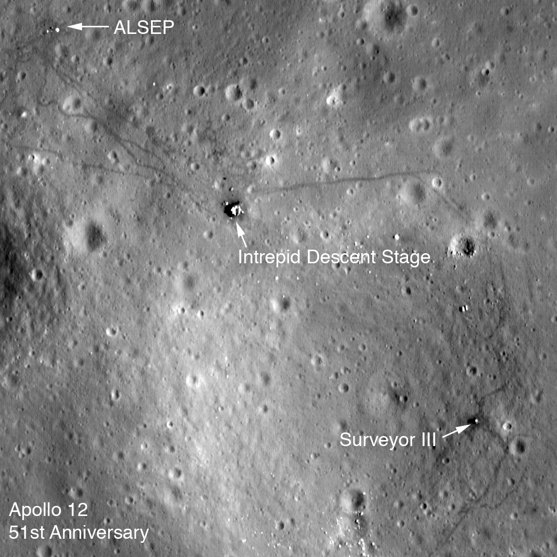
Apollo 12 Fifty-first Anniversary
LROC low-altitude image of the Apollo 12 landing site. The Lunar Module descent stage, Apollo Lunar Science Experiment Package (ALSEP), and Surveyor III spacecraft are all visible along with astronaut tracks. Image is 275 meters wide,...
Published on 13 Nov 2020
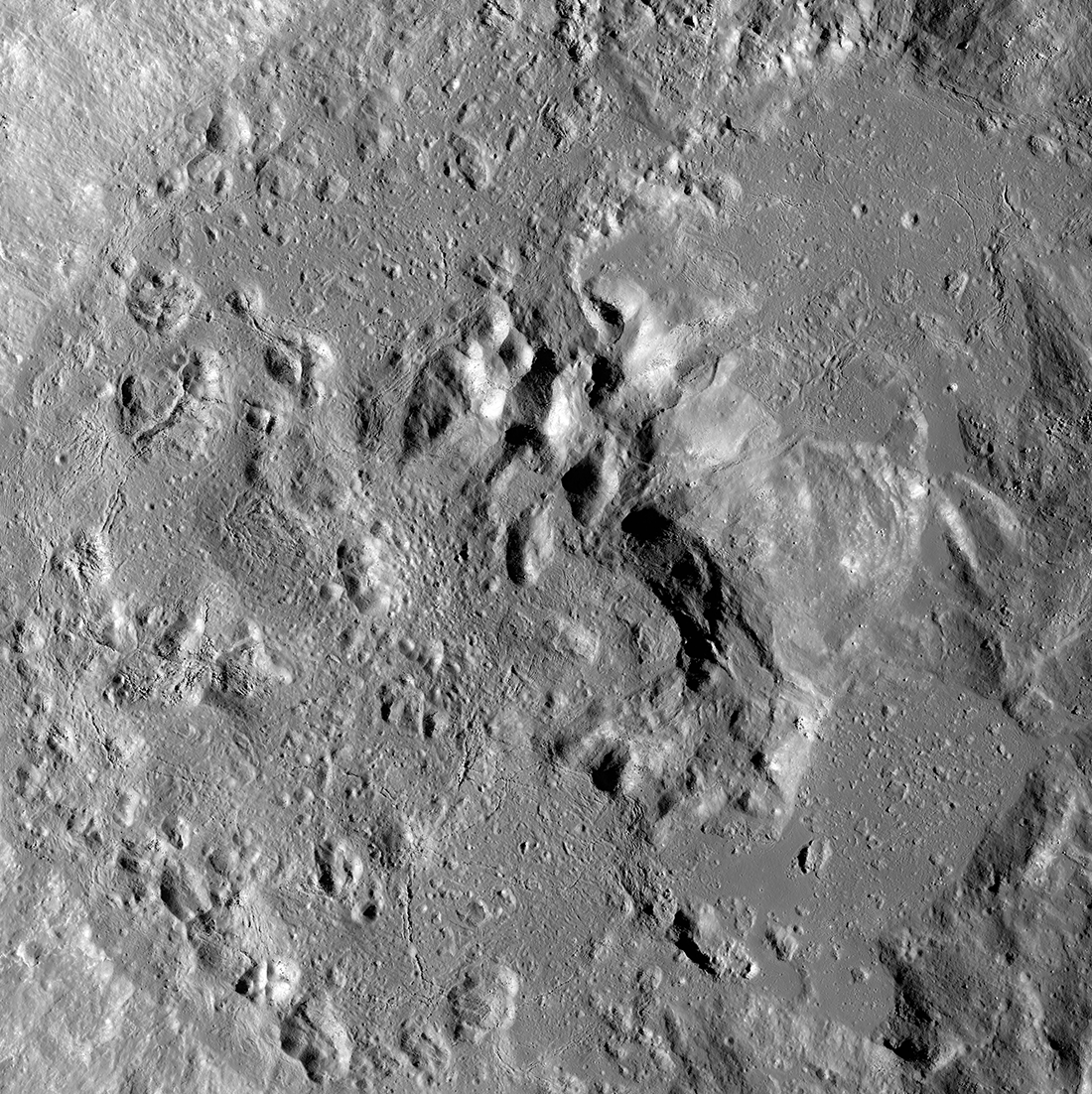
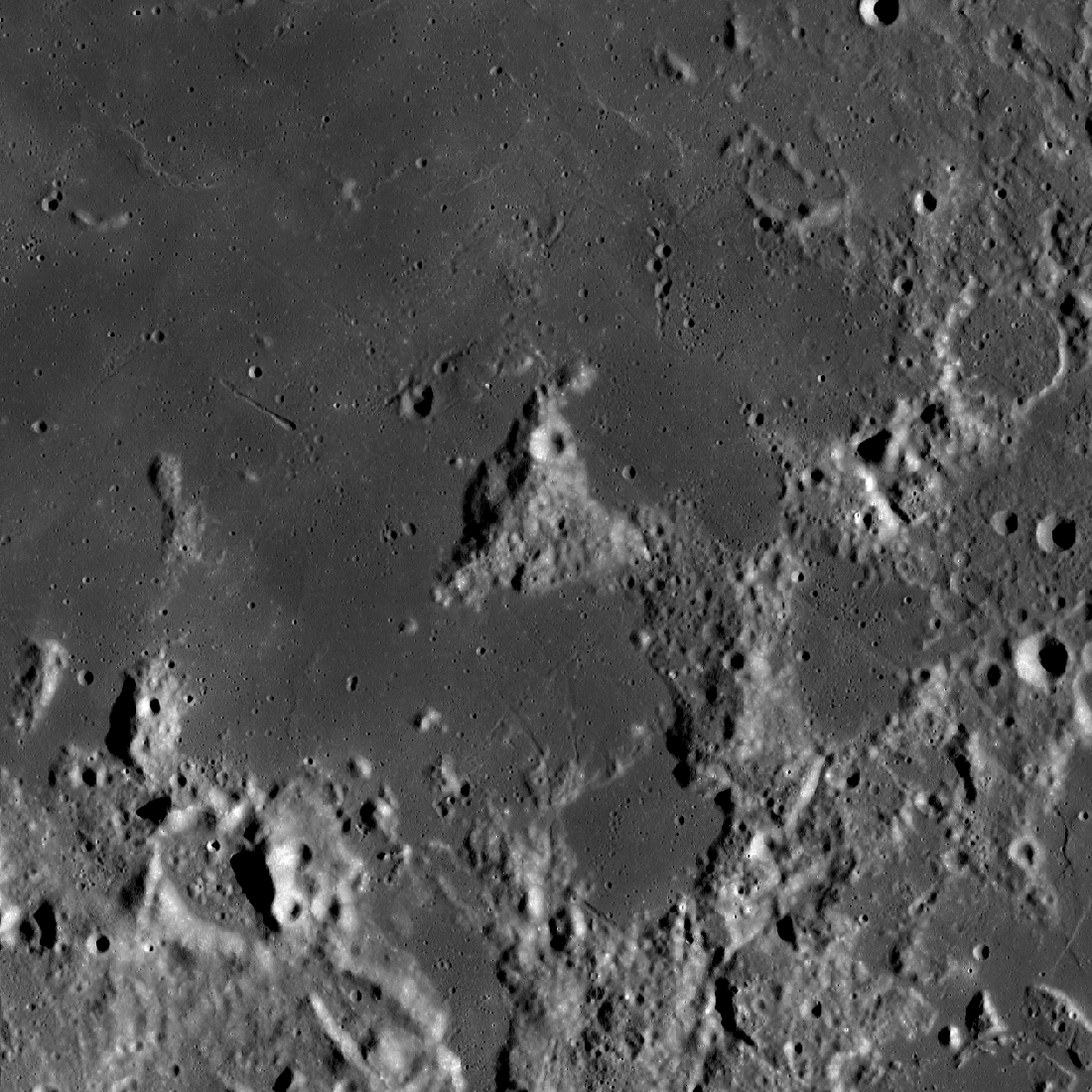
Farside Impact: Crookes Crater
During the formation of Crookes crater (48 km diameter, 10.39° S, 194.92° E), its central peak rebounded after the extreme compression from the high-speed impactor, and a small sea of impact melt eventually solidified on the crater...
Published on 27 Oct 2020
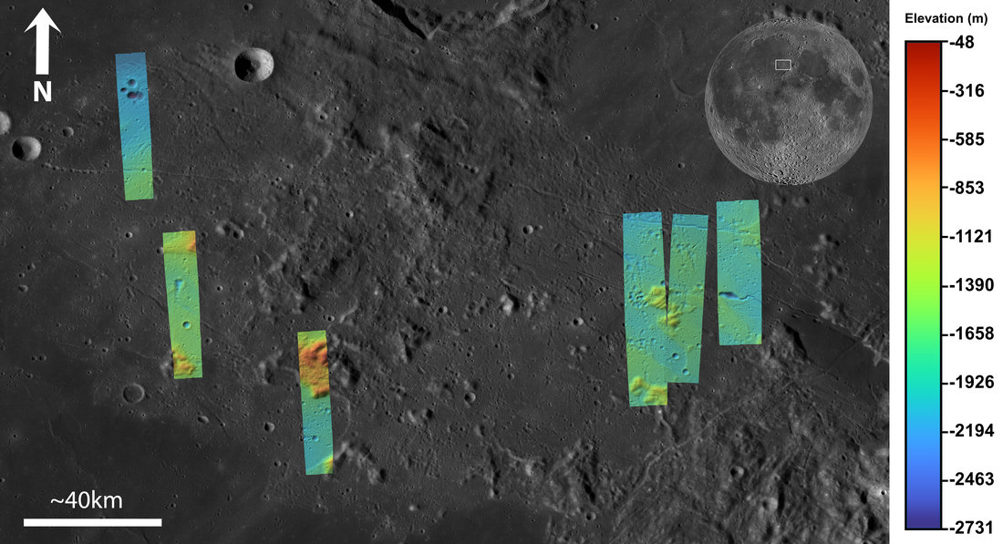
Apennine Bench Formation: A Window into Ancient Volcanism
LROC Wide Angle Camera (WAC) 100 m/px mosaic with 6 colorized Digital Terrain Models (DTMs) of the Apennine Bench Formation (centered near 26° N, 356° E - here in Quickmap), an enigmatic light plains unit located on the central lunar...
Published on 29 Jun 2020
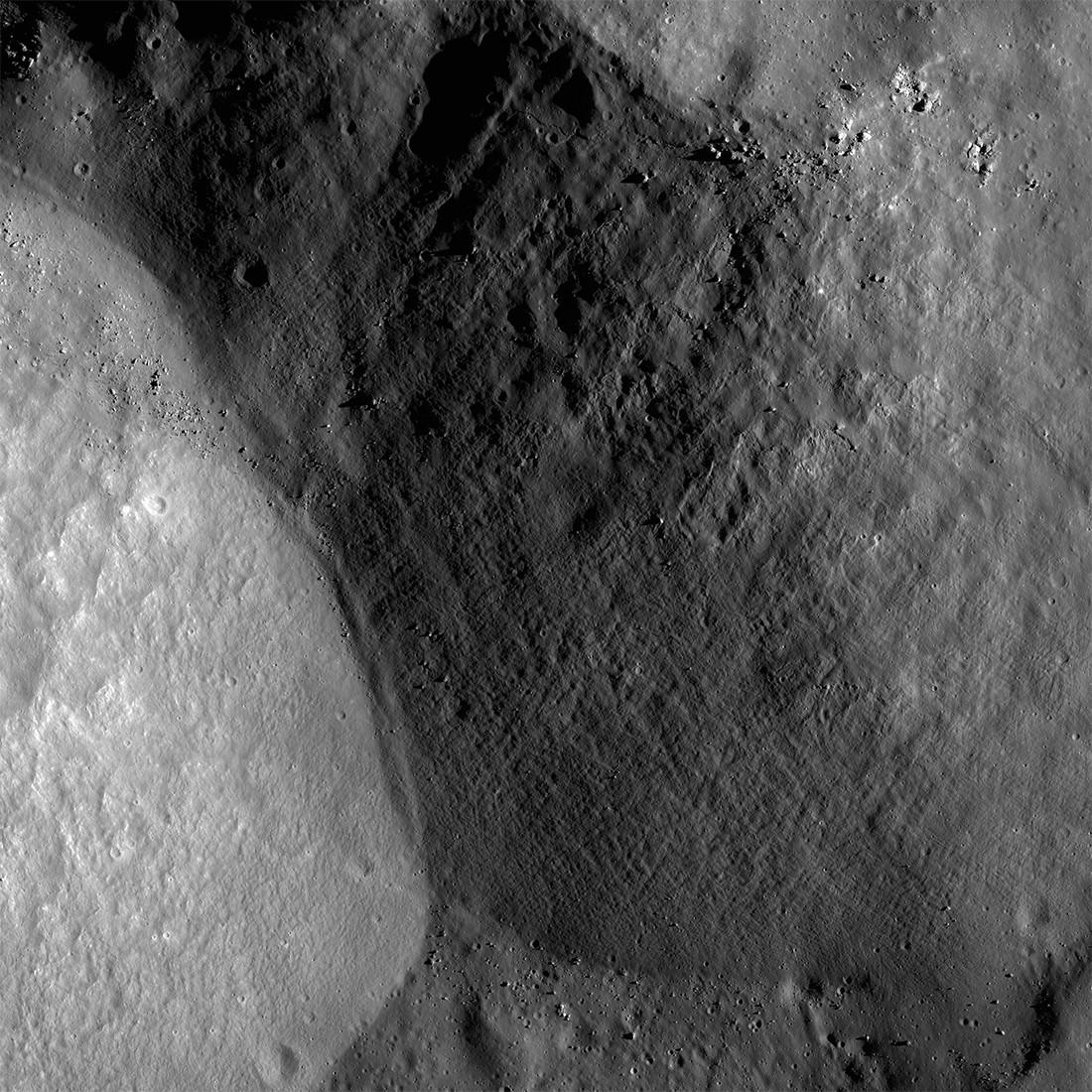
Plumbing the Depths by Scaling the Heights
The central mountainous peaks of Maunder crater are thought to be made of rock that was melted by the impact event that resulted in the Orientale basin. This impact melt rock deposit was then lifted up from below the surface during the...
Published on 19 Feb 2020
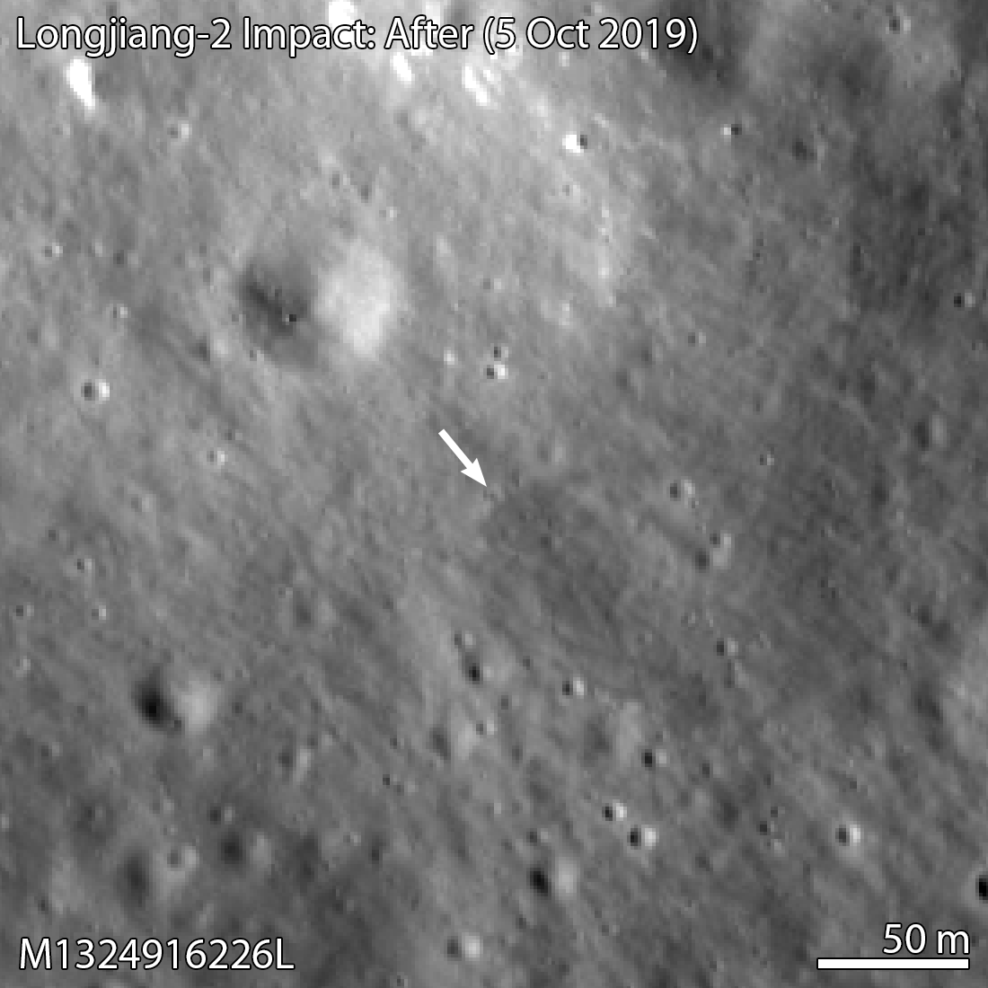
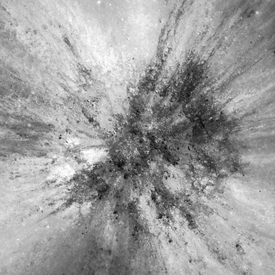
Longjiang-2 Impact Site Found!
The Longjiang-2 spacecraft (also known as DSLWP-B) crashed onto the lunar farside on 31 July 2019 after completing its orbital mission. This new crater was most likely the result of that impact. Image width 330 meters, north is up,...
Published on 14 Nov 2019
"Oceanus Procellarum Base Here - The Eagle Has Landed"
In 1969, NASA published a map showing candidate Apollo 11 and Apollo 12 landing sites. The map was based on photographs taken using large Earth-based telescopes. The map above, based on an LROC global image mosaic, is a near-copy of...
Published on 09 Aug 2019
Almost a Hole-in-One
A geologic story in Antoniadi crater on the Moon's far side. North is toward the top. Image width 1.54 kilometers, NAC M1311837924LR [NASA/GSFC/Arizona State University].
Published on 26 Jul 2019
What Armstrong Saw
Simulated view of what Armstrong saw as the Lunar Module Eagle approached the aim point on the northeast flank of West crater (190 meters diameter). The odd shape of the image area is due to the small windows in the Eagle. North is to...
Published on 16 Jul 2019
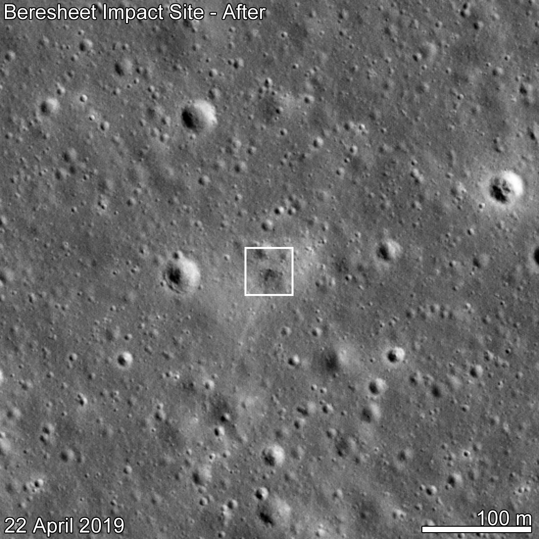
Beresheet Crash Site Spotted!
SpaceIL Beresheet crash site as seen by LROC eleven days after the attempted landing. Date in lower left indicates when the NAC image was acquired, M1310536929R [NASA/GSFC/Arizona State University].
Published on 15 May 2019
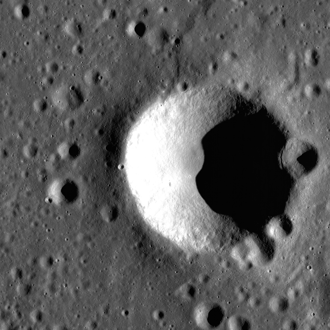
Order from Chaos — Blagg Crater
Blagg crater, named for the British astronomer who helped bring order to lunar naming chaos, is full of surprises. Taken during morning with the Sun shining from the right (east), the image above shows an area of the Moon just 9.5...
Published on 16 Apr 2019
Mount Marilyn: A Lunar Love Story
Mount Marilyn, with its distinctive triangular shape, served as an important navigation landmark for the Apollo 11 astronauts. Portion of LROC Wide Angle Camera mosaic, 138 km wide [NASA/GSFC/Arizona State University].
Published on 21 Dec 2018
Deflector Shields Up!
Part of the westernmost swirl feature in Mare Marginis. This closeup of the center of the anaglyph strip below highlights an area little more than five kilometers wide. Bright swirl areas appeared "painted on" the landscape. Part of NAC...
Published on 06 Sep 2018
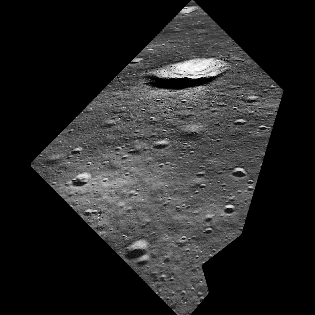
John Young at South Ray Crater
Overhead view of South Ray crater, the most prominent feature at the Apollo 16 Descartes landing site in the central lunar highlands. Astronaut John Young landed Lunar Module Orion north of the crater on 21 April 1972 (UTC)....
Published on 05 Jul 2018
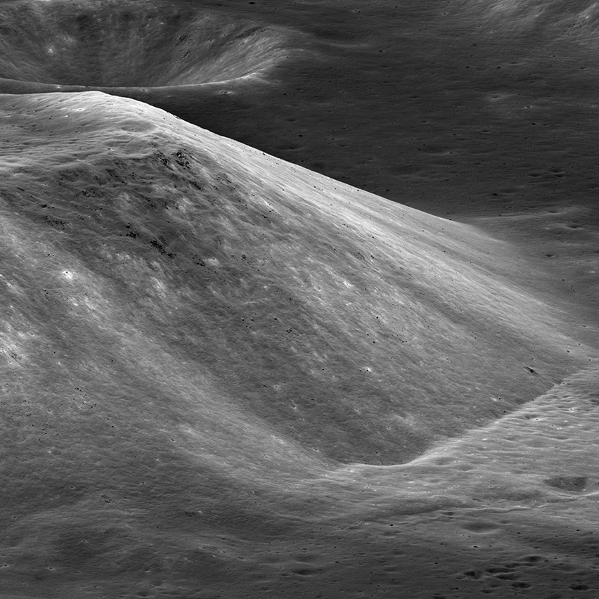
South Massif Landslide
By lunar standards South Massif is a relatively modest mountain, but with a rich history (geologic and exploration). The massif is about 7000 meters across at the base and 2300 meters tall; M1266925685LR, incidence angle 33°, slew angle...
Published on 09 Jun 2018
Lunar Light Plains: The Movie
The Orientale Basin, about 950 kilometers wide, is the striking multi-ringed impact feature at lower right. New research suggests that the impact event that formed Orientale may have emplaced light plains deposits - visible here...
Published on 20 Apr 2018
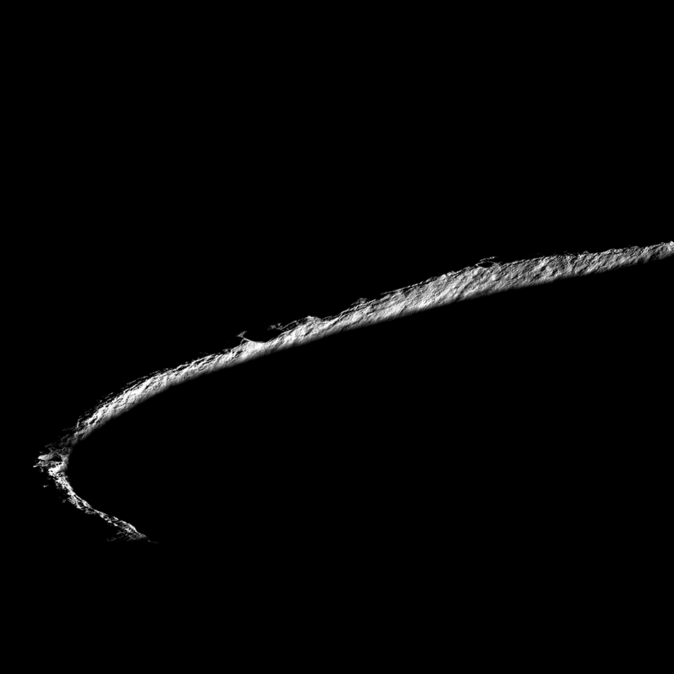
On the Rim!
Spectacular oblique view of the rim of Shackleton crater (21 km diameter, 89.66°S, 129.20°E). While no location on the Moon stays continuously illuminated, three points on the rim remain collectively sunlit for more than 90% of the...
Published on 01 Feb 2018
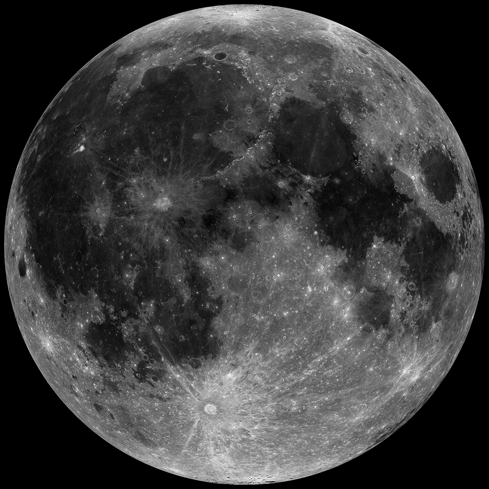
Eclipse!
Super Moon, Blue Moon, Eclipse! All in one month! Look for a spectacular full Moon eclipsed by the shadow of the Earth on the morning of 31 January. Nearside mosaic composed of hundreds images acquired over a 14 day period...
Published on 30 Jan 2018
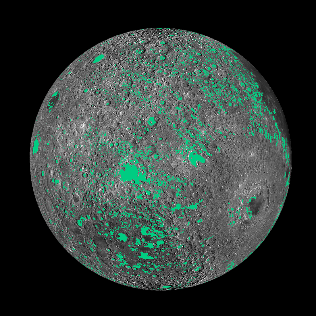
Casting Light on Permanently Shadowed Regions
The locations of south pole permanently shadowed regions (PSRs) with areas >10 km2. Images and information about each PSR can be found in the LROC PSR Atlas. [NASA/GSFC/Arizona State University]
Published on 27 Jan 2018