Featured Images
Mysteries Remain Frozen in our Celestial Backyard
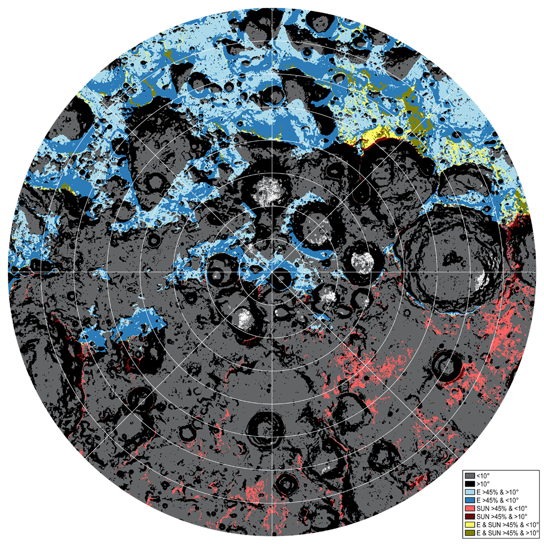
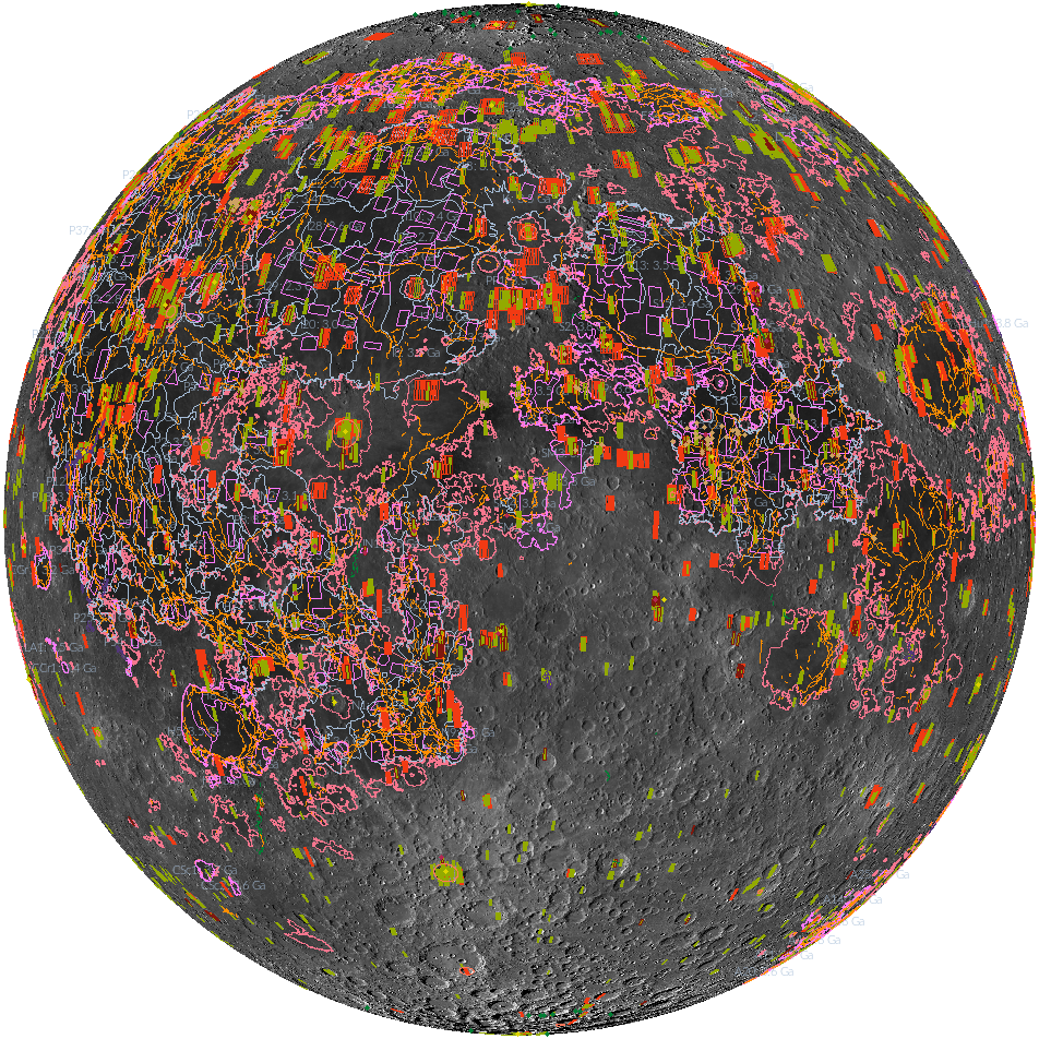
Traversability conditions and landing site assessment map for the lunar south polar region. The percentage of time that the surface will be illuminated and visible to the Earth is modeled for the expected Artemis timeframe (July 9, 2024...
Published on 13 Jun 2023
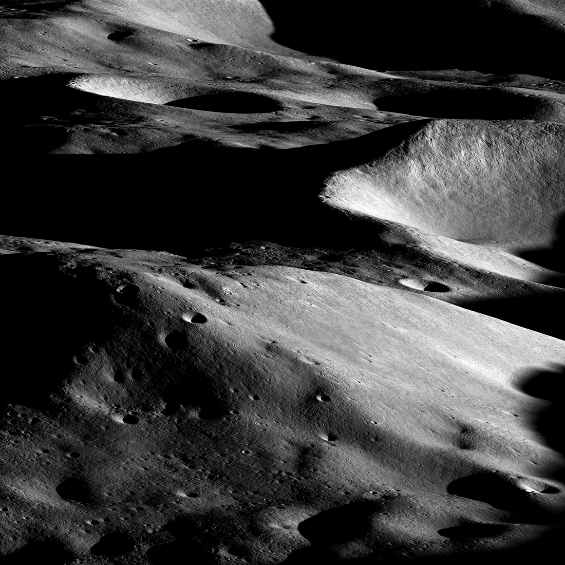
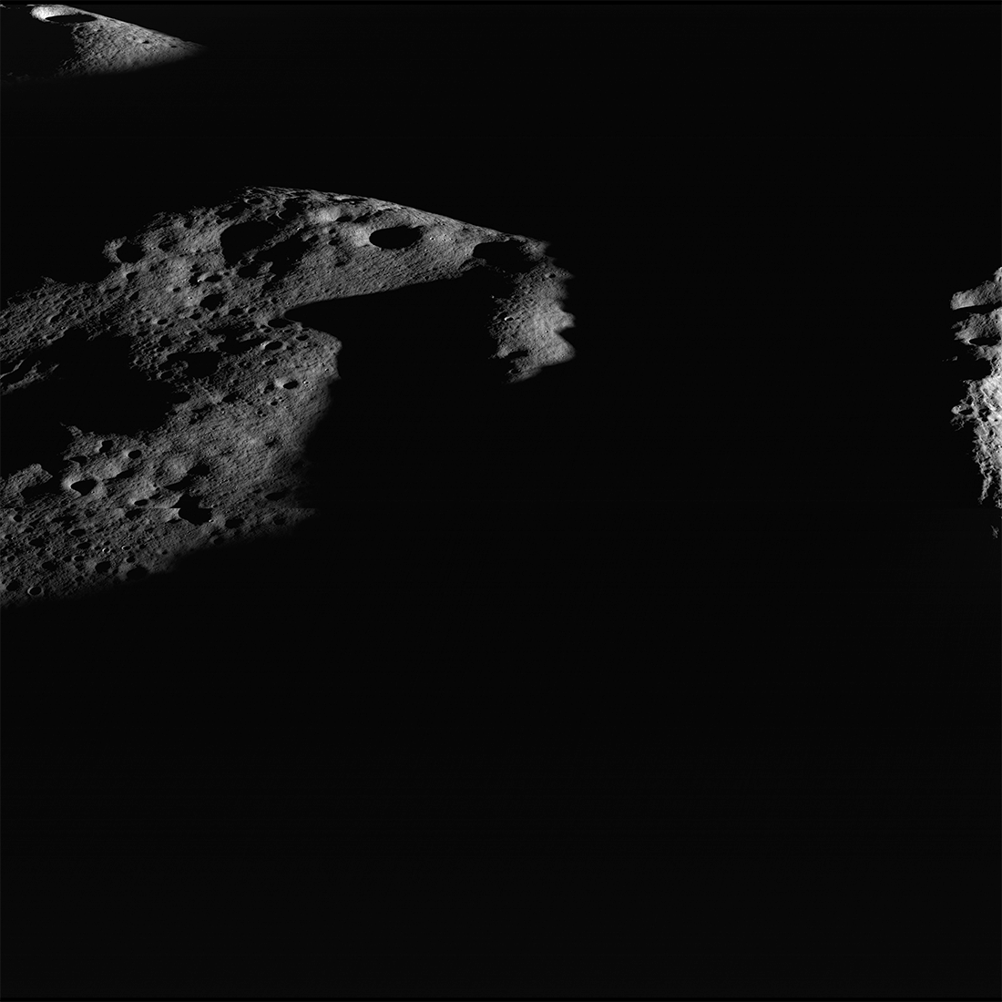
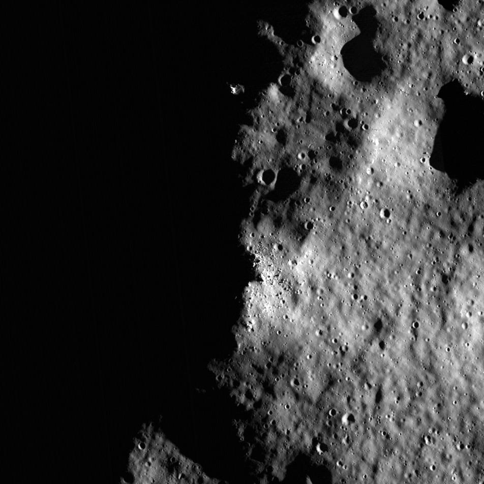
Malapert Massif
Malapert massif (informal name) is thought to be a remnant of the South Pole - Aitken basin rim, which formed more than 4 billion years ago. More recently, this magnificent peak (lower left) was selected as an Artemis 3 candidate...
Published on 14 Mar 2023
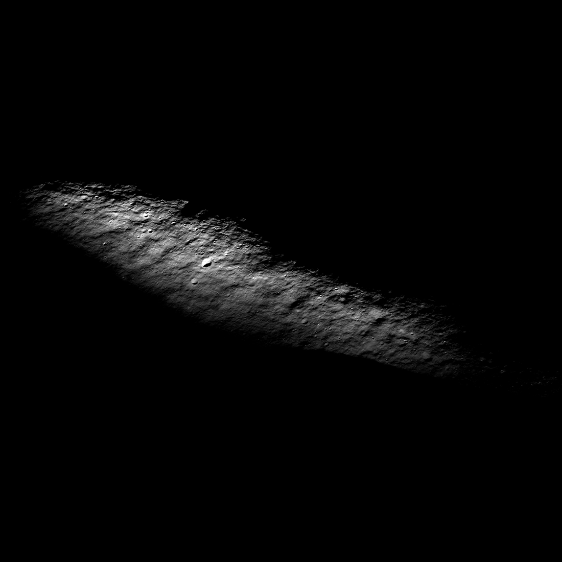
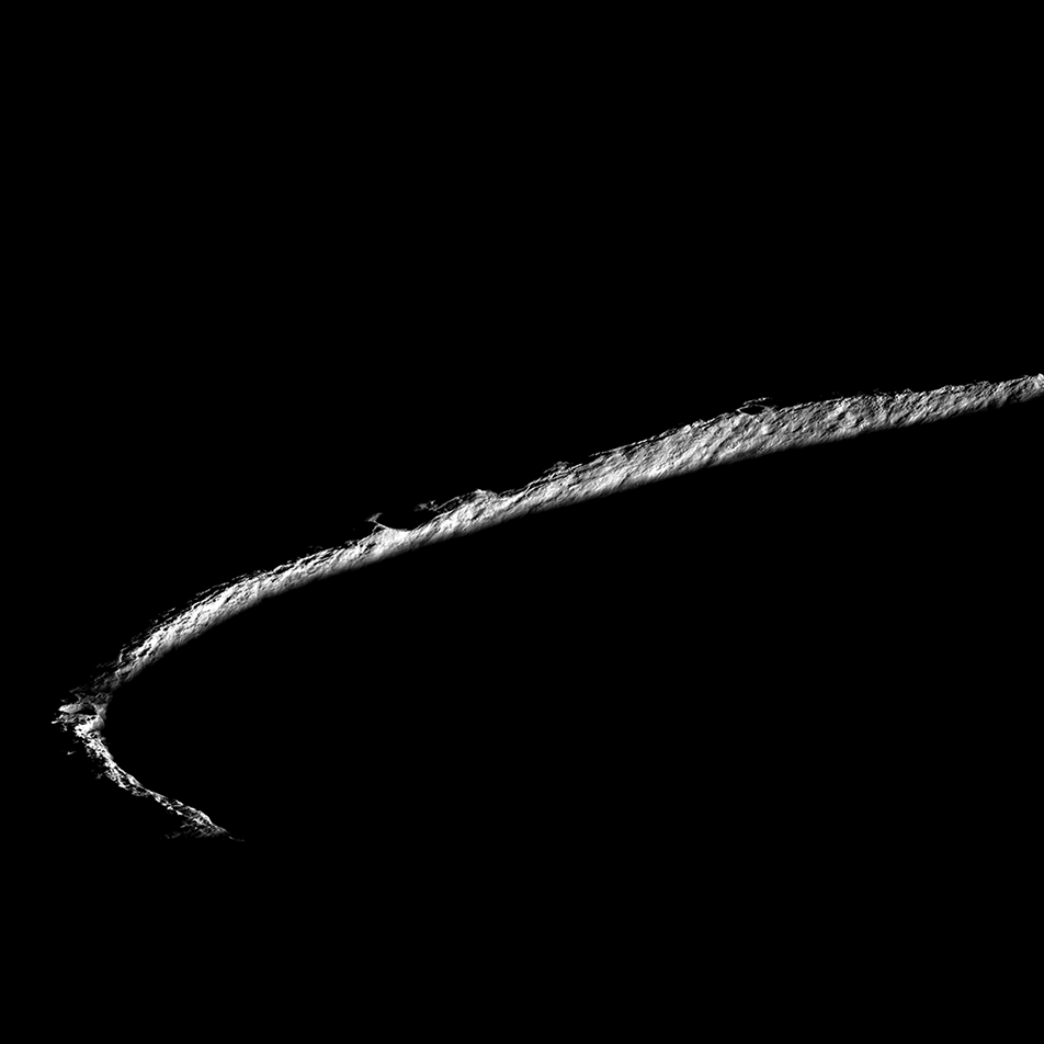
Where is the South Pole?
Often hidden in shadows, the south pole (90°S, 0°E) occurs just inside the rim of Shackleton crater (20-kilometer diameter). This spectacular view, aimed at the pole, was acquired on 18 May 2022. The image is 2400 meters wide in the...
Published on 19 Oct 2022
Sea of Night
Rim of Aepinus crater rising above a sea of dark during a winter night. Illuminated area 1.5 kilometers by 6.0 kilometers, NAC M1338480133LR [NASA/GSFC/Arizona State University].
Published on 19 May 2020
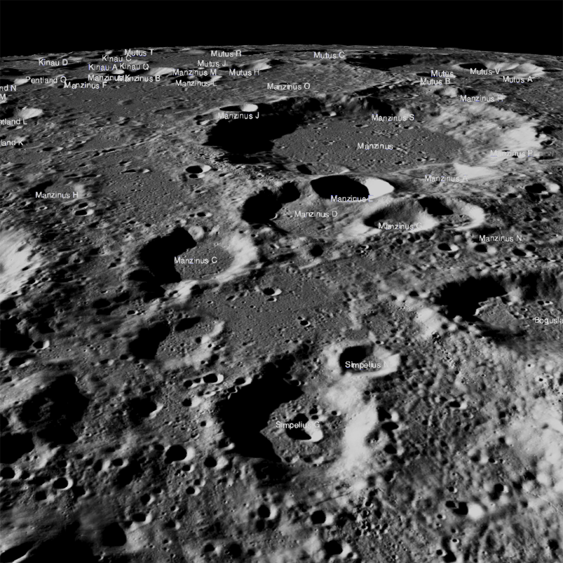
Obscured in the Lunar Highlands?
The Chandrayaan-2 lander, Vikram, attempted a landing September 7th Indian time (Friday the 6th in the United States), on a small patch of lunar highland smooth plains between Simpelius N and Manzinus C craters. Unfortunately the...
Published on 26 Sep 2019
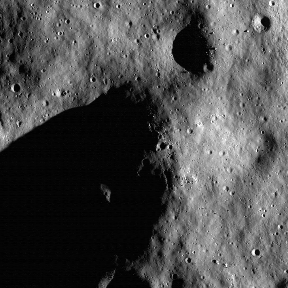
Islands in the Dark
Darkness surrounds illuminated peaks between Shackleton crater (rim crest at right) and de Gerlache crater (out of scene left). As lunar days and seasons progress, darkness creeps along this elevated ridge near the south pole. Image...
Published on 20 May 2019
On the Rim!
Spectacular oblique view of the rim of Shackleton crater (21 km diameter, 89.66°S, 129.20°E). While no location on the Moon stays continuously illuminated, three points on the rim remain collectively sunlit for more than 90% of the...
Published on 01 Feb 2018
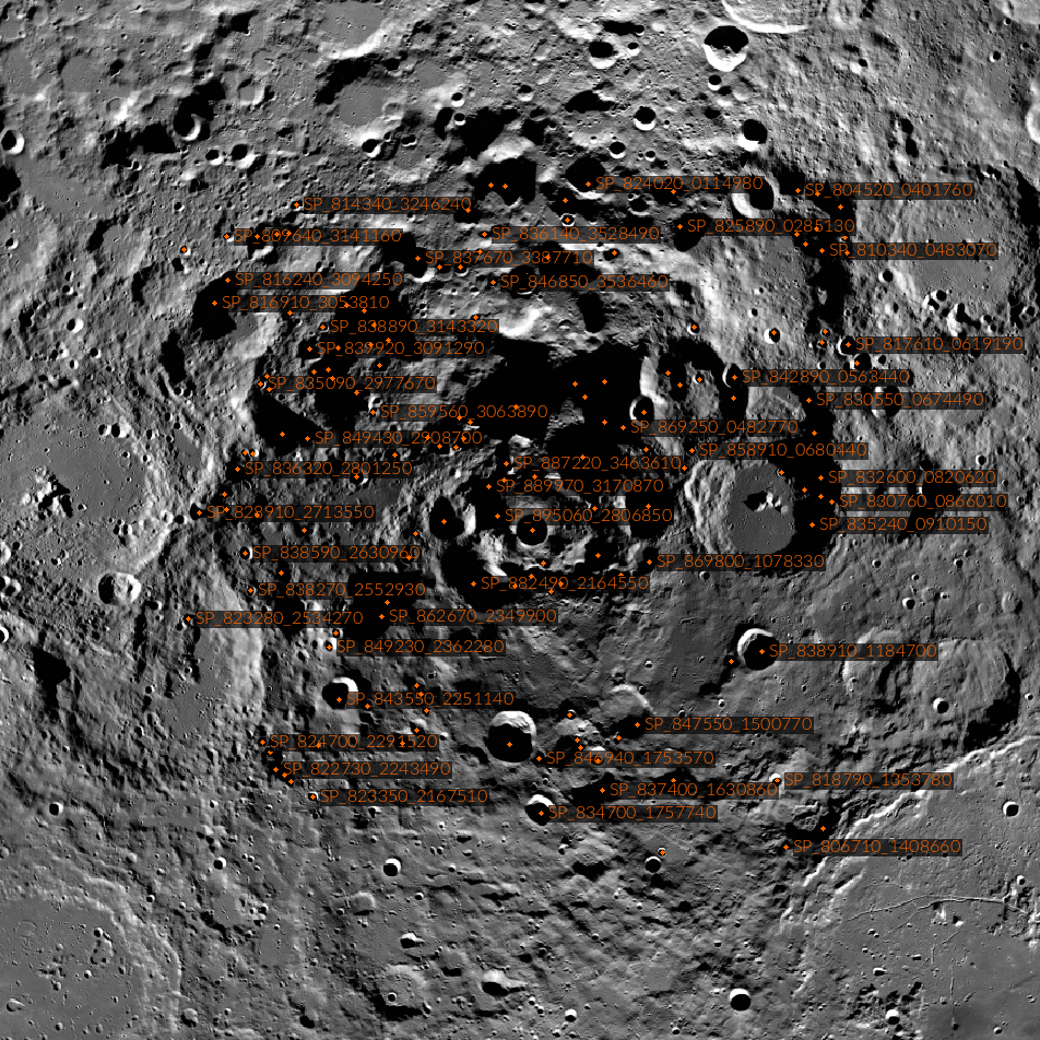
Casting Light on Permanently Shadowed Regions
The locations of south pole permanently shadowed regions (PSRs) with areas >10 km2. Images and information about each PSR can be found in the LROC PSR Atlas. [NASA/GSFC/Arizona State University]
Published on 27 Jan 2018
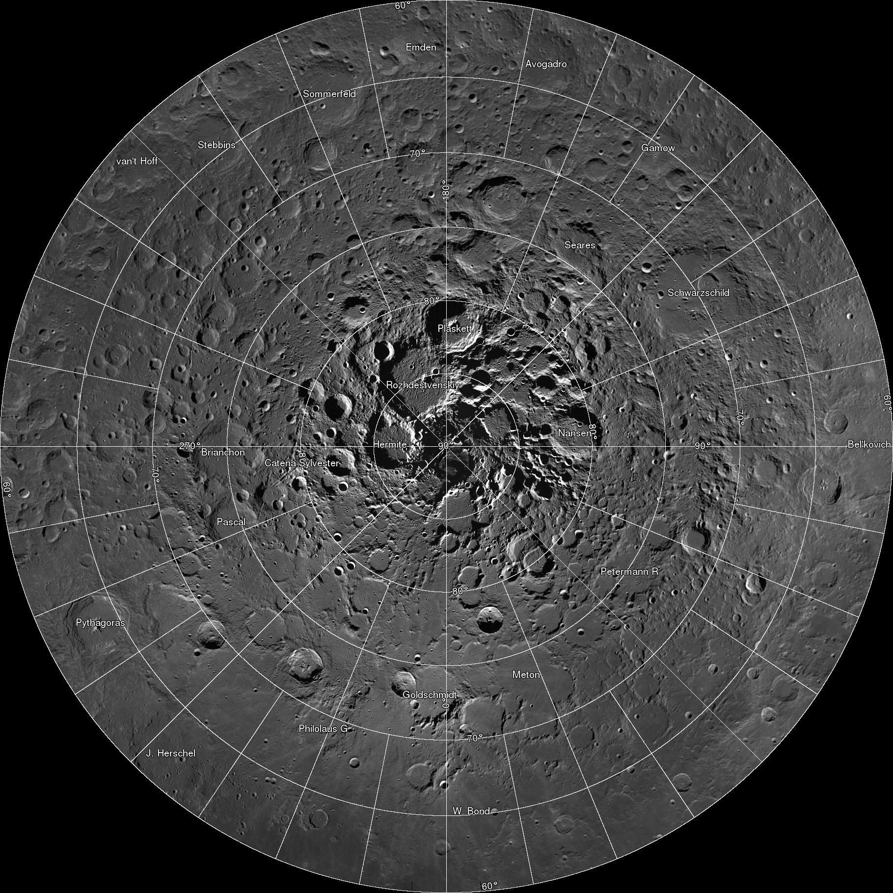
Polar Illumination Maps and More!
New Reduced Data Records (RDRs) available as part of the 32nd Planetary Data System (PDS) release include two versions of the polar illumination maps for each pole. They include this time-weighted north pole illumination...
Published on 12 Jan 2018
'Shaping' Lunar Science with Vector Data
Twenty new shapefiles created by the LROC Team are now available! A few of the shapefiles shown here include mare age units, footprints of digital terrain models (DTMs), and the locations of small geologic features such as...
Published on 18 Jul 2017
Five Years Later: Revisiting an Old Friend
A portion of LROC's first image (M101013931), acquired five years ago today. This region of the rim of Shackleton crater near the lunar South Pole is illuminated over 70% of the time, while the floor of the crater is permanently...
Published on 03 Jul 2014
681 Gigapixels!
Spectacular LROC Northern Polar Mosaic (LNPM) allows exploration from 60°N up to the pole at the astounding pixel scale of 2 meters [NASA/GSFC/Arizona State University].
Published on 18 Mar 2014
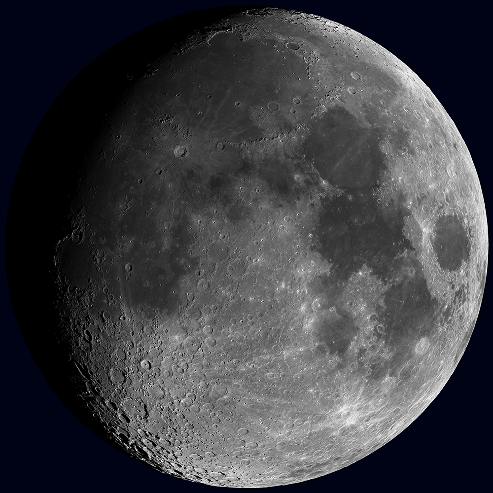
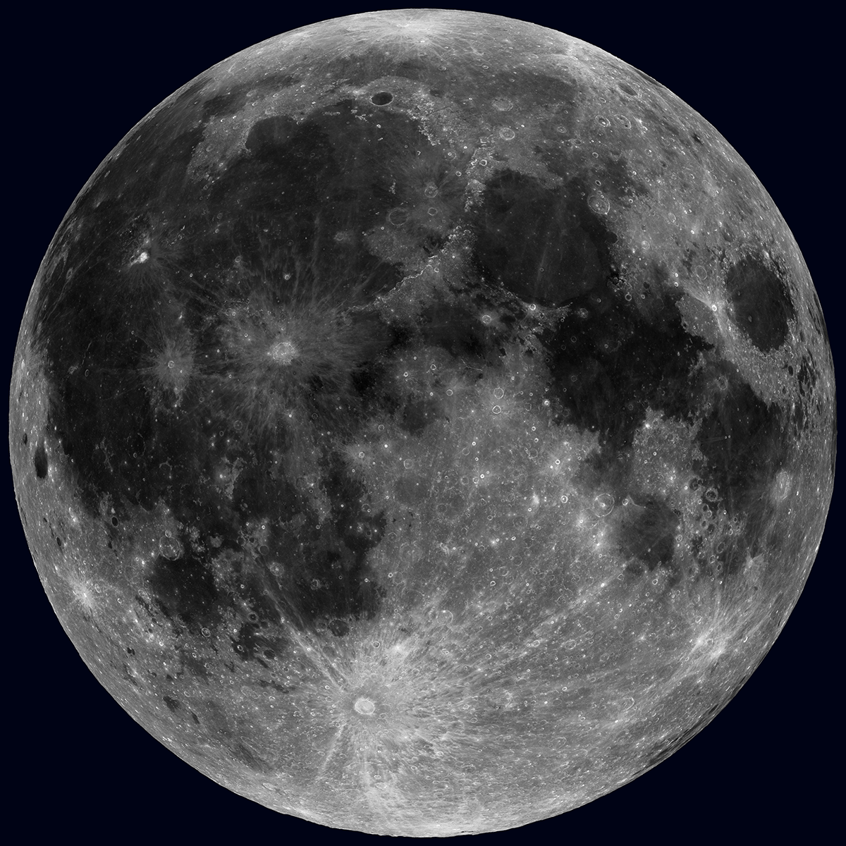
Synthetic Views of the Moon
Synthetic view of the waxing Moon as viewed from Earth on 2013-10-15 17:00:00 UTC [NASA/GSFC/Arizona State University].
Published on 15 Oct 2013
A Unique View Of The Moon
The Sun overhead, across the whole Moon! Of course this is not possible in real life, but 36 nearly complete WAC mosaics make this view possible [NASA/GSFC/Arizona State University].
Published on 17 Jul 2013
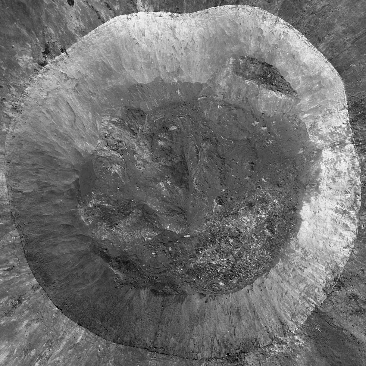
Giordano Bruno, The Big Picture
Mosaic of eight LROC NAC images provides this spectacular view of the interior of Giordano Bruno crater (21 km diameter). Resolution was reduced by 10 times to fit this Featured Image format, M185212646LR, M185219795LR, M185226944LR,...
Published on 26 Jun 2012
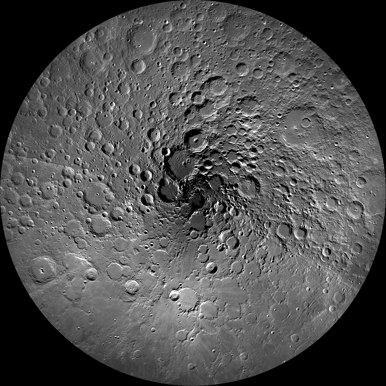
1000 Day Anniversary of LROC Imaging
Rim of Shackleton crater near the lunar South Pole as seen in the first LROC NAC image of the Moon, acquired on 30 June 2009. Image is 850 m across, NAC M101013931 [NASA/GSFC/Arizona State University].
Published on 26 Mar 2012
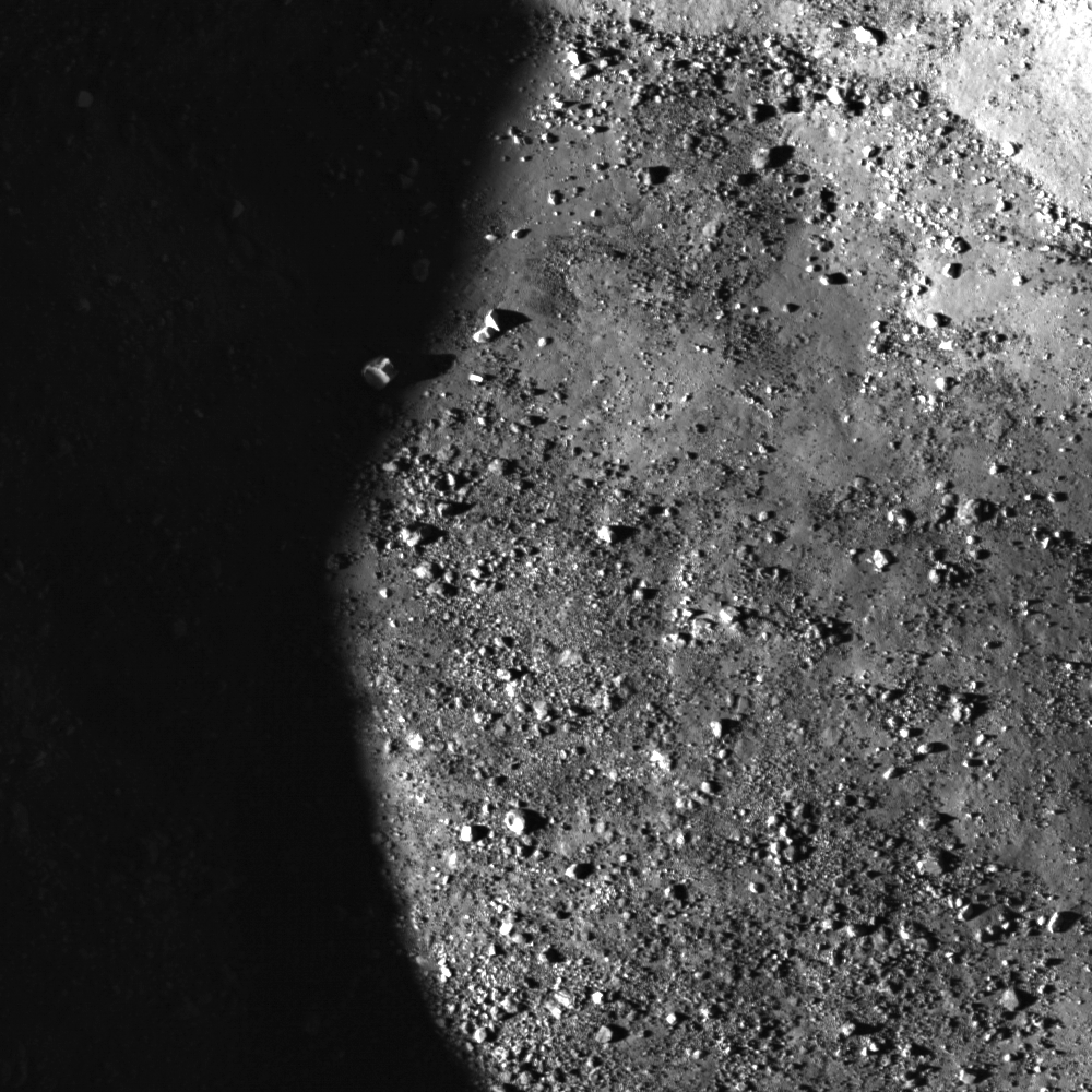
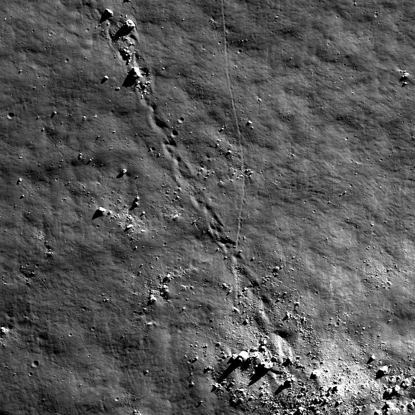
Sunset Boulder
A tall boulder on the floor of a crater catches a few last rays of light at sunset. Image width is 620 m, NAC frame M134442210R [NASA/GSFC/Arizona State University].
Published on 01 Mar 2012
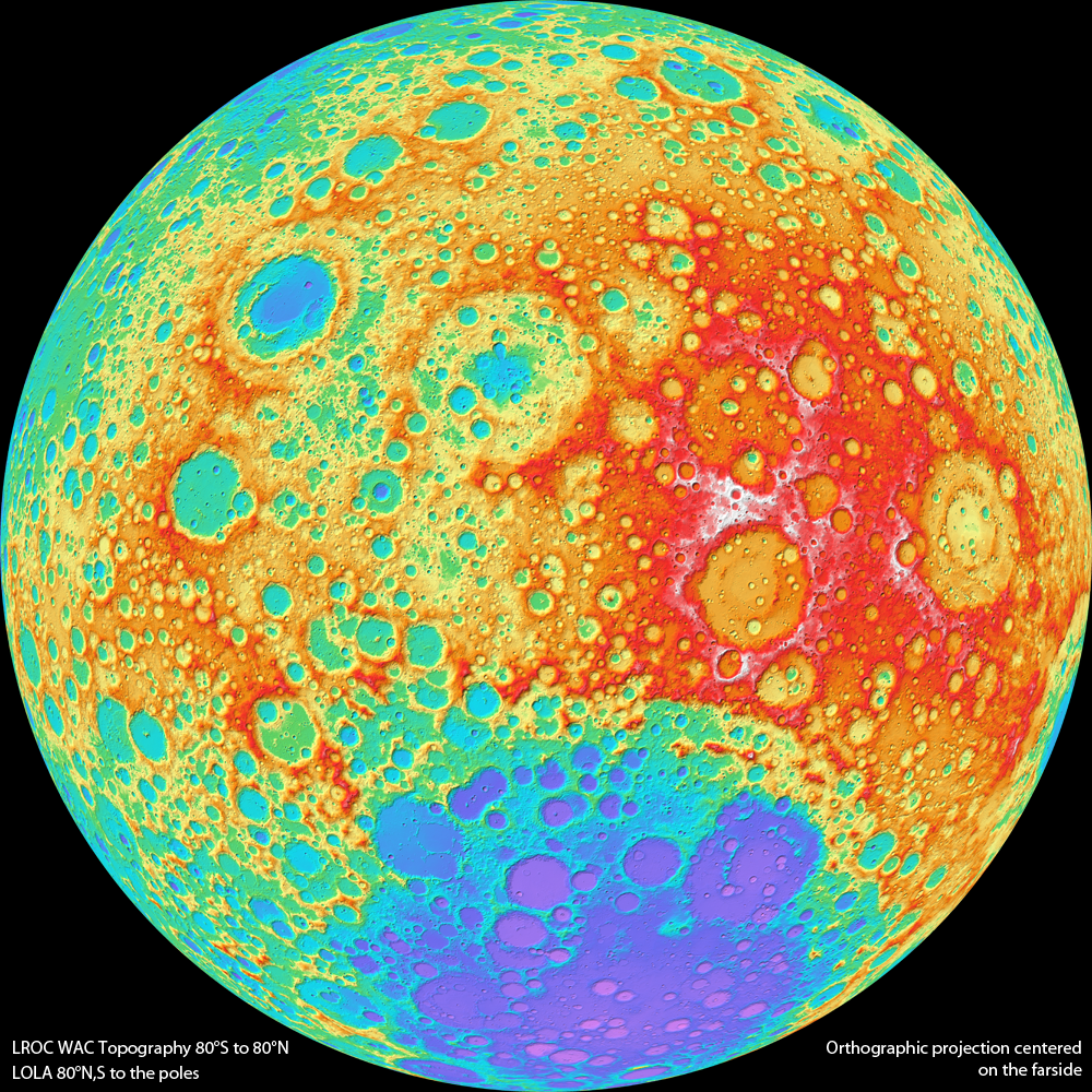
Lunar Topography - As Never Seen Before!
LROC WAC color shaded relief of the lunar farside (NASA/GSFC/DLR/Arizona State University).
Published on 16 Nov 2011
Sampling Schrödinger
Boulders rolled down an incline on a terrace near the Schrödinger basin rim. Boulders are ~20 to 30 m in size. Image width is ~1.2 km, downslope direction to upper left, LROC NAC M159017963R [NASA/GSFC/Arizona State University].
Published on 17 Aug 2011
North Pole Mosaics and Movie
LROC Wide Angle Camera mosaic of the Moon's north pole; polar stereographic projection, 60°N to 90°N [NASA/GSFC/Arizona State University].
Published on 16 Mar 2011