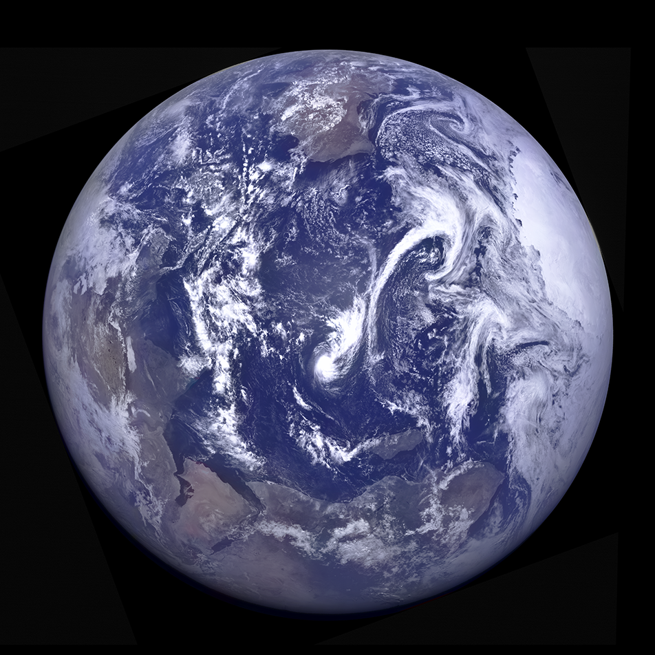
LRO slewed to the east as it passed over the northwest rim (-8.536°N, 251.028°E, 82 km altitude) of the Orientale basin and snapped this spectacular Earth-Moon sequence with the NAC and WAC. Tropical Cyclone Bohale is visible in the center of the image. MODIS (onboard the NASA Aqua satellite) imaged the same storm 3 hours after LROC.
The NAC and WAC images of the Earth were projected using a Point-Perspective projection to recreate the view one would see from the LRO spacecraft while taking the NAC image. Due to the relatively slow speed of the spacecraft slew, many NAC framelets of the Earth were acquired. All these WAC frames were oversampled and averaged, enabling a "super-resolution" color image (115 pixels across!), which was then combined with the 4000-pixel-wide NAC image. In the WAC images, the Earth is only 23 to 24 pixels wide, similar to the view seen here.
The portions of the NAC images showing the Moon were projected onto a celestial sphere (ISIS Skymap function) to determine the relative positions and scales of the lunar horizon and the Earth. These two steps resulted in the correct relative angles and sizes of the Earth and Moon in the final composite image.
Finally, a note about the colors. The 415 nm, 566 nm, and 643 nm bands of the WAC best match the blue, green, and red cones in human color vision, respectively. Unfortunately, the 643nm band was offset by about half a pixel (several hundred kilometers on the Earth's surface) from the 415 nm and 566 nm bands in this image, causing prominent red streaks across the clouds. Therefore, while we used the 643 nm band for color over the continents, for the clouds and oceans, we instead used the 604 nm band (orange, rather than red), as that band aligned perfectly, and used it for those white and blue surfaces caused no significant change in the color.
Reconstructed NAC pair with full Earth over the lunar limb (below). The Earth is cropped to match the lunar coverage. Lunar north is to the left, NAC E1204366496L, M1204366496R (NASA/GSFC/Arizona State University).
Full Earth in all its glory (below). To the left is Africa, India and China are at the top, Australia is visible to the right, and Antarctica fills the lower portion of the image. NAC M1204366496R E1204366496L, [NASA/GSFC/Arizona State University].
And finally, the full-up composite in merged color! LROC E1204366496L, M1204366496R, M1204365627C [NASA/GSFC/Arizona State University].
Past LROC Earth Featured Images
Published by Mark Robinson on 7 April 2023